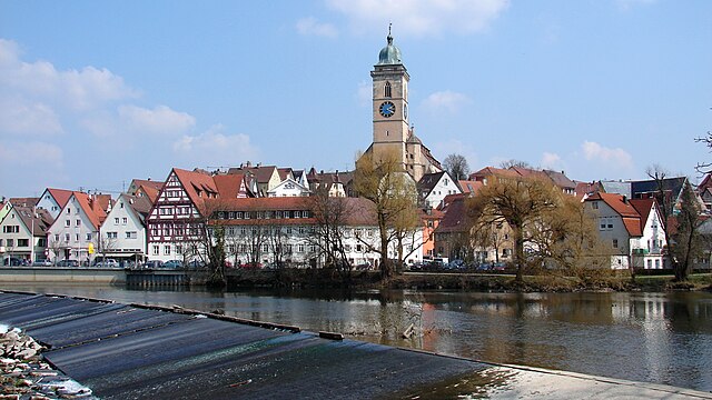
Beuren (Beuren)
- municipality in Esslingen, Baden-Wuerttemberg, Germany
- Country:

- Postal Code: 72660
- Local Dialing Code: 07022; 07025
- Licence Plate Code: ES
- Coordinates: 48° 34' 9" N, 9° 24' 10" E


- GPS tracks (wikiloc): [Link]
- AboveSeaLevel: 435 м m
- Area: 11.69 sq km
- Population: 3585
- Web site: https://www.beuren.de/
- Wikipedia en: wiki(en)
- Wikipedia: wiki(de)
- Wikidata storage: Wikidata: Q80725
- Wikipedia Commons Category: [Link]
Shares border with regions:


Nürtingen
- town in Baden-Württemberg, Germany
- Country:

- Postal Code: 72622
- Local Dialing Code: 07022
- Coordinates: 48° 37' 36" N, 9° 20' 7" E


- GPS tracks (wikiloc): [Link]
- AboveSeaLevel: 291 м m
- Area: 46.9 sq km
- Population: 39960
- Web site: [Link]
Details...


Frickenhausen
- municipality in Germany
- Country:

- Postal Code: 72636
- Local Dialing Code: 07123; 07025; 07022
- Licence Plate Code: ES
- Coordinates: 48° 35' 34" N, 9° 21' 40" E


- GPS tracks (wikiloc): [Link]
- AboveSeaLevel: 323 м m
- Area: 11.35 sq km
- Population: 8729
- Web site: [Link]
Details...


Erkenbrechtsweiler
- municipality in Germany
- Country:

- Postal Code: 73268
- Local Dialing Code: 07026
- Licence Plate Code: ES
- Coordinates: 48° 33' 24" N, 9° 25' 56" E


- GPS tracks (wikiloc): [Link]
- AboveSeaLevel: 702 м m
- Area: 6.93 sq km
- Population: 2109
- Web site: [Link]
Details...


Owen
- municipality in Germany
- Country:

- Postal Code: 73277
- Local Dialing Code: 07021
- Licence Plate Code: ES
- Coordinates: 48° 35' 18" N, 9° 27' 5" E


- GPS tracks (wikiloc): [Link]
- AboveSeaLevel: 391 м m
- Area: 9.7 sq km
- Population: 3404
- Web site: [Link]
Details...


Dettingen unter Teck
- municipality in Germany
- Country:

- Postal Code: 73265
- Local Dialing Code: 07021
- Licence Plate Code: ES
- Coordinates: 48° 37' 0" N, 9° 27' 0" E


- GPS tracks (wikiloc): [Link]
- AboveSeaLevel: 352 м m
- Area: 15.13 sq km
- Population: 5888
- Web site: [Link]
Details...


Neuffen
- municipality in Germany
- Country:

- Postal Code: 72637–72639
- Local Dialing Code: 07025
- Licence Plate Code: ES
- Coordinates: 48° 33' 16" N, 9° 22' 32" E


- GPS tracks (wikiloc): [Link]
- AboveSeaLevel: 408 м m
- Area: 17.45 sq km
- Population: 6343
- Web site: [Link]
Details...


