
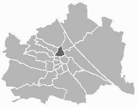
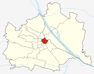
Josefstadt (Josefstadt)
Shares border with regions:

Alsergrund
- 9. district of Vienna
- Country:

- Postal Code: 1090
- Licence Plate Code: W
- Coordinates: 48° 13' 31" N, 16° 21' 25" E


- GPS tracks (wikiloc): [Link]
- AboveSeaLevel: 179 м m
- Area: 2.99 sq km
- Web site: [Link]
Details...
Hernals
- 17. district of Vienna
- Country:
- Postal Code: 1170
- Licence Plate Code: W
- Coordinates: 48° 13' 57" N, 16° 16' 46" E
- GPS tracks (wikiloc): [Link]
- AboveSeaLevel: 224 м m
- Area: 11.35 sq km
- Web site: [Link]
Details...
Ottakring
- 16. district of Vienna
- Country:
- Postal Code: 1160
- Licence Plate Code: W
- Coordinates: 48° 12' 45" N, 16° 18' 38" E
- GPS tracks (wikiloc): [Link]
- AboveSeaLevel: 247 м m
- Area: 8.65 sq km
- Web site: [Link]
Details...

Innere Stadt
- first district of Vienna
- Country:
- Postal Code: 1010
- Licence Plate Code: W
- Coordinates: 48° 12' 35" N, 16° 22' 12" E
- GPS tracks (wikiloc): [Link]
- AboveSeaLevel: 192 м m
- Area: 3.01 sq km
- Web site: [Link]
Details...
Neubau
- 7. district of Vienna
- Country:
- Postal Code: 1070
- Licence Plate Code: W
- Coordinates: 48° 12' 9" N, 16° 20' 53" E
- GPS tracks (wikiloc): [Link]
- AboveSeaLevel: 214 м m
- Area: 1.61 sq km
- Web site: [Link]
Details...

