
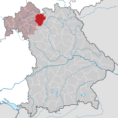
Lower Franconia (Unterfranken)
Includes regions:


Würzburg
- district of Bavaria, Germany
- Country:

- Capital: Würzburg
- Licence Plate Code: OCH; WÜ
- Coordinates: 49° 39' 36" N, 10° 0' 0" E


- GPS tracks (wikiloc): [Link]
- AboveSeaLevel: 346 м m
- Area: 967.56 sq km
- Population: 161340
- Web site: [Link]
Details...


Kitzingen
- district in Bavaria, Germany
- Country:
- Capital: Kitzingen
- Licence Plate Code: KT
- Coordinates: 49° 45' 0" N, 10° 15' 36" E
- GPS tracks (wikiloc): [Link]
- AboveSeaLevel: 231 м m
- Area: 684.00 sq km
- Population: 79304
- Web site: [Link]
Details...


Schweinfurt
- district of Bavaria, Germany
- Country:
- Capital: Schweinfurt
- Licence Plate Code: GEO; SW
- Coordinates: 50° 1' 12" N, 10° 15' 36" E
- GPS tracks (wikiloc): [Link]
- AboveSeaLevel: 222 м m
- Area: 842.00 sq km
- Population: 103697
- Web site: [Link]
Details...

Haßberge
- district in Bavaria, Germany
- Country:
- Capital: Haßfurt
- Licence Plate Code: HAS
- Coordinates: 50° 4' 48" N, 10° 40' 12" E
- GPS tracks (wikiloc): [Link]
- AboveSeaLevel: 368 м m
- Area: 956.00 sq km
- Population: 80257
- Web site: [Link]
Details...


Rhön-Grabfeld
- district in Bavaria, Germany
- Country:
- Capital: Bad Neustadt an der Saale
- Licence Plate Code: MET; KÖN; NES
- Coordinates: 50° 19' 48" N, 10° 15' 0" E
- GPS tracks (wikiloc): [Link]
- AboveSeaLevel: 320 м m
- Area: 1022.00 sq km
- Population: 77197
- Web site: [Link]
Details...
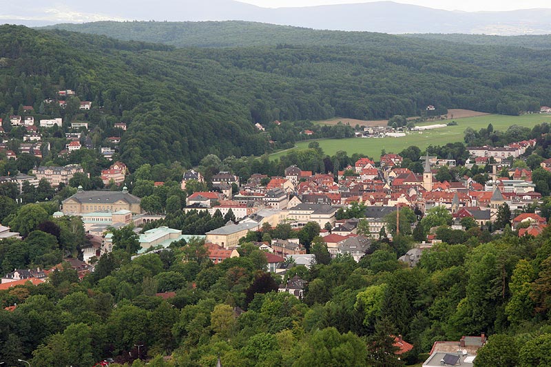

Bad Kissingen
- district in Bavaria, Germany
- Country:
- Capital: Bad Kissingen
- Licence Plate Code: HAB; BRK; KG
- Coordinates: 50° 15' 0" N, 10° 0' 0" E
- GPS tracks (wikiloc): [Link]
- AboveSeaLevel: 330 м m
- Area: 1137.00 sq km
- Population: 99022
- Web site: [Link]
Details...
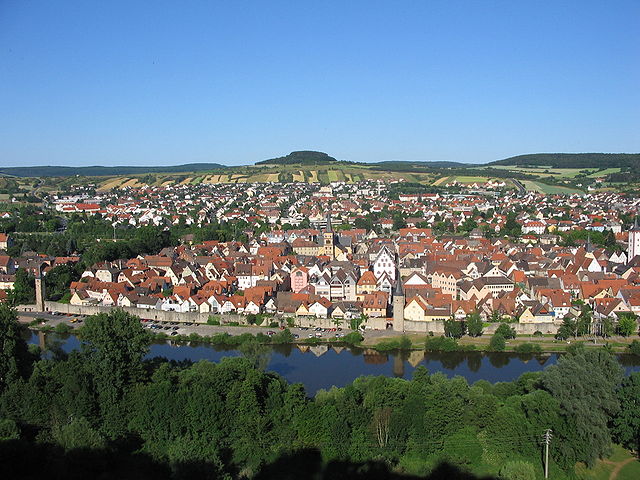

Main-Spessart
- district in Bavaria, Germany
- Country:
- Capital: Karlstadt am Main
- Licence Plate Code: MSP
- Coordinates: 49° 55' 12" N, 9° 45' 0" E
- GPS tracks (wikiloc): [Link]
- AboveSeaLevel: 313 м m
- Area: 1321.4186 sq km
- Population: 125915
- Web site: [Link]
Details...


Aschaffenburg
- district in Bavaria, Germany
- Country:
- Capital: Aschaffenburg
- Licence Plate Code: ALZ; AB
- Coordinates: 50° 4' 48" N, 9° 10' 12" E
- GPS tracks (wikiloc): [Link]
- AboveSeaLevel: 246 м m
- Area: 699.00 sq km
- Population: 152367
Details...


Miltenberg
- district in Bavaria, Germany
- Country:
- Capital: Miltenberg
- Licence Plate Code: MIL
- Coordinates: 49° 45' 0" N, 9° 15' 0" E
- GPS tracks (wikiloc): [Link]
- AboveSeaLevel: 224 м m
- Area: 716.00 sq km
- Population: 114255
- Web site: [Link]
Details...

Würzburg
- city in the region of Franconia, Northern Bavaria, Germany
- Country:
- Postal Code: 97084; 97082; 97080; 97078; 97076; 97074; 97072; 97070
- Local Dialing Code: 0931
- Licence Plate Code: WÜ
- Coordinates: 49° 47' 40" N, 9° 55' 46" E
- GPS tracks (wikiloc): [Link]
- AboveSeaLevel: 177 м m
- Area: 87.6 sq km
- Population: 126010
- Web site: [Link]
Details...
Aschaffenburg
- town in Bavaria, Germany
- Country:
- Postal Code: 63739–63743
- Local Dialing Code: 06021
- Licence Plate Code: AB
- Coordinates: 49° 58' 0" N, 9° 9' 0" E
- GPS tracks (wikiloc): [Link]
- AboveSeaLevel: 138 м m
- Area: 62.57 sq km
- Population: 68986
- Web site: [Link]
Details...

Schweinfurt
- town in Bavaria, Germany
- Country:
- Postal Code: 97422; 97423; 97424; 97421
- Local Dialing Code: 09721
- Licence Plate Code: SW
- Coordinates: 50° 3' 0" N, 10° 14' 0" E
- GPS tracks (wikiloc): [Link]
- AboveSeaLevel: 226 м m
- Area: 35.71 sq km
- Population: 51969
- Web site: [Link]
Details...
Shares border with regions:


Middle Franconia
- administrative region of Franconia in Bavaria, Germany
- Country:
- Capital: Ansbach
- Coordinates: 49° 18' 0" N, 10° 35' 0" E
- GPS tracks (wikiloc): [Link]
- AboveSeaLevel: 401 м m
- Area: 7245.70 sq km
- Population: 1750059
- Web site: [Link]
Details...


Upper Franconia
- administrative region of Franconia in Bavaria, Germany
- Country:
- Capital: Bayreuth
- Coordinates: 49° 57' 0" N, 11° 35' 0" E
- GPS tracks (wikiloc): [Link]
- AboveSeaLevel: 368 м m
- Area: 7230.19 sq km
- Population: 1062398
- Web site: [Link]
Details...


Thuringia
- state of Germany
- Country:
- Capital: Erfurt
- Coordinates: 50° 51' 40" N, 11° 3' 7" E
- GPS tracks (wikiloc): [Link]
- AboveSeaLevel: 266 м m
- Area: 16171.0 sq km
- Population: 2161000
- Web site: [Link]
Details...


Kassel Government Region
- administrative subdivision and region of Hesse, Germany
- Country:
- Capital: Kassel
- Coordinates: 51° 10' 12" N, 9° 25' 12" E
- GPS tracks (wikiloc): [Link]
- AboveSeaLevel: 312 м m
- Area: 8288.7 sq km
- Population: 1220000
- Web site: [Link]
Details...
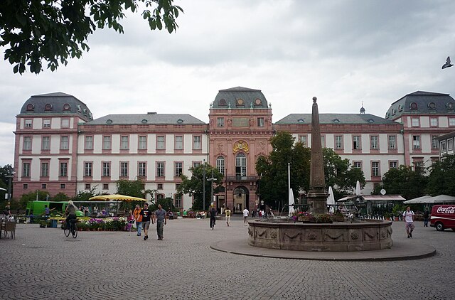
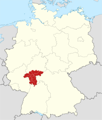
Darmstadt Government Region
- administrative subdivision and region of Hesse, Germany
- Country:
- Capital: Darmstadt
- Coordinates: 50° 4' 48" N, 8° 45' 0" E
- GPS tracks (wikiloc): [Link]
- AboveSeaLevel: 179 м m
- Area: 7444.88 sq km
- Web site: [Link]
Details...


Karlsruhe Government Region
- administrative subdivision and region of Baden-Württemberg, Germany
- Country:
- Capital: Karlsruhe
- Coordinates: 49° 0' 0" N, 8° 30' 0" E
- GPS tracks (wikiloc): [Link]
- AboveSeaLevel: 120 м m
- Area: 6919 sq km
- Web site: [Link]
Details...

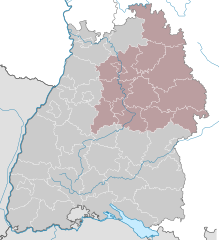
Stuttgart Government Region
- government region of Baden-Württemberg, Germany
- Country:
- Capital: Stuttgart
- Coordinates: 49° 0' 0" N, 9° 40' 12" E
- GPS tracks (wikiloc): [Link]
- AboveSeaLevel: 365 м m
- Area: 10558 sq km
- Web site: [Link]
Details...


