
Reinickendorf (Reinickendorf)
Includes regions:


Heiligensee
- locality of Berlin
- Country:

- Postal Code: 13505; 13503
- Coordinates: 52° 37' 0" N, 13° 14' 0" E


- GPS tracks (wikiloc): [Link]
- AboveSeaLevel: 39 м m
- Area: 10.7 sq km
- Population: 17834
Details...


Konradshöhe
- locality of Berlin
- Country:
- Postal Code: 13505
- Coordinates: 52° 35' 0" N, 13° 14' 0" E
- GPS tracks (wikiloc): [Link]
- AboveSeaLevel: 39 м m
- Area: 2.2 sq km
- Population: 6029
Details...
Lübars
- locality of Berlin
- Country:
- Coordinates: 52° 37' 0" N, 13° 22' 0" E
- GPS tracks (wikiloc): [Link]
- AboveSeaLevel: 53 м m
- Area: 5 sq km
- Population: 4969
Details...


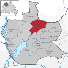
Wittenau
- locality of Berlin
- Country:
- Postal Code: 13469; 13439; 13437; 13435
- Coordinates: 52° 35' 31" N, 13° 19' 35" E
- GPS tracks (wikiloc): [Link]
- AboveSeaLevel: 41 м m
- Area: 5.9 sq km
- Population: 25118
Details...

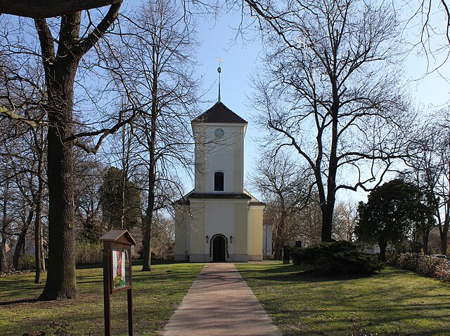
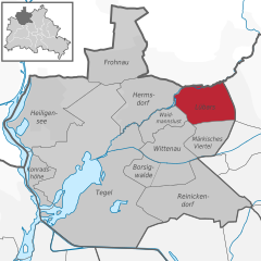
Hermsdorf
- locality of Berlin
- Country:
- Postal Code: 13467
- Coordinates: 52° 37' 0" N, 13° 19' 0" E
- GPS tracks (wikiloc): [Link]
- AboveSeaLevel: 37 м m
- Area: 6.1 sq km
- Population: 15440
Details...


Frohnau
- locality of Berlin
- Country:
- Postal Code: 13465
- Coordinates: 52° 38' 0" N, 13° 18' 0" E
- GPS tracks (wikiloc): [Link]
- AboveSeaLevel: 55 м m
- Area: 7.8 sq km
- Population: 16782
Details...


Waidmannslust
- locality of Berlin
- Country:
- Coordinates: 52° 36' 24" N, 13° 19' 15" E
- GPS tracks (wikiloc): [Link]
- AboveSeaLevel: 47 м m
- Area: 2.3 sq km
Details...


Reinickendorf
- locality of the borough Reinickendorf of Berlin
- Country:
- Postal Code: 13409; 13407; 13403
- Coordinates: 52° 34' 0" N, 13° 20' 0" E
- GPS tracks (wikiloc): [Link]
- AboveSeaLevel: 42 м m
- Area: 10.5 sq km
- Population: 80687
Details...


Tegel
- locality of Berlin
- Country:
- Postal Code: 13509; 13507; 13505; 13503; 13405
- Coordinates: 52° 35' 0" N, 13° 17' 0" E
- GPS tracks (wikiloc): [Link]
- AboveSeaLevel: 36 м m
- Area: 33.7 sq km
- Population: 35474
Details...
Shares border with regions:


Spandau
- borough of Berlin, Germany
- Country:
- Postal Code: 14089; 14052; 13629; 13599; 13597; 13595; 13593; 13591; 13589; 13587; 13585; 13583; 13581
- Coordinates: 52° 33' 0" N, 13° 12' 0" E
- GPS tracks (wikiloc): [Link]
- Area: 91.878 sq km
- Population: 231120
- Web site: [Link]
Details...

Charlottenburg-Wilmersdorf
- borough of Berlin, Germany
- Country:
- Coordinates: 52° 30' 0" N, 13° 17' 0" E
- GPS tracks (wikiloc): [Link]
- Area: 64.7 sq km
- Population: 334351
- Web site: [Link]
Details...

Pankow
- borough of Berlin, Germany
- Country:
- Licence Plate Code: B
- Coordinates: 52° 34' 0" N, 13° 24' 0" E
- GPS tracks (wikiloc): [Link]
- Area: 103 sq km
- Web site: [Link]
Details...


Mitte
- borough of Berlin, Germany
- Country:
- Coordinates: 52° 31' 0" N, 13° 22' 0" E
- GPS tracks (wikiloc): [Link]
- Area: 39.5 sq km
- Population: 333905
- Web site: [Link]
Details...

.svg)