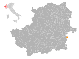
Буттильера-д'Асти (Buttigliera d'Asti, Buttigliera d'Asti)

- коммуна Италии
 Hiking in Буттильера-д'Асти
Buttigliera d'Asti, located in the Piedmont region of Italy, offers beautiful landscapes and a pleasant environment for hiking enthusiasts. The area is known for its rolling hills, vineyards, and picturesque views, making it an excellent destination for outdoor activities. Here are some highlights and tips for hiking in and around Buttigliera d'Asti:
Trails and Routes
-
Local Trails: Buttigliera d'Asti has several well-marked trails suitable for various skill levels. You can find easy walks through vineyards and moderate trails that lead to hilltops with panoramic views.
-
Natural Parks: Nearby natural parks offer more extensive hiking opportunities. The Parco Naturale delle Colline Astigiane, for example, provides a network of trails through hills and forests.
-
Historical Paths: Some trails are connected to historical sites, allowing hikers to explore medieval churches and castles scattered throughout the region.
Scenic Highlights
- Vineyard Views: The area is renowned for its wine production, particularly Barbera and Moscato. Hiking through the vineyards can be a delightful experience, especially in the autumn when the grape harvest occurs.
- Breathtaking Views: Many trails lead to viewpoints where you can see the surrounding countryside, especially the hills and valleys typical of the Asti province.
Tips for Hiking in Buttigliera d'Asti
- Best Time to Go: Spring (April to June) and early autumn (September to October) are ideal times for hiking, as the weather is mild, and the landscapes are vibrant.
- Preparation: Wear appropriate hiking boots and carry plenty of water, especially during hotter months. A map or GPS device can be helpful since some trails may not be well-marked.
- Local Regulations: Be aware of local guidelines for hiking, and respect nature and private property when on trails.
Cultural Aspects
After a hiking day, consider visiting local wineries to taste the regional wines or enjoying Italian cuisine in nearby towns, providing a delightful way to unwind and experience the local culture.
Overall, Buttigliera d'Asti presents a charming setting for hikers who appreciate nature, wine, and picturesque landscapes!
- Страна:

- Почтовый код: 14021
- Телефонный код: 011
- Код автомобильного номера: AT
- Координаты: 45° 1' 22" N, 7° 57' 8" E


- GPS треки (wikiloc): [Ссылка]
- Высота над уровнем моря: 299 м m
- Площадь: 19.16 кв.км
- Население: 2564
- Веб сайт: http://www.comune.buttigliera.at.it
- Википедия русская: wiki(ru)
- Википедия английская: wiki(en)
- Википедия национальная: wiki(it)
- Хранилище Wikidata: Wikidata: Q17758
- Катеория в википедии: [Ссылка]
- код Freebase: [/m/0gbftq]
- код GeoNames: Альт: [6543480]
- ID отношения в OpenStreetMap: [43958]
- UN/LOCODE: [ITBDA]
- код ISTAT: 005012
- кадастровый код Италии: B306
Граничит с регионами:


Рива-прессо-Кьери
- коммуна в Италии
Hiking in Рива-прессо-Кьери
Riva presso Chieri, located in the Piedmont region of Italy, is a charming destination for hiking enthusiasts. Nestled near the confluence of the Po River and various hills and valleys, this area offers a mix of picturesque landscapes, rolling hills, and lush greenery....
- Страна:
- Почтовый код: 10020
- Телефонный код: 011
- Код автомобильного номера: TO
- Координаты: 44° 59' 0" N, 7° 52' 0" E
- GPS треки (wikiloc): [Ссылка]
- Высота над уровнем моря: 262 м m
- Площадь: 35.83 кв.км
- Население: 4705
- Веб сайт: [Ссылка]
Каприльо
- коммуна Италии
Hiking in Каприльо
Capriglio is a charming village located in the Piedmont region of Italy, near the Monferrato area. The surrounding landscape features rolling hills, vineyards, and woodlands, making it an appealing destination for hiking enthusiasts. Here are some highlights of hiking in and around Capriglio:...
- Страна:
- Почтовый код: 14014
- Телефонный код: 0141
- Код автомобильного номера: AT
- Координаты: 45° 0' 13" N, 8° 0' 32" E
- GPS треки (wikiloc): [Ссылка]
- Высота над уровнем моря: 231 м m
- Площадь: 5.06 кв.км
- Население: 288
- Веб сайт: [Ссылка]


Кастельнуово-Дон-Боско
- коммуна Италии
Hiking in Кастельнуово-Дон-Боско
Castelnuovo Don Bosco is a charming town located in the Piedmont region of Italy, renowned for its beautiful landscapes and rich history. The area offers several hiking opportunities that allow you to enjoy its natural beauty, vineyards, and scenic views....
- Страна:
- Почтовый код: 14022
- Телефонный код: 011
- Код автомобильного номера: AT
- Координаты: 45° 2' 30" N, 7° 57' 51" E
- GPS треки (wikiloc): [Ссылка]
- Высота над уровнем моря: 306 м m
- Площадь: 21.61 кв.км
- Население: 3195
- Веб сайт: [Ссылка]
Монтафия
- коммуна Италии
Hiking in Монтафия
Montafia, located in the Piedmont region of Italy, offers a picturesque backdrop for hiking enthusiasts. The area is characterized by rolling hills, vineyards, and stunning views of the surrounding countryside. Here’s what you need to know about hiking in Montafia:...
- Страна:
- Почтовый код: 14014
- Телефонный код: 0141
- Код автомобильного номера: AT
- Координаты: 44° 59' 25" N, 8° 1' 33" E
- GPS треки (wikiloc): [Ссылка]
- Высота над уровнем моря: 267 м m
- Площадь: 14.5 кв.км
- Население: 933
- Веб сайт: [Ссылка]


Вилланова-д'Асти
- коммуна Италии
Hiking in Вилланова-д'Асти
Villanova d'Asti, located in the Piedmont region of Italy, offers a range of scenic hiking opportunities with its rolling hills, vineyards, and picturesque landscapes. Here are some highlights and tips for hiking in this area:...
- Страна:
- Почтовый код: 14019
- Телефонный код: 0141
- Код автомобильного номера: AT
- Координаты: 44° 56' 34" N, 7° 56' 18" E
- GPS треки (wikiloc): [Ссылка]
- Высота над уровнем моря: 260 м m
- Площадь: 41.95 кв.км
- Население: 5686
- Веб сайт: [Ссылка]

Морьондо-Торинезе
- коммуна Италии
Hiking in Морьондо-Торинезе
Moriondo Torinese, located in the Piedmont region of Italy, offers a beautiful setting for hiking enthusiasts. The area is characterized by its rolling hills, vineyards, and scenic views of the surrounding countryside. Here are some key points to consider when hiking in and around Moriondo Torinese:...
- Страна:
- Почтовый код: 10020
- Телефонный код: 011
- Код автомобильного номера: TO
- Координаты: 45° 2' 0" N, 7° 57' 0" E
- GPS треки (wikiloc): [Ссылка]
- Высота над уровнем моря: 328 м m
- Площадь: 6.49 кв.км
- Население: 831
- Веб сайт: [Ссылка]