Опс (canton of Aups, canton d'Aups)
- кантон во Франции, округ Бриньоль
 Hiking in Опс
Canton d'Aups, located in the Var department of the Provence-Alpes-Côte d'Azur region in southeastern France, is an excellent destination for hiking enthusiasts. The region is renowned for its picturesque landscapes, charming villages, and a variety of hiking trails that cater to different skill levels. Here are some key highlights about hiking in Canton d'Aups:
Scenic Trails
-
Gorges du Verdon: While not directly in Aups, this stunning canyon is nearby and offers breathtaking vistas and numerous trails that range from easy walks to challenging scrambles. Many hikers explore the trails that lead along the gorge's rim.
-
Local Hiking Trails: There are many marked trails in and around the Canton d'Aups itself. These often lead through beautiful forests, olive groves, and offer views of the surrounding countryside, including the rolling hills and vineyards that characterize the region.
-
Le Sentier des Moulins: This trail explores the area’s historical mills and gives insight into the traditional rural life of Provence. Walking along this path, you'll enjoy lush landscapes and possibly spot some local wildlife.
Flora and Fauna
Canton d'Aups is part of the Provence region, which is rich in biodiversity. Hikers can enjoy wildflower displays in the spring, diverse plant life, and various bird species throughout the year. The region is known for its aromatic herbs, including lavender and thyme.
Preparation and Considerations
-
Weather: The hiking season generally runs from spring to fall, with the best conditions in late spring (May-June) and early autumn (September-October). Summer can be hot, so ensure you stay hydrated and protect yourself from the sun.
-
Trail Maps: It's advisable to obtain a local hiking map or guidebook, as trail markings may vary in visibility. Various tourism offices in Aups can provide information and resources.
-
Proper Gear: Footwear should be sturdy, and carrying a backpack with essential supplies (water, snacks, first aid kit) is crucial, especially for longer hikes.
-
Respect Nature: As in any natural area, it’s important to respect the local environment. Stick to marked trails, take your litter with you, and be mindful of wildlife habitats.
Local Culture and Amenities
Aups is also known for its charming atmosphere, historical buildings, and participation in local festivals. Engaging with the local culture can greatly enrich your hiking experience. The village offers various amenities, including accommodations, restaurants, and shops, making it easy to plan a comfortable hiking getaway.
Whether you’re an experienced hiker or just looking for a leisurely walk, Canton d'Aups offers a wonderful blend of nature, culture, and adventure. Enjoy your hiking experience!
- Страна:

- Столица: Опс
- Координаты: 43° 37' 0" N, 6° 14' 0" E


- GPS треки (wikiloc): [Ссылка]
- Википедия русская: wiki(ru)
- Хранилище Wikidata: Wikidata: Q1639052
- код кантона INSEE: [8301]
Включает регионы:


Бодинар-сюр-Вердон
- коммуна во Франции
Hiking in Бодинар-сюр-Вердон
Baudinard-sur-Verdon is a charming village located in the Provence-Alpes-Côte d'Azur region of France, nestled in the picturesque landscape near the Verdon Gorge (Gorges du Verdon). The area is renowned for its stunning natural beauty, making it an excellent destination for hiking enthusiasts....
- Страна:
- Почтовый код: 83630
- Координаты: 43° 42' 59" N, 6° 8' 4" E
- GPS треки (wikiloc): [Ссылка]
- Высота над уровнем моря: 650 м m
- Площадь: 21.97 кв.км
- Население: 221
- Веб сайт: [Ссылка]

Бодюан
- коммуна во Франции
Hiking in Бодюан
Bauduen is a charming village located on the shores of the stunning Lake Sainte-Croix in the Provence-Alpes-Côte d'Azur region of France. It offers a picturesque setting for hiking enthusiasts, with a variety of trails that cater to different skill levels and preferences....
- Страна:
- Почтовый код: 83630
- Координаты: 43° 44' 2" N, 6° 10' 33" E
- GPS треки (wikiloc): [Ссылка]
- Площадь: 47.45 кв.км
- Население: 316
- Веб сайт: [Ссылка]

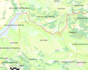
Эгин
- коммуна во Франции
Hiking in Эгин
Aiguines is a charming village located in the Var department of the Provence-Alpes-Côte d'Azur region in southeastern France. It's perched on a cliff overlooking the stunning Lac de Sainte-Croix and serves as a popular gateway to the surrounding natural beauty of the Verdon Regional Natural Park. Here are some key highlights for hiking in and around Aiguines:...
- Страна:
- Почтовый код: 83630
- Координаты: 43° 46' 33" N, 6° 14' 37" E
- GPS треки (wikiloc): [Ссылка]
- Площадь: 114.33 кв.км
- Население: 271
- Веб сайт: [Ссылка]


Вериньон
- коммуна во Франции
Hiking in Вериньон
Vérignon, a beautiful village in the Alpes-de-Haute-Provence region of France, offers various hiking opportunities that showcase the stunning natural landscapes of the Provence region. The area is characterized by its rolling hills, rocky outcrops, and panoramic views, making it a great destination for outdoor enthusiasts....
- Страна:
- Почтовый код: 83630
- Координаты: 43° 39' 12" N, 6° 16' 24" E
- GPS треки (wikiloc): [Ссылка]
- Площадь: 36.9 кв.км
- Население: 10


Опс
- коммуна во Франции
Hiking in Опс
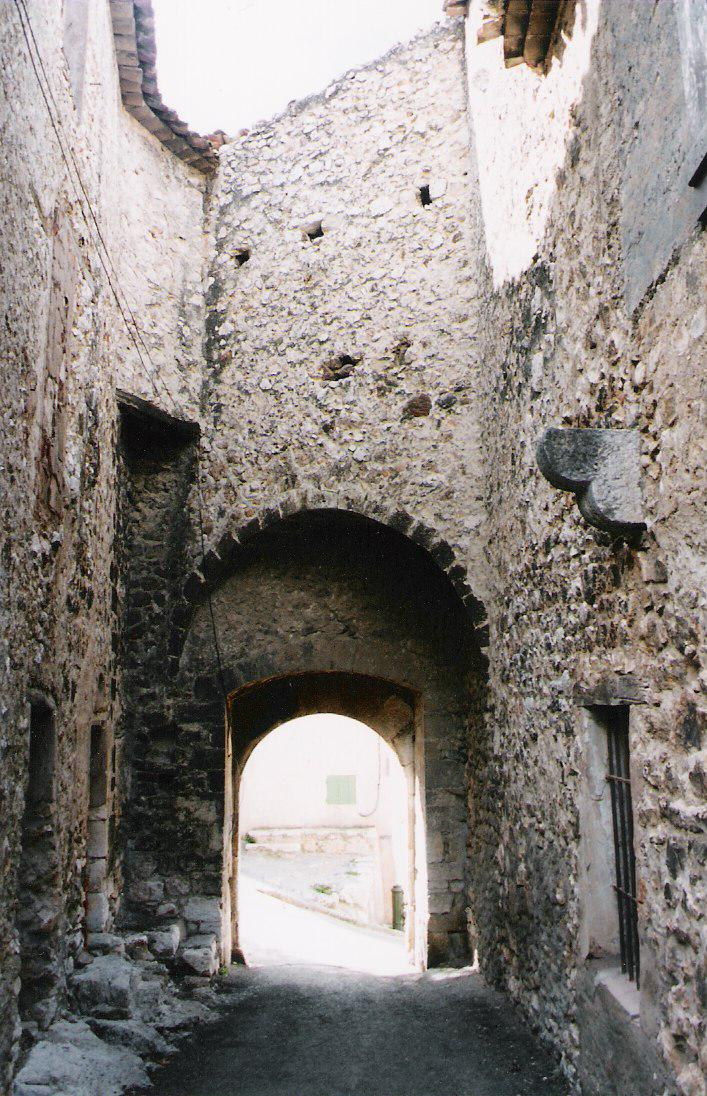
Aups is a charming village located in the Var department of the Provence-Alpes-Côte d'Azur region in southeastern France. It’s known for its picturesque landscapes, rich history, and proximity to the stunning natural areas of the Verdon Gorge. Here are some highlights and considerations for hiking in and around Aups:...
- Страна:
- Почтовый код: 83630
- Координаты: 43° 37' 42" N, 6° 13' 29" E
- GPS треки (wikiloc): [Ссылка]
- Площадь: 64.15 кв.км
- Население: 2134

Ле-Саль-сюр-Вердон
- коммуна во Франции
Hiking in Ле-Саль-сюр-Вердон
Les Salles-sur-Verdon is a picturesque village located in the Var department of southeastern France, known for its proximity to the stunning Gorges du Verdon and the beautiful Lac de Sainte-Croix. Hiking in this area offers a range of landscapes and trails that cater to various skill levels....
- Страна:
- Почтовый код: 83630
- Координаты: 43° 46' 27" N, 6° 12' 35" E
- GPS треки (wikiloc): [Ссылка]
- Площадь: 4.97 кв.км
- Население: 259