Cloppenburg (Landkreis Cloppenburg)
- district in Lower Saxony, Germany
- Country:

- Capital: Cloppenburg
- Licence Plate Code: CLP
- Coordinates: 52° 49' 48" N, 8° 0' 0" E


- GPS tracks (wikiloc): [Link]
- AboveSeaLevel: 27 м m
- Area: 1418.00 sq km
- Population: 165930
- Web site: http://www.lkclp.de/
- Wikipedia en: wiki(en)
- Wikipedia: wiki(de)
- Wikidata storage: Wikidata: Q5945
- Wikipedia Commons Gallery: [Link]
- Wikipedia Commons Category: [Link]
- Wikipedia Commons Maps Category: [Link]
Includes regions:

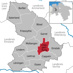
Cloppenburg
- town in Lower Saxony, Germany
- Country:
- Postal Code: 49661
- Local Dialing Code: 04471
- Licence Plate Code: CLP
- Coordinates: 52° 50' 52" N, 8° 2' 38" E
- GPS tracks (wikiloc): [Link]
- AboveSeaLevel: 39 м m
- Area: 70.6 sq km
- Population: 34216
- Web site: [Link]
Details...


Saterland
- municipality in the district of Cloppenburg, in Lower Saxony, Germany
- Country:
- Postal Code: 26683
- Local Dialing Code: 04498; 04492
- Licence Plate Code: CLP
- Coordinates: 53° 2' 0" N, 7° 43' 0" E
- GPS tracks (wikiloc): [Link]
- AboveSeaLevel: 5 м m
- Area: 123.62 sq km
- Population: 13539
- Web site: [Link]
Details...


Emstek
- municipality of Germany
- Country:
- Postal Code: 49685
- Local Dialing Code: 04447; 04473
- Licence Plate Code: CLP
- Coordinates: 52° 49' 0" N, 8° 9' 0" E
- GPS tracks (wikiloc): [Link]
- AboveSeaLevel: 62 м m
- Area: 108.13 sq km
- Population: 11859
- Web site: [Link]
Details...


Barßel
- municipality of Germany
- Country:
- Postal Code: 26676
- Local Dialing Code: 04499
- Licence Plate Code: CLP
- Coordinates: 53° 10' 13" N, 7° 44' 48" E
- GPS tracks (wikiloc): [Link]
- AboveSeaLevel: 2 м m
- Area: 84 sq km
- Population: 12495
- Web site: [Link]
Details...


Cappeln
- municipality of Germany
- Country:
- Postal Code: 49692
- Local Dialing Code: 04478
- Licence Plate Code: CLP
- Coordinates: 52° 48' 44" N, 8° 6' 52" E
- GPS tracks (wikiloc): [Link]
- AboveSeaLevel: 46 м m
- Area: 76.2 sq km
- Population: 6561
- Web site: [Link]
Details...


Löningen
- municipality of Germany
- Country:
- Postal Code: 49624
- Local Dialing Code: 05964; 05962; 05437; 05434; 05432
- Licence Plate Code: CLP
- Coordinates: 52° 43' 0" N, 7° 46' 0" E
- GPS tracks (wikiloc): [Link]
- AboveSeaLevel: 24 м m
- Area: 143 sq km
- Population: 13366
- Web site: [Link]
Details...


Lindern
- municipality of Germany
- Country:
- Postal Code: 49699
- Local Dialing Code: 05957
- Licence Plate Code: CLP
- Coordinates: 52° 50' 42" N, 7° 46' 41" E
- GPS tracks (wikiloc): [Link]
- AboveSeaLevel: 37 м m
- Area: 65.81 sq km
- Population: 4817
- Web site: [Link]
Details...

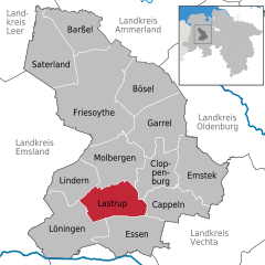
Lastrup
- municipality of Germany
- Country:
- Postal Code: 49688
- Local Dialing Code: 04472
- Licence Plate Code: CLP
- Coordinates: 52° 46' 0" N, 7° 50' 0" E
- GPS tracks (wikiloc): [Link]
- AboveSeaLevel: 45 м m
- Area: 85 sq km
- Population: 6985
- Web site: [Link]
Details...


Bösel
- municipality of Germany
- Country:
- Postal Code: 26219
- Local Dialing Code: 04494
- Licence Plate Code: CLP
- Coordinates: 53° 0' 0" N, 7° 57' 0" E
- GPS tracks (wikiloc): [Link]
- AboveSeaLevel: 13 м m
- Area: 100.1 sq km
- Population: 7709
- Web site: [Link]
Details...
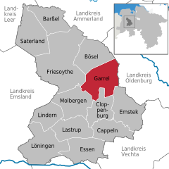
Garrel
- municipality of Germany
- Country:
- Postal Code: 49681
- Local Dialing Code: 04474; 04471
- Licence Plate Code: CLP
- Coordinates: 52° 57' 0" N, 8° 1' 0" E
- GPS tracks (wikiloc): [Link]
- AboveSeaLevel: 20 м m
- Area: 113.23 sq km
- Population: 14918
- Web site: [Link]
Details...
Molbergen
- municipality of Germany
- Country:
- Postal Code: 49696
- Local Dialing Code: 04479; 04475
- Licence Plate Code: CLP
- Coordinates: 52° 52' 0" N, 7° 56' 0" E
- GPS tracks (wikiloc): [Link]
- AboveSeaLevel: 43 м m
- Area: 102.52 sq km
- Population: 8653
- Web site: [Link]
Details...


Friesoythe
- municipality of Germany
- Country:
- Postal Code: 26169
- Local Dialing Code: 04497; 04496; 04493; 04491; 04405
- Licence Plate Code: CLP
- Coordinates: 53° 1' 14" N, 7° 51' 31" E
- GPS tracks (wikiloc): [Link]
- AboveSeaLevel: 6 м m
- Area: 247.14 sq km
- Population: 21918
- Web site: [Link]
Details...
Shares border with regions:
Cappeln
- municipality of Germany
- Country:
- Postal Code: 49692
- Local Dialing Code: 04478
- Licence Plate Code: CLP
- Coordinates: 52° 48' 44" N, 8° 6' 52" E
- GPS tracks (wikiloc): [Link]
- AboveSeaLevel: 46 м m
- Area: 76.2 sq km
- Population: 6561
- Web site: [Link]
Details...
Lastrup
- municipality of Germany
- Country:
- Postal Code: 49688
- Local Dialing Code: 04472
- Licence Plate Code: CLP
- Coordinates: 52° 46' 0" N, 7° 50' 0" E
- GPS tracks (wikiloc): [Link]
- AboveSeaLevel: 45 м m
- Area: 85 sq km
- Population: 6985
- Web site: [Link]
Details...


Leer
- district in Lower Saxony, Germany
- Country:
- Licence Plate Code: LER
- Coordinates: 53° 15' 0" N, 7° 30' 0" E
- GPS tracks (wikiloc): [Link]
- AboveSeaLevel: 1 м m
- Area: 1086.00 sq km
- Population: 168253
- Web site: [Link]
Details...


Osnabrück
- district in Lower Saxony, Germany
- Country:
- Capital: Osnabrück
- Licence Plate Code: OS
- Coordinates: 52° 19' 48" N, 8° 10' 12" E
- GPS tracks (wikiloc): [Link]
- AboveSeaLevel: 57 м m
- Area: 2122.00 sq km
- Population: 354807
- Web site: [Link]
Details...


Vechta
- district in Lower Saxony, Germany
- Country:
- Licence Plate Code: VEC
- Coordinates: 52° 40' 12" N, 8° 15' 0" E
- GPS tracks (wikiloc): [Link]
- AboveSeaLevel: 27 м m
- Area: 813.00 sq km
- Population: 139671
- Web site: [Link]
Details...

Ammerland
- district in Lower Saxony, Germany
- Country:
- Licence Plate Code: WST
- Coordinates: 53° 15' 0" N, 7° 55' 12" E
- GPS tracks (wikiloc): [Link]
- AboveSeaLevel: 7 м m
- Area: 728.00 sq km
- Population: 122698
- Web site: [Link]
Details...


Oldenburg
- district of Lower Saxony, Germany
- Country:
- Licence Plate Code: OL
- Coordinates: 53° 0' 0" N, 8° 25' 12" E
- GPS tracks (wikiloc): [Link]
- AboveSeaLevel: 25 м m
- Area: 1063.00 sq km
- Population: 129484
- Web site: [Link]
Details...

