Lower Saxony (Niedersachsen)
Includes regions:
Verwaltungsbezirk Oldenburg
- former district of Lower Saxony, Germany
- Country:

Details...
Verwaltungsbezirk Brunswick
- former district of Pussia and Lower Saxony, Germany
- Country:
- Coordinates: 52° 10' 12" N, 10° 30' 0" E


- GPS tracks (wikiloc): [Link]
Details...

Osnabrück Government Region
- former district of Pussia and Lower Saxony, Germany
- Country:
Details...


Brunswick
- city in Lower Saxony, Germany
- Country:
- Postal Code: 38114; 38126; 38100; 38100–38126
- Local Dialing Code: 05341; 0531; 05309; 05307; 05300
- Licence Plate Code: BS
- Coordinates: 52° 16' 9" N, 10° 31' 16" E
- GPS tracks (wikiloc): [Link]
- AboveSeaLevel: 75 м m
- Area: 192.70 sq km
- Population: 248667
- Web site: [Link]
Details...


Osnabrück
- German city
- Country:
- Postal Code: 49074–49090
- Local Dialing Code: 05407; 05406; 05402; 0541
- Licence Plate Code: OS
- Coordinates: 52° 16' 44" N, 8° 2' 35" E
- GPS tracks (wikiloc): [Link]
- AboveSeaLevel: 63 м m
- Area: 119.8 sq km
- Population: 164070
- Web site: [Link]
Details...


Oldenburg
- town in Lower Saxony, Germany
- Country:
- Postal Code: 26001–26135
- Local Dialing Code: 0441
- Licence Plate Code: OL
- Coordinates: 53° 8' 38" N, 8° 12' 50" E
- GPS tracks (wikiloc): [Link]
- AboveSeaLevel: 4 м m
- Area: 103.09 sq km
- Population: 165711
- Web site: [Link]
Details...


Wolfsburg
- German city
- Country:
- Postal Code: 38448; 38446; 38444; 38442; 38440
- Local Dialing Code: 05308; 05367; 05366; 05365; 05363; 05362; 05361
- Licence Plate Code: WOB
- Coordinates: 52° 25' 23" N, 10° 47' 14" E
- GPS tracks (wikiloc): [Link]
- AboveSeaLevel: 63 м m
- Area: 204.61 sq km
- Population: 123909
- Web site: [Link]
Details...
Brunswick Government Region
- former entity of Lower Saxony, Germany
- Country:
- Coordinates: 52° 10' 12" N, 10° 30' 0" E
- GPS tracks (wikiloc): [Link]
Details...


Lüneburg Government Region
- former district of Pussia and Lower Saxony, Germany
- Capital: Lüneburg
- Coordinates: 53° 14' 45" N, 10° 24' 34" E
- GPS tracks (wikiloc): [Link]
Details...

Salzgitter
- independent city in southeast Lower Saxony, Germany
- Country:
- Postal Code: 38239; 38229; 38228; 38259; 38226
- Local Dialing Code: 05339; 05300; 05341
- Licence Plate Code: SZ
- Coordinates: 52° 9' 13" N, 10° 24' 21" E
- GPS tracks (wikiloc): [Link]
- AboveSeaLevel: 90 м m
- Area: 224.49 sq km
- Population: 104614
- Web site: [Link]
Details...


Wilhelmshaven
- city in Lower Saxony, Germany
- Country:
- Postal Code: 26382; 26388; 26386; 26389; 26384
- Local Dialing Code: 04421
- Licence Plate Code: WHV
- Coordinates: 53° 31' 0" N, 8° 8' 0" E
- GPS tracks (wikiloc): [Link]
- AboveSeaLevel: 2 м m
- Area: 107.07 sq km
- Population: 76201
- Web site: [Link]
Details...


Delmenhorst
- city in Lower Saxony, Germany
- Country:
- Postal Code: 27749–27755
- Local Dialing Code: 04221
- Licence Plate Code: DEL
- Coordinates: 53° 3' 2" N, 8° 37' 54" E
- GPS tracks (wikiloc): [Link]
- AboveSeaLevel: 7 м m
- Area: 62.45 sq km
- Population: 77045
- Web site: [Link]
Details...
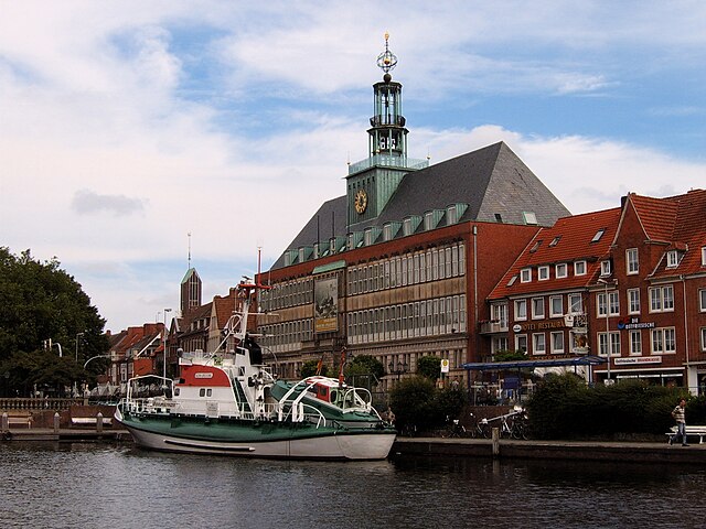

Emden
- biggest city in East Friesland, Lower Saxony, Germany
- Country:
- Postal Code: 26725; 26723; 26721
- Local Dialing Code: 04924; 04927; 04921
- Licence Plate Code: EMD
- Coordinates: 53° 22' 1" N, 7° 12' 22" E
- GPS tracks (wikiloc): [Link]
- AboveSeaLevel: 1 м m
- Area: 112.34 sq km
- Population: 50486
- Web site: [Link]
Details...
Weser-Ems Government Region
- former district of Lower Saxony, Germany
- Country:
- Coordinates: 53° 2' 28" N, 8° 52' 49" E
- GPS tracks (wikiloc): [Link]
Details...
Hanover Government Region
- former district of Pussia and Lower Saxony, Germany
- Coordinates: 52° 22' 0" N, 9° 44' 0" E
- GPS tracks (wikiloc): [Link]
Details...

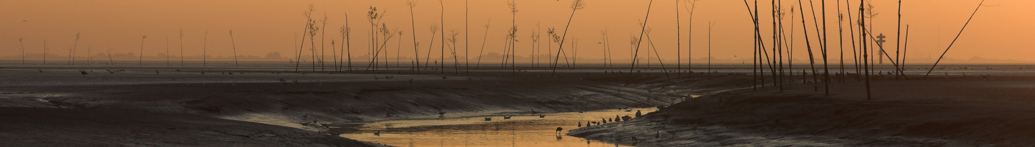
Cuxhaven
- German district of Lower Saxony
- Country:
- Capital: Cuxhaven
- Licence Plate Code: CUX
- Coordinates: 53° 40' 12" N, 8° 49' 48" E
- GPS tracks (wikiloc): [Link]
- AboveSeaLevel: 5 м m
- Area: 2057.78 sq km
- Population: 198670
- Web site: [Link]
Details...


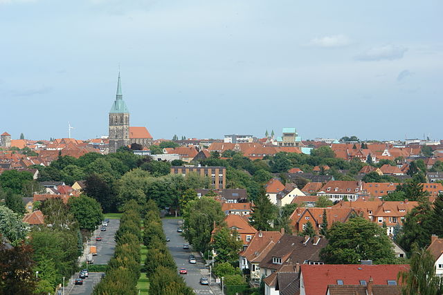
Stade
- German district of Lower Saxony
- Country:
- Licence Plate Code: STD
- Coordinates: 53° 34' 48" N, 9° 25' 12" E
- GPS tracks (wikiloc): [Link]
- AboveSeaLevel: 1 м m
- Area: 1266.00 sq km
- Population: 201638
- Web site: [Link]
Details...


Harburg
- German district in Lower Saxony
- Country:
- Capital: Winsen
- Licence Plate Code: WL
- Coordinates: 53° 19' 43" N, 9° 58' 11" E
- GPS tracks (wikiloc): [Link]
- AboveSeaLevel: 49 м m
- Population: 250326
- Web site: [Link]
Details...
Lüneburg
- German district of Lower Saxony
- Country:
- Capital: Lüneburg
- Licence Plate Code: LG
- Coordinates: 53° 15' 0" N, 10° 30' 0" E
- GPS tracks (wikiloc): [Link]
- AboveSeaLevel: 8 м m
- Area: 1323.10 sq km
- Population: 181605
- Web site: [Link]
Details...


Lüchow-Dannenberg District
- German district in Lower Saxony
- Country:
- Capital: Lüchow
- Licence Plate Code: DAN
- Coordinates: 53° 0' 0" N, 11° 10' 12" E
- GPS tracks (wikiloc): [Link]
- AboveSeaLevel: 13 м m
- Area: 1220.00 sq km
- Population: 48825
- Web site: [Link]
Details...

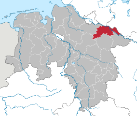
Uelzen District
- German district in Lower Saxony
- Country:
- Licence Plate Code: UE
- Coordinates: 53° 0' 0" N, 10° 34' 48" E
- GPS tracks (wikiloc): [Link]
- AboveSeaLevel: 32 м m
- Area: 1454.00 sq km
- Population: 92961
- Web site: [Link]
Details...
Celle
- German district of Lower Saxony
- Country:
- Licence Plate Code: CE
- Coordinates: 52° 34' 48" N, 10° 4' 48" E
- GPS tracks (wikiloc): [Link]
- AboveSeaLevel: 59 м m
- Area: 1554.00 sq km
- Population: 178370
- Web site: [Link]
Details...


Heidekreis
- district in Lower Saxony, Germany
- Country:
- Capital: Bad Fallingbostel
- Licence Plate Code: HK
- Coordinates: 52° 55' 12" N, 9° 45' 0" E
- GPS tracks (wikiloc): [Link]
- AboveSeaLevel: 64 м m
- Area: 1873.50 sq km
- Population: 139641
- Web site: [Link]
Details...


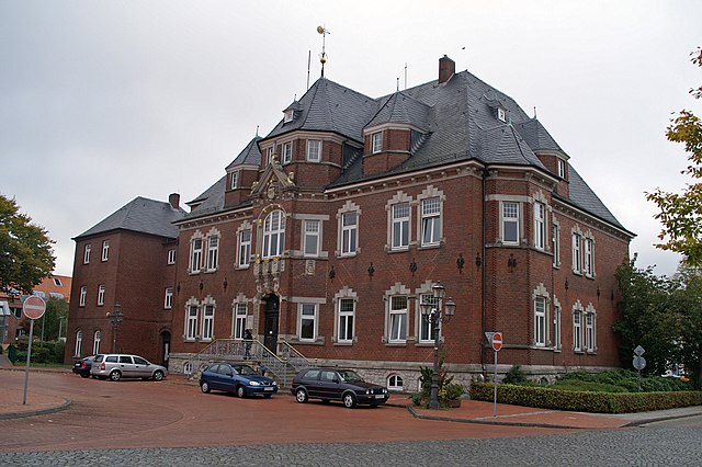
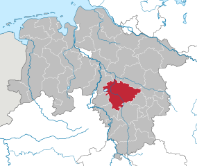
Rotenburg (Wümme)
- German district in Lower Saxony
- Country:
- Licence Plate Code: ROW; BRV
- Coordinates: 53° 15' 0" N, 9° 19' 48" E
- GPS tracks (wikiloc): [Link]
- AboveSeaLevel: 28 м m
- Population: 163372
- Web site: [Link]
Details...


Osterholz
- district in Lower Saxony, Germany
- Country:
- Capital: Osterholz-Scharmbeck
- Licence Plate Code: OHZ
- Coordinates: 53° 15' 0" N, 8° 49' 48" E
- GPS tracks (wikiloc): [Link]
- AboveSeaLevel: 3 м m
- Area: 650.73 sq km
- Population: 112695
- Web site: [Link]
Details...


Verden
- district in Lower Saxony, Germany
- Country:
- Licence Plate Code: VER
- Coordinates: 53° 0' 0" N, 9° 10' 12" E
- GPS tracks (wikiloc): [Link]
- AboveSeaLevel: 23 м m
- Area: 787.70 sq km
- Population: 135842
- Web site: [Link]
Details...

Aurich
- district in Lower Saxony, Germany
- Country:
- Licence Plate Code: AUR; NOR
- Coordinates: 53° 30' 0" N, 7° 19' 48" E
- GPS tracks (wikiloc): [Link]
- AboveSeaLevel: 2 м m
- Area: 1287.00 sq km
- Population: 190066
- Web site: [Link]
Details...

Wittmund
- district in Lower Saxony, Germany
- Country:
- Licence Plate Code: WTM
- Coordinates: 53° 34' 48" N, 7° 45' 0" E
- GPS tracks (wikiloc): [Link]
- AboveSeaLevel: 1 м m
- Area: 656.65 sq km
- Population: 56881
- Web site: [Link]
Details...


Friesland
- district of Germany
- Country:
- Licence Plate Code: FRI
- Coordinates: 53° 30' 0" N, 8° 0' 0" E
- GPS tracks (wikiloc): [Link]
- Area: 608.00 sq km
- Population: 97900
- Web site: [Link]
Details...


Leer
- district in Lower Saxony, Germany
- Country:
- Licence Plate Code: LER
- Coordinates: 53° 15' 0" N, 7° 30' 0" E
- GPS tracks (wikiloc): [Link]
- AboveSeaLevel: 1 м m
- Area: 1086.00 sq km
- Population: 168253
- Web site: [Link]
Details...

Emsland
- district in Lower Saxony, Germany
- Country:
- Capital: Meppen
- Licence Plate Code: EL
- Coordinates: 52° 40' 12" N, 7° 15' 0" E
- GPS tracks (wikiloc): [Link]
- AboveSeaLevel: 25 м m
- Area: 2882.07 sq km
- Population: 321391
- Web site: [Link]
Details...


County of Bentheim
- district in Lower Saxony, Germany
- Country:
- Capital: Nordhorn
- Licence Plate Code: NOH
- Coordinates: 52° 25' 12" N, 7° 4' 48" E
- GPS tracks (wikiloc): [Link]
- AboveSeaLevel: 17 м m
- Area: 981.00 sq km
- Population: 135770
- Web site: [Link]
Details...

Osnabrück
- district in Lower Saxony, Germany
- Country:
- Capital: Osnabrück
- Licence Plate Code: OS
- Coordinates: 52° 19' 48" N, 8° 10' 12" E
- GPS tracks (wikiloc): [Link]
- AboveSeaLevel: 57 м m
- Area: 2122.00 sq km
- Population: 354807
- Web site: [Link]
Details...


Vechta
- district in Lower Saxony, Germany
- Country:
- Licence Plate Code: VEC
- Coordinates: 52° 40' 12" N, 8° 15' 0" E
- GPS tracks (wikiloc): [Link]
- AboveSeaLevel: 27 м m
- Area: 813.00 sq km
- Population: 139671
- Web site: [Link]
Details...


Cloppenburg
- district in Lower Saxony, Germany
- Country:
- Capital: Cloppenburg
- Licence Plate Code: CLP
- Coordinates: 52° 49' 48" N, 8° 0' 0" E
- GPS tracks (wikiloc): [Link]
- AboveSeaLevel: 27 м m
- Area: 1418.00 sq km
- Population: 165930
- Web site: [Link]
Details...

Ammerland
- district in Lower Saxony, Germany
- Country:
- Licence Plate Code: WST
- Coordinates: 53° 15' 0" N, 7° 55' 12" E
- GPS tracks (wikiloc): [Link]
- AboveSeaLevel: 7 м m
- Area: 728.00 sq km
- Population: 122698
- Web site: [Link]
Details...


Wesermarsch
- district in Lower Saxony, Germany
- Country:
- Capital: Brake
- Licence Plate Code: BRA
- Coordinates: 53° 19' 48" N, 8° 19' 48" E
- GPS tracks (wikiloc): [Link]
- Area: 821.87 sq km
- Population: 89282
- Web site: [Link]
Details...


Oldenburg
- district of Lower Saxony, Germany
- Country:
- Licence Plate Code: OL
- Coordinates: 53° 0' 0" N, 8° 25' 12" E
- GPS tracks (wikiloc): [Link]
- AboveSeaLevel: 25 м m
- Area: 1063.00 sq km
- Population: 129484
- Web site: [Link]
Details...


Diepholz
- district in Lower Saxony, Germany
- Country:
- Licence Plate Code: SY; DH
- Coordinates: 52° 40' 12" N, 8° 34' 48" E
- GPS tracks (wikiloc): [Link]
- AboveSeaLevel: 52 м m
- Area: 1987.00 sq km
- Population: 209671
- Web site: [Link]
Details...


Nienburg/Weser
- district in Lower Saxony, Germany
- Country:
- Licence Plate Code: NI
- Coordinates: 52° 40' 12" N, 9° 10' 12" E
- GPS tracks (wikiloc): [Link]
- AboveSeaLevel: 21 м m
- Area: 1399.00 sq km
- Population: 121503
- Web site: [Link]
Details...

Hanover region
- district in Lower Saxony, Germany
- Country:
- Capital: Hanover
- Licence Plate Code: H
- Coordinates: 52° 25' 12" N, 9° 43' 12" E
- GPS tracks (wikiloc): [Link]
- AboveSeaLevel: 55 м m
- Area: 2291 sq km
- Population: 1149594
- Web site: [Link]
Details...
Schaumburg
- district in Lower Saxony, Germany
- Country:
- Licence Plate Code: SHG; RI
- Coordinates: 52° 15' 0" N, 9° 10' 12" E
- GPS tracks (wikiloc): [Link]
- AboveSeaLevel: 84 м m
- Area: 676.00 sq km
- Population: 157616
- Web site: [Link]
Details...


Hamelin-Pyrmont
- district in Lower Saxony, Germany
- Country:
- Capital: Hamelin
- Licence Plate Code: HM
- Coordinates: 52° 4' 48" N, 9° 19' 48" E
- GPS tracks (wikiloc): [Link]
- AboveSeaLevel: 91 м m
- Area: 796.00 sq km
- Population: 148265
- Web site: [Link]
Details...


Holzminden
- district in Lower Saxony, Germany
- Country:
- Licence Plate Code: HOL
- Coordinates: 51° 49' 48" N, 9° 30' 0" E
- GPS tracks (wikiloc): [Link]
- AboveSeaLevel: 177 м m
- Area: 692.00 sq km
- Population: 71510
- Web site: [Link]
Details...

Hildesheim
- district in Lower Saxony, Germany
- Country:
- Capital: Hildesheim
- Licence Plate Code: HI; ALF
- Coordinates: 52° 4' 48" N, 9° 55' 12" E
- GPS tracks (wikiloc): [Link]
- AboveSeaLevel: 80 м m
- Area: 1206.00 sq km
- Population: 277300
- Web site: [Link]
Details...


Northeim
- district in Lower Saxony, Germany
- Country:
- Licence Plate Code: NOM; GAN; EIN
- Coordinates: 51° 45' 0" N, 9° 49' 48" E
- GPS tracks (wikiloc): [Link]
- AboveSeaLevel: 149 м m
- Area: 1267.00 sq km
- Population: 133610
- Web site: [Link]
Details...


Göttingen district
- district in Lower Saxony, Germany
- Country:
- Capital: Göttingen
- Licence Plate Code: GÖ; OHA; HMÜ; DUD
- Coordinates: 51° 30' 0" N, 9° 55' 12" E
- GPS tracks (wikiloc): [Link]
- AboveSeaLevel: 155 м m
- Area: 1117.00 sq km
- Population: 327065
- Web site: [Link]
Details...


Goslar
- district in Lower Saxony, Germany
- Country:
- Capital: Goslar
- Licence Plate Code: GS; CLZ; BRL
- Coordinates: 51° 54' 38" N, 10° 25' 16" E
- GPS tracks (wikiloc): [Link]
- AboveSeaLevel: 263 м m
- Area: 965.07 sq km
- Population: 137979
- Web site: [Link]
Details...
Wolfenbüttel
- district in southeastern Lower Saxony, Germany
- Country:
- Licence Plate Code: WF
- Coordinates: 52° 10' 0" N, 10° 35' 0" E
- GPS tracks (wikiloc): [Link]
- AboveSeaLevel: 87 м m
- Area: 722.33 sq km
- Population: 120904
- Web site: [Link]
Details...

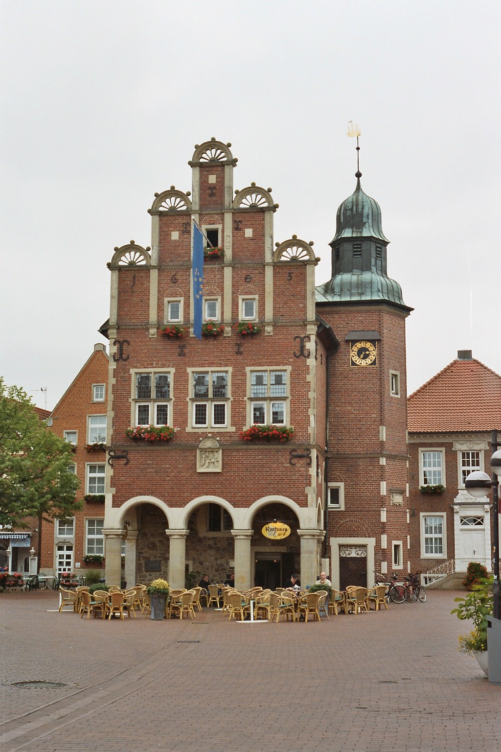
Peine
- district of Lower Saxony, Germany
- Country:
- Capital: Peine
- Licence Plate Code: PE
- Coordinates: 52° 19' 48" N, 10° 15' 0" E
- GPS tracks (wikiloc): [Link]
- AboveSeaLevel: 66 м m
- Area: 535.00 sq km
- Population: 132979
- Web site: [Link]
Details...

Helmstedt
- district of Lower Saxony, Germany
- Country:
- Licence Plate Code: HE
- Coordinates: 52° 15' 0" N, 10° 55' 12" E
- GPS tracks (wikiloc): [Link]
- AboveSeaLevel: 142 м m
- Area: 674.00 sq km
- Population: 92079
- Web site: [Link]
Details...


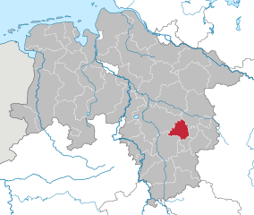
Gifhorn
- district of Lower Saxony, Germany
- Country:
- Capital: Gifhorn
- Licence Plate Code: GF
- Coordinates: 52° 29' 0" N, 10° 33' 0" E
- GPS tracks (wikiloc): [Link]
- AboveSeaLevel: 63 м m
- Area: 1563.00 sq km
- Population: 174749
- Web site: [Link]
Details...


Hildesheim Government Region
- former district of Pussia and Lower Saxony, Germany
- Country:
Details...
Aurich Government Region
- former district of Pussia and Lower Saxony, Germany
- Country:
Details...


Stade Government Region
- former district of Pussia and Lower Saxony, Germany
- Capital: Stade
Details...
Shares border with regions:


Hamburg
- city in Germany, city state and federal state
- Country:
- Postal Code: 22041–22769; 20095–21149
- Local Dialing Code: 04721; 040
- Licence Plate Code: HH
- Coordinates: 53° 33' 0" N, 10° 0' 0" E
- GPS tracks (wikiloc): [Link]
- AboveSeaLevel: 6 м m
- Area: 755.30 sq km
- Population: 1834244
- Web site: [Link]
Details...


Schleswig-Holstein
- state in Northern Germany
- Country:
- Capital: Kiel
- Coordinates: 54° 28' 12" N, 9° 30' 51" E
- GPS tracks (wikiloc): [Link]
- AboveSeaLevel: 12 м m
- Area: 15804.28 sq km
- Population: 2889821
- Web site: [Link]
Details...

Mecklenburg-Vorpommern
- state of Germany
- Country:
- Capital: Schwerin
- Coordinates: 53° 37' 0" N, 12° 42' 0" E
- GPS tracks (wikiloc): [Link]
- AboveSeaLevel: 0 м m
- Area: 23174.0 sq km
- Population: 1596500
- Web site: [Link]
Details...

North Rhine-Westphalia
- state of Germany
- Country:
- Capital: Düsseldorf
- Coordinates: 51° 28' 0" N, 7° 33' 0" E
- GPS tracks (wikiloc): [Link]
- AboveSeaLevel: 45 м m
- Area: 34112.52 sq km
- Population: 17572000
- Web site: [Link]
Details...


Hesse
- state in Germany
- Country:
- Capital: Wiesbaden
- Coordinates: 50° 39' 58" N, 8° 35' 28" E
- GPS tracks (wikiloc): [Link]
- AboveSeaLevel: 264 м m
- Area: 21100.0 sq km
- Population: 6045425
- Web site: [Link]
Details...


Thuringia
- state of Germany
- Country:
- Capital: Erfurt
- Coordinates: 50° 51' 40" N, 11° 3' 7" E
- GPS tracks (wikiloc): [Link]
- AboveSeaLevel: 266 м m
- Area: 16171.0 sq km
- Population: 2161000
- Web site: [Link]
Details...


Saxony-Anhalt
- state of Germany
- Country:
- Capital: Magdeburg
- Coordinates: 51° 58' 16" N, 11° 28' 12" E
- GPS tracks (wikiloc): [Link]
- AboveSeaLevel: 51 м m
- Area: 20451.58 sq km
- Population: 2245470
- Web site: [Link]
Details...


Brandenburg
- state of Germany
- Country:
- Capital: Potsdam
- Coordinates: 52° 21' 43" N, 13° 0' 29" E
- GPS tracks (wikiloc): [Link]
- AboveSeaLevel: 0 м m
- Area: 29478.63 sq km
- Population: 2449193
- Web site: [Link]
Details...
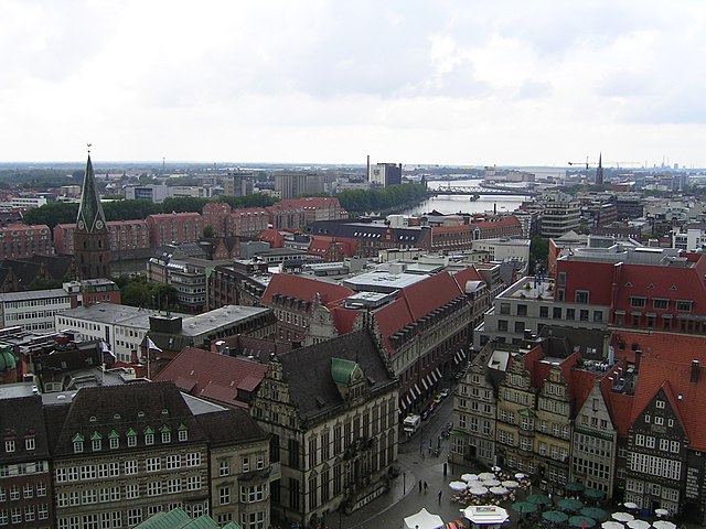

Bremen
- federated state of Germany
- Country:
- Capital: Bremen
- Licence Plate Code: HB
- Coordinates: 53° 20' 50" N, 8° 35' 29" E
- GPS tracks (wikiloc): [Link]
- AboveSeaLevel: 0 м m
- Area: 419.38 sq km
- Population: 661000
- Web site: [Link]
Details...


