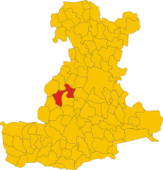
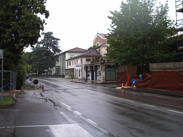
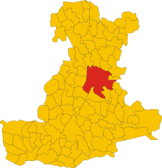
Абано-Терме (Abano Terme, Abano Terme)
- коммуна Италии
Abano Terme, located in the Euganean Hills of northern Italy, is known for its thermal baths and beautiful natural surroundings. While it might not be as renowned for hiking as some other areas in Italy, it does offer several opportunities for walking and exploring the lush landscapes of the Euganean Hills Regional Park. Here are some highlights for hiking in and around Abano Terme:
1.
- The park is characterized by rolling hills, vineyards, and olive groves. It covers more than 18,000 acres and offers numerous trails ranging in difficulty.
- Popular trails lead to scenic viewpoints, including the peaks of Monte Venda, Monte della Madonna, and Monte Gallo.
2.
- Sentiero dei Colli (Hill Path): A network of marked paths that connect various villages in the area, allowing for easy walking and hiking.
- Monte Rua: This is a popular destination for hikes, ascending to one of the highest points in the Euganean Hills with rewarding panoramic views.
- Parks and Nature Reserves: Within the park, there are additional reserves and smaller parks that provide more intimate hiking experiences amid natural beauty.
3.
- The region is rich in biodiversity, boasting a variety of plant species, wildflowers, and wildlife, including deer, foxes, and numerous bird species, particularly during migration seasons.
4.
- Many trails lead to historical sites such as old vineyards, ruins of ancient castles, and charming villages, allowing for a combination of nature and culture during your hikes.
5.
- The ideal times for hiking in Abano Terme are spring (April to June) and autumn (September to November) when the temperatures are mild and the landscapes are particularly beautiful.
6.
- Always carry plenty of water and snacks, wear appropriate footwear, and consider downloading a hiking app or obtaining a physical map of the trails.
- Although many trails are well-marked, it's a good idea to choose routes that match your fitness level and to be mindful of the weather.
7.
- After a day of hiking, you can unwind in one of the famous thermal spas in Abano Terme, taking advantage of the region’s thermal waters to relax and rejuvenate.
If you're in the area and want to hike, be sure to explore the trails and take in the beautiful landscapes, the local flora and fauna, and the cultural heritage of this charming part of Italy!
- Страна:

- Почтовый код: 35031
- Телефонный код: 049
- Код автомобильного номера: PD
- Координаты: 45° 21' 43" N, 11° 47' 33" E


- GPS треки (wikiloc): [Ссылка]
- Высота над уровнем моря: 14 м m
- Площадь: 21.41 кв.км
- Население: 9950
- Веб сайт: http://www.comune.abanoterme.pd.it/
- Википедия русская: wiki(ru)
- Википедия английская: wiki(en)
- Википедия национальная: wiki(it)
- Хранилище Wikidata: Wikidata: Q34603
- Катеория в википедии: [Ссылка]
- код Freebase: [/m/0_l8]
- код GeoNames: Альт: [6541001]
- код VIAF: Альт: [154802445]
- ID отношения в OpenStreetMap: [44739]
- WOEID: [12675700]
- код темы Quora: [Abano-Terme]
- UN/LOCODE: [ITAOM]
- код в Большой российской энциклопедии онлайн: [660199]
- код ISTAT: 028001
- кадастровый код Италии: A001
Граничит с регионами:


Монтегротто-Терме
- коммуна Италии
Montegrotto Terme, located in the Veneto region of Italy, is well-known for its thermal baths and beautiful natural surroundings, making it a great location for hiking enthusiasts. It is situated at the foot of the Colli Euganei Regional Park, which offers a variety of hiking trails suitable for different skill levels....
- Страна:

- Почтовый код: 35036
- Телефонный код: 049
- Код автомобильного номера: PD
- Координаты: 45° 20' 0" N, 11° 47' 0" E


- GPS треки (wikiloc): [Ссылка]
- Высота над уровнем моря: 11 м m
- Площадь: 15.37 кв.км
- Население: 11448
- Веб сайт: [Ссылка]


Теоло
- коммуна Италии
Teolo is a charming town located in the Veneto region of Italy, situated near the Euganean Hills, which are known for their beautiful landscapes, rich history, and diverse flora and fauna. Hiking in Teolo offers a variety of trails and paths that cater to different skill levels and preferences....
- Страна:

- Почтовый код: 35037
- Телефонный код: 049
- Код автомобильного номера: PD
- Координаты: 45° 21' 0" N, 11° 40' 0" E


- GPS треки (wikiloc): [Ссылка]
- Высота над уровнем моря: 175 м m
- Площадь: 31.2 кв.км
- Население: 9014
- Веб сайт: [Ссылка]
Мазера-ди-Падова
- коммуна Италии
Maserà di Padova, a small town located in the province of Padua in northern Italy, offers a variety of outdoor activities, including hiking. The area boasts a mix of natural beauty and cultural heritage, making it an appealing destination for hikers....
- Страна:

- Почтовый код: 35020
- Телефонный код: 049
- Код автомобильного номера: PD
- Координаты: 45° 19' 0" N, 11° 52' 0" E


- GPS треки (wikiloc): [Ссылка]
- Высота над уровнем моря: 9 м m
- Площадь: 17.58 кв.км
- Население: 9127
- Веб сайт: [Ссылка]


Дуе-Карраре
- коммуна Италии
Due Carrare is a charming town located in the province of Padua in the Veneto region of Italy. While it may not be a major hiking destination like the Dolomites or the Italian Alps, there are still opportunities for outdoor enthusiasts to enjoy hiking in the surrounding areas. Here are some aspects to consider if you're planning a hiking trip in and around Due Carrare:...
- Страна:

- Почтовый код: 35020
- Телефонный код: 049
- Код автомобильного номера: PD
- Координаты: 45° 17' 0" N, 11° 50' 0" E


- GPS треки (wikiloc): [Ссылка]
- Высота над уровнем моря: 8 м m
- Площадь: 26.56 кв.км
- Население: 9026
- Веб сайт: [Ссылка]


Сельваццано-Дентро
- коммуна Италии
Selvazzano Dentro is located in the province of Padua in Italy, and while it may not be a well-known hiking destination compared to larger national parks or mountainous regions, there are opportunities for outdoor activities and hiking in the surrounding areas....
- Страна:

- Почтовый код: 35030
- Телефонный код: 049
- Код автомобильного номера: PD
- Координаты: 45° 23' 0" N, 11° 47' 0" E


- GPS треки (wikiloc): [Ссылка]
- Высота над уровнем моря: 18 м m
- Площадь: 19.52 кв.км
- Население: 22903
- Веб сайт: [Ссылка]
Альбиньазего
- коммуна Италии
Albignasego is a municipality in the province of Padua, Italy, located in the Veneto region. While it may not be as widely recognized for hiking as some other areas in the Italian Alps or Apennines, there are still opportunities for outdoor activities and enjoying nature in the surrounding landscapes....
- Страна:

- Почтовый код: 35020
- Телефонный код: 049
- Код автомобильного номера: PD
- Координаты: 45° 21' 0" N, 11° 52' 0" E


- GPS треки (wikiloc): [Ссылка]
- Высота над уровнем моря: 11 м m
- Площадь: 21.16 кв.км
- Население: 26071
- Веб сайт: [Ссылка]


Торрелья
- коммуна Италии
Torreglia is a picturesque town located in the Euganean Hills Regional Park in the Veneto region of Italy. It's a great destination for hiking enthusiasts due to its beautiful landscapes, diverse flora and fauna, and historical sites....
- Страна:

- Почтовый код: 35038
- Телефонный код: 049
- Код автомобильного номера: PD
- Координаты: 45° 20' 0" N, 11° 44' 0" E


- GPS треки (wikiloc): [Ссылка]
- Высота над уровнем моря: 23 м m
- Площадь: 18.85 кв.км
- Население: 6119
- Веб сайт: [Ссылка]


Падуя
- город в Италии
Padua, located in the Veneto region of Italy, is not typically known as a primary hiking destination, but it does offer several opportunities for outdoor enthusiasts to explore the surrounding natural beauty. Here are some popular hiking options and tips for hiking around Padua:...
- Страна:

- Почтовый код: 35121–35143
- Телефонный код: 049
- Код автомобильного номера: PD
- Координаты: 45° 24' 23" N, 11° 52' 40" E


- GPS треки (wikiloc): [Ссылка]
- Высота над уровнем моря: 27 м m
- Площадь: 93.03 кв.км
- Население: 211560
- Веб сайт: [Ссылка]

