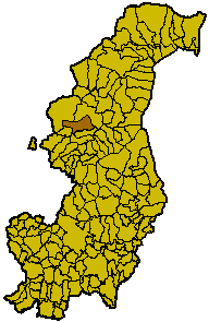
Alta Valle Intelvi (Alta Valle Intelvi)
.svg)
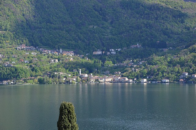
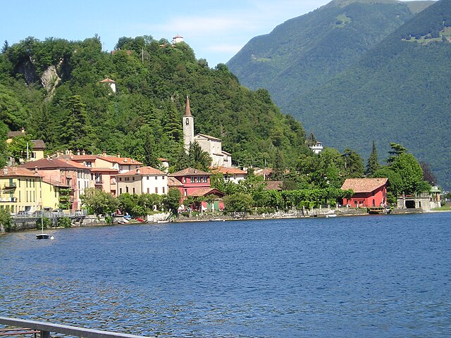
 Hiking in Alta Valle Intelvi
Alta Valle Intelvi is a beautiful area located in the Lombardy region of Italy, nestled between Lake Como and Lake Lugano. It's known for its stunning landscapes, charming villages, and rich natural biodiversity, making it a fantastic destination for hiking enthusiasts. Here are some key highlights for hiking in this region:
Trails and Routes
-
Sentiero dei Wels: This trail offers breathtaking views of both Lake Como and Lake Lugano. It’s a moderate hike that takes you through lush forests and iconic local landscapes.
-
Monte Generoso: This is one of the notable peaks in the area, providing stunning panoramic views. The hike can be challenging, but the reward at the summit is worth the effort.
-
La Via dei Monti Lariani: This long-distance trail connects various points along the western shore of Lake Como and passes through the Alta Valle Intelvi. It is best suited for experienced hikers who enjoy long treks.
-
Lake D'Intevi: A serene hike around this small lake is perfect for a relaxed day out. The scenic surroundings make it an enjoyable experience for families and beginner hikers.
Flora and Fauna
The region is biodiverse, hosting a variety of plant species and wildlife. Be on the lookout for different types of birds, mammals, and unique plants as you trek through forests and along mountain paths.
Best Time to Hike
The best time to hike in Alta Valle Intelvi is during the spring and early fall months (April to June and September to October). During these times, the weather is typically mild, and the landscapes are lush and vibrant.
Safety Tips
- Bring Plenty of Water: Hydration is crucial, especially on longer hikes.
- Dress Appropriately: Wear layered clothing and sturdy hiking boots for varied terrain.
- Check Weather Conditions: Weather can change quickly in the mountains, so be prepared for rain or wind.
- Navigation Tools: Carry a map or GPS device, as some trails may not be well-marked.
Local Culture
Take some time to explore the quaint villages spread throughout the valley, where you can enjoy local cuisine and interact with friendly locals. Trying regional specialties like polenta or local cheeses can be a delightful end to a day of hiking.
Whether you’re an experienced hiker or a casual walker, the Alta Valle Intelvi offers a variety of trails and captivating natural beauty that can cater to all levels of hiking enthusiasts.
- Страна:

- Почтовый код: 22020; 22024
- Телефонный код: 031
- Код автомобильного номера: CO
- Координаты: 45° 59' 5" N, 9° 1' 38" E


- GPS треки (wikiloc): [Ссылка]
- Высота над уровнем моря: 907 м m
- Площадь: 24.95 кв.км
- Население: 2942
- Веб сайт: http://www.comune.altavalleintelvi.co.it/
- Википедия английская: wiki(en)
- Википедия национальная: wiki(it)
- Хранилище Wikidata: Wikidata: Q28104766
- Катеория в википедии: [Ссылка]
- ID отношения в OpenStreetMap: [46669]
- код ISTAT: 013253
- кадастровый код Италии: M383
Включает регионы:


Пеллио-Интельви
- коммуна Италии
Hiking in Пеллио-Интельви
Pellio Intelvi is a charming village located in the Intelvi Valley in the Lombardy region of Italy, near the Swiss border and a short distance from Lake Como. The area offers a variety of hiking opportunities, showcasing beautiful landscapes, lush forests, and panoramic views of the surrounding mountains....
- Страна:
- Почтовый код: 22020
- Телефонный код: 031
- Код автомобильного номера: CO
- Координаты: 45° 59' 0" N, 9° 4' 0" E
- GPS треки (wikiloc): [Ссылка]
- Высота над уровнем моря: 1010 м m
- Площадь: 9.99 кв.км
- Население: 966
- Веб сайт: [Ссылка]
Рампонио-Верна
- коммуна Италии
Hiking in Рампонио-Верна
Ramponio Verna is a picturesque village located in the province of Como, in the Lombardy region of northern Italy. It’s surrounded by natural beauty and offers hiking enthusiasts a variety of trails that showcase its stunning landscapes, including wooded areas, panoramic views, and charming rural settings....
- Страна:
- Почтовый код: 22020
- Телефонный код: 031
- Код автомобильного номера: CO
- Координаты: 45° 59' 0" N, 9° 4' 0" E
- GPS треки (wikiloc): [Ссылка]
- Высота над уровнем моря: 705 м m
- Площадь: 4.92 кв.км
- Веб сайт: [Ссылка]


Ланцо-д’Интельви
- коммуна Италии
Hiking in Ланцо-д’Интельви
Lanzo d'Intelvi is a charming mountain town located in the Italian Alps, specifically in the region of Lombardy. It's a lesser-known but beautiful destination for hiking, offering stunning views, rich flora and fauna, and various trails for different skill levels....
- Страна:
- Почтовый код: 22024
- Телефонный код: 031
- Код автомобильного номера: CO
- Координаты: 45° 59' 0" N, 9° 2' 0" E
- GPS треки (wikiloc): [Ссылка]
- Высота над уровнем моря: 907 м m
- Площадь: 10.04 кв.км
- Население: 1480
Граничит с регионами:
Клайно-кон-Остено
- коммуна Италии
Hiking in Клайно-кон-Остено
Claino con Osteno, located in the province of Como in Lombardy, Italy, is a picturesque area that offers a unique blend of nature, culture, and tranquility. Nestled along the western shore of Lake Como, this small town provides access to beautiful hiking trails that cater to different skill levels....
- Страна:
- Почтовый код: 22010
- Телефонный код: 0344
- Код автомобильного номера: CO
- Координаты: 46° 0' 0" N, 9° 5' 0" E
- GPS треки (wikiloc): [Ссылка]
- Высота над уровнем моря: 280 м m
- Площадь: 12.9 кв.км
- Население: 560
- Веб сайт: [Ссылка]


Centro Valle Intelvi
Hiking in Centro Valle Intelvi
Centro Valle Intelvi, located in the Lombardy region of Italy, is a beautiful area for hiking, surrounded by stunning landscapes, lush forests, and charming villages. Here are some highlights about hiking in this region:...
- Страна:
- Почтовый код: 22023 (dal 18/06/2018)
- Телефонный код: 031
- Код автомобильного номера: CO
- Координаты: 45° 58' 0" N, 9° 5' 0" E
- GPS треки (wikiloc): [Ссылка]
- Высота над уровнем моря: 799 м m
- Площадь: 19.66 кв.км
- Население: 3524
Лайно
- коммуна Италии
Hiking in Лайно
Laino, located in the Calabria region of southern Italy, is surrounded by picturesque landscapes and offers some fantastic opportunities for hiking enthusiasts. The area is characterized by its rugged mountains, lush forests, and stunning views of the surrounding valleys and rivers. Here are some highlights and tips for hiking in Laino:...
- Страна:
- Почтовый код: 22020
- Телефонный код: 031
- Код автомобильного номера: CO
- Координаты: 45° 58' 0" N, 9° 5' 0" E
- GPS треки (wikiloc): [Ссылка]
- Высота над уровнем моря: 700 м m
- Площадь: 6.68 кв.км
- Население: 516
- Веб сайт: [Ссылка]

Вальсольда
- коммуна Италии
Hiking in Вальсольда
Valsolda is a beautiful area situated on the eastern shore of Lake Lugano in northern Italy, known for its stunning landscapes, quaint villages, and a variety of hiking trails. Here are some key points about hiking in Valsolda:...
- Страна:
- Почтовый код: 22010
- Телефонный код: 0344
- Код автомобильного номера: CO
- Координаты: 46° 2' 0" N, 9° 3' 0" E
- GPS треки (wikiloc): [Ссылка]
- Высота над уровнем моря: 275 м m
- Площадь: 31.74 кв.км
- Население: 1548
- Веб сайт: [Ссылка]


Rovio
Hiking in Rovio
Rovio is a charming village located in the beautiful region of Ticino, Switzerland. Nestled in the foothills of the Lugano Mountains, it offers several trails that showcase the stunning scenery of the area, including panoramic views of Lake Lugano and the surrounding mountains....
- Страна:

- Почтовый код: 6821
- Телефонный код: 091
- Код автомобильного номера: TI
- Координаты: 45° 56' 0" N, 8° 59' 0" E
- GPS треки (wikiloc): [Ссылка]
- Высота над уровнем моря: 497 м m
- Площадь: 5.56 кв.км
- Население: 838
- Веб сайт: [Ссылка]


Arogno
Hiking in Arogno
Arogno is a small municipality in the canton of Ticino in southern Switzerland, nestled in the foothills of the Swiss Alps. It's known for its beautiful landscapes, charming villages, and rich cultural heritage. Hiking in Arogno offers a delightful experience, with picturesque trails that showcase stunning views of the surrounding mountains, valleys, and Lake Lugano....
- Страна:
- Почтовый код: 6822
- Телефонный код: 091
- Код автомобильного номера: TI
- Координаты: 45° 58' 0" N, 8° 59' 0" E
- GPS треки (wikiloc): [Ссылка]
- Высота над уровнем моря: 606 м m
- Площадь: 8.53 кв.км
- Население: 1011
- Веб сайт: [Ссылка]