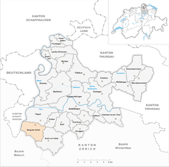
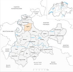
Андельфинген (Andelfingen District, Bezirk Andelfingen)

 Hiking in Андельфинген
Andelfingen District, located in the canton of Zurich, Switzerland, is a picturesque area that offers a variety of hiking opportunities. The region is characterized by rolling hills, vineyards, and scenic views, making it an excellent destination for outdoor enthusiasts.
Highlights of Hiking in Andelfingen District:
-
Scenic Landscapes: The district features beautiful landscapes with a mix of forests, meadows, and vineyards. As you hike, you'll be treated to stunning vistas of the surrounding countryside and the Rhine River.
-
Varied Trail Options: There are numerous trails suitable for hikers of all levels. Whether you're looking for a leisurely stroll or a more challenging hike, you can find paths that fit your preferences.
-
Historical Sites: Some trails may take you past historical sites, including charming villages, churches, and castles. The area is rich in culture and history, which adds another layer to your hiking experience.
-
Wildlife: The region's diverse ecosystems host various wildlife species, making it a great place for nature lovers and bird watchers.
-
Vineyard Trails: Since the district is known for its wine production, you can enjoy specific vineyard trails that offer guided tours, tastings, and an opportunity to learn about local viticulture.
Recommended Hikes:
-
Andelfingen to Eglisau: This is a relatively easy trail that follows the Rhine and offers beautiful river views along with peaceful countryside scenery.
-
Zuglikon Loop: A moderate loop that takes you through vineyards and forests, with various lookout points to absorb the beauty of the surrounding landscapes.
-
Hiking Trails in the Zürcher Weinland: This area is known for its wine culture, and there are numerous trails that weave through the vineyards providing a unique hiking experience combined with local wine tasting opportunities.
Tips for Hiking in Andelfingen District:
-
Maps and Signage: Make sure to have a good map or use a hiking app, as the trails are generally well-marked but can sometimes be confusing in dense forests.
-
Weather: Check the weather conditions before setting out, as they can change rapidly in mountainous regions. Dress in layers to adapt to temperature changes.
-
Respect Nature: Stay on marked trails to protect the natural environment and wildlife.
-
Local Amenities: Take note of any local amenities such as water sources, rest areas, or nearby cafes where you can take a break and refresh.
Enjoy your hiking adventure in Andelfingen District! The natural beauty and tranquil surroundings will surely make for a memorable experience.
- Страна:

- Код автомобильного номера: ZH
- Координаты: 47° 37' 0" N, 8° 40' 0" E


- GPS треки (wikiloc): [Ссылка]
- Высота над уровнем моря: 424 м m
- Площадь: 166.59 кв.км
- Википедия русская: wiki(ru)
- Википедия английская: wiki(en)
- Википедия национальная: wiki(de)
- Хранилище Wikidata: Wikidata: Q660721
- Катеория в википедии: [Ссылка]
- код Freebase: [/m/026m3fd]
- код GeoNames: Альт: [2661751]
- идентификатор местоположения ArchINFORM: [42727]
- идентификатор HDS: [7825]
Включает регионы:

Берг-ам-Ирхель
Hiking in Берг-ам-Ирхель
Berg am Irchel is a small village in the Zurich region of Switzerland, surrounded by beautiful natural landscapes that offer various hiking opportunities. Here are some highlights for hiking in and around Berg am Irchel:...
- Страна:
- Почтовый код: 8415
- Телефонный код: 052
- Код автомобильного номера: ZH
- Координаты: 47° 33' 59" N, 8° 35' 59" E
- GPS треки (wikiloc): [Ссылка]
- Высота над уровнем моря: 410 м m
- Площадь: 7.06 кв.км
- Население: 562
- Веб сайт: [Ссылка]


Тальхайм-ан-дер-Тур
Hiking in Тальхайм-ан-дер-Тур
Thalheim an der Thur is a picturesque village located in the canton of Thurgau in Switzerland. The area is characterized by its rolling hills, lush forests, and scenic views, making it an excellent spot for hiking enthusiasts....
- Страна:
- Почтовый код: 8478
- Телефонный код: 052
- Код автомобильного номера: ZH
- Координаты: 47° 34' 50" N, 8° 45' 15" E
- GPS треки (wikiloc): [Ссылка]
- Высота над уровнем моря: 385 м m
- Площадь: 6.44 кв.км
- Население: 922
- Веб сайт: [Ссылка]


Фойертален
Hiking in Фойертален
Feuerthalen is a charming village located in the Canton of Schaffhausen in Switzerland, situated along the banks of the Rhine River. It's an excellent spot for hiking, featuring beautiful landscapes, scenic views, and a variety of trails suitable for different skill levels. Here are some highlights for those interested in hiking in and around Feuerthalen:...
- Страна:
- Почтовый код: 8445
- Телефонный код: 052
- Код автомобильного номера: ZH
- Координаты: 47° 41' 32" N, 8° 38' 43" E
- GPS треки (wikiloc): [Ссылка]
- Высота над уровнем моря: 400 м m
- Площадь: 2.49 кв.км
- Население: 3636
- Веб сайт: [Ссылка]


Лауфен-Увизен
Hiking in Лауфен-Увизен
Laufen-Uhwiesen is a picturesque area located in the canton of Zurich, Switzerland, known for its beautiful natural landscapes and hiking opportunities. Here’s what you need to know about hiking in this region:...
- Страна:
- Почтовый код: 8248
- Телефонный код: 052
- Код автомобильного номера: ZH
- Координаты: 47° 40' 15" N, 8° 38' 12" E
- GPS треки (wikiloc): [Ссылка]
- Высота над уровнем моря: 457 м m
- Площадь: 6.27 кв.км
- Население: 1669
- Веб сайт: [Ссылка]


Флурлинген
Hiking in Флурлинген
Flurlingen is a charming village located in the canton of Zurich, Switzerland, near the banks of the Rhine River. This area offers beautiful natural scenery and a variety of hiking trails suitable for different skill levels....
- Страна:
- Телефонный код: 052
- Код автомобильного номера: ZH
- Координаты: 47° 41' 2" N, 8° 37' 42" E
- GPS треки (wikiloc): [Ссылка]
- Высота над уровнем моря: 406 м m
- Площадь: 2.40 кв.км
- Население: 1437
- Веб сайт: [Ссылка]

Мартален
- населённый пункт в Швейцарии
Hiking in Мартален
Marthalen, located in the Zurich region of Switzerland, offers beautiful hiking opportunities with stunning views of the surrounding landscapes, including the Rhine River and the hilly terrain of the region. Here are some highlights for hiking in Marthalen:...
- Страна:
- Почтовый код: 8460
- Телефонный код: 052
- Код автомобильного номера: ZH
- Координаты: 47° 37' 36" N, 8° 39' 2" E
- GPS треки (wikiloc): [Ссылка]
- Высота над уровнем моря: 362 м m
- Площадь: 14.11 кв.км
- Население: 1949
- Веб сайт: [Ссылка]


Вальталинген
Hiking in Вальталинген
Waltalingen is a picturesque area located in Switzerland, near the town of Riehen and the border with Germany. While it may not be one of the most famous hiking destinations, it offers beautiful trails and landscapes that are perfect for a day of hiking amidst nature....
- Страна:
- Почтовый код: 8468
- Телефонный код: 052
- Код автомобильного номера: ZH
- Координаты: 47° 37' 24" N, 8° 46' 47" E
- GPS треки (wikiloc): [Ссылка]
- Высота над уровнем моря: 454 м m
- Площадь: 7.25 кв.км
- Население: 654
- Веб сайт: [Ссылка]

Райнау
Hiking in Райнау
Rheinau, located in the Zürcher Oberland region of Switzerland, is known for its stunning landscapes and beautiful hiking trails. The area offers a mix of scenic views, lush greenery, and opportunities to explore the surrounding nature. Here are some highlights about hiking in Rheinau:...
- Страна:
- Почтовый код: 8462
- Телефонный код: 052
- Код автомобильного номера: ZH
- Координаты: 47° 38' 45" N, 8° 36' 24" E
- GPS треки (wikiloc): [Ссылка]
- Высота над уровнем моря: 400 м m
- Площадь: 8.93 кв.км
- Население: 1298
- Веб сайт: [Ссылка]


Оберштамхайм
Hiking in Оберштамхайм
Oberstammheim, located in the Zurich region of Switzerland, offers a range of delightful hiking opportunities amidst beautiful landscapes. The area is characterized by rolling hills, vineyards, and scenic views of the surrounding countryside. Here are some details to consider when planning a hike in Oberstammheim:...
- Страна:
- Почтовый код: 8477
- Телефонный код: 052
- Код автомобильного номера: ZH
- Координаты: 47° 38' 2" N, 8° 47' 58" E
- GPS треки (wikiloc): [Ссылка]
- Высота над уровнем моря: 440 м m
- Площадь: 9.36 кв.км
- Население: 1196
- Веб сайт: [Ссылка]


Фолькен
Hiking in Фолькен
Volken, located in Switzerland, is a picturesque area for hiking, surrounded by stunning landscapes that include rolling hills, dense forests, and scenic views of the nearby mountains. While it may not be as widely known as some of the larger hiking destinations in Switzerland, it offers a peaceful environment for outdoor enthusiasts....
- Страна:
- Почтовый код: 8459
- Телефонный код: 052
- Код автомобильного номера: ZH
- Координаты: 47° 34' 35" N, 8° 37' 48" E
- GPS треки (wikiloc): [Ссылка]
- Высота над уровнем моря: 406 м m
- Площадь: 3.2 кв.км
- Население: 337
- Веб сайт: [Ссылка]

Трюлликон
Hiking in Трюлликон
Trüllikon is a small village located in the Canton of Zurich, Switzerland, surrounded by beautiful landscapes that are perfect for hiking enthusiasts. The region offers a variety of trails that cater to different skill levels, from easy walks suitable for families to more challenging routes for experienced hikers....
- Страна:
- Почтовый код: 8466
- Телефонный код: 052
- Код автомобильного номера: ZH
- Координаты: 47° 38' 31" N, 8° 41' 4" E
- GPS треки (wikiloc): [Ссылка]
- Высота над уровнем моря: 477 м m
- Площадь: 9.80 кв.км
- Население: 1054
- Веб сайт: [Ссылка]


Унтерштамхайм
Hiking in Унтерштамхайм
Unterstammheim is a picturesque village in the Zurich district of Switzerland, surrounded by beautiful landscapes and offers various hiking opportunities. The region is characterized by rolling hills, vineyards, and scenic views of the countryside, making it a great spot for hikers of different skill levels....
- Страна:
- Почтовый код: 8476
- Телефонный код: 052
- Код автомобильного номера: ZH
- Координаты: 47° 38' 21" N, 8° 47' 25" E
- GPS треки (wikiloc): [Ссылка]
- Высота над уровнем моря: 464 м m
- Площадь: 7.32 кв.км
- Население: 891
- Веб сайт: [Ссылка]


Даксен
Hiking in Даксен
Dachsen, located in the Zurich region of Switzerland, is a fantastic destination for hikers, thanks to its stunning natural scenery and diverse trails. Here’s an overview of what you can expect when hiking in and around Dachsen:...
- Страна:
- Почтовый код: 8447
- Телефонный код: 052
- Код автомобильного номера: ZH
- Координаты: 47° 39' 38" N, 8° 37' 29" E
- GPS треки (wikiloc): [Ссылка]
- Высота над уровнем моря: 400 м m
- Площадь: 2.7 кв.км
- Население: 1931
- Веб сайт: [Ссылка]


Адликон-Андельфинген
Hiking in Адликон-Андельфинген
Adlikon bei Andelfingen is a charming village located in the Zurich canton of Switzerland, surrounded by picturesque landscapes that are perfect for hiking enthusiasts. The area boasts a variety of trails suitable for different skill levels, making it an excellent destination for both novice and experienced hikers....
- Страна:
- Почтовый код: 8452
- Телефонный код: 052
- Код автомобильного номера: ZH
- Координаты: 47° 35' 6" N, 8° 42' 26" E
- GPS треки (wikiloc): [Ссылка]
- Высота над уровнем моря: 444 м m
- Площадь: 6.58 кв.км
- Население: 655
- Веб сайт: [Ссылка]


Оссинген
Hiking in Оссинген
Ossingen is a charming municipality located in the canton of Zurich, Switzerland. While it may not be one of the most well-known hiking destinations, it offers beautiful landscapes and a serene environment perfect for outdoor enthusiasts....
- Страна:
- Почтовый код: 8475
- Телефонный код: 052
- Код автомобильного номера: ZH
- Координаты: 47° 36' 46" N, 8° 43' 37" E
- GPS треки (wikiloc): [Ссылка]
- Высота над уровнем моря: 415 м m
- Площадь: 13.07 кв.км
- Население: 1566
- Веб сайт: [Ссылка]

Клайнандельфинген
Hiking in Клайнандельфинген
Kleinandelfingen, located in the picturesque region of Switzerland, offers a variety of hiking opportunities for outdoor enthusiasts. The area is characterized by its scenic landscapes, rolling hills, and beautiful views of the Swiss countryside, making it a delightful destination for both casual hikers and more experienced trekkers....
- Страна:
- Почтовый код: 8451
- Телефонный код: 052
- Код автомобильного номера: ZH
- Координаты: 47° 36' 30" N, 8° 40' 16" E
- GPS треки (wikiloc): [Ссылка]
- Высота над уровнем моря: 357 м m
- Площадь: 10.29 кв.км
- Население: 2077
- Веб сайт: [Ссылка]


Хенггарт
Hiking in Хенггарт
Henggart, located in the Zürcher Oberland in Switzerland, is an excellent destination for hiking enthusiasts. The region features picturesque landscapes, rolling hills, lush forests, and stunning views of the surrounding Alps. Here are some key points to consider when hiking in Henggart:...
- Страна:
- Почтовый код: 8444
- Телефонный код: 052
- Код автомобильного номера: ZH
- Координаты: 47° 33' 45" N, 8° 41' 1" E
- GPS треки (wikiloc): [Ссылка]
- Высота над уровнем моря: 446 м m
- Площадь: 3.03 кв.км
- Население: 2256
- Веб сайт: [Ссылка]


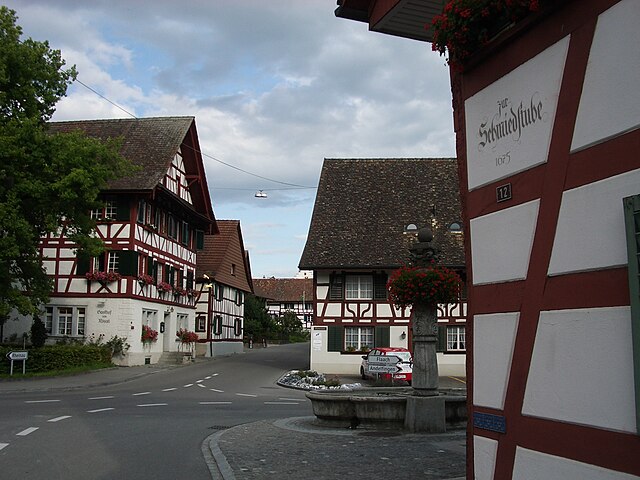
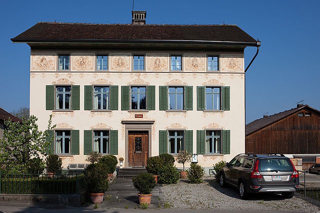
Андельфинген
Hiking in Андельфинген
Andelfingen, a charming village located in the Canton of Zurich in Switzerland, offers a variety of hiking opportunities that showcase the stunning landscapes and natural beauty of the region. Here are some key points for hiking in and around Andelfingen:...
- Страна:
- Телефонный код: 052
- Код автомобильного номера: ZH
- Координаты: 47° 35' 41" N, 8° 40' 44" E
- GPS треки (wikiloc): [Ссылка]
- Высота над уровнем моря: 370 м m
- Площадь: 6.74 кв.км
- Население: 2201
- Веб сайт: [Ссылка]


Хумликон
Hiking in Хумликон
Humlikon, a small village located in Switzerland, offers a tranquil hiking experience surrounded by beautiful landscapes and picturesque scenery. While Humlikon itself is not a major hiking destination, it is well-positioned for accessing trails in the surrounding areas, particularly in the nearby Zurich region and the beautiful cantons of Aargau and Thurgau....
- Страна:
- Почтовый код: 8457
- Телефонный код: 052
- Код автомобильного номера: ZH
- Координаты: 47° 34' 31" N, 8° 40' 31" E
- GPS треки (wikiloc): [Ссылка]
- Высота над уровнем моря: 435 м m
- Площадь: 3.68 кв.км
- Население: 486
- Веб сайт: [Ссылка]


Бух-ам-Ирхель
Hiking in Бух-ам-Ирхель
Buch am Irchel is a charming village located in the cantonal region of Zurich, Switzerland. It offers a variety of hiking opportunities, with beautiful landscapes and scenic views typical of the Swiss countryside. Here are some highlights for hiking in and around Buch am Irchel:...
- Страна:
- Почтовый код: 8414
- Телефонный код: 052
- Код автомобильного номера: ZH
- Координаты: 47° 32' 56" N, 8° 37' 19" E
- GPS треки (wikiloc): [Ссылка]
- Высота над уровнем моря: 534 м m
- Площадь: 10.21 кв.км
- Население: 970
- Веб сайт: [Ссылка]


Труттикон
Hiking in Труттикон
Truttikon is a charming village located in the Zürcher Oberland region of Switzerland, known for its beautiful countryside and scenic hiking trails. The area offers a variety of picturesque routes suitable for hikers of all levels, from leisurely walks to more challenging hikes....
- Страна:
- Почтовый код: 8467
- Телефонный код: 052
- Код автомобильного номера: ZH
- Координаты: 47° 37' 59" N, 8° 43' 48" E
- GPS треки (wikiloc): [Ссылка]
- Высота над уровнем моря: 467 м m
- Площадь: 4.42 кв.км
- Население: 477
- Веб сайт: [Ссылка]

Бенкен
Hiking in Бенкен
Hiking in Benken, located in the Zurich region of Switzerland, offers a delightful experience that combines scenic landscapes with a peaceful countryside atmosphere. Here’s what you need to know:...
- Страна:
- Почтовый код: 8463
- Телефонный код: 052
- Код автомобильного номера: ZH
- Координаты: 47° 39' 15" N, 8° 39' 14" E
- GPS треки (wikiloc): [Ссылка]
- Высота над уровнем моря: 420 м m
- Площадь: 5.66 кв.км
- Население: 857
- Веб сайт: [Ссылка]


Дорф
Hiking in Дорф
Dorf, Switzerland, is a charming village that offers stunning landscapes and excellent hiking opportunities. While "Dorf" generally means "village" in German, there are several specific villages in Switzerland with "Dorf" in their name, such as Zermatt Dorf or Lauterbrunnen Dorf. Each of these areas has its unique hiking trails and attractions. Here's a general overview of what you can expect when hiking in a Swiss Dorf:...
- Страна:
- Почтовый код: 8458
- Телефонный код: 052
- Код автомобильного номера: ZH
- Координаты: 47° 34' 27" N, 8° 38' 59" E
- GPS треки (wikiloc): [Ссылка]
- Высота над уровнем моря: 426 м m
- Площадь: 5.56 кв.км
- Население: 684
- Веб сайт: [Ссылка]


Флах
Hiking in Флах
Flaach, located in the Zurich district of Switzerland, is an excellent destination for hiking enthusiasts. Nestled in the Zürcher Oberland, the area offers picturesque landscapes, diverse trails, and a variety of nature experiences....
- Страна:
- Почтовый код: 8416
- Телефонный код: 052
- Код автомобильного номера: ZH
- Координаты: 47° 34' 35" N, 8° 36' 33" E
- GPS треки (wikiloc): [Ссылка]
- Высота над уровнем моря: 360 м m
- Площадь: 10.16 кв.км
- Население: 1375
- Веб сайт: [Ссылка]
Граничит с регионами:

Винтертур
Hiking in Винтертур
Hiking in the Winterthur District, located in the canton of Zurich, Switzerland, offers a wonderful blend of natural beauty, cultural heritage, and well-maintained trails. Here are some key aspects to consider for hiking in this area:...
- Страна:
- Столица: Винтертур
- Код автомобильного номера: ZH
- Координаты: 47° 30' 0" N, 8° 46' 0" E
- GPS треки (wikiloc): [Ссылка]
- Высота над уровнем моря: 460 м m
- Площадь: 251.30 кв.км


Бюлах
Hiking in Бюлах
Bülach District, located in the Canton of Zurich in Switzerland, offers a variety of hiking opportunities that cater to different skill levels and preferences. The region is characterized by beautiful landscapes, cultivated fields, lush forests, and historic towns....
- Страна:
- Столица: Бюлах
- Код автомобильного номера: ZH
- Координаты: 47° 40' 0" N, 8° 34' 0" E
- GPS треки (wikiloc): [Ссылка]
- Высота над уровнем моря: 564 м m
- Площадь: 185.19 кв.км
- Население: 117000