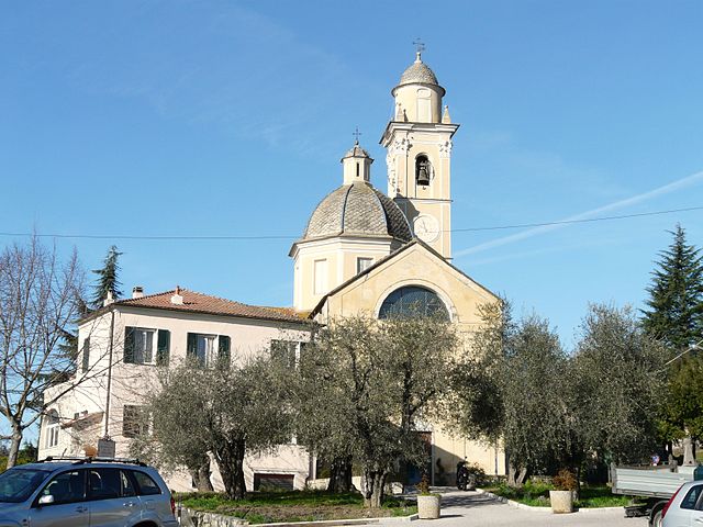
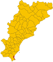
Андора (Andora, Andora)
.svg)
- коммуна Италии
 Hiking in Андора
Andorra, a small principality nestled in the Pyrenees mountains between France and Spain, offers a unique and stunning landscape for hiking enthusiasts. With its rugged terrain, picturesque villages, and rich biodiversity, Andorra is an ideal destination for hikers of all skill levels. Here are some key points about hiking in Andorra:
Types of Hiking Trails
-
Moderate to Advanced Trails: Many hikes in Andorra range from moderate to challenging, making them suitable for experienced hikers. The higher mountain trails, especially those leading to summits or vistas, can be demanding but are incredibly rewarding.
-
Family-Friendly Trails: There are also many easier, well-marked trails that are perfect for families and novice hikers. These trails often lead to scenic spots and are generally safe and accessible.
-
Long-Distance Trails: Andorra has several long-distance trails, including the Andorran GR 11 (a part of the European long-distance footpath network). This trail offers breathtaking views and the possibility to experience diverse landscapes.
Popular Hiking Regions
-
Grandvalira: Known for its ski slopes, Grandvalira also offers fantastic hiking paths during the summer months. You can explore areas like the Pic d’Encampadana for stunning views.
-
Sorteny Valley Natural Park: This area is renowned for its rich flora and varied landscape, featuring trails that showcase beautiful wildflower meadows and unique geological formations.
-
Coma Pedrosa: The highest peak in Andorra, Coma Pedrosa offers a challenging hike that rewards adventurers with panoramic views of the surrounding mountains.
-
Vall de Núria: Located near the French border, this valley features various trails, including some that follow the picturesque Arrós river.
Best Time to Hike
The best time to hike in Andorra is generally from late spring to early autumn (May to October). During this period, the weather is typically mild, snow has melted, and the trails are more accessible. However, the summer months can be busy, so it's wise to start early in the morning to avoid crowds.
Preparation and Considerations
- Gear: Appropriate hiking gear is essential. Make sure to wear sturdy boots, dress in layers, and pack plenty of water and snacks.
- Maps and Guides: While many trails are well-marked, having a map or using a hiking app can help you navigate with ease.
- Weather: Be prepared for rapid weather changes in the mountains. Always check the forecast before heading out and be ready to turn back if conditions worsen.
- Altitude Considerations: Some hikes reach significant altitudes. If you're not accustomed to higher elevations, allow your body to acclimatize and take it slow.
Local Regulations
Always respect local regulations and guidelines. Follow the Leave No Trace principles to preserve the natural beauty of the area, and stay on marked trails to protect the environment.
In summary, Andorra is a fantastic hiking destination that provides a wealth of opportunities for outdoor adventure, from leisurely walks to more challenging treks in breathtaking scenery.
- Страна:

- Почтовый код: 17051
- Телефонный код: 0182
- Код автомобильного номера: SV
- Координаты: 43° 57' 31" N, 8° 8' 22" E


- GPS треки (wikiloc): [Ссылка]
- Высота над уровнем моря: 10 м m
- Площадь: 31.8 кв.км
- Население: 7528
- Веб сайт: http://www.comune.andora.sv.it/
- Википедия русская: wiki(ru)
- Википедия английская: wiki(en)
- Википедия национальная: wiki(it)
- Хранилище Wikidata: Wikidata: Q270508
- Галерея изображений в википедии: [Ссылка]
- Катеория в википедии: [Ссылка]
- код Freebase: [/m/062nv4]
- код GeoNames: Альт: [6542498]
- ID отношения в OpenStreetMap: [42759]
- место в MusicBrainz: [3390914e-4692-432d-9e0b-0edf7edcb20a]
- UN/LOCODE: [ITADA]
- код ISTAT: 009006
- кадастровый код Италии: A278
Граничит с регионами:


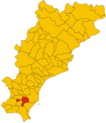
Черво
- коммуна Италии
Hiking in Черво
Cervo, located on the Italian Riviera in Liguria, is a picturesque village known for its charming architecture and stunning coastal views. Hiking in and around Cervo offers a variety of scenic trails that showcase the beauty of the Ligurian landscape, combining coastal paths and inland routes....
- Страна:
- Почтовый код: 18010
- Телефонный код: 0183
- Код автомобильного номера: IM
- Координаты: 43° 55' 31" N, 8° 6' 52" E
- GPS треки (wikiloc): [Ссылка]
- Высота над уровнем моря: 66 м m
- Площадь: 3.59 кв.км
- Население: 1139
- Веб сайт: [Ссылка]


Сан-Бартоломео-аль-Маре
- коммуна Италии
Hiking in Сан-Бартоломео-аль-Маре
San Bartolomeo al Mare, located in the beautiful Liguria region of Italy, is an excellent destination for hiking enthusiasts. The area is known for its stunning coastal views, charming villages, and a network of trails that cater to different skill levels....
- Страна:
- Почтовый код: 18016
- Телефонный код: 0183
- Код автомобильного номера: IM
- Координаты: 43° 55' 40" N, 8° 6' 8" E
- GPS треки (wikiloc): [Ссылка]
- Высота над уровнем моря: 26 м m
- Площадь: 10.85 кв.км
- Население: 3069
- Веб сайт: [Ссылка]


Вилла-Фаральди
- коммуна Италии
Hiking in Вилла-Фаральди
Villa Faraldi is a charming small village located in the province of Imperia in the Italian region of Liguria. Nestled in the hills overlooking the Mediterranean Sea, it's an excellent spot for hiking enthusiasts looking for beautiful scenery, rich history, and a bit of local culture. Here are some highlights of hiking in and around Villa Faraldi:...
- Страна:
- Почтовый код: 18010
- Телефонный код: 0183
- Код автомобильного номера: IM
- Координаты: 43° 58' 2" N, 8° 5' 29" E
- GPS треки (wikiloc): [Ссылка]
- Высота над уровнем моря: 336 м m
- Площадь: 9.52 кв.км
- Население: 472
- Веб сайт: [Ссылка]


Алассио
- коммуна Италии
Hiking in Алассио
Alassio, located on the Italian Riviera in the Liguria region, offers some beautiful hiking opportunities that provide stunning views of the Mediterranean Sea and the surrounding hills. Here are some highlights and tips for hiking in this picturesque area:...
- Страна:
- Почтовый код: 17021
- Телефонный код: 0182
- Код автомобильного номера: SV
- Координаты: 44° 0' 29" N, 8° 10' 23" E
- GPS треки (wikiloc): [Ссылка]
- Высота над уровнем моря: 6 м m
- Площадь: 17.25 кв.км
- Население: 10791
- Веб сайт: [Ссылка]

Гарленда
- коммуна Италии
Hiking in Гарленда
Garlenda is a charming village located in the Italian region of Liguria, nestled in a picturesque valley near the coast and surrounded by stunning hills and nature. Hiking in and around Garlenda offers a mix of beautiful landscapes, historical sites, and a taste of the local culture....
- Страна:
- Почтовый код: 17033
- Телефонный код: 0182
- Код автомобильного номера: SV
- Координаты: 44° 2' 1" N, 8° 5' 49" E
- GPS треки (wikiloc): [Ссылка]
- Высота над уровнем моря: 75 м m
- Площадь: 8.03 кв.км
- Население: 1263
- Веб сайт: [Ссылка]

Лайгуэлья
- коммуна Италии
Hiking in Лайгуэлья
Laigueglia is a charming coastal town located in the Liguria region of Italy, known for its beautiful beaches and picturesque landscapes. While Laigueglia is primarily famous for its sunny shores and Mediterranean climate, it also offers some wonderful hiking opportunities in the surrounding hills and countryside....
- Страна:
- Почтовый код: 17053
- Телефонный код: 0182
- Код автомобильного номера: SV
- Координаты: 43° 58' 28" N, 8° 9' 30" E
- GPS треки (wikiloc): [Ссылка]
- Высота над уровнем моря: 6 м m
- Площадь: 2.72 кв.км
- Население: 1780
- Веб сайт: [Ссылка]


Стелланелло
- коммуна Италии
Hiking in Стелланелло
Stellanello is a charming village located in the Liguria region of Italy, known for its picturesque landscapes and outdoor recreational opportunities. Hiking in this area offers stunning views of the Mediterranean coast, lush greenery, and the surrounding hills....
- Страна:
- Почтовый код: 17020
- Телефонный код: 0182
- Код автомобильного номера: SV
- Координаты: 44° 0' 4" N, 8° 3' 18" E
- GPS треки (wikiloc): [Ссылка]
- Высота над уровнем моря: 141 м m
- Площадь: 17.81 кв.км
- Население: 809
- Веб сайт: [Ссылка]

Вилланова-д'Альбенга
- коммуна Италии
Hiking in Вилланова-д'Альбенга
Villanova d'Albenga is a picturesque village located in the Liguria region of Italy, near the coast and surrounded by beautiful natural landscapes, making it an excellent destination for hiking enthusiasts. The area is characterized by rolling hills, Mediterranean vegetation, and stunning views of both the sea and the surrounding mountains....
- Страна:
- Почтовый код: 17038
- Телефонный код: 0182
- Код автомобильного номера: SV
- Координаты: 44° 2' 46" N, 8° 8' 35" E
- GPS треки (wikiloc): [Ссылка]
- Высота над уровнем моря: 29 м m
- Площадь: 15.89 кв.км
- Население: 2702
- Веб сайт: [Ссылка]