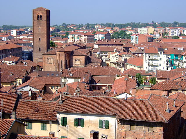
Ариньяно (Arignano, Arignano)

- коммуна Италии
 Hiking in Ариньяно
Arignano is a picturesque municipality located in the region of Piedmont, Italy. While it may not be as widely known for hiking as some other destinations in the Italian Alps or the Apennines, it does offer charming trails and beautiful scenery typical of the Piedmont countryside.
Key Features of Hiking in Arignano:
-
Scenic Routes: The area around Arignano features rolling hills, vineyards, and lush landscapes. Hiking trails often provide stunning views of the surrounding countryside and might lead through charming villages and local farms.
-
Rural Hiking: Many trails in and around Arignano are used for rural hiking, providing a great way to experience the local culture and countryside. You might encounter local wildlife, pastoral settings, and opportunities to taste regional foods.
-
Length and Difficulty: The trails in this region can vary from easy, leisurely walks to more challenging routes, depending on your preference and hiking experience. Always make sure to check trail maps and markings.
-
Spring and Fall: The best times to hike in Arignano are likely in the spring and fall when the temperatures are moderate, and the scenery is particularly beautiful with wildflowers in bloom or autumn colors.
-
Cultural Insights: Hiking can also offer the chance to visit historical sites or engage with the local community, such as nearby wineries or traditional festivals celebrated in the region.
Tips for Hiking in Arignano:
- Trail Finder: Utilize local resources or trail apps to find updated trail information, maps, and difficulty levels.
- Pack Necessities: Bring plenty of water, snacks, and a first aid kit. Good hiking shoes are essential due to varying terrain.
- Respect Nature: Stay on marked paths and follow Leave No Trace principles to help preserve the natural beauty of the area.
- Seasonal Weather: Check the weather before heading out; conditions can change quickly, especially in spring and fall.
Hiking in the Arignano region might not be as crowded as some more famous trails, allowing for a peaceful and immersive experience in nature. Enjoy your adventure!
- Страна:

- Почтовый код: 10020
- Телефонный код: 011
- Код автомобильного номера: TO
- Координаты: 45° 3' 0" N, 7° 54' 0" E


- GPS треки (wikiloc): [Ссылка]
- Высота над уровнем моря: 321 м m
- Площадь: 8.17 кв.км
- Население: 1087
- Веб сайт: http://www.comune.arignano.to.it
- Википедия русская: wiki(ru)
- Википедия английская: wiki(en)
- Википедия национальная: wiki(it)
- Хранилище Wikidata: Wikidata: Q9007
- Катеория в википедии: [Ссылка]
- код Freebase: [/m/0g48cm]
- код GeoNames: Альт: [6537018]
- код VIAF: Альт: [247449462]
- ID отношения в OpenStreetMap: [44012]
- код TGN: [7024714]
- код ISTAT: 001012
- кадастровый код Италии: A405
Граничит с регионами:


Рива-прессо-Кьери
- коммуна в Италии
Hiking in Рива-прессо-Кьери
Riva presso Chieri, located in the Piedmont region of Italy, is a charming destination for hiking enthusiasts. Nestled near the confluence of the Po River and various hills and valleys, this area offers a mix of picturesque landscapes, rolling hills, and lush greenery....
- Страна:
- Почтовый код: 10020
- Телефонный код: 011
- Код автомобильного номера: TO
- Координаты: 44° 59' 0" N, 7° 52' 0" E
- GPS треки (wikiloc): [Ссылка]
- Высота над уровнем моря: 262 м m
- Площадь: 35.83 кв.км
- Население: 4705
- Веб сайт: [Ссылка]


Монкукко-Торинезе
- коммуна Италии
Hiking in Монкукко-Торинезе
Moncucco Torinese is a picturesque village located in the Piedmont region of Italy, known for its beautiful landscapes, vineyards, and rolling hills. Hiking in this area offers a fantastic opportunity to explore its natural beauty, cultural heritage, and serene countryside....
- Страна:
- Почтовый код: 14024
- Телефонный код: 011
- Код автомобильного номера: AT
- Координаты: 45° 4' 9" N, 7° 56' 1" E
- GPS треки (wikiloc): [Ссылка]
- Высота над уровнем моря: 403 м m
- Площадь: 14.33 кв.км
- Население: 897
- Веб сайт: [Ссылка]


Андецено
- коммуна Италии
Hiking in Андецено
Andezeno, located in the Piedmont region of Italy, is a picturesque area known for its beautiful landscapes, rolling hills, and rich natural biodiversity. While not as famous as some larger destinations, it offers a range of hiking opportunities for both casual walkers and more experienced hikers....
- Страна:
- Почтовый код: 10020
- Телефонный код: 011
- Код автомобильного номера: TO
- Координаты: 45° 2' 0" N, 7° 52' 0" E
- GPS треки (wikiloc): [Ссылка]
- Высота над уровнем моря: 306 м m
- Площадь: 7.49 кв.км
- Население: 2027
- Веб сайт: [Ссылка]

Кьери
- коммуна Италии
Hiking in Кьери
Chieri is a charming town located in the Piedmont region of Italy, near Turin. While it may not be as renowned for hiking as some larger national parks or mountainous areas, it offers access to picturesque trails and beautiful landscapes that are suited for hiking enthusiasts....
- Страна:
- Почтовый код: 10023
- Телефонный код: 011
- Код автомобильного номера: TO
- Координаты: 45° 1' 0" N, 7° 49' 0" E
- GPS треки (wikiloc): [Ссылка]
- Высота над уровнем моря: 305 м m
- Площадь: 54.3 кв.км
- Население: 36858
- Веб сайт: [Ссылка]


Марентино
- коммуна Италии
Hiking in Марентино
Marentino is a small town located in the Piedmont region of northern Italy, nestled in the hills near Turin. The area around Marentino offers a range of hiking opportunities that take advantage of its picturesque landscapes, rolling hills, vineyards, and scenic views....
- Страна:
- Почтовый код: 10020
- Телефонный код: 011
- Код автомобильного номера: TO
- Координаты: 45° 3' 0" N, 7° 52' 0" E
- GPS треки (wikiloc): [Ссылка]
- Высота над уровнем моря: 383 м m
- Площадь: 11.26 кв.км
- Население: 1328
- Веб сайт: [Ссылка]
Момбелло-ди-Торино
- коммуна Италии
Hiking in Момбелло-ди-Торино
Mombello di Torino, a charming village located near Turin in the Piedmont region of Italy, offers access to beautiful hiking trails that showcase the region's natural beauty. The surrounding landscape features rolling hills, wooded areas, and scenic views, making it an attractive destination for outdoor enthusiasts....
- Страна:
- Почтовый код: 10020
- Телефонный код: 011
- Код автомобильного номера: TO
- Координаты: 45° 3' 0" N, 7° 55' 0" E
- GPS треки (wikiloc): [Ссылка]
- Высота над уровнем моря: 336 м m
- Площадь: 4.08 кв.км
- Население: 406
- Веб сайт: [Ссылка]