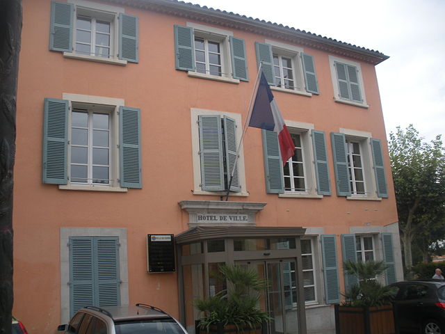
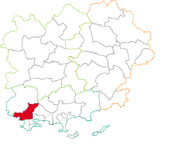
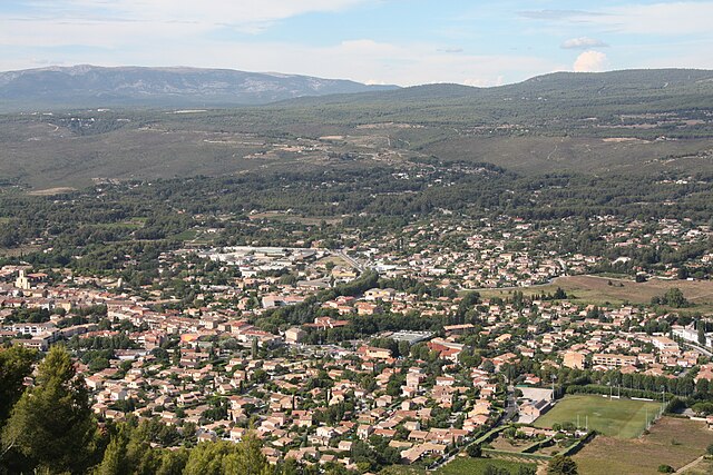
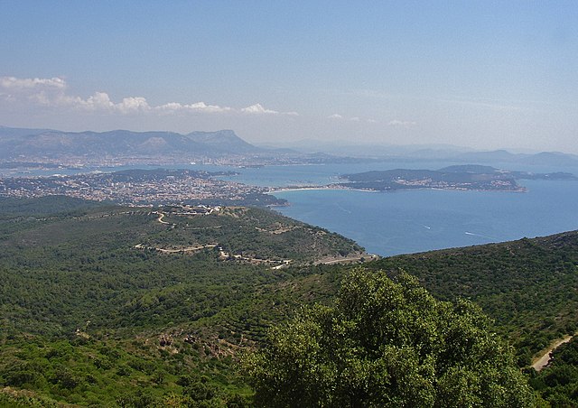
Тулон (arrondissement of Toulon, arrondissement de Toulon)

- округ Франции
 Hiking in Тулон
The Arrondissement of Toulon, located in the Var department of the Provence-Alpes-Côte d'Azur region in southeastern France, is a fantastic destination for hiking enthusiasts. The area boasts a rich combination of stunning coastal landscapes, rugged hills, and picturesque villages, providing a variety of trails for all skill levels. Here are some highlights and tips for hiking in this region:
Notable Hiking Areas
-
Calanques National Park:
- East of Toulon, this breathtaking national park features dramatic cliffs, hidden inlets, and crystal-clear waters. Popular trails include the hike to Calanque Sugiton and Calanque de Morgiou.
- The terrain can be challenging, so ensure you are well-prepared with adequate footwear and hydration.
-
Mont Faron:
- Overlooking Toulon, Mont Faron offers several well-maintained trails, with varying levels of difficulty. The views from the summit are stunning, offering panoramic views of the surrounding area.
- You can reach the summit by hiking or take a cable car if you prefer a more leisurely ascent.
-
Cap Sicié:
- This coastal area presents a variety of trails that wind through pine forests and along the cliffs. The views of the Mediterranean Sea are extraordinary.
- Trails here can be moderate to challenging, so it's essential to have a good sense of direction.
-
Toulon's Coastal Path:
- A more leisurely option, this path allows you to enjoy the beautiful coastline and visit various beaches along the way. It is especially enjoyable in the cooler parts of the day.
-
Cresta des Maures:
- Located a little further inland, this area is known for its untouched natural beauty and offers a different hiking experience with diverse flora and fauna.
Tips for Hiking in Toulon
- Check Local Regulations: Some areas may have specific rules or restricted access, especially during the summer to protect the natural environment.
- Prepare for Weather Conditions: The Mediterranean climate can be hot in the summer, so plan your hikes during the cooler parts of the day and bring plenty of water.
- Trail Maps: Carry a detailed map of the area or a reliable GPS device, as some trails can be less marked.
- Wildlife Awareness: Keep an eye out for local wildlife and plants, and be respectful of the environment by not disturbing any wildlife.
- Local Culture: Take time to explore the local towns and enjoy regional delicacies, as the area is rich in cultural and culinary experiences.
Overall, the Arrondissement of Toulon is a fantastic spot for hiking, offering a balance of scenic beauty, diverse trails, and cultural experiences. Enjoy your adventure in this beautiful region!
- Страна:

- Столица: Тулон
- Координаты: 43° 15' 0" N, 6° 0' 0" E


- GPS треки (wikiloc): [Ссылка]
- Площадь: 1296 кв.км
- Население: 564106
- Википедия русская: wiki(ru)
- Википедия английская: wiki(en)
- Википедия национальная: wiki(fr)
- Хранилище Wikidata: Wikidata: Q537277
- код Freebase: [/m/095kq1]
- код GeoNames: Альт: [2972326]
- код округа INSEE: [832]
- код GNS: -1473155
Включает регионы:

Кюэр
- Упразднённый кантон во Франции
Hiking in Кюэр
Canton de Cuers, located in the Var department of the Provence-Alpes-Côte d'Azur region in southeastern France, offers beautiful landscapes and diverse hiking opportunities. The area is characterized by its Mediterranean climate, with warm summers and mild winters, making it a great destination for outdoor enthusiasts year-round....
Ольюль
- кантон департамента Вар (Франция)
- Страна:
- Столица: Ольюль
- Координаты: 43° 8' 0" N, 5° 51' 0" E
- GPS треки (wikiloc): [Ссылка]
- Население: 39901


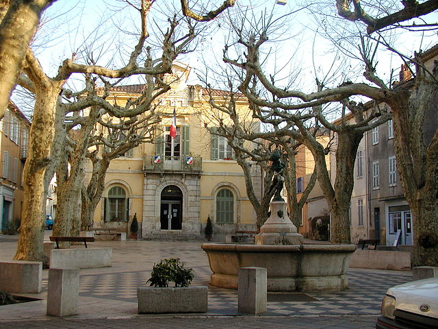
Сольес-Пон
- кантон округа Тулон (Вар, Франция)
Hiking in Сольес-Пон
The Canton of Solliès-Pont, located in the Var department in the Provence-Alpes-Côte d'Azur region of France, offers a variety of hiking opportunities amidst beautiful landscapes, charming villages, and rich natural biodiversity....
- Страна:
- Столица: Сольес-Пон
- Координаты: 43° 11' 0" N, 6° 3' 0" E
- GPS треки (wikiloc): [Ссылка]
- Население: 41113

Ла-Сен-сюр-Мер
- Упразднённый кантон во Франции
- Страна:
- Столица: Ла-Сейн-сюр-Мер
- Координаты: 43° 6' 0" N, 5° 53' 0" E
- GPS треки (wikiloc): [Ссылка]
Коллобриер
- Упразднённый кантон во Франции
- Страна:
- Столица: Коллобриер
- Координаты: 43° 14' 0" N, 6° 18' 0" E
- GPS треки (wikiloc): [Ссылка]


Ле-Боссе
- Упразднённый кантон во Франции
Hiking in Ле-Боссе
Canton du Beausset, located in the Var department of the Provence-Alpes-Côte d'Azur region in southeastern France, is a beautiful area known for its picturesque landscapes, rolling hills, and vineyards. Here’s what you need to know about hiking in this delightful region:...
Сен-Мандрие-сюр-Мер
- Упразднённый кантон во Франции
- Страна:
- Столица: Сен-Мандрие-сюр-Мер
- Координаты: 43° 4' 0" N, 5° 56' 0" E
- GPS треки (wikiloc): [Ссылка]


Тулон-1
- Кантон, округ Тулон, Франция
- Страна:
- Столица: Тулон
- Координаты: 43° 7' 48" N, 5° 55' 48" E
- GPS треки (wikiloc): [Ссылка]
- Население: 48295

Тулон-4
- Кантон, округ Тулон (Франция)
- Страна:
- Столица: Тулон
- Координаты: 43° 6' 36" N, 5° 56' 24" E
- GPS треки (wikiloc): [Ссылка]
- Население: 49899

Тулон-2
- Кантон, округ Тулон (Франция)
- Страна:
- Столица: Тулон
- Координаты: 43° 8' 24" N, 5° 54' 0" E
- GPS треки (wikiloc): [Ссылка]
- Население: 42737

Тулон-3
- Кантон (департамент Вар, Франция)
- Страна:
- Столица: Тулон
- Координаты: 43° 7' 48" N, 5° 56' 24" E
- GPS треки (wikiloc): [Ссылка]
- Население: 53689

Си-Фур-ле-Плаж
- Упразднённый кантон во Франции
- Страна:
- Столица: Си-Фур-ле-Плаж
- Координаты: 43° 6' 3" N, 5° 49' 20" E
- GPS треки (wikiloc): [Ссылка]


Ла-Кро
- Кантон департамента Вар (Франция)
- Страна:
- Столица: Ла-Кро
- Координаты: 43° 9' 0" N, 6° 4' 0" E
- GPS треки (wikiloc): [Ссылка]
- Население: 49641

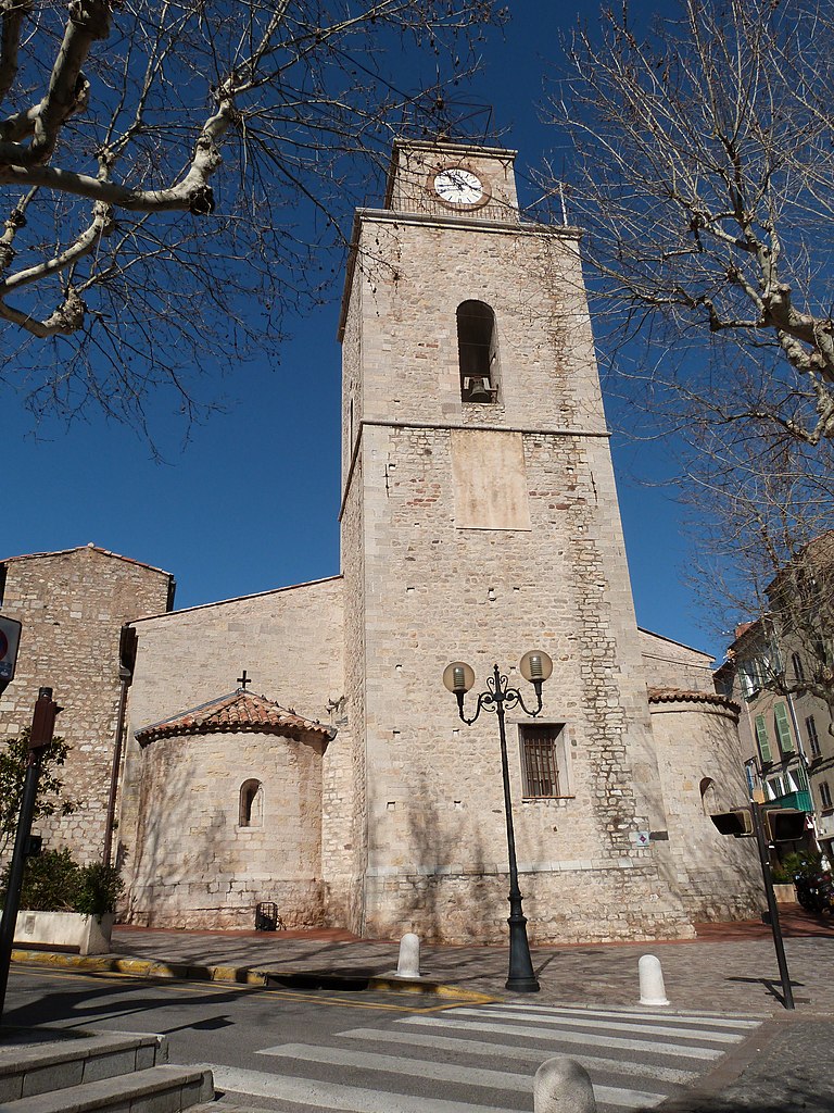
Тулон
- коммуна во Франции
- Страна:
- Почтовый код: 83000
- Координаты: 43° 7' 30" N, 5° 55' 50" E
- GPS треки (wikiloc): [Ссылка]
- Высота над уровнем моря: 1 м m
- Площадь: 42.84 кв.км
- Население: 167479
- Веб сайт: [Ссылка]

Ла-Валет-дю-Вар
- Упразднённый кантон во Франции
- Страна:
- Столица: Ла-Валет-дю-Вар
- Координаты: 43° 8' 0" N, 5° 59' 0" E
- GPS треки (wikiloc): [Ссылка]


Ла-Гард
- Кантон департамента Вар (Франция)
- Страна:
- Столица: Ла-Гард
- Координаты: 43° 7' 32" N, 6° 0' 39" E
- GPS треки (wikiloc): [Ссылка]
- Население: 45254