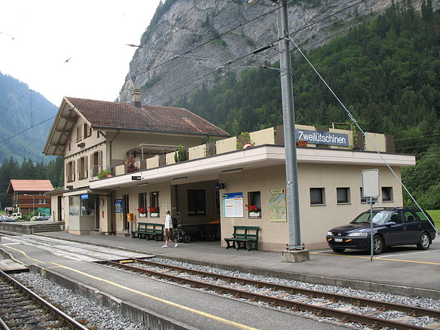
Бёниген (Bönigen, Bönigen)

 Hiking in Бёниген
Bönigen is a picturesque village located near Interlaken in the Bernese Oberland region of Switzerland. It sits at the edge of Lake Brienz and is surrounded by stunning mountain landscapes, making it a great starting point for a variety of hiking experiences.
Hiking Trails in Bönigen
-
Lake Brienz - Hike Around the Lake: One of the most scenic walks is along the shores of Lake Brienz. The trail offers stunning views of the turquoise waters and surrounding mountains.
-
Bönigen to Interlaken: This is an easier hike that takes you along the river and offers beautiful views of the landscape. It’s a pleasant walk for families and beginners.
-
Hiking to the Harder Kulm: From Bönigen, you can hike steeply towards the Harder Kulm viewpoint. This hike is more challenging but rewards you with panoramic views of Interlaken and the surrounding mountains.
-
Schynige Platte: Accessible via a short train ride from Bönigen, this area boasts various trails with exceptional views. The classic Schynige Platte to First hiking trail is popular and offers stunning views along the way.
-
Höheweg Trail: A leisurely hike that allows you to appreciate the natural beauty of the region while passing through lush meadows and forests.
Tips for Hiking in Bönigen
-
Weather: Always check the weather conditions before setting out, as they can change rapidly in the mountains.
-
Gear: Wear appropriate hiking boots and clothing. The trails can vary in difficulty, and good gear can make your hike safer and more enjoyable.
-
Hydration: Carry enough water with you, especially for longer hikes.
-
Wildlife: Be mindful of the local wildlife and respect their habitats.
-
Trail Maps: Consider getting a local map or using a hiking app to stay on track, as some trails might not be well-marked.
-
Local Regulations: Familiarize yourself with local hiking guidelines and regulations to ensure a safe experience.
Bönigen offers not just hiking but also a serene village atmosphere, making it an excellent destination for both nature enthusiasts and those looking to unwind. Enjoy your hiking adventure!
- Страна:

- Почтовый код: 3806
- Телефонный код: 033
- Код автомобильного номера: BE
- Координаты: 46° 41' 11" N, 7° 53' 41" E


- GPS треки (wikiloc): [Ссылка]
- Высота над уровнем моря: 1158 м m
- Площадь: 15.1 кв.км
- Население: 2512
- Веб сайт: http://www.boenigen.ch
- Википедия русская: wiki(ru)
- Википедия английская: wiki(en)
- Википедия национальная: wiki(de)
- Хранилище Wikidata: Wikidata: Q65502
- Катеория в википедии: [Ссылка]
- код Freebase: [/m/0fk_bs]
- код GeoNames: Альт: [7285290]
- код VIAF: Альт: [243857238]
- ID отношения в OpenStreetMap: [1682403]
- идентификатор HDS: [327]
- код швейцарского муниципалитета: [0572]
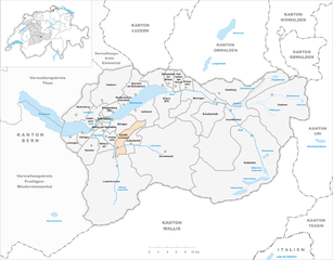
Граничит с регионами:


Изельтвальд
Hiking in Изельтвальд
Iseltwald, a charming village located along the shores of Lake Brienz in Switzerland, offers a stunning backdrop for hiking enthusiasts. The area is known for its breathtaking landscapes, including pristine lake views and majestic alpine scenery. Here are some key points to consider when hiking in Iseltwald:...
- Страна:
- Почтовый код: 3807
- Телефонный код: 033
- Код автомобильного номера: BE
- Координаты: 46° 42' 35" N, 7° 57' 49" E
- GPS треки (wikiloc): [Ссылка]
- Высота над уровнем моря: 1986 м m
- Площадь: 21.9 кв.км
- Население: 441
- Веб сайт: [Ссылка]
Гюндлишванд
Hiking in Гюндлишванд
Gündlischwand is a picturesque village located in the Bernese Oberland region of Switzerland, and it serves as a fantastic base for hiking enthusiasts. The area boasts stunning views of the surrounding mountains, lush valleys, and the iconic Eiger, Mönch, and Jungfrau peaks. Here are some highlights and tips for hiking in Gündlischwand:...
- Страна:
- Почтовый код: 3815
- Телефонный код: 033
- Код автомобильного номера: BE
- Координаты: 46° 36' 59" N, 7° 53' 59" E
- GPS треки (wikiloc): [Ссылка]
- Высота над уровнем моря: 1551 м m
- Площадь: 16.9 кв.км
- Население: 324
- Веб сайт: [Ссылка]

Гштейгвилер
Hiking in Гштейгвилер
Gsteigwiler is a charming village in the Bernese Oberland region of Switzerland, near the popular tourist destination of Interlaken. This area offers breathtaking scenery, a variety of hiking trails, and access to the stunning Swiss Alps, making it an excellent destination for hikers of all levels....
- Страна:
- Почтовый код: 3814
- Телефонный код: 033
- Код автомобильного номера: BE
- Координаты: 46° 39' 8" N, 7° 53' 20" E
- GPS треки (wikiloc): [Ссылка]
- Высота над уровнем моря: 1173 м m
- Площадь: 7.0 кв.км
- Население: 405
- Веб сайт: [Ссылка]


Маттен-Интерлакен
Hiking in Маттен-Интерлакен
Matten bei Interlaken is a fantastic base for hiking in the stunning Bernese Oberland region of Switzerland. Nestled between Lake Thun and Lake Brienz, it offers breathtaking views of the surrounding mountains, including the famous Eiger, Mönch, and Jungfrau....
- Страна:
- Почтовый код: 3800
- Телефонный код: 033
- Код автомобильного номера: BE
- Координаты: 46° 41' 14" N, 7° 51' 54" E
- GPS треки (wikiloc): [Ссылка]
- Высота над уровнем моря: 571 м m
- Площадь: 5.9 кв.км
- Население: 4071
- Веб сайт: [Ссылка]


Нидеррид-Интерлакен
Hiking in Нидеррид-Интерлакен
Niederried bei Interlaken is a picturesque village located near Interlaken in Switzerland. It serves as a great starting point for a variety of hiking trails that cater to different skill levels and preferences. Here are some highlights and tips for hiking in and around Niederried:...
- Страна:
- Почтовый код: 3853
- Телефонный код: 033
- Код автомобильного номера: BE
- Координаты: 46° 42' 59" N, 7° 54' 59" E
- GPS треки (wikiloc): [Ссылка]
- Высота над уровнем моря: 578 м m
- Площадь: 6.81 кв.км
- Население: 348
- Веб сайт: [Ссылка]


Ринггенберг
Hiking in Ринггенберг
Ringgenberg is a charming village located near Interlaken in the Bernese Oberland region of Switzerland. It's an excellent base for hiking enthusiasts, with stunning views of Lake Brienz, the surrounding mountains, and the iconic peaks of the Alps....
- Страна:
- Почтовый код: 3852
- Телефонный код: 033
- Код автомобильного номера: BE
- Координаты: 46° 42' 10" N, 7° 53' 42" E
- GPS треки (wikiloc): [Ссылка]
- Высота над уровнем моря: 819 м m
- Площадь: 8.5 кв.км
- Население: 2663
- Веб сайт: [Ссылка]


Интерлакен
- коммуна в кантоне Берн (Швейцария)
Hiking in Интерлакен
Interlaken, situated in the heart of the Swiss Alps, is a fantastic destination for hiking enthusiasts, offering stunning landscapes, a variety of trails, and breathtaking views of mountains, lakes, and valleys. Here are some highlights to consider when hiking in Interlaken:...
- Страна:
- Почтовый код: 3800
- Телефонный код: 033
- Код автомобильного номера: BE
- Координаты: 46° 41' 17" N, 7° 51' 53" E
- GPS треки (wikiloc): [Ссылка]
- Высота над уровнем моря: 568 м m
- Площадь: 4.4 кв.км
- Население: 5592
- Веб сайт: [Ссылка]


Вильдерсвиль
Hiking in Вильдерсвиль
Wilderswil, located in the Bernese Oberland region of Switzerland, is a charming village nestled between the stunning mountains of the Alps and is a gateway to numerous hikes. Its proximity to Interlaken makes it a popular choice for both locals and tourists seeking outdoor adventures....
- Страна:
- Почтовый код: 3812
- Телефонный код: 033
- Код автомобильного номера: BE
- Координаты: 46° 39' 59" N, 7° 52' 0" E
- GPS треки (wikiloc): [Ссылка]
- Высота над уровнем моря: 884 м m
- Площадь: 13.5 кв.км
- Население: 2672
- Веб сайт: [Ссылка]