Баньярия (Bagnaria, Bagnaria)
.svg)
- коммуна Италии
 Hiking in Баньярия
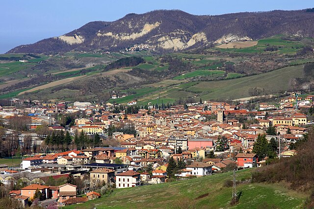
Bagnaria is a small village located in the province of Pavia, Lombardy, Italy, known for its picturesque landscapes and natural beauty. While it may not be as popular as some larger hiking destinations, it does offer opportunities for light to moderate hiking with a focus on enjoying the tranquility of nature.
Key Features for Hiking in Bagnaria:
-
Scenic Trails: The hiking paths around Bagnaria often wind through dense forests, rolling hills, and along streams. You can enjoy stunning views and the serene atmosphere typical of the Italian countryside.
-
Nature and Wildlife: The area around Bagnaria is home to a diverse range of flora and fauna. Keep an eye out for local wildlife, birds, and unique plant species.
-
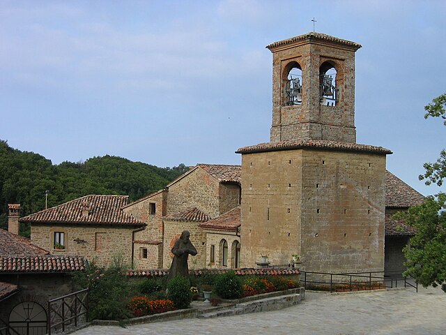
Historical Sites: While hiking, you may come across historical sites or remnants of old agricultural practices, adding a cultural aspect to your walk.
-
Difficulty Levels: The trails can vary in difficulty, catering to both beginners and more experienced hikers. Be sure to choose paths that match your skill level.
-
Best Time to Visit: The best months for hiking in this region are typically from late spring to early autumn (May to September) when the weather is mild and the scenery is at its most vibrant.
Recommended Tips:
- Local Guides: Consider hiring a local guide for a more enriching experience and to explore hidden gems in the area.
- Prepare Properly: Wear appropriate footwear and dress in layers, as mountain weather can be unpredictable.
- Stay Hydrated: Always carry water with you, along with some snacks to keep your energy up.
- Respect Nature: Follow the Leave No Trace principles to help preserve the beauty of the trails for future hikers.
Nearby Attractions:
If you have time, consider exploring nearby towns and attractions, such as vineyards or historical sites in the region of Lombardy.
Overall, hiking in Bagnaria offers a chance to experience the tranquility of the Italian countryside while enjoying physical activity in a beautiful and lesser-known area.
- Страна:

- Почтовый код: 27050
- Телефонный код: 0383
- Код автомобильного номера: PV
- Координаты: 44° 50' 0" N, 9° 7' 0" E


- GPS треки (wikiloc): [Ссылка]
- Высота над уровнем моря: 333 м m
- Площадь: 16.66 кв.км
- Население: 666
- Веб сайт: http://www.comune.bagnaria.pv.it
- Википедия русская: wiki(ru)
- Википедия английская: wiki(en)
- Википедия национальная: wiki(it)
- Хранилище Wikidata: Wikidata: Q39044
- Катеория в википедии: [Ссылка]
- код Freebase: [/m/0gjgq9]
- код GeoNames: Альт: [6542614]
- ID отношения в OpenStreetMap: [43671]
- UN/LOCODE: [ITBAW]
- код ISTAT: 018007
- кадастровый код Италии: A550
Граничит с регионами:

Гремьяско
- коммуна в регионе Пьемонт, Италия
Hiking in Гремьяско
Gremiasco is a charming village located in the Piedmont region of Italy, surrounded by the beautiful scenery of the Italian Alps. While it may not be one of the most recognized hiking destinations, it offers opportunities for nature enthusiasts and hikers looking for a less crowded experience....
- Страна:
- Почтовый код: 15050
- Телефонный код: 0131
- Код автомобильного номера: AL
- Координаты: 44° 47' 50" N, 9° 6' 28" E
- GPS треки (wikiloc): [Ссылка]
- Высота над уровнем моря: 395 м m
- Площадь: 17.38 кв.км
- Население: 318
- Веб сайт: [Ссылка]

Варци
- коммуна Италии
Hiking in Варци
Varzi, located in the Lombardy region of Italy, is a lovely destination for hiking enthusiasts due to its beautiful landscapes and diverse terrain. Here are some highlights about hiking in and around Varzi:...
- Страна:
- Почтовый код: 27057
- Телефонный код: 0383
- Код автомобильного номера: PV
- Координаты: 44° 49' 0" N, 9° 12' 0" E
- GPS треки (wikiloc): [Ссылка]
- Высота над уровнем моря: 426 м m
- Площадь: 57.61 кв.км
- Население: 3194
- Веб сайт: [Ссылка]

Понте-Ницца
- коммуна Италии
Hiking in Понте-Ницца
Ponte Nizza, located in the province of Pavia in Lombardy, Italy, is an excellent destination for hiking enthusiasts. Nestled in a scenic area characterized by rolling hills, forests, and rivers, it offers a variety of trails suitable for different skill levels....
- Страна:
- Почтовый код: 27050
- Телефонный код: 0383
- Код автомобильного номера: PV
- Координаты: 44° 51' 0" N, 9° 6' 0" E
- GPS треки (wikiloc): [Ссылка]
- Высота над уровнем моря: 267 м m
- Площадь: 22.96 кв.км
- Население: 785
- Веб сайт: [Ссылка]