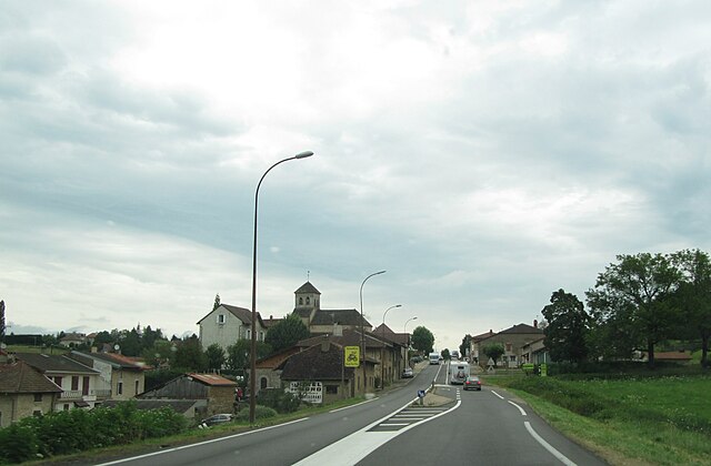
Balanod (Balanod)

- коммуна во Франции
 Hiking in Balanod
Balanod is not a widely recognized hiking destination, so information might be limited. However, it may refer to a local area or region. To provide relevant advice, I would suggest looking into the following general aspects that apply to most hiking locales:
-
Trail Information: Look for local trails that range from easy to difficult, based on your skill level. Check trail websites or local hiking forums for detailed maps and user reviews.
-
Best Seasons: Understand the best times to hike in your area. Researching seasonal weather patterns can help you avoid extreme conditions.
-
Safety Tips: Familiarize yourself with basic hiking safety—carry enough water, wear sturdy footwear, and let someone know your plans.
-
Wildlife and Flora: Learn about the local wildlife and plant life, including any precautions you should take regarding living creatures or poisonous plants in the area.
-
Leave No Trace Principles: Practice these principles to help conserve the environment. Always pack out what you pack in and stay on designated trails.
-
Local Regulations: Check if there are any permits needed for hiking, camping, or any other specific activities in the area.
If you meant a specific region, city, or more localized area named Balanod, please provide more context, and I’ll try to give you more tailored information!
- Страна:

- Почтовый код: 39160
- Координаты: 46° 27' 22" N, 5° 21' 20" E


- GPS треки (wikiloc): [Ссылка]
- Площадь: 4.93 кв.км
- Население: 355
- Википедия английская: wiki(en)
- Википедия национальная: wiki(fr)
- Хранилище Wikidata: Wikidata: Q1161118
- Катеория в википедии: [Ссылка]
- код Freebase: [/m/03mhs6f]
- код GeoNames: Альт: [6448777]
- номер SIREN: [213900350]
- код BNF: [152584008]
- код муниципалитета INSEE: 39035
Граничит с регионами:


L'Aubépin
- коммуна во Франции
Hiking in L'Aubépin
L'Aubépin is a beautiful area that offers a variety of hiking opportunities, typically featuring diverse landscapes, including forests, rivers, cliffs, and possibly agricultural lands. While specific trails may vary, here are some general insights you could expect when hiking in L'Aubépin:...
- Страна:
- Почтовый код: 39160
- Координаты: 46° 26' 23" N, 5° 22' 24" E
- GPS треки (wikiloc): [Ссылка]
- Площадь: 5.67 кв.км
- Население: 148


Condal
- коммуна во Франции
Hiking in Condal
Condal, located in the province of Santa Fe, Argentina, is not widely known as a hiking destination compared to other parts of the country, but it offers a variety of outdoor activities and scenic views for enthusiasts. Here’s what you can expect when hiking in and around Condal:...
- Страна:
- Почтовый код: 71480
- Координаты: 46° 27' 39" N, 5° 16' 54" E
- GPS треки (wikiloc): [Ссылка]
- Площадь: 16.43 кв.км
- Население: 430

Joudes
- коммуна во Франции
Hiking in Joudes
Joudes, a picturesque village in France located in the Auvergne-Rhône-Alpes region, offers a range of hiking opportunities that showcase the stunning natural landscapes of the area. While specific trails can vary, here are some general highlights for hiking in and around Joudes:...
- Страна:
- Почтовый код: 71480
- Координаты: 46° 28' 4" N, 5° 21' 31" E
- GPS треки (wikiloc): [Ссылка]
- Площадь: 11.16 кв.км
- Население: 389


Montagna-le-Reconduit
- коммуна во Франции
Hiking in Montagna-le-Reconduit
Montagna-le-Reconduit is a beautiful hiking destination located in the French Alps. Known for its stunning views, diverse landscapes, and a variety of trails suitable for different skill levels, it attracts hikers throughout the year....
- Страна:
- Почтовый код: 39160
- Координаты: 46° 27' 30" N, 5° 23' 8" E
- GPS треки (wikiloc): [Ссылка]
- Площадь: 5.43 кв.км
- Население: 118


Сент-Амур
- коммуна во Франции
Hiking in Сент-Амур
Saint-Amour, located in the Jura region of France, offers a wonderful setting for hiking enthusiasts with its beautiful landscapes, rich natural diversity, and charming towns nearby. Here are some highlights and tips for hiking in the Saint-Amour area:...
- Страна:
- Почтовый код: 39160
- Координаты: 46° 26' 8" N, 5° 20' 35" E
- GPS треки (wikiloc): [Ссылка]
- Площадь: 11.65 кв.км
- Население: 2366
- Веб сайт: [Ссылка]