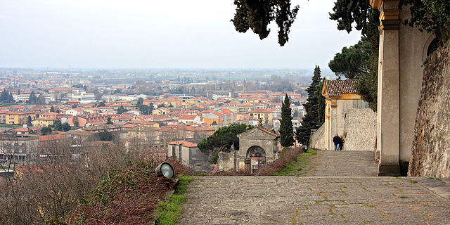
Батталья-Терме (Battaglia Terme, Battaglia Terme)
.svg)
- коммуна Италии
 Hiking in Батталья-Терме
Battaglia Terme is a picturesque town in the Province of Padua, Italy, known for its natural hot springs and beautiful landscapes. While it might not be as famous for hiking as some other areas in Italy, it offers a variety of outdoor activities, including hiking, especially through its nearby natural parks and the surrounding countryside.
Hiking Opportunities Near Battaglia Terme:
-
Parco Regionale dei Colli Euganei:
- This regional park is located nearby and features hills, forests, and vineyards. The park has several marked trails that offer varying levels of difficulty, allowing hikers to enjoy the lush greenery, scenic views, and rich biodiversity. Some popular paths include trails around Monte Ricco and Monte della Madonna.
-
Sentiero degli Eccentrici:
- A specific hiking trail that combines nature with cultural elements, this route takes hikers through various points of interest in the region, showcasing the unique characteristics of the Colli Euganei landscape.
-
Cycling and Walking Paths:
- In addition to traditional hiking, Battaglia Terme and its surroundings feature a number of walking and cycling paths that can be enjoyed year-round. The paths often line along canals and waterways, providing beautiful views and a relatively easy hiking experience.
-
Visit Natural Springs:
- While not a hiking trail in the traditional sense, many paths lead towards the natural hot springs in and around Battaglia Terme. A hike to these springs can be a fulfilling experience, allowing you to relax in hot thermal waters after your outdoor adventures.
Tips for Hiking in Battaglia Terme:
- Prepare for Changing Weather: The weather can change quickly in this region, especially in the hills. Dress in layers and be prepared for sudden changes.
- Hydration and Snacks: Always bring enough water and snacks, as trails may not have amenities along the way.
- Trail Maps: It’s advisable to pick up a map of the trails at local tourist information points, as some paths may not be well-marked.
- Local Guidance: Consider joining guided hikes or local walking groups to discover more about the area’s flora, fauna, and history.
Conclusion:
Hiking in Battaglia Terme offers a charming mix of natural beauty and cultural insights, making it an attractive destination for outdoor enthusiasts. Whether you’re looking for a leisurely stroll through picturesque scenery or a more challenging hike in the nearby hills, Battaglia Terme provides a welcoming experience for hikers of all levels.
- Страна:

- Почтовый код: 35041
- Телефонный код: 049
- Код автомобильного номера: PD
- Координаты: 45° 17' 22" N, 11° 46' 47" E


- GPS треки (wikiloc): [Ссылка]
- Высота над уровнем моря: 11 м m
- Площадь: 6.23 кв.км
- Население: 3838
- Веб сайт: http://www.comune.battaglia-terme.pd.it/
- Википедия русская: wiki(ru)
- Википедия английская: wiki(en)
- Википедия национальная: wiki(it)
- Хранилище Wikidata: Wikidata: Q34684
- Катеория в википедии: [Ссылка]
- код Freebase: [/m/07wcyy]
- код GeoNames: Альт: [6536665]
- код VIAF: Альт: [132515063]
- ID отношения в OpenStreetMap: [44636]
- место в MusicBrainz: [d75164a9-854c-410e-9c67-2e4a69827322]
- UN/LOCODE: [ITZBE]
- код ISTAT: 028011
- кадастровый код Италии: A714
Граничит с регионами:
Пернумия
- коммуна Италии
Hiking in Пернумия
Pernumia is a small municipality located in the Veneto region of Italy, near the city of Padua. While it might not be widely recognized as a hiking destination, it offers a range of pleasant walking and hiking opportunities for those looking to explore the surrounding countryside and enjoy the natural beauty of the area....
- Страна:
- Почтовый код: 35020
- Телефонный код: 0429
- Код автомобильного номера: PD
- Координаты: 45° 16' 0" N, 11° 47' 0" E
- GPS треки (wikiloc): [Ссылка]
- Высота над уровнем моря: 9 м m
- Площадь: 13.18 кв.км
- Население: 3852
- Веб сайт: [Ссылка]

Монтегротто-Терме
- коммуна Италии
Hiking in Монтегротто-Терме
Montegrotto Terme, located in the Veneto region of Italy, is well-known for its thermal baths and beautiful natural surroundings, making it a great location for hiking enthusiasts. It is situated at the foot of the Colli Euganei Regional Park, which offers a variety of hiking trails suitable for different skill levels....
- Страна:
- Почтовый код: 35036
- Телефонный код: 049
- Код автомобильного номера: PD
- Координаты: 45° 20' 0" N, 11° 47' 0" E
- GPS треки (wikiloc): [Ссылка]
- Высота над уровнем моря: 11 м m
- Площадь: 15.37 кв.км
- Население: 11448
- Веб сайт: [Ссылка]

Гальциньяно-Терме
- коммуна Италии
Hiking in Гальциньяно-Терме
Galzignano Terme is a picturesque town located in the Euganean Hills in the Veneto region of Italy. Known for its thermal baths and beautiful landscapes, the area offers a variety of hiking opportunities for outdoor enthusiasts....
- Страна:
- Почтовый код: 35030
- Телефонный код: 049
- Код автомобильного номера: PD
- Координаты: 45° 18' 29" N, 11° 43' 53" E
- GPS треки (wikiloc): [Ссылка]
- Высота над уровнем моря: 22 м m
- Площадь: 18.2 кв.км
- Население: 4321
- Веб сайт: [Ссылка]

Дуе-Карраре
- коммуна Италии
Hiking in Дуе-Карраре
Due Carrare is a charming town located in the province of Padua in the Veneto region of Italy. While it may not be a major hiking destination like the Dolomites or the Italian Alps, there are still opportunities for outdoor enthusiasts to enjoy hiking in the surrounding areas. Here are some aspects to consider if you're planning a hiking trip in and around Due Carrare:...
- Страна:
- Почтовый код: 35020
- Телефонный код: 049
- Код автомобильного номера: PD
- Координаты: 45° 17' 0" N, 11° 50' 0" E
- GPS треки (wikiloc): [Ссылка]
- Высота над уровнем моря: 8 м m
- Площадь: 26.56 кв.км
- Население: 9026
- Веб сайт: [Ссылка]
Монселиче
- коммуна Италии
Hiking in Монселиче
Monselice, located in the Veneto region of Italy, is a charming town that offers a variety of hiking opportunities, particularly in the surrounding Euganean Hills (Colli Euganei). The area is known for its beautiful landscapes, historical sites, and diverse flora and fauna....
- Страна:
- Почтовый код: 35043
- Телефонный код: 0429
- Код автомобильного номера: PD
- Координаты: 45° 14' 0" N, 11° 45' 0" E
- GPS треки (wikiloc): [Ссылка]
- Высота над уровнем моря: 9 м m
- Площадь: 50.57 кв.км
- Население: 17572
- Веб сайт: [Ссылка]