Беггинген (Beggingen, Beggingen)

 Hiking in Беггинген
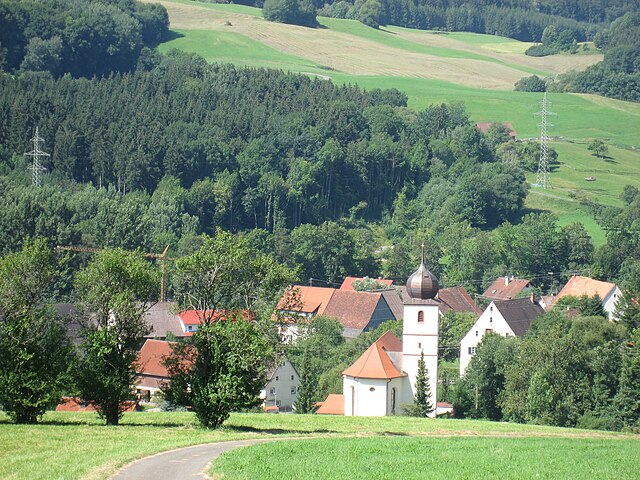
Beggingen is a picturesque village located in the Swiss canton of Aargau, surrounded by beautiful landscapes and natural scenery, making it a great destination for hiking enthusiasts. Here are some details about hiking in the area:
Trails and Routes
-
Local Trails: There are several marked hiking trails around Beggingen that vary in difficulty. You can find easy strolls suitable for families as well as more challenging routes that offer stunning views and a chance to explore nature more deeply.
-
Nature Paths: The region features well-maintained paths through lush forests, rolling hills, and fields. Look out for trails that might lead to viewpoints overlooking the Aare Valley or nearby hills.
-
Nearby Hikes: The area around Beggingen connects to larger hiking networks. You can venture into the nearby Jura mountains or explore trails that follow the Aare River.
-
Seasonal Opportunities: Depending on the time of year, the scenery changes dramatically. Spring and summer offer blooming wildflowers and vibrant greenery, while autumn brings stunning foliage.
Duration and Difficulty
- Duration: Most local trails can be completed in a few hours, perfect for day hikes. Longer routes may require a full day, so plan accordingly.
- Difficulty: There are options for all skill levels. Beginners may enjoy gentle trails while more experienced hikers can tackle steeper climbs or longer distances.
Safety and Preparation
- Always check the weather before heading out, as conditions can change rapidly in Switzerland.
- Wear proper hiking boots and carry enough water, snacks, and a first-aid kit.
- Map out your route in advance and consider using a GPS or hiking app for navigation.
Local Recommendations
- Visit local tourist information offices for up-to-date trail maps and advice.
- Consider joining guided hikes for a more enriching experience, where local guides can provide insights about the area’s history and ecology.
Conclusion
Hiking in Beggingen offers natural beauty and tranquility, making it an excellent choice for both casual walkers and serious hikers. Whether you want a leisurely day hike or a more challenging outdoor adventure, this region has something to offer. Happy hiking!
- Страна:

- Почтовый код: 8228
- Телефонный код: 052
- Код автомобильного номера: SH
- Координаты: 47° 45' 55" N, 8° 32' 39" E


- GPS треки (wikiloc): [Ссылка]
- Высота над уровнем моря: 586 м m
- Площадь: 12.58 кв.км
- Население: 486
- Веб сайт: http://www.beggingen.ch
- Википедия русская: wiki(ru)
- Википедия английская: wiki(en)
- Википедия национальная: wiki(de)
- Хранилище Wikidata: Wikidata: Q69123
- Катеория в википедии: [Ссылка]
- код Freebase: [/m/0fvrrf]
- код GeoNames: Альт: [7285179]
- код VIAF: Альт: [240348289]
- ID отношения в OpenStreetMap: [1683620]
- идентификатор местоположения ArchINFORM: [45613]
- место в MusicBrainz: [5c0e0a13-b96a-4443-bac4-2307f1fe7c9b]
- идентификатор HDS: [1282]
- код швейцарского муниципалитета: [2951]
Граничит с регионами:


Шлайтайм
Hiking in Шлайтайм
Schleitheim, located in the canton of Schaffhausen in Switzerland, is a fantastic destination for hiking enthusiasts. Surrounded by picturesque landscapes, lush forests, and rolling hills, the area offers several trails that cater to different skill levels, making it ideal for both beginners and experienced hikers. Here are some highlights and details for hiking in Schleitheim:...
- Страна:
- Почтовый код: 8226
- Телефонный код: 052
- Код автомобильного номера: SH
- Координаты: 47° 44' 57" N, 8° 29' 6" E
- GPS треки (wikiloc): [Ссылка]
- Высота над уровнем моря: 533 м m
- Площадь: 21.63 кв.км
- Население: 1688
- Веб сайт: [Ссылка]

Блумберг
Hiking in Блумберг
Blumberg, located in the southern part of Germany, is surrounded by beautiful landscapes that offer numerous hiking opportunities. The region is characterized by its forests, rolling hills, and scenic views, making it a great destination for both novice and experienced hikers....
- Страна:

- Почтовый код: 78176
- Телефонный код: 07736; 07702
- Код автомобильного номера: VS
- Координаты: 47° 50' 21" N, 8° 32' 3" E
- GPS треки (wikiloc): [Ссылка]
- Высота над уровнем моря: 704 м m
- Площадь: 98.69 кв.км
- Население: 9975
- Веб сайт: [Ссылка]