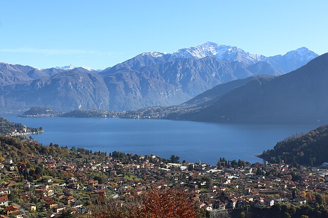
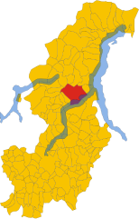
Бене-Ларио (Bene Lario, Bene Lario)
.svg)
- коммуна Италии
 Hiking in Бене-Ларио
Bene Lario is a charming village located on the western shore of Lake Como in Italy. It offers a range of hiking opportunities that allow you to experience stunning natural beauty, historical sites, and the unique culture of the region. Here are some highlights to consider when hiking in and around Bene Lario:
Trails and Routes
-
Sentiero del Viandante:
- This well-known hiking trail runs along the eastern shore of Lake Como but can be accessed from nearby areas. It offers breathtaking views of the lake and surrounding mountains.
-
Monte Legnone:
- A more challenging hike, this trail takes you to Monte Legnone, one of the highest peaks in the region, offering panoramic views of Lake Como and the surrounding Alps.
-
Local Trails:
- Bene Lario has several local hiking paths that lead you through olive groves, forests, and alongside the lake. Many of these will guide you to hidden viewpoints, providing tranquil spots to rest and enjoy nature.
Points of Interest
- San Giovanni Battista Church: As you hike, consider visiting this historic church, known for its beautiful architecture and scenic location.
- Waterfalls and Streams: The area is dotted with waterfalls that can be a refreshing sight during your hikes, especially after rainfall.
Tips for Hiking in Bene Lario
- Gear: Ensure you have sturdy hiking boots, plenty of water, and sun protection, as trails can be steep and exposed.
- Weather: Check the local weather forecast. Mountain weather can be unpredictable, and it’s important to be prepared.
- Local Guidance: If you’re unfamiliar with the area, consider hiring a local guide or joining a guided hike to fully appreciate the beauty and history of the trails.
Conclusion
Hiking in Bene Lario offers an ideal mix of natural beauty and cultural richness. Whether you prefer easy walks along the lake or challenging mountain ascents, there’s something for every hiking enthusiast in this picturesque part of Italy. Enjoy your adventures!
- Страна:

- Почтовый код: 22010
- Телефонный код: 0344
- Код автомобильного номера: CO
- Координаты: 46° 2' 0" N, 9° 11' 0" E


- GPS треки (wikiloc): [Ссылка]
- Высота над уровнем моря: 370 м m
- Площадь: 5.59 кв.км
- Население: 335
- Веб сайт: http://www.comune.benelario.co.it
- Википедия русская: wiki(ru)
- Википедия английская: wiki(en)
- Википедия национальная: wiki(it)
- Хранилище Wikidata: Wikidata: Q244101
- Катеория в википедии: [Ссылка]
- код Freebase: [/m/0gh_7y]
- код GeoNames: Альт: [6543720]
- ID отношения в OpenStreetMap: [46710]
- код ISTAT: 013021
- кадастровый код Италии: A778
Граничит с регионами:
Tremezzina
Hiking in Tremezzina
Tremezzina is a picturesque area located on the western shore of Lake Como in Italy. It consists of several charming towns, including Tremezzo, Lenno, and Mezzegra, all surrounded by stunning landscapes, lush greenery, and breathtaking views of the lake and the surrounding mountains. Here are some highlights about hiking in Tremezzina:...
- Страна:
- Почтовый код: 22016
- Телефонный код: 0344
- Код автомобильного номера: CO
- Координаты: 45° 58' 51" N, 9° 12' 10" E
- GPS треки (wikiloc): [Ссылка]
- Высота над уровнем моря: 200 м m
- Площадь: 29.41 кв.км
- Население: 5118
- Веб сайт: [Ссылка]
Карлаццо
- коммуна Италии
Hiking in Карлаццо
Carlazzo, located in the province of Como in Italy, is a picturesque destination for hiking enthusiasts. Nestled near the northern banks of Lake Lugano, Carlazzo offers beautiful scenery, diverse trails, and the charm of the surrounding Italian landscape....
- Страна:
- Почтовый код: 22010
- Телефонный код: 0344
- Код автомобильного номера: CO
- Координаты: 46° 3' 0" N, 9° 9' 0" E
- GPS треки (wikiloc): [Ссылка]
- Высота над уровнем моря: 481 м m
- Площадь: 12.73 кв.км
- Население: 3162
- Веб сайт: [Ссылка]
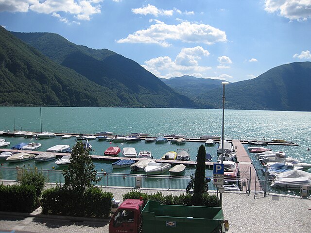

Порлецца
- коммуна Италии
Hiking in Порлецца
Porlezza is a charming town located on the shores of Lake Lugano in the Italian region of Lombardy, near the border with Switzerland. It offers beautiful natural scenery, making it an excellent destination for hiking enthusiasts. Here are some highlights and tips for hiking in and around Porlezza:...
- Страна:
- Почтовый код: 22018
- Телефонный код: 0344
- Код автомобильного номера: CO
- Координаты: 46° 2' 0" N, 9° 8' 0" E
- GPS треки (wikiloc): [Ссылка]
- Высота над уровнем моря: 275 м m
- Площадь: 18.64 кв.км
- Население: 4972
- Веб сайт: [Ссылка]
Грандола-ед-Унити
- коммуна Италии
Hiking in Грандола-ед-Унити
Grandola ed Uniti, located in the Italian region of Lombardy, is surrounded by stunning natural landscapes, making it an excellent destination for hiking enthusiasts. This area has a mix of terrain, including mountainous regions, forests, and lakes, providing a variety of hiking experiences suitable for different skill levels....
- Страна:
- Почтовый код: 22010
- Телефонный код: 0344
- Код автомобильного номера: CO
- Координаты: 46° 2' 0" N, 9° 13' 0" E
- GPS треки (wikiloc): [Ссылка]
- Высота над уровнем моря: 443 м m
- Площадь: 16.9 кв.км
- Население: 1298
- Веб сайт: [Ссылка]