Бёй (Beuil, Beuil)

- коммуна в департаменте Приморские Альпы, регион Прованс — Альпы — Лазурный Берег, Франция
 Hiking in Бёй
Beuil is a picturesque village located in the Alpes-Maritimes region of southeastern France, known for its stunning alpine scenery and outdoor recreational opportunities. It serves as an excellent base for hiking enthusiasts, offering a variety of trails that cater to different skill levels.
Hiking Trails in Beuil
-
Les Gorges de Daluis: This trail offers breathtaking views of the red rock formations and a chance to explore the gorges. The hike can range from easy to moderate, depending on the specific route you choose.
-
Sentier des Sapins: This is an easier, family-friendly trail that winds through beautiful forests of fir trees. It’s a great option for those looking to enjoy nature without a strenuous climb.
-
Col de la Cayolle: For more experienced hikers, the paths around Col de la Cayolle provide challenging hikes with incredible views of the surrounding mountains and alpine lakes.
-
Montée à la Tête de Fels: This is another popular hiking route that takes you up to the head of Fels, offering panoramic views of the valley and surrounding peaks. The ascent can be moderately difficult but is rewarding.
Best Times to Hike
The best time for hiking in Beuil generally spans from late spring to early fall (May to October), when the weather is milder and the trails are more accessible. Summer can be warm, so early morning hikes are advisable to avoid the heat.
Preparation Tips
- Gear: Wear appropriate hiking boots and bring layers, as mountain weather can change quickly. Also, consider bringing trekking poles for stability on uneven terrain.
- Hydration: Carry enough water and snacks, as some trails can be long, and amenities may be limited.
- Navigation: While many trails are well-marked, carrying a map or using a hiking app for navigation can be helpful.
Local Facilities
Beuil has various facilities including restaurants, accommodations, and shops where hikers can relax and replenish after a day on the trails. The village’s charming atmosphere makes it a delightful place to unwind and enjoy local cuisine.
Safety Considerations
Always check the weather forecast before heading out, and inform someone about your hiking plans. If you’re uncertain about the trail difficulty, seek advice from local guides or tourist information centers.
Enjoy your hiking adventures in Beuil—it’s a splendid area to explore nature!
- Страна:

- Почтовый код: 06470
- Координаты: 44° 5' 42" N, 6° 59' 15" E


- GPS треки (wikiloc): [Ссылка]
- Площадь: 75.65 кв.км
- Население: 513
- Веб сайт: http://www.beuil.fr
- Википедия русская: wiki(ru)
- Википедия английская: wiki(en)
- Википедия национальная: wiki(fr)
- Хранилище Wikidata: Wikidata: Q274742
- Катеория в википедии: [Ссылка]
- код Freebase: [/m/03m4yvy]
- код Freebase: [/m/03m4yvy]
- код GeoNames: Альт: [3032945]
- код GeoNames: Альт: [3032945]
- номер SIREN: [210600169]
- номер SIREN: [210600169]
- код BNF: [160402309]
- код BNF: [160402309]
- код VIAF: Альт: [240810871]
- код VIAF: Альт: [240810871]
- WOEID: [579720]
- WOEID: [579720]
- код муниципалитета INSEE: 06016
- код муниципалитета INSEE: 06016
Граничит с регионами:

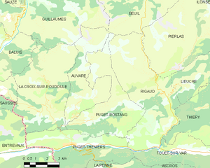
Риго
- коммуна в департаменте Приморские Альпы, регион Прованс — Альпы — Лазурный Берег, Франция
Hiking in Риго
Rigaud, located in the Alpes-Maritimes region of France, offers a lovely setting for hiking enthusiasts. Nestled in the foothills of the French Alps, this area is known for its beautiful landscapes, charming villages, and scenic trails....
- Страна:
- Почтовый код: 06260
- Координаты: 43° 59' 27" N, 6° 59' 29" E
- GPS треки (wikiloc): [Ссылка]
- Площадь: 32.54 кв.км
- Население: 207

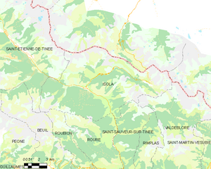
Изола
- коммуна в департаменте Приморские Альпы, регион Прованс — Альпы — Лазурный Берег, Франция
Hiking in Изола
Isola is a charming village located in the Alpes-Maritimes region of France, renowned for its stunning natural landscapes and outdoor activities, especially hiking. Situated in the heart of the Southern Alps, Isola offers a variety of trails that cater to different skill levels, from leisurely walks to more challenging hikes....
- Страна:
- Почтовый код: 06420
- Координаты: 44° 11' 9" N, 7° 3' 8" E
- GPS треки (wikiloc): [Ссылка]
- Площадь: 97.98 кв.км
- Население: 693


Овар
- коммуна в департаменте Приморские Альпы, регион Прованс — Альпы — Лазурный Берег, Франция
Hiking in Овар
Auvare is a beautiful village located in the Alpes-Maritimes department in the Provence-Alpes-Côte d'Azur region of southeastern France. Nestled in a picturesque landscape, it is an excellent spot for hiking enthusiasts looking for scenic trails and a peaceful atmosphere....
- Страна:
- Почтовый код: 06260
- Координаты: 43° 59' 17" N, 6° 54' 29" E
- GPS треки (wikiloc): [Ссылка]
- Площадь: 18.27 кв.км
- Население: 36

Пеон
- коммуна в департаменте Приморские Альпы, регион Прованс — Альпы — Лазурный Берег, Франция
Hiking in Пеон
Péone is a charming village located in the Alpes-Maritimes region of France, nestled in the Southern French Alps. It offers various hiking opportunities, ideal for both beginners and experienced hikers. Here are some key points about hiking in the area:...
- Страна:
- Почтовый код: 06470
- Координаты: 44° 7' 3" N, 6° 54' 30" E
- GPS треки (wikiloc): [Ссылка]
- Площадь: 48.59 кв.км
- Население: 866
- Веб сайт: [Ссылка]

Пюже-Ростан
- коммуна в департаменте Приморские Альпы, регион Прованс — Альпы — Лазурный Берег, Франция
Hiking in Пюже-Ростан
Puget-Rostang is a picturesque area in the French Alps, particularly known for its stunning landscapes, diverse trails, and rich biodiversity. While it may not be as widely known as some other hiking destinations, it offers a variety of hiking experiences suitable for different skill levels....
- Страна:
- Почтовый код: 06260
- Координаты: 43° 58' 26" N, 6° 55' 4" E
- GPS треки (wikiloc): [Ссылка]
- Высота над уровнем моря: 771 м m
- Площадь: 22.46 кв.км
- Население: 133

Рубьон
- коммуна в департаменте Приморские Альпы, регион Прованс — Альпы — Лазурный Берег, Франция
Hiking in Рубьон
Roubion is a charming village located in the Alpes-Maritimes region of southeastern France. Surrounded by stunning natural landscapes, it offers a wealth of hiking opportunities for outdoor enthusiasts. Here are some highlights and tips for hiking in and around Roubion:...
- Страна:
- Почтовый код: 06420
- Координаты: 44° 5' 34" N, 7° 3' 2" E
- GPS треки (wikiloc): [Ссылка]
- Площадь: 27.26 кв.км
- Население: 118

Пьерла
- коммуна в департаменте Приморские Альпы, регион Прованс — Альпы — Лазурный Берег, Франция
Hiking in Пьерла
Pierlas is a charming village located in the Alpes-Maritimes department of France, nestled in the scenic region of Provence-Alpes-Côte d'Azur. It's a great place for hiking enthusiasts looking to explore nature and enjoy breathtaking views of the surrounding mountains and valleys....
- Страна:
- Почтовый код: 06260
- Координаты: 44° 1' 54" N, 7° 2' 8" E
- GPS треки (wikiloc): [Ссылка]
- Площадь: 31.31 кв.км
- Население: 97


Гийом
- коммуна в департаменте Приморские Альпы, регион Прованс — Альпы — Лазурный Берег, Франция
Hiking in Гийом
Guillaumes is a charming village located in the Alpes-Maritimes department in southeastern France. It’s nestled in the Mercantour National Park, making it a fantastic base for hikers and nature enthusiasts. Here are some highlights and tips for hiking in the Guillaumes area:...
- Страна:
- Почтовый код: 06470
- Координаты: 44° 5' 26" N, 6° 51' 13" E
- GPS треки (wikiloc): [Ссылка]
- Площадь: 87.02 кв.км
- Население: 640

Сент-Этьен-де-Тине
- коммуна в департаменте Приморские Альпы, регион Прованс — Альпы — Лазурный Берег, Франция
Hiking in Сент-Этьен-де-Тине
Saint-Étienne-de-Tinée is a charming village located in the Alpes-Maritimes region of southeastern France, nestled in the Tinée Valley. It serves as a great base for hikers looking to explore the stunning natural landscapes of the surrounding area, including the Mercantour National Park, which is renowned for its dramatic scenery and diverse wildlife....
- Страна:
- Почтовый код: 06660
- Координаты: 44° 15' 25" N, 6° 55' 29" E
- GPS треки (wikiloc): [Ссылка]
- Высота над уровнем моря: 1139 м m
- Площадь: 173.81 кв.км
- Население: 1468