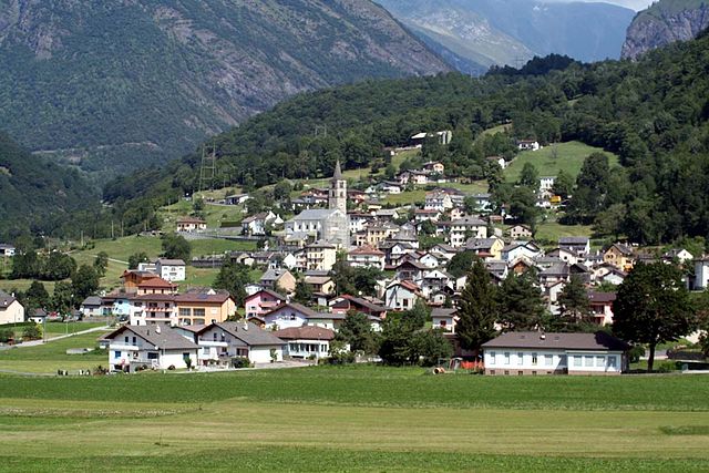
Бленио (Blenio District, Bezirk Blenio)

 Hiking in Бленио
Blenio District, located in the canton of Ticino in Switzerland, offers a stunning backdrop for hiking enthusiasts. It's characterized by its diverse landscapes, ranging from lush valleys to rugged mountains. Here are some key highlights for hiking in the Blenio District:
Scenic Trails
-
Sentiero dell'Acqua: This picturesque trail allows hikers to follow the path of water through the lush landscapes of the Blenio Valley. The route showcases beautiful waterfalls, streams, and the natural beauty of the region.
-
Piz Blenio: Ascend this peak for spectacular panoramic views of the surrounding mountains and valleys. The hike to the summit can be challenging but is highly rewarding.
-
Val di Blenio: The valley itself has numerous hiking options, including lower-elevation trails that are more accessible and suitable for families or less experienced hikers.
Nature and Wildlife
The district is abundant in flora and fauna, with opportunities to spot various wildlife species. The diverse ecosystems, including forests, meadows, and alpine landscapes, provide a rich natural experience.
Cultural Experience
In addition to the natural beauty, the Blenio District is home to charming villages where you can experience local culture, cuisine, and traditions. Places like Blenio's historic towns offer glimpses into the area's heritage.
Accessibility and Seasonality
-
Best Time to Hike: Late spring through early autumn (May to October) offers the best hiking conditions, with warm weather and clear trails. However, certain high-altitude paths may still be snowbound in early summer.
-
Difficulty Levels: Hikes can range from easy walks to more difficult mountain ascents, catering to various skill levels. It’s important to check trail conditions and difficulty before embarking.
Practical Tips
- Equipment: Proper hiking footwear is essential, and depending on the trail, you may need trekking poles or even crampons for more challenging paths.
- Maps and Guides: While many trails are well-marked, carrying a map or a GPS device is advisable, especially if venturing on less traveled paths.
- Local Guidelines: Respect local regulations concerning wildlife and natural preservation, and always practice Leave No Trace principles.
Conclusion
Hiking in the Blenio District provides an excellent combination of natural beauty, adventure, and cultural exploration. Whether you're a seasoned hiker or a beginner, this region offers trails that cater to all. Be sure to plan ahead and enjoy the stunning landscapes that Ticino has to offer!
- Страна:

- Столица: Acquarossa
- Код автомобильного номера: TI
- Координаты: 46° 27' 20" N, 8° 56' 18" E


- GPS треки (wikiloc): [Ссылка]
- Высота над уровнем моря: 712 м m
- Площадь: 360.6 кв.км
- Википедия русская: wiki(ru)
- Википедия английская: wiki(en)
- Википедия национальная: wiki(de)
- Хранилище Wikidata: Wikidata: Q660533
- Катеория в википедии: [Ссылка]
- код Freebase: [/m/0grwwn]
- код GeoNames: Альт: [6458784]
- код GND: Альт: [102468248X]
- идентификатор местоположения ArchINFORM: [42223]
- идентификатор HDS: [8541]
Включает регионы:
Olivone
Hiking in Olivone
Kreis Olivone is located in the canton of Ticino in Switzerland, an area known for its stunning natural landscapes, including mountains, valleys, and pristine lakes. Hiking in this region is a fantastic experience, offering various trails suitable for different fitness levels and skill sets....
- Страна:

Malvaglia
Hiking in Malvaglia
Kreis Malvaglia, located in the picturesque Ticino region of Switzerland, offers a variety of hiking opportunities that cater to different skill levels and preferences. The stunning landscapes, characterized by mountains, valleys, and lush nature, make it an ideal destination for outdoor enthusiasts....
- Страна:

Acquarossa
Hiking in Acquarossa
Kreis Acquarossa is a picturesque region located in the canton of Ticino, Switzerland. It's known for its stunning natural landscapes, including mountains, valleys, and stunning views of the surrounding areas. Here are some key points to consider when planning a hike in this beautiful region:...
- Страна:
Граничит с регионами:


Ривьера
Hiking in Ривьера
Hiking in the Riviera District offers a unique blend of coastal views, lush landscapes, and charming towns. Here’s a breakdown of what you can typically expect when hiking in this region:...
- Страна:
- Код автомобильного номера: TI
- Координаты: 46° 21' 0" N, 8° 59' 0" E
- GPS треки (wikiloc): [Ссылка]
- Высота над уровнем моря: 264 м m
- Площадь: 166.4 кв.км