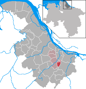
Блидерсдорф (Bliedersdorf, Bliedersdorf)

 Hiking in Блидерсдорф
Bliedersdorf is a small village located in the Lower Saxony region of Germany, near the larger town of Lüneburg. While the village itself may not be a well-known hiking destination, the surrounding areas provide opportunities for outdoor exploration. Here are some key points about hiking in and around Bliedersdorf:
-
Scenic Nature: The vicinity boasts beautiful landscapes, including forests, meadows, and rivers. Nature walks can provide a peaceful escape and are suitable for hikers of all levels.
-
Lüneburg Heath: While not directly in Bliedersdorf, the Lüneburg Heath (Lüneburger Heide) is a nearby natural reserve famous for its heather-covered landscapes, especially beautiful in late summer. It offers numerous marked trails, ensuring a delightful hiking experience.
-
Local Trails: Check for local trails and routes that might run through Bliedersdorf or connect to nearby towns. You may find smaller paths suitable for walking or cycling.
-
Wildlife Observation: The region is home to various wildlife species. Keep an eye out for birds and other animals during your hike.
-
Hiking Tips:
- Always wear sturdy footwear and appropriate clothing.
- Bring plenty of water and snacks.
- A map or a mobile app can help navigate the trails.
- Be mindful of local regulations and nature preservation practices.
-
Accessibility: Depending on your starting point, consider public transport options from larger cities like Hamburg or Lüneburg to reach Bliedersdorf.
-
Community Events: Occasionally, local hiking groups or community events may offer organized hikes. Check local community boards or websites for updates.
Hiking around Bliedersdorf can be a charming way to enjoy the rural German landscape. Make sure to plan ahead and check trail conditions before heading out!
- Страна:

- Почтовый код: 21640
- Телефонный код: 04163
- Код автомобильного номера: STD
- Координаты: 53° 29' 0" N, 9° 34' 0" E


- GPS треки (wikiloc): [Ссылка]
- Высота над уровнем моря: 23 м m
- Площадь: 12.42 кв.км
- Население: 1720
- Веб сайт: http://www.horneburg.de/
- Википедия русская: wiki(ru)
- Википедия английская: wiki(en)
- Википедия национальная: wiki(de)
- Хранилище Wikidata: Wikidata: Q505569
- Галерея изображений в википедии: [Ссылка]
- Катеория в википедии: [Ссылка]
- код Freebase: [/m/02r_gj7]
- код Freebase: [/m/02r_gj7]
- код Freebase: [/m/02r_gj7]
- код GeoNames: Альт: [2947769]
- код GeoNames: Альт: [2947769]
- код GeoNames: Альт: [2947769]
- код VIAF: Альт: [246614300]
- код VIAF: Альт: [246614300]
- код VIAF: Альт: [246614300]
- ID отношения в OpenStreetMap: [444929]
- ID отношения в OpenStreetMap: [444929]
- ID отношения в OpenStreetMap: [444929]
- код GND: Альт: [4238723-1]
- код GND: Альт: [4238723-1]
- код GND: Альт: [4238723-1]
- WOEID: [639497]
- WOEID: [639497]
- WOEID: [639497]
- идентификатор муниципалитетов в Германии: 03359007
- идентификатор муниципалитетов в Германии: 03359007
- идентификатор муниципалитетов в Германии: 03359007
Граничит с регионами:

Ноттенсдорф
Hiking in Ноттенсдорф
Nottensdorf, located in the northern part of Germany, offers some lovely hiking opportunities in a scenic environment. The region is characterized by a mix of forests, meadows, and waterways, providing a diverse landscape for hikers of all skill levels....
- Страна:
- Почтовый код: 21640
- Телефонный код: 04163
- Код автомобильного номера: STD
- Координаты: 53° 29' 0" N, 9° 36' 0" E
- GPS треки (wikiloc): [Ссылка]
- Высота над уровнем моря: 22 м m
- Площадь: 7.14 кв.км
- Население: 1441
- Веб сайт: [Ссылка]