
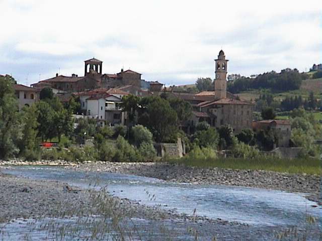
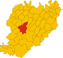
Боббио (Bobbio, Bobbio)
.svg)
- коммуна Италии
 Hiking in Боббио
Bobbio is a charming town located in the Emilia-Romagna region of northern Italy, surrounded by the beautiful landscape of the Apennine Mountains. This area is rich in natural beauty, history, and opportunities for outdoor activities, making it an appealing destination for hiking enthusiasts.
Hiking Opportunities in Bobbio
-
Variety of Trails: The region offers a range of hiking trails for different skill levels, from easy walks suitable for families to more challenging treks for experienced hikers. Trails can lead you through picturesque landscapes, including forests, rivers, and mountain vistas.
-
Cultural and Historical Sites: While hiking in and around Bobbio, you can encounter historical elements such as the ancient Roman bridge, the Abbey of San Colombano, and various medieval architecture. These sites add an extra dimension to your hiking experience.
-
Natural Parks: The nearby Parco Regionale dell'Appennino Tosco-Emiliano provides additional hiking options. This park features diverse flora and fauna, as well as stunning views and a chance to enjoy the tranquility of nature.
-
Scenic Views: Many trails offer panoramic views of the surrounding hills and valleys. Be sure to bring your camera, as the landscape can be particularly breathtaking during sunrise and sunset.
-
Local Cuisine: After a day of hiking, you can enjoy delicious local cuisine in Bobbio, which is known for its rich culinary traditions. Try some typical dishes and enjoy the local hospitality.
Tips for Hiking in Bobbio
-
Seasonal Considerations: The best time to hike in Bobbio is during spring and fall when the weather is mild. Summer can be hot, and winter may bring snow to higher elevations.
-
Gear Up: Wear appropriate hiking gear, including sturdy hiking boots, weather-appropriate clothing, and don’t forget essentials such as water, snacks, a map, and a first-aid kit.
-
Respect Nature: Stay on designated trails to help preserve the natural environment, and make sure to follow any local guidelines regarding wildlife and plant conservation.
-
Guided Hikes: Consider joining a guided hike if you are unfamiliar with the area. Local guides can provide valuable insights into the landscape, culture, and history of Bobbio and its surroundings.
-
Physical Preparedness: Ensure that you are physically prepared for the hike you choose, understanding your own fitness level and limits.
Hiking in Bobbio offers a fantastic opportunity to explore the natural beauty and cultural richness of Italy. Whether you're looking for a leisurely stroll or a challenging trek, you'll find trails that suit your preferences. Enjoy your adventure!
- Страна:

- Почтовый код: 29022
- Телефонный код: 0523
- Код автомобильного номера: PC
- Координаты: 44° 46' 17" N, 9° 23' 11" E


- GPS треки (wikiloc): [Ссылка]
- Высота над уровнем моря: 272 м m
- Площадь: 106.53 кв.км
- Население: 3589
- Веб сайт: http://www.comune.bobbio.pc.it
- Википедия русская: wiki(ru)
- Википедия английская: wiki(en)
- Википедия национальная: wiki(it)
- Хранилище Wikidata: Wikidata: Q11498
- Галерея изображений в википедии: [Ссылка]
- Катеория в википедии: [Ссылка]
- код Freebase: [/m/01w31g]
- код GeoNames: Альт: [6539653]
- код VIAF: Альт: [153577673]
- ID отношения в OpenStreetMap: [43560]
- код GND: Альт: [4080441-0]
- UN/LOCODE: [ITBOB]
- код в энциклопедии «Британника онлайн»: [place/Bobbio]
- код Цифрового атласа Римской империи: [1460]
- код ISNI: Альт: [0000 0001 2188 6152]
- код NKC: [ge976998]
- код Pleiades: [383594]
- код ISTAT: 033005
- кадастровый код Италии: A909
Граничит с регионами:


Коли
- коммуна Италии
Hiking in Коли
Coli, located in the Emilia-Romagna region of Italy, offers a wealth of hiking opportunities amid stunning landscapes and rich natural diversity. Nestled in the Apennine Mountains, Coli is known for its lush forests, rolling hills, and picturesque views, making it an excellent destination for outdoor enthusiasts....
- Страна:
- Почтовый код: 29020
- Телефонный код: 0523
- Код автомобильного номера: PC
- Координаты: 44° 45' 0" N, 9° 25' 0" E
- GPS треки (wikiloc): [Ссылка]
- Высота над уровнем моря: 638 м m
- Площадь: 71.69 кв.км
- Население: 873
- Веб сайт: [Ссылка]


Корте-Бруньятелла
- коммуна Италии
Hiking in Корте-Бруньятелла
Corte Brugnatella is a charming municipality located in the province of Piacenza, in the Emilia-Romagna region of Italy. This area offers a fantastic range of hiking opportunities, thanks to its picturesque landscapes, rolling hills, and rich natural beauty. Here are a few key points to consider for hiking in and around Corte Brugnatella:...
- Страна:
- Почтовый код: 29020
- Телефонный код: 0523
- Код автомобильного номера: PC
- Координаты: 44° 41' 45" N, 9° 23' 7" E
- GPS треки (wikiloc): [Ссылка]
- Высота над уровнем моря: 476 м m
- Площадь: 46.31 кв.км
- Население: 580
- Веб сайт: [Ссылка]


Пьоццано
- коммуна Италии
Hiking in Пьоццано
Piozzano, a charming village in the Emilia-Romagna region of Northern Italy, is surrounded by beautiful landscapes that make it a great destination for hiking enthusiasts. The area is characterized by rolling hills, lush forests, and picturesque views, offering several trails that range from easy walks to more challenging hikes....
- Страна:
- Почтовый код: 29010
- Телефонный код: 0523
- Код автомобильного номера: PC
- Координаты: 44° 55' 31" N, 9° 29' 39" E
- GPS треки (wikiloc): [Ссылка]
- Высота над уровнем моря: 222 м m
- Площадь: 43.61 кв.км
- Население: 624
- Веб сайт: [Ссылка]
Траво
- коммуна Италии
Hiking in Траво
Travo, located in the Corsica region of France, offers a unique blend of scenic beauty, rich history, and outdoor adventures for hiking enthusiasts. Here are some key points about hiking in and around Travo:...
- Страна:
- Почтовый код: 29020
- Телефонный код: 0523
- Код автомобильного номера: PC
- Координаты: 44° 52' 0" N, 9° 33' 0" E
- GPS треки (wikiloc): [Ссылка]
- Высота над уровнем моря: 171 м m
- Площадь: 81.01 кв.км
- Население: 2121
- Веб сайт: [Ссылка]


Санта-Маргерита-ди-Стаффора
- коммуна Италии
Hiking in Санта-Маргерита-ди-Стаффора
Santa Margherita di Staffora is a charming village located in the Province of Pavia, in the Lombardy region of northern Italy. Nestled in the scenic Staffora Valley in the Appennino Pavese, it offers a variety of hiking opportunities, characterized by beautiful landscapes, wooded trails, and panoramic views of the surrounding mountains....
- Страна:
- Почтовый код: 27050
- Телефонный код: 0383
- Код автомобильного номера: PV
- Координаты: 44° 44' 0" N, 9° 17' 0" E
- GPS треки (wikiloc): [Ссылка]
- Высота над уровнем моря: 550 м m
- Площадь: 36.9 кв.км
- Население: 478
- Веб сайт: [Ссылка]


Бралло-ди-Прегола
- коммуна Италии
Hiking in Бралло-ди-Прегола
Brallo di Pregola is a small town in the Lombardy region of northern Italy, surrounded by beautiful natural landscapes that make it a great destination for hiking enthusiasts. Located in the Oltrepò Pavese area, it offers a mix of rolling hills, lush forests, and panoramic views. Here are some key points to consider when planning a hike in Brallo di Pregola:...
- Страна:
- Почтовый код: 27050
- Телефонный код: 0383
- Код автомобильного номера: PV
- Координаты: 44° 44' 0" N, 9° 17' 0" E
- GPS треки (wikiloc): [Ссылка]
- Высота над уровнем моря: 951 м m
- Площадь: 46.15 кв.км
- Население: 580
- Веб сайт: [Ссылка]


Романьезе
- коммуна Италии
Hiking in Романьезе
Romagnese is a beautiful destination for hiking enthusiasts located in the Lombardy region of northern Italy. Nestled in the Appennino Piacentino, this area is known for its stunning natural landscapes, rolling hills, forests, and a variety of trails catering to different skill levels. Here’s what you can expect when hiking in Romagnese:...
- Страна:
- Почтовый код: 27050
- Телефонный код: 0383
- Код автомобильного номера: PV
- Координаты: 44° 50' 0" N, 9° 20' 0" E
- GPS треки (wikiloc): [Ссылка]
- Высота над уровнем моря: 630 м m
- Площадь: 29.72 кв.км
- Население: 669
- Веб сайт: [Ссылка]
Менконико
- коммуна Италии
Hiking in Менконико
Menconico is a small village located in the Lombardy region of Italy, surrounded by beautiful landscapes and natural features that make it an appealing destination for hikers. Here are some details about hiking in and around Menconico:...
- Страна:
- Почтовый код: 27050
- Телефонный код: 0383
- Код автомобильного номера: PV
- Координаты: 44° 48' 0" N, 9° 17' 0" E
- GPS треки (wikiloc): [Ссылка]
- Высота над уровнем моря: 728 м m
- Площадь: 28.14 кв.км
- Население: 357
- Веб сайт: [Ссылка]