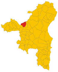
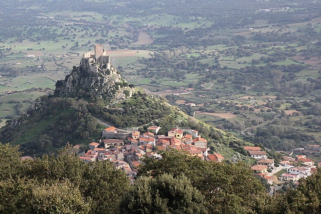
Боттидда (Bottidda, Bottidda)
- коммуна Италии
Bottidda, a small town located in the heart of the Sardinia region of Italy, offers a unique backdrop for hiking enthusiasts. Surrounded by rugged landscapes, rolling hills, and lush vegetation, it provides opportunities for both leisurely strolls and more challenging hikes.
Hiking Trails
-
Local Trails: The area boasts a variety of trails that vary in difficulty. Many paths wind through scenic countryside, allowing hikers to experience the natural beauty of Sardinia's flora and fauna.
-
Supramonte Region: Nearby, the Supramonte mountain range features breathtaking views and more challenging routes. This area is recognized for its dramatic limestone cliffs, deep gorges, and ancient caves.
-
Gennargentu National Park: A bit further afield, this national park is home to Sardinia’s highest peaks. Trails here offer tree-covered paths, panoramic views, and the opportunity to spot local wildlife.
Preparation
-
Gear: Ensure you have sturdy hiking boots, a backpack, plenty of water, snacks, and a first aid kit. A trekking pole can also be useful for uneven terrain.
-
Weather Considerations: Be aware of the weather conditions before heading out. Sardinia can be quite hot in the summer; early morning hikes are recommended for comfort.
-
Maps and Guides: It’s advisable to have a map or a GPS device, as some trails may not be well-marked. Local guides can also enhance your experience by providing insights about the culture and environment.
Safety Tips
- Always inform someone about your hiking plans.
- Check weather conditions and be prepared for sudden changes.
- Stay on marked trails to protect the environment and avoid getting lost.
- Be cautious of wildlife; while many animals are shy, it's best to be vigilant.
Additional Attractions
Aside from hiking, Bottidda is also rich in cultural heritage. You might explore local historical sites, enjoy traditional Sardinian cuisine, and engage with friendly locals.
Overall, Bottidda offers a wonderful hiking experience interwoven with the vibrant culture and stunning natural landscapes of Sardinia. Whether you're a beginner or an experienced hiker, you’ll find something to enjoy in this picturesque region.
- Страна:

- Почтовый код: 07010
- Телефонный код: 079
- Код автомобильного номера: SS
- Координаты: 40° 23' 32" N, 9° 0' 32" E


- GPS треки (wikiloc): [Ссылка]
- Высота над уровнем моря: 396 м m
- Площадь: 33.71 кв.км
- Население: 680
- Веб сайт: http://www.comune.bottidda.ss.it
- Википедия русская: wiki(ru)
- Википедия английская: wiki(en)
- Википедия национальная: wiki(it)
- Хранилище Wikidata: Wikidata: Q390601
- Катеория в википедии: [Ссылка]
- код Freebase: [/m/0gqsy1]
- код GeoNames: Альт: [6541354]
- ID отношения в OpenStreetMap: [40458]
- WOEID: [711334]
- код ISTAT: 090016
- кадастровый код Италии: B094
Граничит с регионами:


Оротелли
- коммуна Италии
Orotelli is a charming village located in the heart of Sardinia, Italy. It is surrounded by stunning natural landscapes, making it a great destination for hiking enthusiasts. The area offers a mix of terrains, including forests, hills, and mountainous regions, each presenting unique opportunities for exploration....
- Страна:

- Почтовый код: 08020
- Телефонный код: 0784
- Код автомобильного номера: NU
- Координаты: 40° 18' 13" N, 9° 6' 45" E


- GPS треки (wikiloc): [Ссылка]
- Высота над уровнем моря: 406 м m
- Площадь: 61.18 кв.км
- Население: 2017
- Веб сайт: [Ссылка]


Боно
- коммуна Италии
Hiking in Bono, Sardinia, is a wonderful experience, showcasing the island's stunning landscapes, rich history, and diverse flora and fauna. Located in the heart of Sardinia, Bono is surrounded by picturesque mountains, lush forests, and charming villages, making it a great base for outdoor enthusiasts....
- Страна:

- Почтовый код: 07011
- Телефонный код: 079
- Код автомобильного номера: SS
- Координаты: 40° 24' 55" N, 9° 1' 43" E


- GPS треки (wikiloc): [Ссылка]
- Высота над уровнем моря: 540 м m
- Площадь: 74.54 кв.км
- Население: 3531
- Веб сайт: [Ссылка]


Бонорва
- коммуна Италии
Bonorva, located in the Sardinia region of Italy, is a wonderful destination for hiking enthusiasts. The area is characterized by its rich natural landscapes, with rolling hills, forests, and a variety of flora and fauna. Here are some highlights and considerations for hiking in Bonorva:...
- Страна:

- Почтовый код: 07012
- Телефонный код: 079
- Код автомобильного номера: SS
- Координаты: 40° 25' 0" N, 8° 46' 0" E


- GPS треки (wikiloc): [Ссылка]
- Высота над уровнем моря: 508 м m
- Площадь: 149.75 кв.км
- Население: 3386
- Веб сайт: [Ссылка]


Бургос
- коммуна Италии
Hiking in Burgos, Sardinia, offers a fantastic opportunity to explore the natural beauty and rugged terrain of the island. Located in the northern part of Sardinia, Burgos is surrounded by stunning landscapes that are ideal for hiking enthusiasts. Here are some key highlights about hiking in this area:...
- Страна:

- Почтовый код: 07010
- Телефонный код: 079
- Код автомобильного номера: SS
- Координаты: 40° 23' 29" N, 8° 59' 40" E


- GPS треки (wikiloc): [Ссылка]
- Высота над уровнем моря: 575 м m
- Площадь: 18.08 кв.км
- Население: 903
- Веб сайт: [Ссылка]


Эспорлату
- коммуна Италии
Esporlatu, located in the Province of Huesca in the Aragon region of Spain, is a beautiful area for hiking enthusiasts. Nestled in the foothills of the Pyrenees, it offers stunning landscapes and diverse trails suitable for various skill levels....
- Страна:

- Почтовый код: 07010
- Телефонный код: 079
- Код автомобильного номера: SS
- Координаты: 40° 23' 8" N, 8° 59' 24" E


- GPS треки (wikiloc): [Ссылка]
- Высота над уровнем моря: 474 м m
- Площадь: 18.4 кв.км
- Население: 395
- Веб сайт: [Ссылка]


Иллорай
- коммуна Италии
Illorai is a small town located in the heart of Sardinia, Italy. The region is known for its stunning landscapes, rich history, and traditional culture, making it a great destination for hiking enthusiasts. Here are some highlights and considerations for hiking in Illorai:...
- Страна:

- Почтовый код: 07010
- Телефонный код: 079
- Код автомобильного номера: SS
- Координаты: 40° 21' 13" N, 8° 59' 59" E


- GPS треки (wikiloc): [Ссылка]
- Высота над уровнем моря: 503 м m
- Площадь: 57.19 кв.км
- Население: 846
- Веб сайт: [Ссылка]

