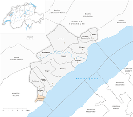
Boudry District (Bezirk Boudry)

 Hiking in Boudry District
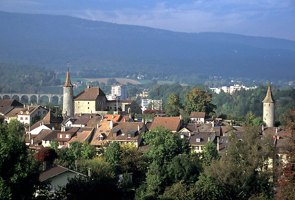
Boudry District, located in the Canton of Neuchâtel in Switzerland, offers a variety of hiking opportunities that showcase the area's beautiful landscapes, rich history, and diverse ecosystems.
Key Highlights of Hiking in Boudry District:
-
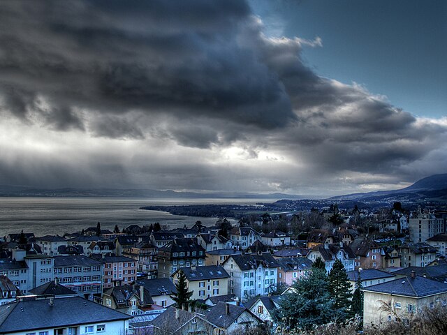
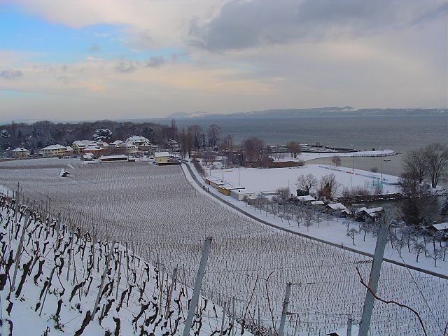
Scenic Landscapes: The district is characterized by rolling hills, vineyards, and stunning views of Lake Neuchâtel and the surrounding Jura Mountains. Many trails offer panoramic viewpoints, making them ideal for photography and enjoying nature.
-
Hiking Trails: There are several marked hiking trails in the area, ranging from easy walks suitable for families to more challenging hikes for experienced adventurers. The trails are well-maintained and are often marked with yellow signs indicating the routes.
-
Winery Tours: Hiking in Boudry often leads through vineyards, which provide an excellent opportunity to taste local wines. Many trails pass by wineries that offer tastings and tours, allowing hikers to enjoy the region’s viticulture.
-
Cultural and Historical Sites: Along the trails, you can discover historical sites, including old villages and ruins that speak to the region's rich heritage. Boudry itself has some notable architecture and sites worth exploring.
-
Nature Reserves: The area is home to various nature reserves that protect local flora and fauna, providing hikers with opportunities to observe wildlife in its natural habitat. The ecological diversity makes for a unique hiking experience.
-
Accessibility: Boudry is well-connected by public transport, making it easy for hikers to access different starting points for their excursions. Train and bus services facilitate entry to popular trailheads.
-
Seasonal Hiking: While most hiking can be enjoyed during spring and summer, autumn offers spectacular foliage colors, and winter trails might be available for snowshoeing. It’s essential to check local conditions to ensure safety and accessibility.
-
Safety and Preparedness: Always take necessary precautions before heading out. It's advisable to wear appropriate footwear, bring enough water, and have a map or a GPS device on hand. Additionally, check local forecasts for weather conditions before your hike.
Suggested Routes:
- Les Crêtets Trail: A moderate trail that offers wonderful views of the lake and the Alps in the distance.
- Neuchâtel Lake Shore: A flat and easy hike along the waterfront, perfect for leisurely walks and enjoying the scenery.
- Vineyard Trails: Explore routes that weave through the vineyards, providing both exercise and the chance to sample local cuisine and wines.
Conclusion:
Hiking in Boudry District is a rewarding experience that combines nature, culture, and adventure. Whether you are a seasoned hiker or a casual walker, you will find trails that suit your interests and ability levels. Enjoy your hike!
- Страна:

- Столица: Boudry
- Код автомобильного номера: NE
- Координаты: 46° 57' 0" N, 6° 50' 0" E


- GPS треки (wikiloc): [Ссылка]
- Высота над уровнем моря: 485 м m
- Площадь: 105.58 кв.км
- Википедия английская: wiki(en)
- Википедия национальная: wiki(de)
- Хранилище Wikidata: Wikidata: Q661133
- Катеория в википедии: [Ссылка]
- код Freebase: [/m/0f_s7s]
- код GeoNames: Альт: [6458825]
- идентификатор местоположения ArchINFORM: [42737]
Включает регионы:

Milvignes
Hiking in Milvignes
Milvignes, located in the canton of Neuchâtel in Switzerland, offers a range of beautiful hiking opportunities for outdoor enthusiasts. The region is known for its picturesque landscapes, including rolling hills, vineyards, and the nearby Lake Neuchâtel....
- Страна:
- Почтовый код: 2012, 2013, 2014
- Телефонный код: 032
- Код автомобильного номера: NE
- Координаты: 46° 58' 0" N, 6° 52' 0" E
- GPS треки (wikiloc): [Ссылка]
- Высота над уровнем моря: 457 м m
- Площадь: 8.78 кв.км
- Население: 9008
- Веб сайт: [Ссылка]


Bevaix
Hiking in Bevaix
Bevaix, located in the Neuchâtel region of Switzerland, is a picturesque village that offers a variety of hiking opportunities, particularly for those who enjoy scenic views of both the Swiss countryside and Lake Neuchâtel. Here are some highlights for hiking in and around Bevaix:...
- Страна:
- Почтовый код: 2022
- Телефонный код: 032
- Код автомобильного номера: NE
- Координаты: 46° 55' 52" N, 6° 48' 15" E
- GPS треки (wikiloc): [Ссылка]
- Высота над уровнем моря: 570 м m
- Площадь: 10.76 кв.км
- Население: 3784
- Веб сайт: [Ссылка]

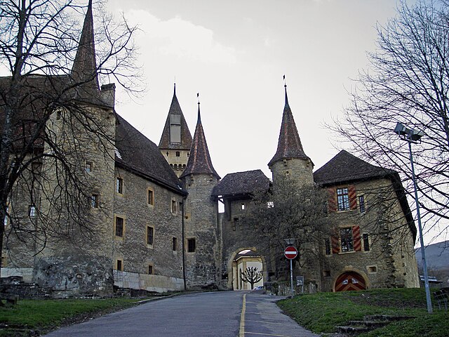
Boudry
Hiking in Boudry
Boudry is a picturesque town located in the Canton of Neuchâtel in Switzerland. It is surrounded by beautiful natural landscapes, making it an excellent spot for hiking enthusiasts. Here’s what you can expect when hiking in and around Boudry:...
- Страна:
- Телефонный код: 032
- Код автомобильного номера: NE
- Координаты: 46° 57' 0" N, 6° 50' 0" E
- GPS треки (wikiloc): [Ссылка]
- Высота над уровнем моря: 446 м m
- Площадь: 16.78 кв.км
- Население: 6124
- Веб сайт: [Ссылка]

Peseux
Hiking in Peseux
Peseux, a charming municipality located in the canton of Neuchâtel, Switzerland, offers a variety of hiking opportunities that showcase the region's stunning natural landscapes. Surrounded by rolling hills, forests, and views of Lake Neuchâtel, hikers can enjoy both leisurely strolls and more challenging trails....
- Страна:
- Почтовый код: 2034
- Телефонный код: 032
- Код автомобильного номера: NE
- Координаты: 46° 59' 44" N, 6° 53' 22" E
- GPS треки (wikiloc): [Ссылка]
- Высота над уровнем моря: 715 м m
- Площадь: 3.43 кв.км
- Население: 5825
- Веб сайт: [Ссылка]


Рошфор
Hiking in Рошфор
Rochefort, located in the heart of Switzerland, offers a variety of beautiful hiking opportunities for outdoor enthusiasts. The region is characterized by stunning landscapes, picturesque views of the Alps, and a tranquil environment that makes it perfect for hiking....
- Страна:
- Почтовый код: 2019, 2149
- Телефонный код: 032
- Код автомобильного номера: NE
- Координаты: 46° 59' 0" N, 6° 49' 0" E
- GPS треки (wikiloc): [Ссылка]
- Высота над уровнем моря: 759 м m
- Площадь: 25.84 кв.км
- Население: 1266
- Веб сайт: [Ссылка]

Cortaillod
Hiking in Cortaillod
Cortaillod is a charming village located in the Neuchâtel District of Switzerland, nestled along the shores of Lake Neuchâtel. It is surrounded by beautiful natural landscapes and offers a variety of hiking opportunities that cater to different skill levels. Here are some key highlights about hiking in and around Cortaillod:...
- Страна:
- Почтовый код: 2016
- Телефонный код: 032
- Код автомобильного номера: NE
- Координаты: 46° 57' 0" N, 6° 51' 0" E
- GPS треки (wikiloc): [Ссылка]
- Высота над уровнем моря: 487 м m
- Площадь: 3.67 кв.км
- Население: 4774
- Веб сайт: [Ссылка]
Corcelles-Cormondrèche
Hiking in Corcelles-Cormondrèche
Corcelles-Cormondrèche is a charming region located in the canton of Neuchâtel, Switzerland, known for its picturesque landscapes and numerous hiking opportunities. The area offers a mix of gentle hills, lush forests, and stunning views of Lake Neuchâtel and the surrounding Jura mountains....
- Страна:
- Почтовый код: 2035 and 2036
- Телефонный код: 032
- Код автомобильного номера: NE
- Координаты: 46° 59' 0" N, 6° 53' 0" E
- GPS треки (wikiloc): [Ссылка]
- Высота над уровнем моря: 537 м m
- Площадь: 4.86 кв.км
- Население: 4740
- Веб сайт: [Ссылка]
Fresens
Hiking in Fresens
It seems there may be a typo in your request for information about "Fresens." If you're referring to a specific hiking area or location, it might be helpful to provide the correct name....
- Страна:
- Почтовый код: 2027
- Телефонный код: 032
- Код автомобильного номера: NE
- Координаты: 46° 53' 19" N, 6° 44' 52" E
- GPS треки (wikiloc): [Ссылка]
- Высота над уровнем моря: 618 м m
- Площадь: 1.58 кв.км
- Население: 252
Montalchez
Hiking in Montalchez
Montalchez is not a widely known hiking destination, so it might be a lesser-known area or possibly a misspelling of a more recognized location. However, hiking in various regions typically involves enjoying scenic landscapes, exploring nature, and engaging in physical activity....
- Страна:
- Почтовый код: 2027
- Телефонный код: 032
- Код автомобильного номера: NE
- Координаты: 46° 53' 54" N, 6° 44' 40" E
- GPS треки (wikiloc): [Ссылка]
- Высота над уровнем моря: 674 м m
- Площадь: 6.41 кв.км
- Население: 240


Gorgier
Hiking in Gorgier
Gorgier is a charming municipality located in the canton of Neuchâtel in Switzerland. It’s situated near the shores of Lake Neuchâtel, and its scenic landscape offers a variety of outdoor activities, including hiking. Here are some key points to keep in mind if you're planning to hike in Gorgier:...
- Страна:
- Почтовый код: 2023
- Телефонный код: 032
- Код автомобильного номера: NE
- Координаты: 46° 55' 27" N, 6° 45' 54" E
- GPS треки (wikiloc): [Ссылка]
- Высота над уровнем моря: 915 м m
- Площадь: 13.97 кв.км
- Население: 2021
- Веб сайт: [Ссылка]

Vaumarcus
Hiking in Vaumarcus
Vaumarcus is a charming village located in the canton of Neuchâtel, Switzerland, known for its beautiful landscapes and proximity to Lake Neuchâtel. It offers a variety of hiking opportunities that cater to different skill levels, making it a great destination for both novice and experienced hikers....
- Страна:
- Почтовый код: 2028
- Телефонный код: 032
- Код автомобильного номера: NE
- Координаты: 46° 53' 0" N, 6° 45' 0" E
- GPS треки (wikiloc): [Ссылка]
- Высота над уровнем моря: 452 м m
- Площадь: 1.78 кв.км
- Население: 268
- Веб сайт: [Ссылка]


Saint-Aubin-Sauges
Hiking in Saint-Aubin-Sauges
Saint-Aubin-Sauges is a picturesque municipality located along the shores of Lake Neuchâtel in Switzerland, offering beautiful landscapes and a variety of hiking options. Here’s what you can expect when hiking in this region:...
- Страна:
- Почтовый код: 2024
- Телефонный код: 032
- Код автомобильного номера: NE
- Координаты: 46° 54' 26" N, 6° 45' 16" E
- GPS треки (wikiloc): [Ссылка]
- Высота над уровнем моря: 716 м m
- Площадь: 7.71 кв.км
- Население: 2399
- Веб сайт: [Ссылка]


Brot-Dessous
Hiking in Brot-Dessous
Brot-Dessous is a beautiful location for hiking, situated in Switzerland's picturesque region of the Alps. This area is known for its stunning landscapes, rich biodiversity, and well-maintained trails that cater to various skill levels. Here are a few key points about hiking in Brot-Dessous:...
- Страна:
- Телефонный код: 032
- Код автомобильного номера: NE
- Координаты: 46° 57' 41" N, 6° 45' 42" E
- GPS треки (wikiloc): [Ссылка]
- Высота над уровнем моря: 937 м m
- Площадь: 4.95 кв.км