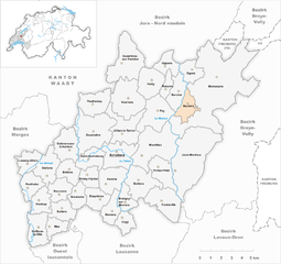
Boulens (Boulens)
Boulens, located in the canton of Vaud in Switzerland, is a charming area with beautiful landscapes and opportunities for hiking. The region offers various trails that cater to different skill levels, from easy walks to more challenging hikes.
Key Features:
-
Scenic Views: Hikes around Boulens provide stunning views of the surrounding hills and valleys, particularly of the Swiss countryside.
-
Trail Varieties: There are various trails to explore, with options for both longer and shorter hikes. Many trails are well-marked, making them accessible for hikers of all experiences.
-
Natural Environment: The trails take you through picturesque landscapes, including forests, meadows, and the serene ambiance typical of rural Switzerland.
-
Nearby Attractions: While hiking, you may encounter small villages and local farms, allowing for a glimpse into Swiss rural life. Some routes may also lead to educational and cultural sites.
-
Accessibility: Boulens is generally accessible by public transport, making it easy for hikers to reach the starting points of trails.
Hiking Tips:
-
Seasonal Considerations: Check trail conditions depending on the season, as some routes may be affected by snow in winter or mud in spring.
-
Preparation: Bring plenty of water, snacks, a map or GPS device, and wear appropriate footwear. Always inform someone of your plans before heading out.
-
Local Guidelines: Respect local guidelines and conservation efforts to preserve the natural beauty of the area.
Whether you’re a local resident or a visitor looking to explore the Swiss countryside, hiking in Boulens can offer a rewarding experience amidst nature.
- Страна:

- Почтовый код: 1063
- Телефонный код: 021
- Код автомобильного номера: VD
- Координаты: 46° 41' 0" N, 6° 43' 0" E


- GPS треки (wikiloc): [Ссылка]
- Высота над уровнем моря: 718 м m
- Площадь: 3.42 кв.км
- Население: 378
- Веб сайт: http://www.boulens.ch
- Википедия английская: wiki(en)
- Википедия национальная: wiki(de)
- Хранилище Wikidata: Wikidata: Q52273
- Катеория в википедии: [Ссылка]
- код Freebase: [/m/09p0t2]
- код GeoNames: Альт: [8533267]
- ID отношения в OpenStreetMap: [1684863]
- идентификатор HDS: [2461]
- код швейцарского муниципалитета: [5661]

