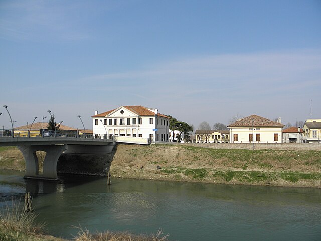
Боволента (Bovolenta, Bovolenta)
.svg)
- коммуна Италии
 Hiking in Боволента
Bovolenta is a small town in the Veneto region of Italy, known primarily for its agricultural landscape and proximity to the iconic scenery of the Veneto countryside. While Bovolenta itself may not be a hiking hotspot compared to larger natural reserves or mountainous areas, there are still opportunities for hiking and enjoying the outdoors.
Here are some details and suggestions for hiking around Bovolenta:
-
Local Trails: The countryside surrounding Bovolenta offers various walking paths and trails. You can explore rural roads, fields, and vineyards, which can provide a peaceful hiking experience. Look for local trail maps or ask local residents for popular routes.
-
Regional Parks: If you’re willing to travel a bit further, consider visiting regional parks in the surrounding areas, such as the Parco Regionale dei Colli Euganei. Located about 20 kilometers from Bovolenta, this park features hilly terrain, diverse flora and fauna, and scenic views. There are many marked trails of varying difficulty levels for hiking enthusiasts.
-
Historic Routes: Some trails may take you past historical sites or local landmarks, allowing you to combine hiking with cultural experiences. For instance, exploring the nearby towns or historical buildings can be an enriching addition to your hikes.
-
Best Time to Hike: The best time for hiking in this region is generally during the spring (April to June) and early fall (September to October) when the weather is mild. Summer can be hot, and winter may bring cold and wet conditions.
-
Preparation: Make sure to wear appropriate footwear and clothing, stay hydrated, and carry snacks. Since Bovolenta is flat, ensure that you are prepared for changing terrains if you decide to venture into the hilly areas nearby.
-
Safety: Always inform someone about your hiking plans, especially if you are venturing into more remote areas, and consider using maps or GPS for navigation.
Though Bovolenta may be off the beaten path for hiking, it offers a great opportunity for those looking to enjoy the scenic Italian countryside. Consider exploring the local area and combining outdoor activity with cultural experiences!
- Страна:

- Почтовый код: 35024
- Телефонный код: 049
- Код автомобильного номера: PD
- Координаты: 45° 16' 0" N, 11° 56' 0" E


- GPS треки (wikiloc): [Ссылка]
- Высота над уровнем моря: 6 м m
- Площадь: 22.78 кв.км
- Население: 3471
- Веб сайт: http://www.comune.bovolenta.pd.it/
- Википедия русская: wiki(ru)
- Википедия английская: wiki(en)
- Википедия национальная: wiki(it)
- Хранилище Wikidata: Wikidata: Q34674
- Катеория в википедии: [Ссылка]
- код Freebase: [/m/0gk408]
- код GeoNames: Альт: [6538329]
- код VIAF: Альт: [240570319]
- ID отношения в OpenStreetMap: [44547]
- UN/LOCODE: [ITBOV]
- код ISTAT: 028014
- кадастровый код Италии: B106
Граничит с регионами:

Польверара
- коммуна Италии
Hiking in Польверара
Polverara is a small village located in Italy, and although not widely recognized as a main hiking destination, its proximity to various landscapes and natural sites can provide some enjoyable outdoor experiences. Here are some aspects to consider when hiking in and around Polverara:...
- Страна:
- Почтовый код: 35020
- Телефонный код: 049
- Код автомобильного номера: PD
- Координаты: 45° 18' 34" N, 11° 57' 17" E
- GPS треки (wikiloc): [Ссылка]
- Высота над уровнем моря: 6 м m
- Площадь: 9.84 кв.км
- Население: 3334
- Веб сайт: [Ссылка]

Кандьана
- коммуна Италии
Hiking in Кандьана
Hiking in Canada offers a diverse array of landscapes, trails, and experiences suited to all skill levels. Here are some highlights and popular hiking destinations across the country:...
- Страна:
- Почтовый код: 35020
- Телефонный код: 049
- Код автомобильного номера: PD
- Координаты: 45° 13' 0" N, 11° 58' 0" E
- GPS треки (wikiloc): [Ссылка]
- Высота над уровнем моря: 4 м m
- Площадь: 22.27 кв.км
- Население: 2313
- Веб сайт: [Ссылка]

Картура
- коммуна Италии
Hiking in Картура
Cartura is a charming town in the province of Padua, Italy, and while it may not be as widely recognized for hiking as some larger national parks or mountainous regions, it can still serve as a great base for exploring the surrounding countryside. The area features scenic landscapes, including hills, vineyards, and rivers, particularly along the nearby Bacchiglione River....
- Страна:
- Почтовый код: 35025
- Телефонный код: 049
- Код автомобильного номера: PD
- Координаты: 45° 16' 0" N, 11° 52' 0" E
- GPS треки (wikiloc): [Ссылка]
- Высота над уровнем моря: 6 м m
- Площадь: 16.28 кв.км
- Население: 4680
- Веб сайт: [Ссылка]
Казальсеруго
- коммуна Италии
Hiking in Казальсеруго
Casalserugo is a small town in the Veneto region of Italy, located near the city of Padua. While it may not be a well-known hiking destination, the surrounding areas offer various opportunities for outdoor activities, including hiking....
- Страна:
- Почтовый код: 35020
- Телефонный код: 049
- Код автомобильного номера: PD
- Координаты: 45° 19' 0" N, 11° 55' 0" E
- GPS треки (wikiloc): [Ссылка]
- Высота над уровнем моря: 8 м m
- Площадь: 15.5 кв.км
- Население: 5360
- Веб сайт: [Ссылка]
Понтелонго
- коммуна Италии
Hiking in Понтелонго
Pontelongo, a quaint town in the Veneto region of Italy, offers a unique blend of natural beauty and cultural heritage. Although it may not be as widely recognized as other hiking destinations in Italy, there are several charming trails and walking paths in and around the area that cater to outdoor enthusiasts....
- Страна:
- Почтовый код: 35029
- Телефонный код: 049
- Код автомобильного номера: PD
- Координаты: 45° 15' 0" N, 12° 1' 0" E
- GPS треки (wikiloc): [Ссылка]
- Высота над уровнем моря: 5 м m
- Площадь: 10.89 кв.км
- Население: 3741
- Веб сайт: [Ссылка]

Террасса-Падована
- коммуна Италии
Hiking in Террасса-Падована
Terrassa Padovana is located in the Veneto region of Italy, in an area that is rich in natural scenery and history. The region offers various hiking opportunities that cater to different skill levels....
- Страна:
- Почтовый код: 35020
- Телефонный код: 049
- Код автомобильного номера: PD
- Координаты: 45° 15' 0" N, 11° 54' 0" E
- GPS треки (wikiloc): [Ссылка]
- Высота над уровнем моря: 6 м m
- Площадь: 14.81 кв.км
- Население: 2637
- Веб сайт: [Ссылка]

Бруджине
- коммуна Италии
Hiking in Бруджине
Brugine, located in the Veneto region of Italy, is not primarily known as a hiking destination like some of the more mountainous areas of Italy. However, it offers a unique rural landscape that can be appealing for leisurely walks and gentle hikes. Here are some details that could enhance your hiking experience in and around Brugine:...
- Страна:
- Почтовый код: 35020
- Телефонный код: 049
- Код автомобильного номера: PD
- Координаты: 45° 18' 0" N, 11° 59' 33" E
- GPS треки (wikiloc): [Ссылка]
- Высота над уровнем моря: 7 м m
- Площадь: 19.55 кв.км
- Население: 7116
- Веб сайт: [Ссылка]