
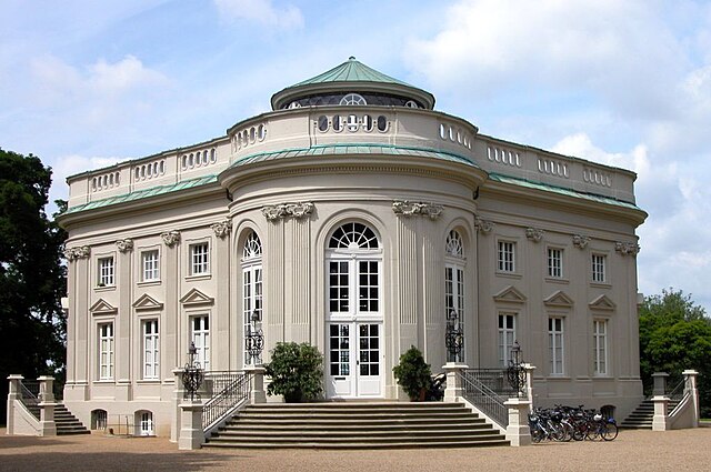
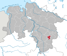
Брауншвейг (Brunswick, Braunschweig)


- город в земле Нижняя Саксония, Германия
 Hiking in Брауншвейг
Braunschweig, located in Lower Saxony, Germany, offers a variety of hiking options that allow you to explore its natural beauty, historical sites, and charming landscapes. Here's an overview of what you can expect when hiking in and around Braunschweig:
1.
- Braunschweiger Land: The surrounding rural area of Braunschweig is ideal for hiking, with numerous trails winding through forests, fields, and meadows.
- Landschaftsschutzgebiet (Landscape Protection Area): This area on the outskirts of the city includes diverse habitats and is great for observing local flora and fauna.
2.
- Oberstadt Trail: A scenic trail that takes you through various neighborhoods, parks, and green spaces within Braunschweig itself.
- Heinrichsweg: This designated walking route connects Braunschweig with nearby towns and villages, ideal for those looking for a longer hike.
3.
- Old Town Exploration: Hike through the historic city center, visiting landmarks such as the Braunschweig Cathedral, the Dankwarderode Castle, and the 'Löwe' statue. This can be an enjoyable urban hike with cultural stops.
4.
- Harz National Park: Although a bit further away, it’s easily accessible for a day trip. This area offers challenging hikes with breathtaking views, dense forests, and rugged terrain.
- Elm-Lappwald Nature Park: Just a short drive from Braunschweig, this park features extensive hiking trails through picturesque landscapes and is perfect for enjoying nature.
5.
- Preparation: Always check local maps and trail conditions before heading out. It's also wise to equip yourself with a good pair of hiking boots and sufficient water.
- Weather: The weather can vary, so be prepared for sudden changes, especially in the spring and autumn.
- Local Guides and Groups: Consider joining local hiking clubs or guided tours to discover lesser-known trails and enjoy the experience with others.
6.
- Look out for organized hiking events or workshops that may take place throughout the year. These can be a great way to meet fellow hikers and learn more about the local environment.
Hiking around Braunschweig offers a mix of outdoor adventure, cultural exploration, and the chance to connect with nature. Whether you're a beginner or an experienced hiker, you'll find trails that suit your preferences.
- Страна:

- Почтовый код: 38114; 38126; 38100; 38100–38126
- Телефонный код: 05341; 0531; 05309; 05307; 05300
- Код автомобильного номера: BS
- Координаты: 52° 16' 9" N, 10° 31' 16" E


- GPS треки (wikiloc): [Ссылка]
- Высота над уровнем моря: 75 м m
- Площадь: 192.70 кв.км
- Население: 248667
- Веб сайт: https://www.braunschweig.de/
- Википедия русская: wiki(ru)
- Википедия английская: wiki(en)
- Википедия национальная: wiki(de)
- Хранилище Wikidata: Wikidata: Q2773
- Галерея изображений в википедии: [Ссылка]
- Катеория в википедии: [Ссылка]
- Карты в википедии: [Ссылка]
- код Freebase: [/m/0dgfx]
- код GeoNames: Альт: [2945024]
- код BNF: [11865975h]
- код VIAF: Альт: [134835052]
- ID отношения в OpenStreetMap: [62531]
- код GND: Альт: [4008065-1]
- идентификатор местоположения ArchINFORM: [343]
- код LCNAF: Альт: [n50049852]
- место в MusicBrainz: [5d668739-7f88-4062-9bc5-11a90e838310]
- WOEID: [640831]
- код темы Quora: [Braunschweig-Germany]
- код TGN: [7004434]
- код SUDOC: [148004571]
- код в энциклопедии «Британника онлайн»: [place/Braunschweig-Germany]
- EMLO location ID: [9a83844c-0c1e-4a88-a4a5-b7b121ee863f]
- код места в Facebook: [111926982166966]
- код в Большой российской энциклопедии онлайн: [1882571]
- код ISNI: Альт: [0000 0001 2238 1180]
- dmoz: Альт: [Regional/Europe/Germany/States/Lower_Saxony/Localities/Brunswick/]
- код NLI: [000971614]
- код NUTS: [DE911]
- Nomisma ID: [braunschweig]
- код статьи Klexikon: [Braunschweig]
- код Католической энциклопедии: [03019a]
- идентификатор муниципалитетов в Германии: 03101000
- код US National Archives: 10044955
- код района Германии: 03101
Включает регионы:

Heidberg-Melverode
Hiking in Heidberg-Melverode
Heidberg-Melverode is a district located in the city of Braunschweig, Germany. While it may not be as widely recognized for hiking as some large national parks or mountainous areas, there are still opportunities for hikers to explore the natural surroundings and enjoy outdoor activities....
- Страна:
- Почтовый код: 38122; 38124
- Координаты: 52° 13' 50" N, 10° 31' 56" E
- GPS треки (wikiloc): [Ссылка]


Weststadt
Hiking in Weststadt
Weststadt is a district in Braunschweig, Germany, and while it may not be renowned for traditional hiking trails like some larger natural parks or mountains, it does offer some lovely opportunities for walking and enjoying nature....
- Страна:
- Почтовый код: 38122; 38120
- Телефонный код: 0531
- Координаты: 52° 14' 56" N, 10° 29' 10" E
- GPS треки (wikiloc): [Ссылка]
- Площадь: 6.793 кв.км


Hondelage
Hiking in Hondelage
Hondelage, a district in the city of Braunschweig in Lower Saxony, Germany, is not primarily known for extensive hiking trails like some mountainous regions, but it does offer some pleasant walking and hiking opportunities in and around the area. While you may not find challenging mountain hikes, there are still options for enjoying nature and outdoor activities....
- Страна:
- Почтовый код: 38118; 38110
- Телефонный код: 05309
- Координаты: 52° 18' 52" N, 10° 36' 15" E
- GPS треки (wikiloc): [Ссылка]
- Высота над уровнем моря: 75 м m

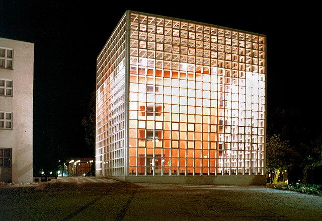
Innenstadt
Hiking in Innenstadt
Braunschweig's Innenstadt (city center) may not be traditionally recognized for hiking in the way mountainous or rural regions are, but it offers plenty of opportunities for walking and exploring urban trails. While hiking in a city may differ from trekking in nature, it can still be an enjoyable experience, especially if you appreciate architecture, history, and local culture....
- Страна:
- Почтовый код: 38114; 38118; 38100
- Координаты: 52° 15' 51" N, 10° 31' 18" E
- GPS треки (wikiloc): [Ссылка]

Lehndorf-Watenbüttel
Hiking in Lehndorf-Watenbüttel
Lehndorf-Watenbüttel is a district in Braunschweig, Germany, known more for its suburban environment than for traditional hiking trails. However, there are several nearby areas and parks that can provide enjoyable walking and hiking experiences....
- Страна:
- Почтовый код: 38114; 38112; 38116
- Координаты: 52° 17' 0" N, 10° 27' 45" E
- GPS треки (wikiloc): [Ссылка]
- Площадь: 27.35 кв.км

Nordstadt
Hiking in Nordstadt
Nordstadt in Braunschweig offers several opportunities for outdoor activities, including hiking, although it is more of an urban area rather than a wilderness hiking destination. Here are some key points to consider if you’re planning to hike in and around Braunschweig, specifically in Nordstadt:...
- Страна:
- Почтовый код: 38106; 38112; 38114
- Координаты: 52° 17' 6" N, 10° 31' 27" E
- GPS треки (wikiloc): [Ссылка]

Rüningen
Hiking in Rüningen
Rüningen is a district located in the city of Braunschweig, Germany, and while it might not be known as a major hiking destination, there are still opportunities for outdoor activities and nature exploration in the surrounding areas....
- Страна:
- Почтовый код: 38122
- Телефонный код: 0531
- Координаты: 52° 13' 19" N, 10° 30' 10" E
- GPS треки (wikiloc): [Ссылка]
- Высота над уровнем моря: 76 м m


Schunteraue
Hiking in Schunteraue
Schunteraue, located in Germany, is a picturesque area characterized by its lush nature, meandering streams, and diverse wildlife. Here’s what you need to know about hiking in this beautiful region:...
- Страна:
- Почтовый код: 38108
- Телефонный код: 0531
- Координаты: 52° 18' 0" N, 10° 32' 18" E
- GPS треки (wikiloc): [Ссылка]
- Высота над уровнем моря: 70 м m

Stöckheim-Leiferde
Hiking in Stöckheim-Leiferde
Stöckheim-Leiferde is located in the Lower Saxony region of Germany, and while it may not be as well-known for hiking as some other areas, it offers a variety of outdoor experiences. The landscape consists of gentle hills, forests, and agricultural fields, providing a peaceful setting for hikers....
- Страна:
- Почтовый код: 38122; 38124
- Координаты: 52° 12' 31" N, 10° 30' 57" E
- GPS треки (wikiloc): [Ссылка]
- Высота над уровнем моря: 75 м m
- Площадь: 10.41 кв.км

Südstadt-Rautheim-Mascherode
Hiking in Südstadt-Rautheim-Mascherode
Südstadt-Rautheim-Mascherode is a district in the city of Braunschweig, Germany. While it might not be widely known as a major hiking destination, there are opportunities for outdoor activities in and around the area....
- Страна:
- Почтовый код: 38126
- Координаты: 52° 14' 7" N, 10° 34' 7" E
- GPS треки (wikiloc): [Ссылка]

Watenbüttel-Ölper-Völkenrode
Hiking in Watenbüttel-Ölper-Völkenrode
Watenbüttel, Ölper, and Völkenrode are neighborhoods in the city of Braunschweig in Lower Saxony, Germany. While these areas may not be the first that come to mind for hiking, they do offer some opportunities for outdoor activities and nature walks....
- Страна:

Timmerlah-Geitelde-Stiddien
Hiking in Timmerlah-Geitelde-Stiddien
Timmerlah-Geitelde-Stiddien is a picturesque area located near Braunschweig in Lower Saxony, Germany. Hiking in this region offers a variety of landscapes, including woodlands, fields, and scenic views of the surrounding countryside....
- Страна:
- Почтовый код: 38120; 38122
- Координаты: 52° 13' 27" N, 10° 27' 29" E
- GPS треки (wikiloc): [Ссылка]

Veltenhof-Rühme
Hiking in Veltenhof-Rühme
Veltenhof-Rühme is a scenic area in Germany that offers various opportunities for hiking. It's characterized by its picturesque landscapes, featuring rolling hills, forests, and some charming rural scenery. While specific trails may not be as well-known as larger national parks, the region provides a lovely backdrop for hiking enthusiasts looking for a more tranquil experience....
- Страна:
- Почтовый код: 38112
- Координаты: 52° 18' 18" N, 10° 30' 23" E
- GPS треки (wikiloc): [Ссылка]

Viewegsgarten-Bebelhof
Hiking in Viewegsgarten-Bebelhof
Viewegsgarten-Bebelhof is a scenic park located in the city of Braunschweig, Germany. This area offers a great opportunity for urban hiking and enjoying the natural beauty within the city's boundaries. Here's some information on hiking and outdoor activities you can enjoy in this area:...
- Страна:
- Почтовый код: 38104; 38126; 38124; 38122; 38102; 38100
- Координаты: 52° 15' 3" N, 10° 32' 48" E
- GPS треки (wikiloc): [Ссылка]
- Площадь: 6.71 кв.км

Volkmarode
Hiking in Volkmarode
Volkmarode is a district in the city of Braunschweig (Brunswick) in Germany. While it may not be as well-known as larger national parks or famous trails, hiking in and around Volkmarode can still be a delightful experience for nature lovers and outdoor enthusiasts....
- Страна:
- Почтовый код: 38104; 38118
- Координаты: 52° 17' 18" N, 10° 35' 42" E
- GPS треки (wikiloc): [Ссылка]
Wabe-Schunter
Hiking in Wabe-Schunter
Wabe-Schunter is a natural area in the Ethiopian highlands, particularly known for its diverse landscapes, rich biodiversity, and cultural significance. Hiking in this region can provide a unique experience for outdoor enthusiasts, with opportunities to explore various trails, observe wildlife, and engage with local communities....
- Страна:
- Координаты: 52° 16' 46" N, 10° 34' 14" E
- GPS треки (wikiloc): [Ссылка]

Wabe-Schunter-Beberbach
Hiking in Wabe-Schunter-Beberbach
Wabe-Schunter-Beberbach is a picturesque area located in the Lower Saxony region of Germany. While it may not be as widely known as some other hiking destinations, it offers beautiful natural landscapes and diverse trails perfect for hikers of various skill levels. Here are some highlights for hiking in this area:...
- Страна:
- Почтовый код: 38104; 38110; 38118
- Координаты: 52° 16' 50" N, 10° 33' 37" E
- GPS треки (wikiloc): [Ссылка]
- Площадь: 30.568 кв.км

Wenden-Thune-Harxbüttel
Hiking in Wenden-Thune-Harxbüttel
Wenden-Thune-Harxbüttel is a picturesque area in Germany that offers a variety of hiking opportunities through scenic landscapes. The region features a mix of forested areas, open fields, and charming villages, making it an ideal spot for both novice and experienced hikers....
- Страна:
- Почтовый код: 38110
- Координаты: 52° 20' 1" N, 10° 30' 9" E
- GPS треки (wikiloc): [Ссылка]
Westliches Ringgebiet
Hiking in Westliches Ringgebiet
Westliches Ringgebiet is a district located in the city of Gelsenkirchen in Germany. While this area is primarily urban and industrial, it does offer some opportunities for walking and hiking, particularly in the parks and green spaces within and around the district....
- Страна:
- Почтовый код: 38116; 38114; 38120; 38118; 38122
- Координаты: 52° 15' 9" N, 10° 30' 22" E
- GPS треки (wikiloc): [Ссылка]

Östliches Ringgebiet
Hiking in Östliches Ringgebiet
The Östliches Ringgebiet, or Eastern Ring Area, is a picturesque region located in northeastern Germany, specifically within the state of Lower Saxony. Known for its diverse landscapes, this area offers numerous opportunities for hiking and enjoying the great outdoors. Here are some highlights and tips for hiking in this region:...
- Страна:
- Почтовый код: 38102; 38106; 38104
- Координаты: 52° 16' 9" N, 10° 32' 33" E
- GPS треки (wikiloc): [Ссылка]


Bienrode
Hiking in Bienrode
Bienrode is a district located in the city of Braunschweig, Germany. It's known for its scenic landscapes and opportunities for outdoor activities, including hiking. While Bienrode itself may not have a multitude of extensive hiking trails, it serves as a great starting point for exploring nearby natural areas....
- Страна:
- Почтовый код: 38110
- Телефонный код: 05307
- Координаты: 52° 19' 1" N, 10° 31' 45" E
- GPS треки (wikiloc): [Ссылка]
- Высота над уровнем моря: 71 м m
Bienrode-Waggum-Bevenrode
Hiking in Bienrode-Waggum-Bevenrode
Bienrode, Waggum, and Bevenrode are three districts that are part of the city of Braunschweig in Lower Saxony, Germany. While this area might not be widely known for extensive hiking trails like more mountainous regions, it does offer some pleasant walking and hiking opportunities, particularly for those looking to enjoy nature and local scenery close to urban settings....
- Страна:
- Координаты: 52° 19' 15" N, 10° 34' 1" E
- GPS треки (wikiloc): [Ссылка]

Broitzem
Hiking in Broitzem
Broitzem is a small community located in the Braunschweig district of Lower Saxony, Germany. While it's primarily a residential area, it offers opportunities for outdoor activities, including hiking and enjoying nature....
- Страна:
- Почтовый код: 38122
- Телефонный код: 0531
- Координаты: 52° 14' 4" N, 10° 28' 51" E
- GPS треки (wikiloc): [Ссылка]
- Высота над уровнем моря: 84 м m
- Население: 6073
Граничит с регионами:
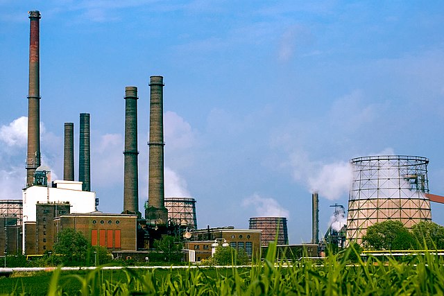
Зальцгиттер
- город в Нижней Саксонии
Hiking in Зальцгиттер
Salzgitter, located in Lower Saxony, Germany, offers a variety of hiking opportunities amidst its scenic landscapes. This region is characterized by rolling hills, forests, and lakes, making it a great destination for nature lovers and hikers of all skill levels. Here are some highlights for hiking in Salzgitter:...
- Страна:
- Почтовый код: 38239; 38229; 38228; 38259; 38226
- Телефонный код: 05339; 05300; 05341
- Код автомобильного номера: SZ
- Координаты: 52° 9' 13" N, 10° 24' 21" E
- GPS треки (wikiloc): [Ссылка]
- Высота над уровнем моря: 90 м m
- Площадь: 224.49 кв.км
- Население: 104614
- Веб сайт: [Ссылка]

Фордорф
Hiking in Фордорф
Vordorf, a small village in Lower Saxony, Germany, may not be as widely recognized as some major hiking destinations, but it offers a peaceful setting for outdoor enthusiasts. Here are some points of interest and things to consider when hiking in and around Vordorf:...
- Страна:
- Почтовый код: 38533
- Телефонный код: 05304
- Код автомобильного номера: GF
- Координаты: 52° 22' 0" N, 10° 31' 0" E
- GPS треки (wikiloc): [Ссылка]
- Высота над уровнем моря: 83 м m
- Площадь: 19.26 кв.км
- Население: 3032
- Веб сайт: [Ссылка]
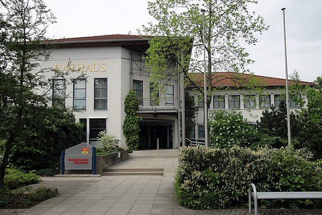
Управление Папентайх
Hiking in Управление Папентайх
Papenteich is a beautiful area located in Germany, known for its scenic landscapes and hiking opportunities. While it may not be as widely recognized as some other hiking destinations, it offers a variety of trails suitable for different skill levels, from casual walks to more challenging hikes....
- Страна:
- Код автомобильного номера: GF
- Координаты: 52° 23' 0" N, 10° 32' 0" E
- GPS треки (wikiloc): [Ссылка]
- Площадь: 100.85 кв.км
- Население: 24628
- Веб сайт: [Ссылка]

Майне
Hiking in Майне
Hiking in Meine, a small village in Lower Saxony, Germany, offers scenic views and a tranquil experience for nature enthusiasts. While it's not widely known as a hiking destination, the surrounding areas feature several trails and natural attractions that can be appreciated....
- Страна:
- Почтовый код: 38527
- Телефонный код: 05307; 05304
- Код автомобильного номера: GF
- Координаты: 52° 23' 0" N, 10° 32' 0" E
- GPS треки (wikiloc): [Ссылка]
- Высота над уровнем моря: 79 м m
- Площадь: 38.74 кв.км
- Население: 8744
- Веб сайт: [Ссылка]

Швюльпер
Hiking in Швюльпер
Schwülper is a small village located in Lower Saxony, Germany. While it might not be as widely known as larger cities for hiking, the area surrounding Schwülper offers some lovely opportunities for outdoor enthusiasts looking to explore nature....
- Страна:
- Почтовый код: 38179
- Телефонный код: 0531; 05303
- Код автомобильного номера: GF
- Координаты: 52° 20' 49" N, 10° 27' 3" E
- GPS треки (wikiloc): [Ссылка]
- Высота над уровнем моря: 64 м m
- Площадь: 20.90 кв.км
- Население: 7322
- Веб сайт: [Ссылка]


Фехельде
Hiking in Фехельде
Vechelde, located in Lower Saxony, Germany, is a quaint village that offers access to some beautiful landscapes and hiking opportunities. While it may not be as prominently recognized for hiking as some larger national parks or mountainous regions, it does have its share of charming trails and natural scenery....
- Страна:
- Почтовый код: 38159
- Телефонный код: 05302; 05300
- Код автомобильного номера: PE
- Координаты: 52° 15' 37" N, 10° 21' 54" E
- GPS треки (wikiloc): [Ссылка]
- Высота над уровнем моря: 74 м m
- Площадь: 75.89 кв.км
- Население: 17071
- Веб сайт: [Ссылка]


Вендебург
Hiking in Вендебург
Wendeburg, located in Lower Saxony, Germany, is a small municipality that offers charming landscapes for hiking enthusiasts. While it may not have the extensive trail systems found in larger national parks, it provides an inviting environment for nature walks and leisurely treks....
- Страна:
- Почтовый код: 38176
- Телефонный код: 05171; 05302; 05303
- Код автомобильного номера: PE
- Координаты: 52° 19' 0" N, 10° 24' 0" E
- GPS треки (wikiloc): [Ссылка]
- Высота над уровнем моря: 67 м m
- Площадь: 60.02 кв.км
- Население: 10880
- Веб сайт: [Ссылка]
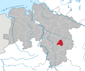
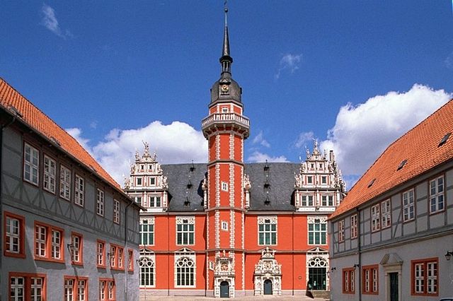
Вольфенбюттель
- район Нижней Саксонии, Германия
Hiking in Вольфенбюттель
Wolfenbüttel is a beautiful district located in Lower Saxony, Germany, known for its picturesque landscapes, historic towns, and a variety of outdoor activities, including hiking. Here are some key points about hiking in the Wolfenbüttel district:...
- Страна:
- Код автомобильного номера: WF
- Координаты: 52° 10' 0" N, 10° 35' 0" E
- GPS треки (wikiloc): [Ссылка]
- Высота над уровнем моря: 87 м m
- Площадь: 722.33 кв.км
- Население: 120904
- Веб сайт: [Ссылка]

Пайне
Hiking in Пайне
Peine is a district located in Lower Saxony, Germany, and it offers various outdoor activities, including hiking. The region is known for its beautiful landscapes, with a mix of forests, meadows, and picturesque villages. Here are some key points about hiking in the Peine district:...
- Страна:
- Столица: Пайне
- Код автомобильного номера: PE
- Координаты: 52° 19' 48" N, 10° 15' 0" E
- GPS треки (wikiloc): [Ссылка]
- Высота над уровнем моря: 66 м m
- Площадь: 535.00 кв.км
- Население: 132979
- Веб сайт: [Ссылка]

Хельмштедт
Hiking in Хельмштедт
Helmstedt is a district located in Lower Saxony, Germany, and is known for its beautiful natural landscapes and varied hiking opportunities. The region combines cultural heritage with outdoor activities, making it an appealing destination for hikers of all skill levels. Here are some highlights and features of hiking in Helmstedt:...
- Страна:
- Код автомобильного номера: HE
- Координаты: 52° 15' 0" N, 10° 55' 12" E
- GPS треки (wikiloc): [Ссылка]
- Высота над уровнем моря: 142 м m
- Площадь: 674.00 кв.км
- Население: 92079
- Веб сайт: [Ссылка]


Гифхорн
- район в земле Нижняя Саксония (Германия)
Hiking in Гифхорн
Gifhorn, located in Lower Saxony, Germany, is surrounded by beautiful landscapes that offer a variety of hiking opportunities. The district is characterized by its picturesque lakes, forests, and gentle hills, making it an attractive destination for hikers of all skill levels....
- Страна:
- Столица: Гифхорн
- Код автомобильного номера: GF
- Координаты: 52° 29' 0" N, 10° 33' 0" E
- GPS треки (wikiloc): [Ссылка]
- Высота над уровнем моря: 63 м m
- Площадь: 1563.00 кв.км
- Население: 174749
- Веб сайт: [Ссылка]