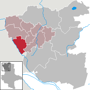
Броме (Brome, Brome)

 Hiking in Броме
Brome, located in Lower Saxony, Germany, is a charming town surrounded by scenic landscapes, making it an ideal spot for hiking enthusiasts. While Brome itself is a small community, its proximity to natural reserves and parks enhances the hiking experience in the region.
Hiking Trails and Terrain
-
Around Brome: There are various forest paths and small country roads that can be hiked, offering peaceful routes through the picturesque countryside, often lined with meadows and pastures.
-
Bramberge Nature Reserve: A short drive from Brome, this area features well-marked trails and diverse flora and fauna. The paths here are suitable for both casual walkers and seasoned hikers.
-
Wendland Region: To the north and east of Brome lies the Wendland region, renowned for its beautiful landscapes and numerous hiking routes. You can explore the “Wendland Trail,” which offers a longer multi-day hiking option for adventure seekers.
-
Ellernfeld: This nearby area offers hiker-friendly paths and is known for its tranquil scenery, making it a favorite among locals.
Tips for Hiking in Brome
-
Prepare for the Weather: The weather in Germany can be unpredictable, so it’s advisable to check forecasts before heading out and dress in layers.
-
Footwear: Wear sturdy, comfortable hiking boots as trails can vary from easy walks to more rugged paths.
-
Navigation Tools: Although many trails are marked, bringing a map or a GPS device can enhance your experience, especially in less familiar areas.
-
Local Amenities: Brome has a few places to rest and eat, but plan ahead regarding food and water, especially if you're out for an extended hike.
-
Respect Nature: As with any hiking activity, remember to follow the Leave No Trace principles to preserve the area for others.
Additional Activities
In addition to hiking, Brome offers opportunities for cycling and nature observation, making it a versatile destination for outdoor enthusiasts. Local events may also include seasonal festivals which add to the cultural experience of your visit.
Whether you’re a beginner or an experienced hiker, exploring the trails around Brome can provide a refreshing escape into nature.
- Страна:

- Почтовый код: 38465
- Телефонный код: 05833
- Код автомобильного номера: GF
- Координаты: 52° 36' 0" N, 10° 57' 0" E


- GPS треки (wikiloc): [Ссылка]
- Высота над уровнем моря: 72 м m
- Площадь: 36.66 кв.км
- Население: 3400
- Веб сайт: https://www.brome.de/
- Википедия русская: wiki(ru)
- Википедия английская: wiki(en)
- Википедия национальная: wiki(de)
- Хранилище Wikidata: Wikidata: Q659900
- Катеория в википедии: [Ссылка]
- код Freebase: [/m/0c66yz]
- код Freebase: [/m/0c66yz]
- код GeoNames: Альт: [6559058]
- код GeoNames: Альт: [6559058]
- код VIAF: Альт: [146747255]
- код VIAF: Альт: [146747255]
- ID отношения в OpenStreetMap: [1329992]
- ID отношения в OpenStreetMap: [1329992]
- код GND: Альт: [4344508-1]
- код GND: Альт: [4344508-1]
- идентификатор местоположения ArchINFORM: [45763]
- идентификатор местоположения ArchINFORM: [45763]
- код LCNAF: Альт: [n96030613]
- код LCNAF: Альт: [n96030613]
- место в MusicBrainz: [b7168d7d-ef4b-4fbc-832b-0311cfc34239]
- место в MusicBrainz: [b7168d7d-ef4b-4fbc-832b-0311cfc34239]
- WOEID: [641461]
- WOEID: [641461]
- код TGN: [1038663]
- код TGN: [1038663]
- код Historical Gazetteer: [BROOMEJO52LO]
- код Historical Gazetteer: [BROOMEJO52LO]
- FAST ID: [1275491]
- FAST ID: [1275491]
- идентификатор муниципалитетов в Германии: 03151005
- идентификатор муниципалитетов в Германии: 03151005
- код GNS: -1752828
- код GNS: -1752828
Граничит с регионами:


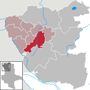
Клётце
Hiking in Клётце
Klötze is a small town located in the state of Saxony-Anhalt, Germany. While it may not be as widely known as some larger hiking destinations, there are opportunities for outdoor activities and hiking in the surrounding areas....
- Страна:
- Почтовый код: 38486
- Телефонный код: 03909; 039085; 039008; 039005
- Координаты: 52° 37' 34" N, 11° 9' 41" E
- GPS треки (wikiloc): [Ссылка]
- Высота над уровнем моря: 60 м m
- Площадь: 278.29 кв.км
- Население: 10115
- Веб сайт: [Ссылка]

Парзау
Hiking in Парзау
Parsau is a small village in Germany, located in the state of Lower Saxony. While it may not be as widely known for hiking as some other areas, the surrounding landscapes offer opportunities for nature walks and mild hiking excursions. Here are some points to consider if you're planning to hike in or near Parsau:...
- Страна:
- Почтовый код: 38470
- Телефонный код: 05368
- Код автомобильного номера: GF
- Координаты: 52° 31' 59" N, 10° 52' 0" E
- GPS треки (wikiloc): [Ссылка]
- Высота над уровнем моря: 62 м m
- Площадь: 29.45 кв.км
- Население: 1919
- Веб сайт: [Ссылка]

Юбар
Hiking in Юбар
Jübar is a small town in the Altmark region of Germany, known for its tranquil rural landscape and scenic beauty. While it may not be as well-known for hiking as some larger national parks or mountainous regions, there are still opportunities for pleasant walks and hikes in and around the area....
- Страна:
- Почтовый код: 38489
- Телефонный код: 039003
- Код автомобильного номера: SAW
- Координаты: 52° 41' 23" N, 10° 54' 47" E
- GPS треки (wikiloc): [Ссылка]
- Высота над уровнем моря: 75 м m
- Площадь: 70.89 кв.км
- Население: 1631
- Веб сайт: [Ссылка]

Бетцендорф
Hiking in Бетцендорф
Beetzendorf, located in Lower Saxony, Germany, might not be the first destination that comes to mind for hiking, but it offers a peaceful and scenic environment for walking enthusiasts. Here’s a brief overview of what you can expect when hiking in and around Beetzendorf:...
- Страна:
- Почтовый код: 38486; 38489
- Телефонный код: 039000
- Код автомобильного номера: SAW
- Координаты: 52° 42' 0" N, 11° 5' 30" E
- GPS треки (wikiloc): [Ссылка]
- Высота над уровнем моря: 35 м m
- Площадь: 25.46 кв.км
- Население: 3190
- Веб сайт: [Ссылка]

Виттинген
Hiking in Виттинген
Wittingen is located in the Lower Saxony region of Germany and offers several opportunities for hiking enthusiasts to explore the natural beauty of the area. Here are some key points about hiking in Wittingen:...
- Страна:
- Почтовый код: 29379; 29378
- Телефонный код: 05839; 05836; 05834; 05831
- Код автомобильного номера: GF
- Координаты: 52° 43' 0" N, 10° 44' 0" E
- GPS треки (wikiloc): [Ссылка]
- Высота над уровнем моря: 79 м m
- Площадь: 225.08 кв.км
- Население: 11589
- Веб сайт: [Ссылка]

Тюлау
Hiking in Тюлау
Tülau is not widely recognized as a hiking destination, and there may be limited information available about specific trails or routes in that area. It's possible that you're referring to a lesser-known or local hiking spot, or it may be a misspelling of a more famous location....
- Страна:
- Почтовый код: 38474
- Телефонный код: 05833
- Код автомобильного номера: GF
- Координаты: 52° 34' 59" N, 10° 52' 0" E
- GPS треки (wikiloc): [Ссылка]
- Высота над уровнем моря: 72 м m
- Площадь: 23.53 кв.км
- Население: 1514
- Веб сайт: [Ссылка]

Эра-Лессин
Hiking in Эра-Лессин
Ehra-Lessien is a small municipality located in Lower Saxony, Germany. While it may not be as well-known for hiking as some of the larger national parks or mountainous regions in Germany, there are still opportunities for outdoor activities in and around the area....
- Страна:
- Почтовый код: 38468
- Телефонный код: 05377
- Код автомобильного номера: GF
- Координаты: 52° 35' 49" N, 10° 47' 46" E
- GPS треки (wikiloc): [Ссылка]
- Высота над уровнем моря: 63 м m
- Площадь: 56.08 кв.км
- Население: 1931
- Веб сайт: [Ссылка]