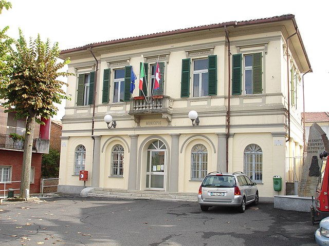
Бруно (Bruno, Bruno)

- коммуна италии в Италии, Пьемонт, Асти
 Hiking in Бруно
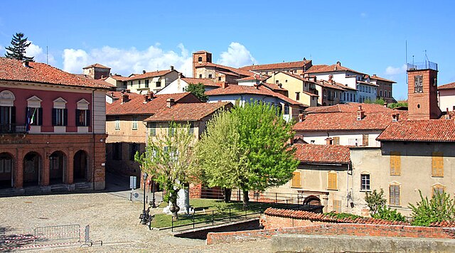
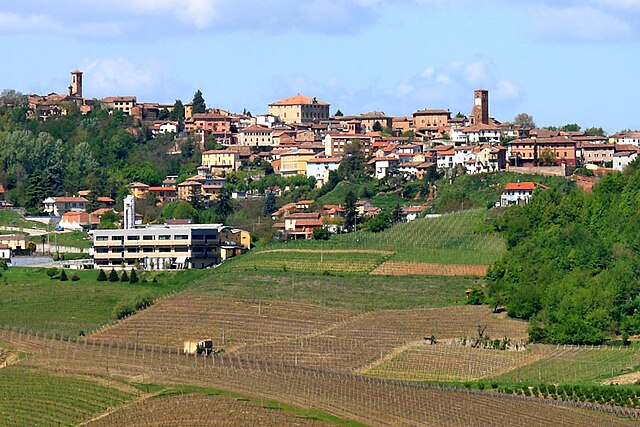
Bruno is a charming small town located in the Piedmont region of northern Italy, nestled in the hills of the Langhe area, known for its stunning landscapes, rich history, and excellent food and wine. Hiking in this region offers a variety of trails that cater to different levels of experience, and it provides a great opportunity to explore the beautiful natural environment and picturesque vineyards.
Hiking Options in and around Bruno:
-
Vineyard Trails: The trails around Bruno often wind through the vineyards and rolling hills characteristic of the Langhe region. These paths provide scenic views and the chance to see the famous Barolo and Barbaresco wine-producing areas.
-
Natural Parks: Nearby natural parks, such as the Marguareis Natural Park and the Alta Langa, offer a range of hiking options from easy walks to more challenging treks. These parks are home to diverse flora and fauna, making them great for nature enthusiasts as well.
-
Historical Trails: The area is rich in history, so you might consider hiking routes that lead to ancient castles, rural churches, and villages that showcase traditional Piedmontese architecture. Exploring these sites can add cultural depth to your hiking experience.
-
Ancient Roadways: Some trails follow ancient paths that connect different villages, providing a glimpse into the history and culture of the region while hiking through wonderful landscapes.
-
Seasonal Considerations: Spring and autumn are particularly beautiful times to hike in this region, as the weather is typically mild, and you can enjoy the changing colors of the vineyards and forests. Summer can be hot, so be sure to plan your hikes for early morning or late afternoon.
-
Wine Tasting Opportunities: Incorporating visits to local wineries along your hiking route can enhance your experience. Many vineyards welcome hikers and offer tastings, giving you a taste of the local wine culture.
Tips for Hiking in Bruno:
- Footwear: Wear sturdy hiking boots for comfort and support, as some trails may be uneven or steep.
- Weather: Check the weather forecast before you head out, as conditions can change quickly in the hills.
- Hydration and Snacks: Bring plenty of water and some snacks, especially if you plan on a longer hike.
- Trail Maps: Utilize local maps or hiking apps for guidance, as some trails might not be well-marked.
- Respect Nature: Follow the Leave No Trace principles to help preserve the natural beauty of the area for future hikers.
Exploring the hiking trails in and around Bruno, Piedmont, can provide a wonderful mix of exercise, stunning scenery, and cultural enrichment. Enjoy your hiking adventure!
- Страна:

- Почтовый код: 14046
- Телефонный код: 0141
- Код автомобильного номера: AT
- Координаты: 44° 47' 39" N, 8° 26' 30" E


- GPS треки (wikiloc): [Ссылка]
- Высота над уровнем моря: 198 м m
- Площадь: 8.9 кв.км
- Население: 322
- Веб сайт: http://www.comune.bruno.at.it
- Википедия русская: wiki(ru)
- Википедия английская: wiki(en)
- Википедия национальная: wiki(it)
- Хранилище Wikidata: Wikidata: Q17756
- Катеория в википедии: [Ссылка]
- код Freebase: [/m/0gbfrz]
- код GeoNames: Альт: [6540135]
- ID отношения в OpenStreetMap: [43650]
- код ISTAT: 005010
- кадастровый код Италии: B221
Граничит с регионами:
Бергамаско
- коммуна в регионе Пьемонт, Италия
Hiking in Бергамаско
Bergamasco, located in the Piedmont region of northern Italy, is a picturesque area known for its beautiful landscapes and outdoor activities, including hiking. Here are some key aspects to consider when hiking in the Bergamasco region:...
- Страна:
- Почтовый код: 15022
- Телефонный код: 0131
- Код автомобильного номера: AL
- Координаты: 44° 49' 42" N, 8° 27' 21" E
- GPS треки (wikiloc): [Ссылка]
- Высота над уровнем моря: 125 м m
- Площадь: 13.44 кв.км
- Население: 726
- Веб сайт: [Ссылка]
Карентино
- коммуна в регионе Пьемонт, Италия
Hiking in Карентино
Carentino, while not widely known as a major hiking destination, offers beautiful landscapes that can be perfect for outdoor enthusiasts. Situated in a region that combines natural beauty with rich cultural heritage, it's an excellent spot for those looking to experience the tranquility of nature away from the more trafficked trails....
- Страна:
- Почтовый код: 15022
- Телефонный код: 0131
- Код автомобильного номера: AL
- Координаты: 44° 49' 47" N, 8° 28' 21" E
- GPS треки (wikiloc): [Ссылка]
- Высота над уровнем моря: 160 м m
- Площадь: 9.79 кв.км
- Население: 331
- Веб сайт: [Ссылка]
Кассине
- коммуна в регионе Пьемонт, Италия
Hiking in Кассине
Hiking in Cassine, which is commonly associated with the Cassine Well and the surrounding areas in California, can be a delightful experience for nature enthusiasts. The region is characterized by its rich biodiversity, scenic views, and a variety of trails suitable for different skill levels. Here are some highlights to consider when planning a hiking trip in this area:...
- Страна:
- Почтовый код: 15016
- Телефонный код: 0144
- Код автомобильного номера: AL
- Координаты: 44° 45' 3" N, 8° 31' 44" E
- GPS треки (wikiloc): [Ссылка]
- Высота над уровнем моря: 190 м m
- Площадь: 33.09 кв.км
- Население: 2953
- Веб сайт: [Ссылка]
Кастельнуово-Бельбо
- коммуна Италии
Hiking in Кастельнуово-Бельбо
Castelnuovo Belbo is a charming village located in the Piedmont region of Italy, known for its picturesque landscapes and rich vineyards. The area offers various hiking opportunities, especially for those looking to explore the beautiful rolling hills and scenic vineyards of the Monferrato area....
- Страна:
- Почтовый код: 14043
- Телефонный код: 0141
- Код автомобильного номера: AT
- Координаты: 44° 48' 11" N, 8° 24' 40" E
- GPS треки (wikiloc): [Ссылка]
- Высота над уровнем моря: 122 м m
- Площадь: 9.55 кв.км
- Население: 859
- Веб сайт: [Ссылка]

Момбаруццо
- коммуна Италии
Hiking in Момбаруццо
Mombaruzzo is a charming village located in the Piedmont region of Italy, known for its picturesque landscapes, rolling hills, and vineyards. While Mombaruzzo isn't typically recognized as a major hiking destination, there are several opportunities for hiking and outdoor activities in the surrounding areas....
- Страна:
- Почтовый код: 14046
- Телефонный код: 0141
- Код автомобильного номера: AT
- Координаты: 44° 46' 21" N, 8° 26' 57" E
- GPS треки (wikiloc): [Ссылка]
- Высота над уровнем моря: 275 м m
- Площадь: 22.4 кв.км
- Население: 1104
- Веб сайт: [Ссылка]