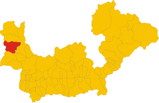
Камподольчино (Campodolcino, Campodolcino)
.svg)
- коммуна Италии
 Hiking in Камподольчино
Campodolcino is a picturesque village located in the province of Sondrio in the Lombardy region of Italy, nestled in the heart of the Italian Alps. This area is not only known for its stunning landscapes but also for the variety of hiking opportunities it offers, catering to all levels of outdoor enthusiasts.
Hiking Opportunities
-
Trails: There are numerous well-marked trails in and around Campodolcino, ranging from easy walks to challenging hikes. Popular routes include:
- Lago di das Ables: A scenic hike that leads you to a beautiful lake, perfect for a relaxing picnic.
- Val Gerola: A more challenging hike that offers breathtaking views of the surrounding peaks and valleys.
-
Difficulty Levels:
- Beginners can enjoy the easier paths along the valley floor.
- Experienced hikers can tackle steeper trails that ascend into the higher altitudes, offering stunning panoramic views.
-
Duration: Hikes can vary significantly in length, from short walks of a couple of hours to full-day treks that can take 6-8 hours. Make sure to check the estimated times and distances on trail maps before setting out.
-
Guided Tours: For those unfamiliar with the area, hiring a local guide can greatly enhance the experience. Guides can provide insight into the local flora and fauna and ensure you stay on the safest routes.
Best Time to Hike
The best time for hiking in Campodolcino is typically late spring through early autumn (May to October). During these months, the weather is generally pleasant, and the trails are more accessible. Late spring offers blooming wildflowers, while autumn presents stunning foliage.
Preparation Tips
- Gear: Wear comfortable hiking boots, and don’t forget to bring a map, water, snacks, and sun protection.
- Weather: Always check the weather forecast before setting out, as conditions can change rapidly in the mountains.
- Wildlife: Keep an eye out for local wildlife, including deer, ibex, and various bird species.
Additional Activities
In addition to hiking, Campodolcino offers other outdoor activities such as mountain biking, skiing in the winter months, and rock climbing for those looking for a bit more adventure.
Overall, hiking in Campodolcino is a fantastic way to experience the natural beauty of the Italian Alps while enjoying outdoor activities suited to various skill levels. Just remember to respect nature and follow trail guidelines to preserve this beautiful environment for future hikers.
- Страна:

- Почтовый код: 23021
- Телефонный код: 0343
- Код автомобильного номера: SO
- Координаты: 46° 24' 18" N, 9° 21' 11" E


- GPS треки (wikiloc): [Ссылка]
- Высота над уровнем моря: 1071 м m
- Площадь: 48.49 кв.км
- Население: 931
- Веб сайт: http://www.comune.campodolcino.so.it/
- Википедия русская: wiki(ru)
- Википедия английская: wiki(en)
- Википедия национальная: wiki(it)
- Хранилище Wikidata: Wikidata: Q39299
- Катеория в википедии: [Ссылка]
- код Freebase: [/m/0gj2pb]
- код GeoNames: Альт: [6539469]
- код VIAF: Альт: [248307179]
- ID отношения в OpenStreetMap: [47170]
- код темы Quora: [Campodolcino]
- код Цифрового атласа Римской империи: [42309]
- код ISTAT: 014012
- кадастровый код Италии: B530
Граничит с регионами:

Сан-Джакомо-Филиппо
- коммуна Италии
Hiking in Сан-Джакомо-Филиппо
San Giacomo Filippo, located in the Sondrio province of Lombardy, Italy, offers a variety of hiking opportunities amidst stunning landscapes of the Valtellina Valley. The region is characterized by its mountainous terrain, charming villages, lush forests, and impressive views of the surrounding Alps....
- Страна:
- Почтовый код: 23020
- Телефонный код: 0343
- Код автомобильного номера: SO
- Координаты: 46° 20' 0" N, 9° 22' 0" E
- GPS треки (wikiloc): [Ссылка]
- Высота над уровнем моря: 679 м m
- Площадь: 61.85 кв.км
- Население: 349
- Веб сайт: [Ссылка]
Пьюро
- коммуна Италии
Hiking in Пьюро
Piuro is a picturesque village located in the Lombardy region of northern Italy, nestled in the Seriana Valley and close to the border with Switzerland. The area is known for its stunning natural beauty, making it a great destination for hiking enthusiasts. Here are some highlights about hiking in Piuro:...
- Страна:
- Почтовый код: 23020
- Телефонный код: 0343
- Код автомобильного номера: SO
- Координаты: 46° 19' 51" N, 9° 25' 18" E
- GPS треки (wikiloc): [Ссылка]
- Высота над уровнем моря: 382 м m
- Площадь: 84.25 кв.км
- Население: 1932
- Веб сайт: [Ссылка]


Мадезимо
- коммуна Италии
Hiking in Мадезимо
Madesimo, located in the Lombardy region of Italy, is a popular destination for hiking, especially during the summer months when the snow melts and reveals stunning landscapes. Nestled in the Alps, Madesimo offers a variety of trails suitable for hikers of all ages and skill levels. Here are some key highlights of hiking in the area:...
- Страна:
- Почтовый код: 23024
- Телефонный код: 0343
- Код автомобильного номера: SO
- Координаты: 46° 26' 0" N, 9° 21' 0" E
- GPS треки (wikiloc): [Ссылка]
- Высота над уровнем моря: 1399 м m
- Площадь: 85.66 кв.км
- Население: 517
- Веб сайт: [Ссылка]


Мезокко
Hiking in Мезокко
Mesocco, located in the picturesque Mendrisiotto region of southern Switzerland, offers a variety of hiking opportunities that cater to different skill levels and interests. Nestled in the valley of the Moesa River, this charming area is known for its stunning landscapes, historic villages, and lush nature....
- Страна:

- Почтовый код: 6563
- Телефонный код: 091
- Код автомобильного номера: GR
- Координаты: 46° 23' 29" N, 9° 14' 15" E
- GPS треки (wikiloc): [Ссылка]
- Высота над уровнем моря: 828 м m
- Площадь: 164.9 кв.км
- Население: 1374
- Веб сайт: [Ссылка]