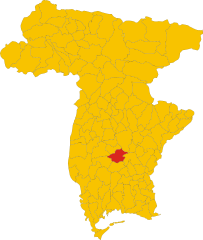
Кампоформидо (Campoformido, Campoformido)
.svg)
- коммуна Италии
 Hiking in Кампоформидо
Campoformido, located in the Friuli Venezia Giulia region of northern Italy, offers some beautiful hiking opportunities amidst picturesque landscapes. The area is characterized by rolling hills, agricultural fields, and stunning views of the surrounding mountains, particularly the Carnic Alps to the north and the Julian Alps to the northwest.
Hiking Opportunities:
-
Trails and Routes:
- The region features a network of trails suitable for various skill levels, ranging from easy walks to more challenging hikes. Look for local marked trails that are well-maintained and cater to both beginners and experienced hikers.
- The nearby Natural Park of Culebra and other protected areas may offer additional hiking opportunities with more diverse flora and fauna.
-
Scenic Views:
- Many trails provide breathtaking vistas of the Julian Alps, the Adriatic Sea in the distance, and expansive views over the Po Valley.
- Sunrise and sunset hikes can be particularly rewarding for those seeking stunning photographic opportunities.
-
Cultural and Historical Attractions:
- As you hike, you may encounter charming villages, traditional farms, and historic sites. Don't hesitate to explore local architecture and traditions, as these add to the hiking experience.
- Look out for signs of local wildlife and flora, enhancing your appreciation for the natural environment.
-
Seasonal Considerations:
- The best times for hiking in Campoformido are generally spring (April to June) and fall (September to October) when temperatures are milder and the landscapes are vibrant.
- In winter, depending on weather conditions, certain trails may be accessible for snowshoeing or winter hiking, but always check local conditions and avalanche risk.
-
Preparation and Safety:
- Always carry sufficient water, snacks, and a map or GPS device. Cell service can be spotty in remote areas.
- Dress in layers to accommodate changing weather conditions and wear appropriate hiking boots for comfort and stability.
When planning your hike in Campoformido, it’s essential to check local resources for trail maps, conditions, and any necessary permits. Whether you are looking for a leisurely stroll or a more strenuous hike, the beauty of the region has something to offer every outdoor enthusiast. Happy hiking!
- Страна:

- Почтовый код: 33030
- Телефонный код: 0432
- Код автомобильного номера: UD
- Координаты: 46° 1' 0" N, 13° 10' 0" E


- GPS треки (wikiloc): [Ссылка]
- Высота над уровнем моря: 78 м m
- Площадь: 21.93 кв.км
- Население: 7891
- Веб сайт: http://www.comune.campoformido.ud.it
- Википедия русская: wiki(ru)
- Википедия английская: wiki(en)
- Википедия национальная: wiki(it)
- Хранилище Wikidata: Wikidata: Q53232
- Катеория в википедии: [Ссылка]
- код Freebase: [/m/03b661]
- код GeoNames: Альт: [6538362]
- код VIAF: Альт: [241453180]
- ID отношения в OpenStreetMap: [79288]
- UN/LOCODE: [ITCMD]
- код ISTAT: 030016
- кадастровый код Италии: B536
Граничит с регионами:


Удине
- коммуна Италии
Hiking in Удине
Udine, located in the northeastern part of Italy, offers a variety of hiking opportunities that showcase its natural beauty and stunning landscapes. Here are some highlights about hiking in the Udine area:...
- Страна:
- Почтовый код: 33100
- Телефонный код: 0432
- Код автомобильного номера: UD
- Координаты: 46° 4' 0" N, 13° 14' 0" E
- GPS треки (wikiloc): [Ссылка]
- Высота над уровнем моря: 113 м m
- Площадь: 57.17 кв.км
- Население: 99341
- Веб сайт: [Ссылка]
Базилиано
- коммуна Италии
Hiking in Базилиано
Basiliano is a charming municipality located in the Friuli Venezia Giulia region of northern Italy. Although it may not be as well-known for hiking as some other areas in Italy, it offers a variety of beautiful landscapes, local trails, and access to the surrounding natural parks and hills. Here are some things to consider for hiking in and around Basiliano:...
- Страна:
- Почтовый код: 33031
- Телефонный код: 0432
- Код автомобильного номера: UD
- Координаты: 46° 1' 0" N, 13° 6' 0" E
- GPS треки (wikiloc): [Ссылка]
- Высота над уровнем моря: 77 м m
- Площадь: 43.05 кв.км
- Население: 5345
- Веб сайт: [Ссылка]


Пазиан-ди-Прато
- коммуна Италии
Hiking in Пазиан-ди-Прато
Pasian di Prato is a municipality located in the Friuli Venezia Giulia region of northeastern Italy, known for its beautiful natural landscapes and proximity to the Julian Alps. While it may not be the most widely recognized hiking destination, it offers several trails and opportunities for outdoor enthusiasts....
- Страна:
- Почтовый код: 33037
- Телефонный код: 0432
- Код автомобильного номера: UD
- Координаты: 46° 3' 0" N, 13° 12' 0" E
- GPS треки (wikiloc): [Ссылка]
- Высота над уровнем моря: 106 м m
- Площадь: 15.41 кв.км
- Население: 9363
- Веб сайт: [Ссылка]

Поццуоло-дель-Фриули
- коммуна Италии
Hiking in Поццуоло-дель-Фриули
Pozzuolo del Friuli is a charming municipality located in the Friuli Venezia Giulia region of northeastern Italy. Known for its scenic landscapes and rich cultural heritage, it offers opportunities for outdoor activities, including hiking....
- Страна:
- Почтовый код: 33050
- Телефонный код: 0432
- Код автомобильного номера: UD
- Координаты: 45° 58' 5" N, 13° 11' 49" E
- GPS треки (wikiloc): [Ссылка]
- Высота над уровнем моря: 67 м m
- Площадь: 34.37 кв.км
- Население: 6927
- Веб сайт: [Ссылка]