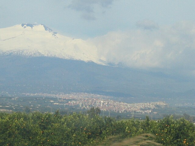
Кампоротондо-Этнео (Camporotondo Etneo, Camporotondo Etneo)
- коммуна в Италии
Camporotondo Etneo, situated on the eastern slopes of Mount Etna in Sicily, Italy, offers a wonderful blend of natural beauty, cultural heritage, and intriguing hiking opportunities. Here’s what you can expect when hiking in this region:
Trails and Terrain
- Mount Etna Proximity: Being close to Mount Etna, hikers can access various trails leading up the volcano, which present diverse landscapes including volcanic rock, lush forests, and unique flora.
- Local Trails: There are lesser-known paths around Camporotondo Etneo that can provide a more secluded hiking experience, often less crowded than the popular routes on Etna.
Points of Interest
- Scenic Views: Many trails will reward hikers with panoramic views of the surrounding valleys, the Ionian Sea, and, of course, Mount Etna itself, especially from higher vantage points.
- Flora and Fauna: The area is rich in biodiversity, with opportunities to observe various species of plants and wildlife indigenous to the region.
- Cultural Landmarks: Along some hiking routes, you may come across historical sites, such as ancient churches and traditional Sicilian architecture, providing additional cultural context to your hike.
Hiking Tips
- Weather Preparedness: The weather can change rapidly, especially in higher altitudes. Be sure to check forecasts, wear appropriate layers, and prepare for possible rain or colder temperatures at higher elevations.
- Stay Hydrated: Always carry sufficient water, especially in the warmer months when temperatures can rise significantly.
- Footwear: Wear sturdy hiking boots with good ankle support, as trails can sometimes be rocky or uneven.
- Local Guidance: Consider hiring a local guide for a more enriching experience, as they can provide insight into the flora, fauna, and geological history of the area.
Safety Considerations
- Volcanic Activity: Keep informed about the volcanic activity of Mount Etna. The region is known for its eruptions, and some trails might be affected by ongoing geological activity.
- Trail Markers: Make sure to follow marked trails, as venturing off-path can lead to getting lost or encountering hazardous terrain.
Conclusion
Hiking in Camporotondo Etneo can be a rewarding experience for both novice and seasoned hikers, offering a perfect combination of natural beauty, adventure, and a taste of Sicilian culture. Whether exploring rugged mountain paths or gentle woodland trails, you’re sure to find something captivating in this enchanting region. Remember to respect the natural environment and local customs as you enjoy your hike!
- Страна:

- Почтовый код: 95040
- Телефонный код: 095
- Код автомобильного номера: CT
- Координаты: 37° 34' 0" N, 15° 0' 0" E


- GPS треки (wikiloc): [Ссылка]
- Высота над уровнем моря: 445 м m
- Площадь: 6.55 кв.км
- Население: 5138
- Веб сайт: http://www.comune.camporotondoetneo.ct.it/
- Википедия русская: wiki(ru)
- Википедия английская: wiki(en)
- Википедия национальная: wiki(it)
- Хранилище Wikidata: Wikidata: Q478265
- Катеория в википедии: [Ссылка]
- код Freebase: [/m/0gqh3j]
- код GeoNames: Альт: [6543310]
- ID отношения в OpenStreetMap: [39269]
- UN/LOCODE: [ITZFY]
- код ISTAT: 087012
- кадастровый код Италии: B561
Граничит с регионами:
Бельпассо
- коммуна в Италии
Belpasso, located on the eastern slope of Mount Etna in Sicily, Italy, offers a variety of hiking opportunities that combine stunning natural landscapes, fascinating geological features, and rich local history. Here are some key aspects to consider for a hiking experience in Belpasso:...
- Страна:

- Почтовый код: 95032
- Телефонный код: 095
- Код автомобильного номера: CT
- Координаты: 37° 35' 0" N, 14° 59' 0" E


- GPS треки (wikiloc): [Ссылка]
- Высота над уровнем моря: 551 м m
- Площадь: 166.33 кв.км
- Население: 28126
- Веб сайт: [Ссылка]


Мистербьянко
- коммуна в Италии
Misterbianco is a charming town located in the Province of Catania, Sicily, Italy. While it is primarily known for its suburban character and proximity to the larger city of Catania, there are several outdoor opportunities and hiking options in and around the area. Here are some aspects to consider if you are thinking about hiking in Misterbianco:...
- Страна:

- Почтовый код: 95045
- Телефонный код: 095
- Код автомобильного номера: CT
- Координаты: 37° 31' 6" N, 15° 0' 25" E


- GPS треки (wikiloc): [Ссылка]
- Высота над уровнем моря: 210 м m
- Площадь: 37.68 кв.км
- Население: 49992
- Веб сайт: [Ссылка]


Мотта-Сант'Анастазия
- коммуна в Италии
 Hiking in Мотта-Сант'Анастазия
Motta Sant'Anastasia is a charming town located in the Syracuse province of Sicily, Italy. While more renowned for its historical significance and picturesque views, it also offers some opportunities for hiking and outdoor activities. Here are some key points to consider if you're planning to hike in or around Motta Sant'Anastasia:...
- Страна:

- Почтовый код: 95040
- Телефонный код: 095
- Код автомобильного номера: CT
- Координаты: 37° 30' 0" N, 14° 58' 0" E


- GPS треки (wikiloc): [Ссылка]
- Высота над уровнем моря: 275 м m
- Площадь: 35.71 кв.км
- Население: 12189
- Веб сайт: [Ссылка]
Сан-Пьетро-Кларенца
- коммуна в Италии
San Pietro Clarenza is a charming town located on the northeastern slopes of Mount Etna, the largest active volcano in Europe. While it may not be widely recognized for extensive hiking trails, its proximity to Mount Etna makes it an excellent base for hiking enthusiasts looking to explore the area....
- Страна:

- Почтовый код: 95030
- Телефонный код: 095
- Код автомобильного номера: CT
- Координаты: 37° 34' 0" N, 15° 1' 0" E


- GPS треки (wikiloc): [Ссылка]
- Высота над уровнем моря: 463 м m
- Площадь: 6.27 кв.км
- Население: 7862
- Веб сайт: [Ссылка]
