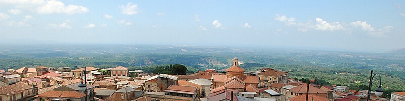
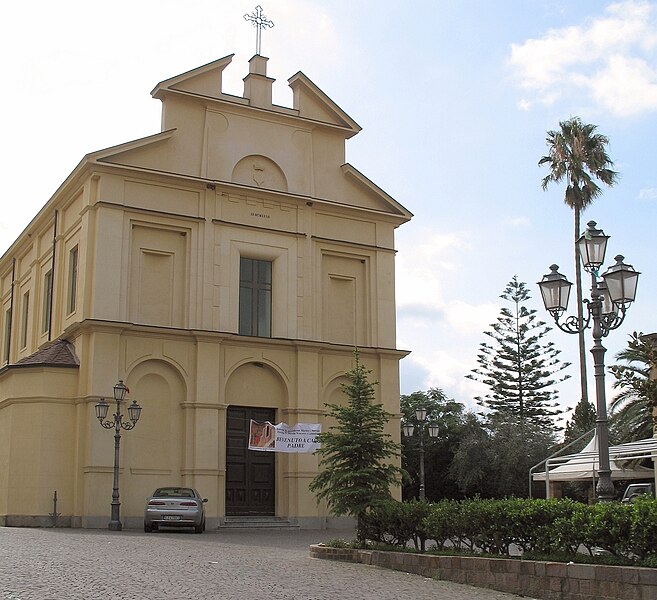
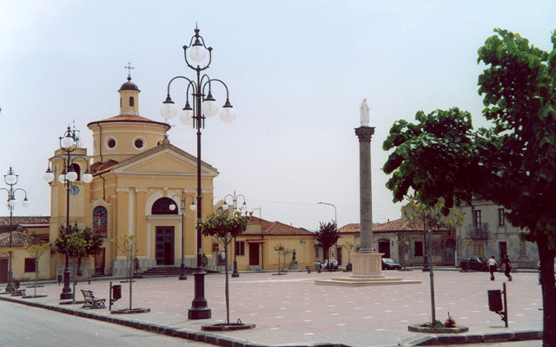
Кандидони (Candidoni, Candidoni)
.svg)
- коммуна Италии
 Hiking in Кандидони
Candidoni is a charming commune located in Calabria, southern Italy. Surrounded by hills and rich in natural beauty, it offers various hiking opportunities that allow you to immerse yourself in the stunning landscapes of the region.
Hiking Trails and Areas
-
Aspromonte National Park: This is one of the most notable natural parks near Candidoni. It features a network of trails ranging from easy to challenging, winding through diverse flora and fauna. You can find breathtaking views, waterfalls, and unique rock formations.
-
Mount Stilo: A popular trail leads to the summit of Mount Stilo, where hikers can enjoy panoramic views of the surrounding areas, including the Ionian Sea. The trek can be challenging but rewards you with its scenic beauty.
-
Rural Paths: The area around Candidoni has many small rural paths that connect various villages and historical sites. These trails are perfect for those looking for a more leisurely hike while taking in local culture.
Recommendations
- Best Time to Hike: Spring and autumn are ideal for hiking in Candidoni, as the weather is usually mild and the landscapes are at their most vibrant.
- Gear Up: Wear sturdy hiking boots and carry plenty of water. A map or GPS device is advisable, as some trails can be less marked.
- Local Guides: Consider hiring a local guide for a more in-depth experience and to ensure you choose the best trails suited to your skill level.
Points of Interest
- Historical Sites: Along your hikes, you may encounter ancient churches and ruins that reflect the history of the region.
- Wildlife Watching: Keep an eye out for native wildlife, including birds and unique plants along the trails.
Overall, hiking in Candidoni offers a fantastic way to explore Calabria's natural beauty and rich cultural heritage. Whether you’re a novice or an experienced hiker, you’ll find trails that cater to your interests.
- Страна:

- Почтовый код: 89020
- Телефонный код: 0966
- Код автомобильного номера: RC
- Координаты: 38° 30' 0" N, 16° 5' 0" E


- GPS треки (wikiloc): [Ссылка]
- Высота над уровнем моря: 239 м m
- Площадь: 26.95 кв.км
- Население: 418
- Веб сайт: http://www.comune.candidoni.rc.it
- Википедия русская: wiki(ru)
- Википедия английская: wiki(en)
- Википедия национальная: wiki(it)
- Хранилище Wikidata: Wikidata: Q54588
- Катеория в википедии: [Ссылка]
- код Freebase: [/m/0gny2d]
- код GeoNames: Альт: [6537707]
- ID отношения в OpenStreetMap: [39645]
- код ISTAT: 080019
- кадастровый код Италии: B591
Граничит с регионами:

Лауреана-ди-Боррелло
- коммуна Италии
Hiking in Лауреана-ди-Боррелло
Laureana di Borrello is a charming town located in the Calabria region of southern Italy. It offers a rich array of hiking opportunities, thanks to its beautiful landscapes, rolling hills, and proximity to the Aspromonte National Park. Here’s what you can expect when hiking in this area:...
- Страна:
- Почтовый код: 89023
- Телефонный код: 0966
- Код автомобильного номера: RC
- Координаты: 38° 29' 31" N, 16° 4' 52" E
- GPS треки (wikiloc): [Ссылка]
- Высота над уровнем моря: 273 м m
- Площадь: 35.69 кв.км
- Население: 5080
- Веб сайт: [Ссылка]


Розарно
- коммуна Италии
Hiking in Розарно
Hiking in Rosarno, a town in Calabria, Italy, can be a unique and enriching experience. While Rosarno itself is not a major hiking destination, it is situated near various natural landscapes and regional parks that offer beautiful trails and scenic views....
- Страна:
- Почтовый код: 89025
- Телефонный код: 0966
- Код автомобильного номера: RC
- Координаты: 38° 29' 6" N, 15° 58' 47" E
- GPS треки (wikiloc): [Ссылка]
- Высота над уровнем моря: 60 м m
- Площадь: 39.56 кв.км
- Население: 14776
- Веб сайт: [Ссылка]

Серрата
- коммуна Италии
Hiking in Серрата
Serrata, located in the Calabria region of southern Italy, is a lesser-known but beautiful area for hiking enthusiasts. Known for its rugged landscapes and diverse natural beauty, Calabria offers a unique experience for hikers looking to explore Italy's natural scenery away from the more touristy spots....
- Страна:
- Почтовый код: 89020
- Телефонный код: 0966
- Код автомобильного номера: RC
- Координаты: 38° 30' 45" N, 16° 6' 0" E
- GPS треки (wikiloc): [Ссылка]
- Высота над уровнем моря: 283 м m
- Площадь: 22.06 кв.км
- Население: 821
- Веб сайт: [Ссылка]
Лимбади
- коммуна Италии
Hiking in Лимбади
Hiking in Limbadi, located in the Indian state of Gujarat, offers a unique blend of natural beauty and cultural experiences. The region is characterized by its rural landscapes, rolling hills, and agricultural fields....
- Страна:
- Почтовый код: 89844
- Телефонный код: 0963
- Код автомобильного номера: VV
- Координаты: 38° 34' 0" N, 15° 58' 0" E
- GPS треки (wikiloc): [Ссылка]
- Высота над уровнем моря: 229 м m
- Площадь: 29.15 кв.км
- Население: 3606
- Веб сайт: [Ссылка]

Милето
- коммуна Италии
Hiking in Милето
Mileto, a town located in the Calabria region of southern Italy, is surrounded by beautiful landscapes that are suitable for hiking. While it may not be as well-known as some other hiking destinations in Italy, it offers a variety of trails that can appeal to different levels of hikers....
- Страна:
- Почтовый код: 89852
- Телефонный код: 0963
- Код автомобильного номера: VV
- Координаты: 38° 36' 28" N, 16° 4' 3" E
- GPS треки (wikiloc): [Ссылка]
- Высота над уровнем моря: 365 м m
- Площадь: 34.94 кв.км
- Население: 7152
- Веб сайт: [Ссылка]


Никотера
- коммуна Италии
Hiking in Никотера
Nicotera, a charming town located in the Calabria region of southern Italy, offers beautiful coastal scenery and rich historical sites, making it a wonderful region for hiking enthusiasts....
- Страна:
- Почтовый код: 89844
- Телефонный код: 0963
- Код автомобильного номера: VV
- Координаты: 38° 33' 0" N, 15° 56' 0" E
- GPS треки (wikiloc): [Ссылка]
- Высота над уровнем моря: 220 м m
- Площадь: 28.25 кв.км
- Население: 6155
- Веб сайт: [Ссылка]
Сан-Калоджеро
- коммуна Италии
Hiking in Сан-Калоджеро
San Calogero, located in Sicily, Italy, is a beautiful destination for hiking enthusiasts, offering a mix of stunning landscapes, rich flora and fauna, and cultural experiences. Here are some details about hiking in the area:...
- Страна:
- Почтовый код: 89842
- Телефонный код: 0963
- Код автомобильного номера: VV
- Координаты: 38° 34' 0" N, 16° 1' 0" E
- GPS треки (wikiloc): [Ссылка]
- Высота над уровнем моря: 261 м m
- Площадь: 25.34 кв.км
- Население: 4178
- Веб сайт: [Ссылка]