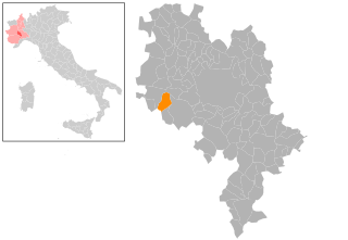
Кантарана (Cantarana, Cantarana)

- коммуна Италии
 Hiking in Кантарана
Cantarana is not widely known as a hiking destination, so it’s possible you might be referring to a specific local area, regional name, or perhaps a hiking trail within a larger known park or mountainous region. However, there are several general tips and suggestions for hiking in any area, which I can provide:
-
Research the Trails: Before you go, look for maps, trail descriptions, and local resources related to Cantarana. This may include websites, trail guides, or local hiking clubs.
-
Know Your Skill Level: Be aware of your fitness level and choose trails that match your skills. Trail difficulty can vary widely, from easy walks to challenging climbs.
-
Prepare for Weather: Check the weather conditions before heading out. Dress in layers and bring rain gear if necessary.
-
Leave No Trace: Follow the principles of Leave No Trace to help preserve the environment. Carry out what you bring in, stay on marked trails, and minimize your impact on the landscape.
-
Safety First: Always let someone know your hiking plans. Carry a first aid kit, enough water, snacks, and a fully charged phone. Consider carrying a map and compass or GPS if you're off well-marked trails.
-
Wildlife Awareness: Be aware of the local wildlife. Understand any risks associated with animals in the area, and know how to respond if you encounter them.
-
Join a Group: If you're unfamiliar with the area or hiking in general, consider joining a local hiking group or finding a guide who can provide insights and ensure safety.
If you provide more specific details about Cantarana—like its location, features, or what facilities might be available—I could give more tailored advice or information about the best hiking spots!
- Страна:

- Почтовый код: 14010
- Телефонный код: 0141
- Код автомобильного номера: AT
- Координаты: 44° 54' 12" N, 8° 1' 43" E


- GPS треки (wikiloc): [Ссылка]
- Высота над уровнем моря: 176 м m
- Площадь: 9.72 кв.км
- Население: 1015
- Веб сайт: http://www.comune.cantarana.at.it
- Википедия русская: wiki(ru)
- Википедия английская: wiki(en)
- Википедия национальная: wiki(it)
- Хранилище Wikidata: Wikidata: Q17769
- Катеория в википедии: [Ссылка]
- код Freebase: [/m/0gbf_3]
- код GeoNames: Альт: [6542382]
- код VIAF: Альт: [305247753]
- ID отношения в OpenStreetMap: [43777]
- UN/LOCODE: [ITCN5]
- код ISTAT: 005018
- кадастровый код Италии: B633
Граничит с регионами:
Дузино-Сан-Микеле
- коммуна Италии
Hiking in Дузино-Сан-Микеле
Dusino San Michele is a small municipality located in the Piedmont region of Italy. While it may not be as widely known as major hiking destinations, it can offer charming walking paths and scenic nature for those looking for a more tranquil outdoor experience....
- Страна:
- Почтовый код: 14010
- Телефонный код: 0141
- Код автомобильного номера: AT
- Координаты: 44° 54' 51" N, 7° 58' 19" E
- GPS треки (wikiloc): [Ссылка]
- Высота над уровнем моря: 264 м m
- Площадь: 11.93 кв.км
- Население: 1047
- Веб сайт: [Ссылка]

Феррере
- коммуна Италии
Hiking in Феррере
Ferrere is a quaint location in Italy, offering scenic views and various hiking trails that cater to a range of skill levels. Though Ferrere itself may not be a prominent hiking destination like larger national parks or mountainous regions, its surrounding areas, especially in the Piedmont region, offer some lovely opportunities for outdoor enthusiasts....
- Страна:
- Почтовый код: 14012
- Телефонный код: 0141
- Код автомобильного номера: AT
- Координаты: 44° 52' 34" N, 7° 59' 39" E
- GPS треки (wikiloc): [Ссылка]
- Высота над уровнем моря: 268 м m
- Площадь: 13.93 кв.км
- Население: 1586
- Веб сайт: [Ссылка]


Сан-Дамьяно-д'Асти
- коммуна Италии
Hiking in Сан-Дамьяно-д'Асти
San Damiano d'Asti, located in the Piedmont region of Italy, offers a charming landscape that is well-suited for hiking enthusiasts. The area is characterized by rolling hills, vineyards, and scenic countryside, making it an ideal spot for various hiking trails. Here are some highlights and tips for hiking in and around San Damiano d'Asti:...
- Страна:
- Почтовый код: 14015
- Телефонный код: 0141
- Код автомобильного номера: AT
- Координаты: 44° 50' 4" N, 8° 3' 53" E
- GPS треки (wikiloc): [Ссылка]
- Высота над уровнем моря: 179 м m
- Площадь: 47.87 кв.км
- Население: 8347
- Веб сайт: [Ссылка]
Тильоле
- коммуна Италии
Hiking in Тильоле
Tigliole, located in the Piedmont region of Italy, offers a charming rural landscape that's perfect for hiking enthusiasts. The area is characterized by rolling hills, vineyards, and beautiful countryside views, making it an excellent destination for both casual walkers and more experienced hikers....
- Страна:
- Почтовый код: 14016
- Телефонный код: 0141
- Код автомобильного номера: AT
- Координаты: 44° 53' 14" N, 8° 4' 40" E
- GPS треки (wikiloc): [Ссылка]
- Высота над уровнем моря: 239 м m
- Площадь: 16.12 кв.км
- Население: 1724
- Веб сайт: [Ссылка]
Вальфенера
- коммуна Италии
Hiking in Вальфенера
Valfenera, located in the Piedmont region of Italy, offers scenic landscapes and a variety of outdoor activities, including hiking. Although it may not be as widely known as some other hiking hotspots, it has its own charm with rolling hills, vineyards, and picturesque rural settings....
- Страна:
- Почтовый код: 14017
- Телефонный код: 0141
- Код автомобильного номера: AT
- Координаты: 44° 54' 10" N, 7° 57' 55" E
- GPS треки (wikiloc): [Ссылка]
- Высота над уровнем моря: 282 м m
- Площадь: 22.04 кв.км
- Население: 2464
- Веб сайт: [Ссылка]
Виллафранка-д'Асти
- коммуна Италии
Hiking in Виллафранка-д'Асти
Villafranca d'Asti is a charming town in the Piedmont region of Italy, located near the Po River and surrounded by picturesque landscapes. Hiking in this area can be quite rewarding, thanks to its rolling hills, vineyards, and the beautiful countryside....
- Страна:
- Почтовый код: 14018
- Телефонный код: 0141
- Код автомобильного номера: AT
- Координаты: 44° 54' 46" N, 8° 1' 58" E
- GPS треки (wikiloc): [Ссылка]
- Высота над уровнем моря: 206 м m
- Площадь: 12.88 кв.км
- Население: 3047
- Веб сайт: [Ссылка]