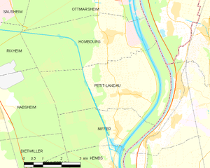
Ильзак (canton of Illzach, canton d'Illzach)
 Hiking in Ильзак
Canton d'Illzach, located in the Haut-Rhin department of Alsace, France, offers a variety of hiking opportunities amidst beautiful landscapes. While the canton itself is quite small and suburban, it serves as a great starting point to explore the surrounding regions, including the stunning landscapes of the Vosges mountains and the Rhine riverbanks.
Hiking Highlights:
-
Scenic Trails: The area has numerous trails ranging from easy walks to more challenging hikes. Nearby, you can explore paths that follow the Rhine River, offering picturesque views and opportunities for bird watching.
-
Vosges Mountains: A short drive will take you into the foothills of the Vosges Mountains, where you can find extensive networks of hiking trails. Popular destinations include the Grand Ballon, which boasts panoramic views and a variety of trails catering to different fitness levels.
-
Floral and Fauna Diversity: The natural environment around Canton d'Illzach is rich in flora and fauna. You can expect to see diverse plant life, wildlife, and beautiful landscapes, especially in the spring and summer months.
-
Cultural Sites: Throughout the area, there are also opportunities to hike to historical and cultural sites, including charming villages, vineyards, and historic monuments.
-
Nature Reserves: Explore local nature reserves that protect the native ecosystems. These areas often feature well-marked trails and informative signage about the local environment.
Tips for Hiking in Canton d'Illzach:
- Weather: The weather can change quickly, especially in the mountains. Always check the forecast before heading out and dress accordingly in layers.
- Maps and Guides: Use local hiking guides or maps to plan your routes. The local tourist office can provide up-to-date information on trail conditions and difficulties.
- Safety: Carry enough water and snacks, and let someone know your hiking plan, especially if you’re venturing into less populated areas.
- Footwear: Wear sturdy hiking boots to navigate various terrains comfortably.
Whether you're a beginner or an experienced hiker, Canton d'Illzach and its surroundings provide excellent options for enjoying the outdoors in beautiful Alsace.
- Страна:

- Столица: Ильзак
- Координаты: 47° 47' 0" N, 7° 20' 0" E


- GPS треки (wikiloc): [Ссылка]
- Википедия русская: wiki(ru)
- Хранилище Wikidata: Wikidata: Q1398516
- код LCNAF: Альт: [n95026784]
- код кантона INSEE: [6831]
Включает регионы:
Пети-Ландо
- коммуна во Франции
Hiking in Пети-Ландо
Petit-Landau, though small, is nestled in the scenic Alsace region of France, and it offers a tranquil environment for hiking enthusiasts. The area is characterized by rolling hills, lush vineyards, and beautiful landscapes typical of the Alsace region....
- Страна:
- Почтовый код: 68490
- Координаты: 47° 43' 50" N, 7° 31' 10" E
- GPS треки (wikiloc): [Ссылка]
- Площадь: 17.51 кв.км
- Население: 808


Оттмарсайм
- коммуна во Франции
Hiking in Оттмарсайм
Ottmarsheim, located in the Alsace region of France near the border with Germany, offers a charming setting for outdoor enthusiasts. While it is primarily known for its historical significance and beautiful architecture, particularly the Abbey of Ottmarsheim, the surrounding areas provide opportunities for hiking and nature walks....
- Страна:
- Почтовый код: 68490
- Координаты: 47° 47' 14" N, 7° 30' 37" E
- GPS треки (wikiloc): [Ссылка]
- Высота над уровнем моря: 217.235 м m
- Площадь: 25.67 кв.км
- Население: 1760
- Веб сайт: [Ссылка]


Ниффер
- коммуна во Франции
Hiking in Ниффер
Niffer, a small commune in the Alsace region of France, offers picturesque landscapes and a charming countryside ideal for hiking enthusiasts. While it may not be as widely recognized for hiking as larger national parks or mountainous regions, the area surrounding Niffer does present opportunities for nature walks and exploration....
- Страна:
- Почтовый код: 68680
- Координаты: 47° 42' 50" N, 7° 30' 34" E
- GPS треки (wikiloc): [Ссылка]
- Площадь: 8.72 кв.км
- Население: 961
- Веб сайт: [Ссылка]


Рюлисайм
- коммуна во Франции
Hiking in Рюлисайм
Ruelisheim, located in the Alsace region of France, offers a charming setting for hiking enthusiasts. While it may not be as widely known as some larger hiking destinations, the area has its own unique appeal....
- Страна:
- Почтовый код: 68270
- Координаты: 47° 49' 23" N, 7° 21' 30" E
- GPS треки (wikiloc): [Ссылка]
- Площадь: 7.27 кв.км
- Население: 2278
- Веб сайт: [Ссылка]

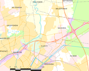
Ильзак
- коммуна во Франции
Hiking in Ильзак
Illzach, located in the Alsace region of France near the city of Mulhouse, offers a blend of urban and natural hiking opportunities. While Illzach itself may not be known for extensive hiking trails, the surrounding areas provide beautiful landscapes and more challenging hikes....
- Страна:
- Почтовый код: 68110
- Координаты: 47° 46' 56" N, 7° 20' 53" E
- GPS треки (wikiloc): [Ссылка]
- Площадь: 7.5 кв.км
- Население: 14626
- Веб сайт: [Ссылка]


Бальдерсайм
- коммуна во Франции
Hiking in Бальдерсайм
Baldersheim is a picturesque area known for its scenic landscapes and outdoor activities, but specific hiking trails and options can vary based on local geography and development. Since Baldersheim may refer to several different locations, you’ll want to clarify which one you’re interested in, often it relates to places in Europe, such as in France or Germany....
- Страна:
- Почтовый код: 68390
- Координаты: 47° 48' 1" N, 7° 22' 49" E
- GPS треки (wikiloc): [Ссылка]
- Площадь: 12.76 кв.км
- Население: 2608

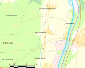
Бантзенайм
- коммуна во Франции
Hiking in Бантзенайм
Bantzenheim is a small commune in the Alsace region of France, known for its charming countryside and scenic landscapes. While it may not be as widely recognized as some larger hiking destinations, there are still opportunities for enjoyable hikes in and around Bantzenheim. Here are some aspects to consider for hiking in this area:...
- Страна:
- Почтовый код: 68490
- Координаты: 47° 49' 29" N, 7° 30' 56" E
- GPS треки (wikiloc): [Ссылка]
- Площадь: 21.22 кв.км
- Население: 1637
- Веб сайт: [Ссылка]


Баттенайм
- коммуна во Франции
Hiking in Баттенайм
Battenheim, located in the Alsace region of France, offers a variety of scenic landscapes and hiking opportunities for outdoor enthusiasts. Its proximity to the Vosges Mountains and the Rhine River makes it an attractive destination for nature lovers. Here are some key points about hiking in the Battenheim area:...
- Страна:
- Почтовый код: 68390
- Координаты: 47° 49' 11" N, 7° 22' 54" E
- GPS треки (wikiloc): [Ссылка]
- Площадь: 16.88 кв.км
- Население: 1508


Шалампе
- коммуна во Франции
Hiking in Шалампе
Chalampé is a small commune located in the Grand Est region of France, near the border with Germany and Switzerland. While it may not be widely recognized as a hiking destination compared to more mountainous areas, there are still opportunities for pleasant walks and exploration in the surrounding landscapes....
- Страна:
- Почтовый код: 68490
- Координаты: 47° 49' 14" N, 7° 32' 28" E
- GPS треки (wikiloc): [Ссылка]
- Площадь: 4.77 кв.км
- Население: 955

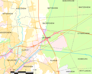
Сосайм
- коммуна во Франции
Hiking in Сосайм
Sausheim is a small commune located near Mulhouse in the Alsace region of northeastern France. While Sausheim itself may not be a significant hiking destination, it is conveniently located near several beautiful natural areas and trails that are popular with hikers....
- Страна:
- Почтовый код: 68390
- Координаты: 47° 47' 12" N, 7° 22' 23" E
- GPS треки (wikiloc): [Ссылка]
- Площадь: 16.91 кв.км
- Население: 5475


Омбур
- коммуна во Франции
Hiking in Омбур
Hombourg, located in Belgium, is known for its picturesque landscapes and charming countryside, making it an excellent destination for hiking enthusiasts. The region is characterized by its rolling hills, dense forests, and beautiful valleys, which offer a variety of hiking trails suitable for different skill levels....
- Страна:
- Почтовый код: 68490
- Координаты: 47° 45' 32" N, 7° 30' 20" E
- GPS треки (wikiloc): [Ссылка]
- Площадь: 15.32 кв.км
- Население: 1304