
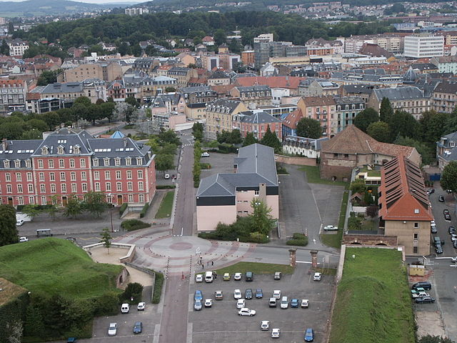
Верхний Рейн (Haut-Rhin, Haut-Rhin)


- департамент Франции
 Hiking in Верхний Рейн
Haut-Rhin, located in the Alsace region of France, offers some stunning hiking opportunities. The region is characterized by its picturesque landscapes, charming villages, and a rich cultural heritage, making it an excellent destination for hikers of all levels. Here are some highlights and tips for hiking in Haut-Rhin:
Trail Types
-
Scenic Trails: The Alsace Wine Route is a popular choice, where hikers can explore vineyards, charming towns like Colmar and Riquewihr, and enjoy stunning views of the Rhine valley and the Vosges Mountains.
-
Mountain Trails: The Vosges Mountains offer more challenging hikes. Trails such as the Grand Ballon (the highest peak in the Vosges) provide breathtaking panoramic views and are suitable for more experienced hikers.
-
Family-Friendly Walks: There are numerous easier trails suitable for families, such as paths around lakes, through forests, and along gentle slopes. Many of these have educational signage about the local flora and fauna.
Notable Hikes
-
Le Sentier des Lacs: This trail takes you around several beautiful lakes in the Vosges region, making it a serene hiking experience.
-
The Hike to Château du Haut-Koenigsbourg: This historical castle offers a fascinating blend of history and hiking, with trails leading to the castle featuring stunning views.
-
The King’s Trail (Sentier des Rois): A scenic route through vineyards and beech forests that showcases the local landscape and invites hikers to discover the winemaking culture of Alsace.
Best Seasons
-
Spring and Fall: These seasons typically offer mild weather and beautiful changing colors of the foliage, great for hiking.
-
Summer: While popular for hiking, be prepared for warmer temperatures and occasional rainfall. Bring plenty of water and snacks.
-
Winter: Some trails are suitable for snowshoeing or winter hiking, but check conditions before heading out.
Practical Tips
-
Maps and Markings: Most trails are well marked, but having a map or a hiking app is always a good idea. The local tourist offices often provide detailed maps.
-
Gear Up: Wear sturdy hiking boots and dress in layers. Weather can change quickly in the mountains.
-
Respect Nature: Practice Leave No Trace principles by staying on marked trails and respecting wildlife.
-
Local Cuisine: Don’t miss the chance to enjoy local Alsatian cuisine, known for its hearty meals, and stop by a vineyard for a wine tasting after your hike.
Conclusion
Hiking in Haut-Rhin is a delightful experience, combining beautiful landscapes, cultural heritage, and excellent trails. Whether you're a seasoned hiker or a casual walker, the region has something to offer for everyone. Enjoy your adventures in this charming part of France!
- Страна:

- Столица: Кольмар
- Координаты: 47° 57' 51" N, 7° 19' 11" E


- GPS треки (wikiloc): [Ссылка]
- Площадь: 3525 кв.км
- Население: 762743
- Веб сайт: http://www.haut-rhin.gouv.fr/
- Википедия русская: wiki(ru)
- Википедия английская: wiki(en)
- Википедия национальная: wiki(fr)
- Хранилище Wikidata: Wikidata: Q12722
- Галерея изображений в википедии: [Ссылка]
- Катеория в википедии: [Ссылка]
- Карты в википедии: [Ссылка]
- код Freebase: [/m/0mhhw]
- код GeoNames: Альт: [3013663]
- номер SIREN: [226800019]
- код BNF: [11878095k]
- код VIAF: Альт: [314807969]
- ID отношения в OpenStreetMap: [7403]
- код GND: Альт: [4042900-3]
- идентификатор местоположения ArchINFORM: [2742]
- код LCNAF: Альт: [n80013632]
- код тезауруса PACTOLS: [pcrtBSN1Pqogs9]
- место в MusicBrainz: [aaae617b-d869-4b98-bd52-ed05aa849322]
- код темы Quora: [Haut-Rhin]
- код SUDOC: [02655514X]
- код в Большой каталанской энциклопедии: [0003161]
- идентификатор HDS: [7563]
- код ISNI: Альт: [0000 0001 1958 7356]
- код NUTS: [FR422]
- код департамента Франции INSEE: [68]
- ISO 3166-2: FR-68
Включает регионы:

Кольмар
- округ во Франции, метрополия Франции, Эльзас, Верхний Рейн
- Страна:
- Столица: Кольмар
- Координаты: 48° 3' 0" N, 7° 15' 0" E
- GPS треки (wikiloc): [Ссылка]
- Площадь: 666 кв.км
Аммерцвиллер
- коммуна во Франции
Hiking in Аммерцвиллер
Ammertzwiller is a small commune located in the Alsace region of France, near the border with Switzerland. While it may not be as famous as some of the more well-known hiking destinations, there are opportunities for hiking in and around Ammertzwiller that can be quite enjoyable....
- Страна:
- Почтовый код: 68210
- Координаты: 47° 41' 20" N, 7° 10' 2" E
- GPS треки (wikiloc): [Ссылка]
- Площадь: 3.05 кв.км
- Население: 469

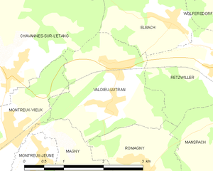
Валдьё-Лютран
- коммуна во Франции
Hiking in Валдьё-Лютран
Valdieu-Lutran is a lovely area in the Vosges department of France, known for its beautiful natural landscapes and opportunities for outdoor activities, including hiking. While it might not be as well-known as larger national parks, this region offers a variety of trails suitable for different skill levels, making it a great destination for hikers seeking tranquility and scenic views....
- Страна:
- Почтовый код: 68210
- Координаты: 47° 37' 36" N, 7° 3' 30" E
- GPS треки (wikiloc): [Ссылка]
- Высота над уровнем моря: 340 м m
- Площадь: 5.17 кв.км
- Население: 395


Манспак
- коммуна во Франции
Hiking in Манспак
Manspach is a charming village located in the Alsace region of France, close to the border with Switzerland. The area around Manspach is characterized by beautiful landscapes, including rolling hills, forests, and a variety of trails suitable for hiking enthusiasts of all skill levels....
- Страна:
- Почтовый код: 68210
- Координаты: 47° 36' 59" N, 7° 6' 19" E
- GPS треки (wikiloc): [Ссылка]
- Площадь: 5.33 кв.км
- Население: 571

Сен-Ком
- коммуна во Франции
Hiking in Сен-Ком
Saint-Cosme, located in France, is a charming place for hiking enthusiasts. While it may not be as famous as some of the larger national parks or hiking regions, it offers a unique blend of scenic views, nature, and historical sites....
- Страна:
- Почтовый код: 68210
- Координаты: 47° 40' 54" N, 7° 3' 47" E
- GPS треки (wikiloc): [Ссылка]
- Площадь: 2.71 кв.км
- Население: 95


Маньи
- коммуна во Франции
Hiking in Маньи
Magny is a small commune located in the Haut-Rhin department in the Grand Est region of France. While it might not be a widely known hiking destination, the surrounding areas in Alsace offer some beautiful hiking opportunities that can be explored from Magny....
- Страна:
- Почтовый код: 68210
- Координаты: 47° 36' 16" N, 7° 3' 12" E
- GPS треки (wikiloc): [Ссылка]
- Площадь: 4.3 кв.км
- Население: 305


Монтрё-Вьё
- коммуна во Франции
Hiking in Монтрё-Вьё
Montreux-Vieux, located in the Alsace region of France near the border with Switzerland, offers a beautiful natural setting ideal for hiking enthusiasts. Here are some key highlights about hiking in this area:...
- Страна:
- Почтовый код: 68210
- Координаты: 47° 37' 11" N, 7° 1' 21" E
- GPS треки (wikiloc): [Ссылка]
- Площадь: 4.14 кв.км
- Население: 885
- Веб сайт: [Ссылка]


Рибовилле
- коммуна во Франции
- Страна:
- Почтовый код: 68150
- Координаты: 48° 11' 43" N, 7° 19' 6" E
- GPS треки (wikiloc): [Ссылка]
- Площадь: 32.21 кв.км
- Население: 4746
- Веб сайт: [Ссылка]


Роршвир
- коммуна во Франции
- Страна:
- Почтовый код: 68590
- Координаты: 48° 13' 2" N, 7° 21' 46" E
- GPS треки (wikiloc): [Ссылка]
- Высота над уровнем моря: 362 м m
- Площадь: 2.47 кв.км
- Население: 382

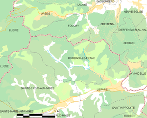
Ромбак-ле-Фран
- коммуна во Франции
- Страна:
- Почтовый код: 68660
- Координаты: 48° 17' 3" N, 7° 15' 38" E
- GPS треки (wikiloc): [Ссылка]
- Площадь: 17.87 кв.км
- Население: 801


Монтрё-Жён
- коммуна во Франции
Hiking in Монтрё-Жён
Montreux-Jeune, located in the scenic setting of Switzerland, offers a variety of hiking opportunities that cater to different skill levels and preferences. This region is known for its stunning natural landscapes, including lush forests, rolling hills, and picturesque views of Lake Geneva and the surrounding Alps....
- Страна:
- Почтовый код: 68210
- Координаты: 47° 36' 40" N, 7° 1' 55" E
- GPS треки (wikiloc): [Ссылка]
- Площадь: 3.36 кв.км
- Население: 358


Ретсвиллер
- коммуна во Франции
Hiking in Ретсвиллер
Retzwiller is a small commune located in the Alsace region of France, known for its picturesque landscapes and scenic hiking opportunities. While it may not be as famous as some larger hiking destinations, it offers charming trails that embrace both the natural beauty of the surrounding countryside and the cultural heritage of the region....
- Страна:
- Почтовый код: 68210
- Координаты: 47° 37' 52" N, 7° 5' 36" E
- GPS треки (wikiloc): [Ссылка]
- Площадь: 4.1 кв.км
- Население: 709
Niederbetschdorf
- Страна:
- Координаты: 48° 53' 53" N, 7° 54' 54" E
- GPS треки (wikiloc): [Ссылка]
Oberbetschdorf
- Страна:
- Координаты: 48° 53' 55" N, 7° 54' 6" E
- GPS треки (wikiloc): [Ссылка]


Доендорф
- коммуна в департаменте Нижний Рейн, Франция
- Страна:
- Почтовый код: 67350
- Координаты: 48° 49' 49" N, 7° 39' 19" E
- GPS треки (wikiloc): [Ссылка]
- Площадь: 7.63 кв.км
- Население: 1448


Ангенбитен
- коммуна во Франции
- Страна:
- Почтовый код: 67980
- Координаты: 48° 33' 33" N, 7° 36' 50" E
- GPS треки (wikiloc): [Ссылка]
- Площадь: 4.11 кв.км
- Население: 1511
- Веб сайт: [Ссылка]
Форстайм
- коммуна во Франции
- Страна:
- Почтовый код: 67580
- Координаты: 48° 53' 50" N, 7° 42' 51" E
- GPS треки (wikiloc): [Ссылка]
- Площадь: 5.05 кв.км
- Население: 574
- Веб сайт: [Ссылка]
Эжене
- коммуна во Франции
- Страна:
- Почтовый код: 67360
- Координаты: 48° 53' 26" N, 7° 44' 28" E
- GPS треки (wikiloc): [Ссылка]
- Площадь: 1.76 кв.км
- Население: 415


Гуженайм
- коммуна во Франции
- Страна:
- Почтовый код: 67270
- Координаты: 48° 42' 7" N, 7° 33' 58" E
- GPS треки (wikiloc): [Ссылка]
- Площадь: 6.58 кв.км
- Население: 540
- Веб сайт: [Ссылка]


Экверсайм
- коммуна во Франции
- Страна:
- Почтовый код: 67550
- Координаты: 48° 40' 52" N, 7° 41' 39" E
- GPS треки (wikiloc): [Ссылка]
- Площадь: 7.46 кв.км
- Население: 1329
- Веб сайт: [Ссылка]

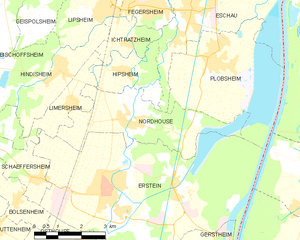
Нордуз
- коммуна во Франции
- Страна:
- Почтовый код: 67150
- Координаты: 48° 26' 54" N, 7° 40' 22" E
- GPS треки (wikiloc): [Ссылка]
- Площадь: 11 кв.км
- Население: 1737

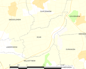
Рор
- коммуна во Франции
- Страна:
- Почтовый код: 67270
- Координаты: 48° 41' 46" N, 7° 32' 49" E
- GPS треки (wikiloc): [Ссылка]
- Площадь: 3.34 кв.км
- Население: 271

Стютзайм-Оффенайм
- коммуна во Франции
- Страна:
- Почтовый код: 67370
- Координаты: 48° 37' 42" N, 7° 37' 31" E
- GPS треки (wikiloc): [Ссылка]
- Площадь: 7.14 кв.км
- Население: 1388
- Веб сайт: [Ссылка]

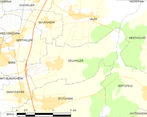
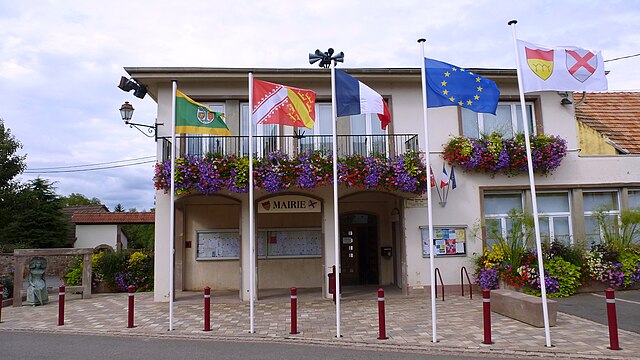
Зельвиллер
- коммуна во Франции
- Страна:
- Почтовый код: 67140
- Координаты: 48° 23' 52" N, 7° 29' 52" E
- GPS треки (wikiloc): [Ссылка]
- Площадь: 8.79 кв.км
- Население: 750


Оберосберген
- коммуна во Франции
- Страна:
- Почтовый код: 67205
- Координаты: 48° 36' 24" N, 7° 41' 7" E
- GPS треки (wikiloc): [Ссылка]
- Площадь: 3.79 кв.км
- Население: 5207
- Веб сайт: [Ссылка]


Флексбур
- коммуна во Франции
- Страна:
- Почтовый код: 67310
- Координаты: 48° 34' 19" N, 7° 25' 51" E
- GPS треки (wikiloc): [Ссылка]
- Площадь: 1.7 кв.км
- Население: 472

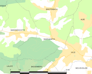
Сен-Мартен
- Страна:
- Почтовый код: 67220
- Координаты: 48° 21' 2" N, 7° 17' 23" E
- GPS треки (wikiloc): [Ссылка]
- Площадь: 3.97 кв.км
- Население: 352

Нидерредерн
- коммуна в департаменте Нижний Рейн, Франция
- Страна:
- Почтовый код: 67470
- Координаты: 48° 54' 22" N, 8° 2' 52" E
- GPS треки (wikiloc): [Ссылка]
- Площадь: 6.88 кв.км
- Население: 923


Бишвилье
- коммуна во Франции
- Страна:
- Почтовый код: 67240
- Координаты: 48° 45' 59" N, 7° 51' 25" E
- GPS треки (wikiloc): [Ссылка]
- Площадь: 17.25 кв.км
- Население: 12579
- Веб сайт: [Ссылка]


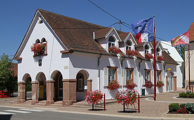
Миттельбергхайм
- коммуна во Франции
- Страна:
- Почтовый код: 67140
- Координаты: 48° 23' 45" N, 7° 26' 31" E
- GPS треки (wikiloc): [Ссылка]
- Площадь: 3.83 кв.км
- Население: 655
- Веб сайт: [Ссылка]


Стеж
- коммуна во Франции
- Страна:
- Почтовый код: 67220
- Координаты: 48° 21' 39" N, 7° 14' 19" E
- GPS треки (wikiloc): [Ссылка]
- Площадь: 9.86 кв.км
- Население: 601
- Веб сайт: [Ссылка]


Ингвиллер
- коммуна во Франции
- Страна:
- Почтовый код: 67340
- Координаты: 48° 52' 23" N, 7° 28' 37" E
- GPS треки (wikiloc): [Ссылка]
- Площадь: 18.05 кв.км
- Население: 4106
- Веб сайт: [Ссылка]


Санд
- Страна:
- Почтовый код: 67230
- Координаты: 48° 22' 58" N, 7° 36' 48" E
- GPS треки (wikiloc): [Ссылка]
- Площадь: 6.35 кв.км
- Население: 1189

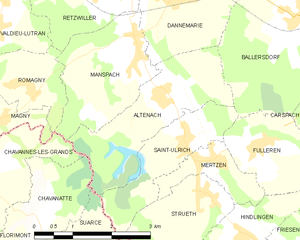
Альтенах
- коммуна во Франции
Hiking in Альтенах
Altenach is a picturesque location that offers a variety of hiking opportunities, ideal for both beginners and experienced hikers. Nestled in a scenic area, Altenach features beautiful landscapes, including lush forests, rolling hills, and breathtaking views....
- Страна:
- Почтовый код: 68210
- Координаты: 47° 36' 24" N, 7° 6' 43" E
- GPS треки (wikiloc): [Ссылка]
- Площадь: 6.18 кв.км
- Население: 378


Баллерсдорф
- коммуна во Франции
Hiking in Баллерсдорф
Ballersdorf is a quaint village located in Bavaria, Germany, known for its picturesque landscapes and peaceful countryside. While it may not be widely recognized as a major hiking destination, it does offer some charming trails that provide an opportunity to explore the natural beauty of the Bavarian region....
- Страна:
- Почтовый код: 68210
- Координаты: 47° 37' 24" N, 7° 9' 36" E
- GPS треки (wikiloc): [Ссылка]
- Площадь: 10.72 кв.км
- Население: 825


Балшвиллер
- коммуна во Франции
Hiking in Балшвиллер
Balschwiller is a charming village located in the Alsace region of France, near the border with Switzerland. It is surrounded by beautiful landscapes and offers various hiking opportunities for outdoor enthusiasts. Here are some aspects to consider when hiking in and around Balschwiller:...
- Страна:
- Почтовый код: 68210
- Координаты: 47° 40' 7" N, 7° 10' 6" E
- GPS треки (wikiloc): [Ссылка]
- Площадь: 9.79 кв.км
- Население: 785


Гильдвиллер
- коммуна во Франции
Hiking in Гильдвиллер
Gildwiller is a small village in the Alsace region of France. While it may not be as well-known for hiking as some larger areas, it offers a picturesque landscape and a peaceful environment that can delight outdoor enthusiasts....
- Страна:
- Почтовый код: 68210
- Координаты: 47° 41' 22" N, 7° 8' 3" E
- GPS треки (wikiloc): [Ссылка]
- Высота над уровнем моря: 295 м m
- Площадь: 5.02 кв.км
- Население: 283


Бельманьи
- коммуна во Франции
Hiking in Бельманьи
Bellemagny, located in the picturesque region of the French Alps, offers a variety of hiking experiences suitable for all levels, from leisurely walks to challenging mountain treks. The area is characterized by stunning landscapes, including rugged mountains, lush forests, and serene lakes....
- Страна:
- Почтовый код: 68210
- Координаты: 47° 41' 23" N, 7° 4' 2" E
- GPS треки (wikiloc): [Ссылка]
- Площадь: 2.1 кв.км
- Население: 188


Гоммерсдорф
- коммуна во Франции
Hiking in Гоммерсдорф
Gommersdorf is a small village in Germany, and while it might not be as widely known as some larger hiking destinations, it can still offer some charming trails and beautiful landscapes typically found in the region. Here are a few things to consider when planning a hiking trip in and around Gommersdorf:...
- Страна:
- Почтовый код: 68210
- Координаты: 47° 38' 24" N, 7° 7' 46" E
- GPS треки (wikiloc): [Ссылка]
- Площадь: 4.15 кв.км
- Население: 350

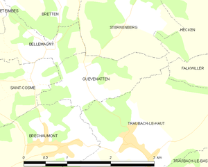
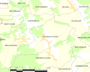
Гевенаттен
- коммуна во Франции
Hiking in Гевенаттен
Guevenatten is a lesser-known but beautiful hiking destination that offers a range of trails suitable for various skill levels. While specific trail names and conditions can vary, here are some general features you might expect:...
- Страна:
- Почтовый код: 68210
- Координаты: 47° 40' 55" N, 7° 4' 46" E
- GPS треки (wikiloc): [Ссылка]
- Площадь: 2.15 кв.км
- Население: 138

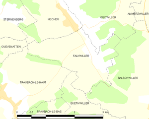
Фальквиллер
- коммуна во Франции
Hiking in Фальквиллер
Falkwiller is a small town in the Alsace region of France, known for its picturesque landscapes and charming countryside. While it may not be as widely recognized for hiking as some other regions in France, it offers opportunities to explore nature and enjoy outdoor activities....
- Страна:
- Почтовый код: 68210
- Координаты: 47° 40' 53" N, 7° 8' 2" E
- GPS треки (wikiloc): [Ссылка]
- Площадь: 3.55 кв.км
- Население: 187
- Веб сайт: [Ссылка]


Бютвиллер
- коммуна во Франции
Hiking in Бютвиллер
Buethwiller is a small village located in the Alsace region of France, which is known for its picturesque landscapes and outdoor activities. The area offers a range of hiking opportunities suitable for various skill levels, from gentle walks in the countryside to more challenging hikes through the surrounding hills and forests....
- Страна:
- Почтовый код: 68210
- Координаты: 47° 39' 23" N, 7° 8' 58" E
- GPS треки (wikiloc): [Ссылка]
- Площадь: 3.84 кв.км
- Население: 269


Брешомон
- коммуна во Франции
Hiking in Брешомон
Bréchaumont is a small village located in the Doubs department of eastern France, close to the Swiss border. It offers picturesque landscapes and trails for hikers looking to experience the natural beauty of the region....
- Страна:
- Почтовый код: 68210
- Координаты: 47° 40' 8" N, 7° 4' 15" E
- GPS треки (wikiloc): [Ссылка]
- Площадь: 6.51 кв.км
- Население: 414


Экен
- коммуна во Франции
Hiking in Экен
Hecken, located in the Haut-Rhin department of the Alsace region in northeastern France, offers a picturesque backdrop for hiking enthusiasts. The region is characterized by its stunning natural landscapes, vineyards, and charming villages, making it a delightful destination for outdoor activities. Here’s what you can expect when hiking in and around Hecken:...
- Страна:
- Почтовый код: 68210
- Координаты: 47° 41' 31" N, 7° 7' 29" E
- GPS треки (wikiloc): [Ссылка]
- Площадь: 2.45 кв.км
- Население: 460


Бреттен
- коммуна во Франции
Hiking in Бреттен
Bretten, located in the Haut-Rhin department of Alsace in France, offers a delightful experience for hiking enthusiasts. The region is characterized by its beautiful landscapes, vineyards, and picturesque villages, making it an excellent destination for both casual walkers and seasoned hikers....
- Страна:
- Почтовый код: 68780
- Координаты: 47° 41' 58" N, 7° 4' 19" E
- GPS треки (wikiloc): [Ссылка]
- Площадь: 4.16 кв.км
- Население: 175

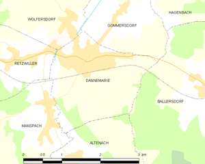
Данмари
Hiking in Данмари
Dannemarie, located in the Haut-Rhin department in the Alsace region of France, offers scenic hiking opportunities that allow you to explore the beautiful landscapes of the region. While the town itself is small, it serves as a great starting point for several hiking routes and outdoor activities in the surrounding areas....
- Страна:
- Почтовый код: 68210
- Координаты: 47° 37' 48" N, 7° 7' 9" E
- GPS треки (wikiloc): [Ссылка]
- Площадь: 4.35 кв.км
- Население: 2252
- Веб сайт: [Ссылка]

Этемб
- коммуна во Франции
Hiking in Этемб
Eteimbes, a picturesque area located near Lake Geneva in Switzerland, offers a range of hiking opportunities that cater to various skill levels. Here are some highlights for hiking in Eteimbes:...
- Страна:
- Почтовый код: 68210
- Координаты: 47° 42' 11" N, 7° 2' 59" E
- GPS треки (wikiloc): [Ссылка]
- Площадь: 4.96 кв.км
- Население: 386


Аженбак
- коммуна во Франции
Hiking in Аженбак
Hagenbach, located in the Haut-Rhin department of the Alsace region in northeastern France, offers a picturesque setting that is ideal for hiking enthusiasts. While it may not be as widely recognized as some other hiking destinations in the region, it provides charming paths and trails that allow hikers to explore both the natural landscape and the local culture....
- Страна:
- Почтовый код: 68210
- Координаты: 47° 39' 1" N, 7° 9' 23" E
- GPS треки (wikiloc): [Ссылка]
- Площадь: 4.81 кв.км
- Население: 679


Сен-Луи
- коммуна во Франции
Hiking in Сен-Луи
Saint-Louis, located in the Haut-Rhin department of the Alsace region in northeastern France, offers a unique blend of natural beauty and cultural experiences, making it an interesting spot for hikers....
- Страна:
- Почтовый код: 68300
- Координаты: 47° 35' 7" N, 7° 33' 54" E
- GPS треки (wikiloc): [Ссылка]
- Высота над уровнем моря: 254 м m
- Площадь: 16.85 кв.км
- Население: 20401
- Веб сайт: [Ссылка]


Дифматтен
- коммуна во Франции
Hiking in Дифматтен
Diefmatten, located in the Vosges Mountains of France, is a beautiful area for hiking enthusiasts. The region is known for its stunning landscapes, diverse flora and fauna, and various hiking trails that cater to different skill levels....
- Страна:
- Почтовый код: 68780
- Координаты: 47° 42' 28" N, 7° 6' 56" E
- GPS треки (wikiloc): [Ссылка]
- Площадь: 3.17 кв.км
- Население: 275


Шаван-сюр-л’Этан
- коммуна во Франции
Hiking in Шаван-сюр-л’Этан
Chavannes-sur-l'Étang is a lovely location for hiking enthusiasts situated in the beautiful region of Switzerland, known for its stunning landscapes and outdoor activities. Here are some key points to consider when planning a hike in this area:...
- Страна:
- Почтовый код: 68210
- Координаты: 47° 37' 54" N, 7° 1' 28" E
- GPS треки (wikiloc): [Ссылка]
- Площадь: 6.04 кв.км
- Население: 693


Эльбак
- коммуна во Франции
Hiking in Эльбак
Elbach is a charming region located in Germany, known for its picturesque landscapes and rich natural beauty. While the specifics about hiking trails in Elbach might vary, the surrounding areas are typically characterized by lush forests, rolling hills, and scenic views that make it a delightful destination for hikers....
- Страна:
- Почтовый код: 68210
- Координаты: 47° 38' 28" N, 7° 4' 44" E
- GPS треки (wikiloc): [Ссылка]
- Площадь: 3.18 кв.км
- Население: 255


Эглинген
- коммуна во Франции
Hiking in Эглинген
Eglingen is a small village in Germany, located in the district of Göppingen in Baden-Württemberg. While it may not be as well-known as larger hiking destinations, it offers several opportunities for outdoor exploration and hiking in the surrounding areas....
- Страна:
- Почтовый код: 68720
- Координаты: 47° 39' 55" N, 7° 10' 55" E
- GPS треки (wikiloc): [Ссылка]
- Площадь: 3.72 кв.км
- Население: 366

Тробак-ле-О
- коммуна во Франции
Hiking in Тробак-ле-О
Traubach-le-Haut is a charming commune located in the Haut-Rhin department of the Alsace region in northeastern France. It's a great destination for hiking enthusiasts, offering beautiful scenery, rich natural landscapes, and opportunities to explore local flora and fauna....
- Страна:
- Почтовый код: 68210
- Координаты: 47° 40' 12" N, 7° 5' 29" E
- GPS треки (wikiloc): [Ссылка]
- Площадь: 6.91 кв.км
- Население: 609

Танн
Hiking in Танн
The Arrondissement of Thann, located in the Alsace region of northeastern France, offers beautiful hiking opportunities, particularly in the Vosges Mountains. Here are some highlights and information for hiking in this area:...
- Страна:
- Столица: Тан
- Координаты: 47° 50' 0" N, 7° 5' 0" E
- GPS треки (wikiloc): [Ссылка]
- Площадь: 525 кв.км


Спекбак-ле-Ба
- коммуна во Франции
Hiking in Спекбак-ле-Ба
Spechbach-le-Bas is a charming village located in the Alsace region of France, close to the Vosges Mountains, which provides a beautiful backdrop for hiking enthusiasts. The area is known for its picturesque landscapes, diverse flora and fauna, and well-marked trails that cater to various skill levels....
- Страна:
- Почтовый код: 68720
- Координаты: 47° 40' 13" N, 7° 13' 42" E
- GPS треки (wikiloc): [Ссылка]
- Площадь: 4.14 кв.км
- Население: 677


Спекбак-ле-О
- коммуна во Франции
Hiking in Спекбак-ле-О
Spechbach-le-Haut is a charming commune located in the Alsace region of France. While not as widely known as some of the major hiking destinations in the area, it offers access to beautiful landscapes and hiking opportunities that can be enjoyed by both beginners and experienced hikers....
- Страна:
- Почтовый код: 68720
- Координаты: 47° 40' 50" N, 7° 13' 0" E
- GPS треки (wikiloc): [Ссылка]
- Площадь: 3.92 кв.км
- Население: 634

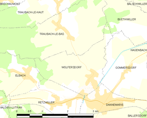
Вольферсдорф
- коммуна во Франции
Hiking in Вольферсдорф
Wolfersdorf, located in the Haut-Rhin department of France, is a charming village that offers a unique hiking experience. Nestled in the Alsace region, it has picturesque landscapes, rolling hills, and proximity to natural attractions....
- Страна:
- Почтовый код: 68210
- Координаты: 47° 38' 26" N, 7° 6' 49" E
- GPS треки (wikiloc): [Ссылка]
- Площадь: 3.66 кв.км
- Население: 360


Тробак-ле-Ба
- коммуна во Франции
Hiking in Тробак-ле-Ба
Traubach-le-Bas is a charming village located in the Alsace region of France, known for its beautiful natural scenery and outdoor activities, including hiking. Here’s what you might expect when hiking in and around Traubach-le-Bas:...
- Страна:
- Почтовый код: 68210
- Координаты: 47° 39' 21" N, 7° 6' 3" E
- GPS треки (wikiloc): [Ссылка]
- Площадь: 6.78 кв.км
- Население: 504


Стерненбер
- коммуна во Франции
Hiking in Стерненбер
Sternenberg is a small village located in the Haut-Rhin department of France, situated in the Alsace region. The surrounding area is characterized by its beautiful landscapes, including rolling hills, vineyards, and forests, making it a great destination for hiking enthusiasts....
- Страна:
- Почтовый код: 68780
- Координаты: 47° 41' 45" N, 7° 5' 38" E
- GPS треки (wikiloc): [Ссылка]
- Площадь: 3.44 кв.км
- Население: 153
Альткирш (округ)
Hiking in Альткирш (округ)
The Arrondissement of Altkirch, located in the Haut-Rhin department of the Alsace region in northeastern France, offers a variety of hiking opportunities amidst beautiful natural landscapes. This area is characterized by its rolling hills, dense forests, and picturesque villages, making it an excellent destination for outdoor enthusiasts....
- Страна:
- Столица: Альткирш
- Координаты: 47° 35' 0" N, 7° 10' 0" E
- GPS треки (wikiloc): [Ссылка]
- Площадь: 663 кв.км
- Население: 69648


Гебвиллер (округ)
Hiking in Гебвиллер (округ)
The Arrondissement of Guebwiller, located in northeastern France within the Haut-Rhin department of Alsace, offers a wonderful mix of scenic landscapes, charming villages, and rich cultural history that makes it a fantastic destination for hiking enthusiasts. Here are some highlights about hiking in this area:...
- Страна:
- Столица: Гебвиллер
- Координаты: 47° 55' 0" N, 7° 20' 0" E
- GPS треки (wikiloc): [Ссылка]
- Площадь: 584 кв.км

Мюлуз
- округ Франции
Hiking in Мюлуз
The Arrondissement of Mulhouse, located in the Alsace region of northeastern France, offers a variety of hiking opportunities that showcase the region's diverse landscapes, charming villages, and rich history. Here are some highlights and tips for hiking in this area:...
- Страна:
- Столица: Мюлуз
- Координаты: 47° 40' 0" N, 7° 25' 0" E
- GPS треки (wikiloc): [Ссылка]
- Площадь: 634 кв.км
- Население: 350632
Рибовилле (округ)
- Страна:
- Столица: Рибовилле
- Координаты: 48° 10' 0" N, 7° 15' 0" E
- GPS треки (wikiloc): [Ссылка]
- Площадь: 462 кв.км
Граничит с регионами:

Золотурн
- кантон в Швейцарии
Hiking in Золотурн
Hiking in the Canton of Solothurn offers a fantastic blend of natural beauty, historical sites, and picturesque villages. Located in Switzerland, Solothurn is known for its picturesque landscapes, ranging from rolling hills to stunning valleys and the scenic banks of the River Aare....
- Страна:

- Столица: Золотурн
- Код автомобильного номера: SO
- Координаты: 47° 9' 0" N, 7° 38' 0" E
- GPS треки (wikiloc): [Ссылка]
- Высота над уровнем моря: 432 м m
- Площадь: 790.45 кв.км
- Веб сайт: [Ссылка]


Базель-Ланд
- полукантон в Швейцарии
Hiking in Базель-Ланд
Hiking in the Canton of Basel-Landschaft, located in Switzerland, offers an excellent opportunity to explore the region's beautiful landscapes, charming villages, and diverse ecosystems. Here are some key points to consider when planning your hike in this area:...
- Страна:
- Столица: Листаль
- Код автомобильного номера: BL
- Координаты: 47° 27' 47" N, 7° 45' 21" E
- GPS треки (wikiloc): [Ссылка]
- Высота над уровнем моря: 327 м m
- Площадь: 517.67 кв.км
- Веб сайт: [Ссылка]

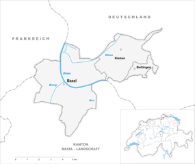
Базель-Штадт
- полукантон в Швейцарии
Hiking in Базель-Штадт
Hiking in the Canton of Basel-Stadt offers a unique blend of urban landscapes and natural surroundings. Though Basel-Stadt is one of the smallest cantons in Switzerland and is largely urban, it provides access to beautiful parks, scenic riversides, and nearby regions that are perfect for hiking....
- Страна:
- Столица: Базель
- Код автомобильного номера: BS
- Координаты: 47° 34' 0" N, 7° 36' 0" E
- GPS треки (wikiloc): [Ссылка]
- Высота над уровнем моря: 260 м m
- Площадь: 36.95 кв.км
- Население: 200256
- Веб сайт: [Ссылка]


Нижний Рейн
- департамент Франции
- Страна:
- Столица: Страсбург
- Координаты: 48° 49' 0" N, 7° 47' 0" E
- GPS треки (wikiloc): [Ссылка]
- Площадь: 4755 кв.км
- Население: 1121407
- Веб сайт: [Ссылка]


Юра
- кантон в Швейцарии
Hiking in Юра
Hiking in the Canton of Jura, Switzerland, is a fantastic experience for outdoor enthusiasts. This region is known for its stunning landscapes, rolling hills, dense forests, and picturesque Jura mountains. Here are some key points to consider if you're planning to hike in the Canton of Jura:...
- Страна:
- Столица: Делемон
- Код автомобильного номера: JU
- Координаты: 47° 22' 0" N, 7° 9' 0" E
- GPS треки (wikiloc): [Ссылка]
- Высота над уровнем моря: 435 м m
- Площадь: 838.51 кв.км
- Население: 69100
- Веб сайт: [Ссылка]

Территория Бельфор
- департамент Франции
Hiking in Территория Бельфор
The Territoire de Belfort, located in the Bourgogne-Franche-Comté region of eastern France, offers a variety of hiking opportunities amidst its diverse landscapes. Here are some key aspects of hiking in this area:...
- Страна:
- Столица: Бельфор
- Координаты: 47° 45' 0" N, 7° 0' 0" E
- GPS треки (wikiloc): [Ссылка]
- Площадь: 609.4 кв.км
- Население: 144483
- Веб сайт: [Ссылка]


Вогезы
- департамент Франции
- Страна:
- Столица: Эпиналь
- Координаты: 48° 10' 0" N, 6° 25' 0" E
- GPS треки (wikiloc): [Ссылка]
- Площадь: 5874 кв.км
- Население: 372016
- Веб сайт: [Ссылка]


Баден-Вюртемберг
- федеральная земля Германии
Hiking in Баден-Вюртемберг
Baden-Württemberg, located in southwestern Germany, is a fantastic region for hiking enthusiasts. With its diverse landscapes, from the Black Forest to the Swabian Jura and picturesque vineyards along the Rhine River, the area offers a variety of trails suitable for all skill levels. Here are some highlights:...
- Страна:

- Столица: Штутгарт
- Координаты: 48° 32' 16" N, 9° 2' 28" E
- GPS треки (wikiloc): [Ссылка]
- Высота над уровнем моря: 327 м m
- Площадь: 35751.65 кв.км
- Население: 10703000
- Веб сайт: [Ссылка]