canton of Valdoie (canton de Valdoie)

 Hiking in canton of Valdoie
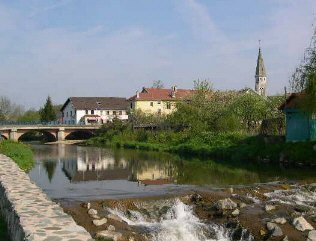
The Canton of Valdoie, located in the region of Bourgogne-Franche-Comté in eastern France, offers a picturesque backdrop for hiking enthusiasts. Nestled near the Doubs River and surrounded by rolling hills and diverse landscapes, it features a mix of natural beauty, charming villages, and historical sites that make it an attractive destination for hikers.
Here are some highlights about hiking in the Canton of Valdoie:
Scenic Trails
-
Variety of Terrain: The canton has a range of trails that cater to different skill levels, from easy strolls to more challenging hikes. Whether you prefer flat trails by the riverside or more strenuous paths through wooded areas, you'll find options that suit your preferences.
-
Natural Parks: The nearby Regional Natural Park of Doubs is a short distance away, offering extensive trail networks that explore the region's dense forests, limestone cliffs, and stunning vistas.
-
Panoramic Views: Certain trails in Valdoie provide breathtaking panoramic views of the surrounding countryside, allowing hikers to enjoy the beauty of both nature and the quaint villages scattered throughout the area.
Points of Interest
-
Cultural Landmarks: Hiking through the canton offers not only natural beauty but the opportunity to discover historical sites, charming stone houses, and local churches that reflect the region’s heritage.
-
Local Flora and Fauna: Hikers may encounter a diverse range of wildlife and plant species, making it a great place for nature enthusiasts and photographers.
-
Rivers and Lakes: Trails often follow rivers and lakes, allowing for peaceful moments by the water and chances to observe aquatic life.
Tips for Hiking in Valdoie
- Weather: Check the weather forecast before heading out. Trails can be muddy or slippery after rain, so it's essential to dress appropriately and wear sturdy footwear.
- Maps and Guides: It’s advisable to have a detailed map or a guidebook. Local tourism offices often provide information on trail conditions and recommendations.
- Pack Essentials: Bring plenty of water, snacks, a first-aid kit, and sun protection, as some trails may take several hours to complete.
- Respect Nature: Stay on marked trails, follow Leave No Trace principles, and respect wildlife and local habitats.
Hiking in the Canton of Valdoie can be a rewarding experience, combining outdoor activity with the chance to immerse yourself in the region’s natural and cultural heritage. Whether you’re a seasoned hiker or a casual walker, you’re likely to find a trail that captures your interest.
- Страна:

- Столица: Valdoie
- Координаты: 47° 39' 3" N, 6° 49' 45" E


- GPS треки (wikiloc): [Ссылка]
- Население: 15483
- Википедия английская: wiki(en)
- Википедия национальная: wiki(fr)
- Хранилище Wikidata: Wikidata: Q656889
- код кантона INSEE: [9009]
Включает регионы:


Cravanche
- коммуна во Франции
- Страна:
- Почтовый код: 90300
- Координаты: 47° 39' 14" N, 6° 49' 57" E
- GPS треки (wikiloc): [Ссылка]
- Площадь: 1.35 кв.км
- Население: 1952
- Веб сайт: [Ссылка]


Essert
- коммуна во Франции
Hiking in Essert
Hiking in Essert, located in the Territoire de Belfort region of France, offers a delightful combination of natural beauty, picturesque landscapes, and accessibility for outdoor enthusiasts. Here are some highlights and tips for hiking in this area:...
- Страна:
- Почтовый код: 90850
- Координаты: 47° 37' 55" N, 6° 48' 59" E
- GPS треки (wikiloc): [Ссылка]
- Площадь: 7.01 кв.км
- Население: 3268
- Веб сайт: [Ссылка]

Valdoie
- коммуна во Франции
- Страна:
- Почтовый код: 90300
- Координаты: 47° 40' 2" N, 6° 50' 31" E
- GPS треки (wikiloc): [Ссылка]
- Площадь: 4.66 кв.км
- Население: 5382
- Веб сайт: [Ссылка]