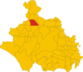
Каподимонте (Capodimonte, Capodimonte)
.svg)
- коммуна Италии
 Hiking in Каподимонте
Capodimonte is a charming town located on the shores of Lake Bolsena in the Lazio region of Italy. While it may not be as widely recognized for hiking as some other locations, it offers beautiful landscapes and potential hiking opportunities. Here are some highlights and tips for hiking in and around Capodimonte:
Scenery
- Lake Bolsena: The area offers stunning views of Lake Bolsena, which is the largest volcanic lake in Europe. Hiking trails around the lake can provide picturesque panoramas of the water and surrounding hills.
- Natural Beauty: The region is rich in flora and fauna, along with rolling hills and vineyards, providing a serene hiking experience.
Hiking Trails
- Lake Bolsena Circuit: There are various paths that circle around the lake, some of which can be accessed from Capodimonte. These trails can vary in difficulty, catering to both beginner and experienced hikers.
- Ancient Paths: There are historical routes in the area that lead through charming villages and natural landscapes, allowing hikers to explore the local culture and heritage.
- Nearby Parks: The nearby Monte Rufeno Natural Reserve offers more challenging trails with diverse ecosystems, including dense woodlands and varied wildlife.
Tips for Hiking in Capodimonte
- Preparation: Make sure to wear appropriate hiking boots and carry plenty of water and snacks.
- Weather: Check the weather before your hike, as conditions can change rapidly, especially in the spring and fall.
- Local Guidance: Consider contacting local hiking groups or guides for information on the best trails and to learn more about the area's cultural heritage.
- Respect Nature: Follow the principles of Leave No Trace to protect the local environment.
Cultural Aspects
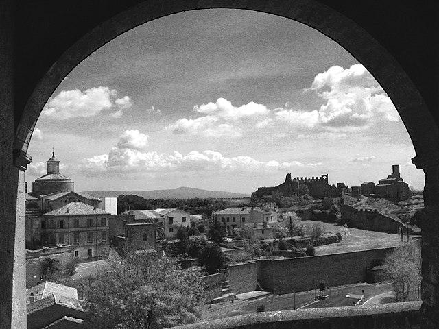
- After your hike, take some time to explore Capodimonte itself, which has historical sites such as the Piazza del Cimitero and beautiful views over the lake.
- Consider visiting local wineries if you're interested in tasting the regional wines.
Overall, while Capodimonte may not be a hiking hotspot in the traditional sense, it certainly offers a peaceful and scenic environment to enjoy nature and outdoor activities. Happy hiking!
- Страна:

- Почтовый код: 01010
- Телефонный код: 0761
- Код автомобильного номера: VT
- Координаты: 42° 32' 51" N, 11° 54' 20" E


- GPS треки (wikiloc): [Ссылка]
- Высота над уровнем моря: 334 м m
- Площадь: 61.29 кв.км
- Население: 1718
- Веб сайт: http://www.comune.capodimonte.vt.it
- Википедия русская: wiki(ru)
- Википедия английская: wiki(en)
- Википедия национальная: wiki(it)
- Хранилище Wikidata: Wikidata: Q160243
- Катеория в википедии: [Ссылка]
- код Freebase: [/m/0gm3_p]
- код GeoNames: Альт: [6541122]
- код VIAF: Альт: [123134096]
- ID отношения в OpenStreetMap: [42050]
- код GND: Альт: [4582884-2]
- код LCNAF: Альт: [n78028839]
- код NLI: [000972734]
- FAST ID: [1312119]
- код ISTAT: 056013
- кадастровый код Италии: B663
Граничит с регионами:


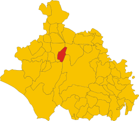
Латера
- коммуна Италии
Hiking in Латера
Latera is a small town located in the Lazio region of Italy, known for its beautiful landscapes, historical sites, and hiking opportunities. The area is characterized by tranquil countryside, rolling hills, and picturesque views, making it an excellent destination for outdoor enthusiasts....
- Страна:
- Почтовый код: 01010
- Телефонный код: 0761
- Код автомобильного номера: VT
- Координаты: 42° 37' 45" N, 11° 49' 45" E
- GPS треки (wikiloc): [Ссылка]
- Высота над уровнем моря: 508 м m
- Площадь: 22.43 кв.км
- Население: 828
- Веб сайт: [Ссылка]

Градоли
- коммуна Италии
Hiking in Градоли
Gradoli is a charming village located in the province of Viterbo in the Lazio region of Italy. Nestled on the slopes of the Aniene River valley, Gradoli offers an array of scenic landscapes that are perfect for hiking enthusiasts....
- Страна:
- Почтовый код: 01010
- Телефонный код: 0761
- Код автомобильного номера: VT
- Координаты: 42° 38' 40" N, 11° 51' 20" E
- GPS треки (wikiloc): [Ссылка]
- Высота над уровнем моря: 470 м m
- Площадь: 43.81 кв.км
- Население: 1348
- Веб сайт: [Ссылка]

Марта
- коммуна Италии
Hiking in Марта
Hiking in Marta, a small town in the Lazio region of Italy, offers a unique blend of stunning natural landscapes and cultural experiences. Located on the shores of Lake Bolsena, Marta is surrounded by rolling hills, vineyards, and picturesque countryside, making it a great destination for outdoor enthusiasts....
- Страна:
- Почтовый код: 01010
- Телефонный код: 0761
- Код автомобильного номера: VT
- Координаты: 42° 32' 4" N, 11° 55' 33" E
- GPS треки (wikiloc): [Ссылка]
- Высота над уровнем моря: 315 м m
- Площадь: 33.54 кв.км
- Население: 3416
- Веб сайт: [Ссылка]


Пьянсано
- коммуна Италии
Hiking in Пьянсано
Piansano is a charming town located in the province of Viterbo in Italy, surrounded by picturesque landscapes that offer various hiking opportunities. Here are some key points about hiking in and around Piansano:...
- Страна:
- Почтовый код: 01010
- Телефонный код: 0761
- Код автомобильного номера: VT
- Координаты: 42° 31' 23" N, 11° 49' 48" E
- GPS треки (wikiloc): [Ссылка]
- Высота над уровнем моря: 409 м m
- Площадь: 26.61 кв.км
- Население: 1975
- Веб сайт: [Ссылка]

Тускания
- коммуна Италии
Hiking in Тускания
Tuscania, a charming town in the Lazio region of Italy, offers a beautiful backdrop for hiking enthusiasts. Nestled in a landscape of rolling hills, ancient ruins, and lush greenery, it provides a variety of hiking opportunities suited for different skill levels. Here are some key points about hiking in and around Tuscania:...
- Страна:
- Почтовый код: 01017
- Телефонный код: 0761
- Код автомобильного номера: VT
- Координаты: 42° 25' 17" N, 11° 52' 19" E
- GPS треки (wikiloc): [Ссылка]
- Высота над уровнем моря: 165 м m
- Площадь: 208.69 кв.км
- Население: 8369
- Веб сайт: [Ссылка]


Валентано
- коммуна Италии
Hiking in Валентано
Valentano, located in the Lazio region of Italy, is a charming town known for its natural beauty and historical significance. Hiking in and around Valentano offers a mix of scenic trails, lush landscapes, and a taste of local culture....
- Страна:
- Почтовый код: 01018
- Телефонный код: 0761
- Код автомобильного номера: VT
- Координаты: 42° 33' 55" N, 11° 49' 37" E
- GPS треки (wikiloc): [Ссылка]
- Высота над уровнем моря: 538 м m
- Площадь: 43.5 кв.км
- Население: 2879
- Веб сайт: [Ссылка]