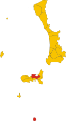
Каполивери (Capoliveri, Capoliveri)
.svg)
- коммуна Италии
 Hiking in Каполивери
Capoliveri is a charming town located on the island of Elba in Italy, known for its beautiful landscapes, rich history, and vibrant hiking trails. Here are some key points to consider if you're interested in hiking in Capoliveri:
Trails and Scenery:
-
Varied Terrain: The area offers a mix of coastal and inland trails, featuring stunning views of the Tyrrhenian Sea, lush Mediterranean vegetation, and rugged hills.
-
Popular Hiking Routes:
- Monte Calamita: This area features trails that lead up to Monte Calamita, offering panoramic views of the island and the surrounding sea. The ascent can be steep, but the rewards are worth it.
- Path of the Mining Trail: This historical trail takes you through former mining areas, where you can learn about the island's mining history while enjoying the beautiful landscapes.
- Pianotta to the Fetovaia Beach: A scenic coastal route that allows hikers to experience Elba's stunning beaches along the way.
-
Diverse Flora and Fauna: The trails are rich in biodiversity, with unique flora and fauna typical of the Mediterranean region. Keep an eye out for local wildlife, including various bird species.
Preparation and Tips:
- Trail Maps: It’s advisable to carry a trail map or download a hiking app that provides GPS navigation to avoid getting lost.
- Weather Conditions: The weather can change suddenly, so it's essential to check the forecast before heading out and dress appropriately in layers.
- Hydrate and Snack: Bring plenty of water and snacks, as some trails may not have facilities nearby.
- Respect Nature: Stay on marked paths, carry out any trash, and respect local wildlife and vegetation.
Local Culture:
Capoliveri is not just about hiking; it's also a great place to experience local culture. After a long hike, consider enjoying local cuisine in one of the town’s restaurants or cafés, where you can try regional specialties like fish dishes and local wines.
Accessibility:
Most trails are accessible from the town center, making it easy to embark on a hiking adventure. Some trails may have uneven terrain, so proper footwear is recommended.
Hiking in Capoliveri is a fantastic way to explore the natural beauty of Elba, making it a must-visit destination for hiking enthusiasts. Enjoy your hike!
- Страна:

- Почтовый код: 57031
- Телефонный код: 0565
- Код автомобильного номера: LI
- Координаты: 42° 45' 0" N, 10° 23' 0" E


- GPS треки (wikiloc): [Ссылка]
- Высота над уровнем моря: 167 м m
- Площадь: 39.56 кв.км
- Население: 4036
- Веб сайт: http://www.comune.capoliveri.li.it
- Википедия русская: wiki(ru)
- Википедия английская: wiki(en)
- Википедия национальная: wiki(it)
- Хранилище Wikidata: Wikidata: Q157720
- Галерея изображений в википедии: [Ссылка]
- Катеория в википедии: [Ссылка]
- код Freebase: [/m/0gldd3]
- код GeoNames: Альт: [6540474]
- код VIAF: Альт: [123803289]
- ID отношения в OpenStreetMap: [42146]
- место в MusicBrainz: [a736bb1a-a553-437f-8971-7e41b2a1d2a2]
- код ISTAT: 049004
- кадастровый код Италии: B669
Граничит с регионами:


Кампо-нелль'Эльба
- коммуна Италии
Hiking in Кампо-нелль'Эльба
Campo nell'Elba is a charming village located on the island of Elba, which is part of Italy's Tuscany region. Known for its stunning landscapes, Mediterranean climate, and rich history, it's a fantastic destination for hikers and outdoor enthusiasts. Here are some highlights and tips for hiking in this beautiful area:...
- Страна:
- Почтовый код: 57034
- Телефонный код: 0565
- Код автомобильного номера: LI
- Координаты: 42° 45' 0" N, 10° 14' 0" E
- GPS треки (wikiloc): [Ссылка]
- Высота над уровнем моря: 2 м m
- Площадь: 55.79 кв.км
- Население: 4869
- Веб сайт: [Ссылка]


Порто-Аццурро
- коммуна Италии
Hiking in Порто-Аццурро
Porto Azzurro is a charming coastal town located on the island of Elba, which is part of Italy's Tuscany region. The area is known for its stunning natural beauty, picturesque landscapes, and crystal-clear waters, making it a great destination for hiking enthusiasts....
- Страна:
- Почтовый код: 57036
- Телефонный код: 0565
- Код автомобильного номера: LI
- Координаты: 42° 46' 0" N, 10° 24' 0" E
- GPS треки (wikiloc): [Ссылка]
- Высота над уровнем моря: 2 м m
- Площадь: 13.33 кв.км
- Население: 3740
- Веб сайт: [Ссылка]

Портоферрайо
- коммуна Италии
Hiking in Портоферрайо
Portoferraio, located on the island of Elba in Italy, is a fantastic destination for hiking enthusiasts. Known for its stunning coastal landscapes, rich history, and diverse natural environments, there are several trails and areas worth exploring:...
- Страна:
- Почтовый код: 57037
- Телефонный код: 0565
- Код автомобильного номера: LI
- Координаты: 42° 49' 0" N, 10° 19' 0" E
- GPS треки (wikiloc): [Ссылка]
- Высота над уровнем моря: 4 м m
- Площадь: 48.48 кв.км
- Население: 11955
- Веб сайт: [Ссылка]