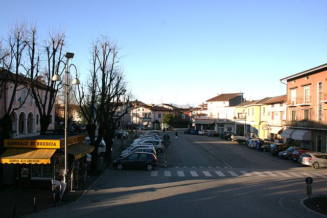
Каприано-дель-Колле (Capriano del Colle, Capriano del Colle)
.svg)
- коммуна Италии
 Hiking in Каприано-дель-Колле
Capriano del Colle is a charming area in Italy, located in the province of Brescia in the Lombardy region. The area is known for its beautiful landscapes, vineyards, and hills, making it a great spot for hiking enthusiasts.
Hiking Trails
-
Local Trails: Capriano del Colle offers numerous hiking trails that traverse through vineyards, olive groves, and rolling hills. The paths are generally well-marked and cater to various skill levels, from easy strolls to more challenging hikes.
-
Monte Netto: This is one of the popular hiking destinations in the area. The trail to Monte Netto provides stunning views of the surrounding countryside and is a great way to experience the local flora and fauna.
-
Sentiero del Vino: Known as the Wine Trail, this path combines hiking with wine tasting. As you navigate the trail, you can stop at local wineries to sample the region's wines, making for a delightful experience.
Tips for Hiking in Capriano del Colle
-
Best Time to Hike: The ideal hiking seasons are spring and autumn when the weather is mild. Summer can be hot, while winter may bring snow in higher elevations.
-
Equipment: Wear comfortable hiking boots with good grip, and bring necessary supplies like water, snacks, a first-aid kit, and weather-appropriate clothing.
-
Local Regulations: Respect local wildlife and flora. Stick to marked trails, and avoid disturbing natural habitats.
-
Guided Tours: If you're unfamiliar with the area or prefer a guided experience, consider joining a local hiking tour. Knowledgeable guides can enhance your experience by sharing insights about the landscape, history, and culture.
Additional Attractions
While hiking, take the opportunity to explore the charming villages and historical sites nearby, such as ancient villas and churches. The local cuisine is also a highlight, so don’t forget to sample some regional dishes at local eateries after your hike.
In conclusion, hiking in Capriano del Colle offers a blend of natural beauty, cultural experiences, and outdoor adventure, making it a fantastic destination for hiking enthusiasts. Enjoy your adventure!
- Страна:

- Почтовый код: 25020
- Телефонный код: 030
- Код автомобильного номера: BS
- Координаты: 45° 27' 18" N, 10° 7' 43" E


- GPS треки (wikiloc): [Ссылка]
- Высота над уровнем моря: 92 м m
- Площадь: 13.97 кв.км
- Население: 4644
- Веб сайт: http://www.comune.capriano.bs.it/
- Википедия русская: wiki(ru)
- Википедия английская: wiki(en)
- Википедия национальная: wiki(it)
- Хранилище Wikidata: Wikidata: Q103768
- Катеория в википедии: [Ссылка]
- код Freebase: [/m/041pt6]
- код GeoNames: Альт: [6543177]
- ID отношения в OpenStreetMap: [45014]
- UN/LOCODE: [ITCRL]
- код ISTAT: 017037
- кадастровый код Италии: B698
Граничит с регионами:
Аццано-Мелла
- коммуна Италии
Hiking in Аццано-Мелла
Azzano Mella is a small municipality located in the province of Brescia, Lombardy, Italy. Although it may not be as famous as some of the larger national parks or mountain ranges, it offers a unique experience for hikers, particularly those looking to explore the scenic countryside and enjoy some local charm....
- Страна:
- Почтовый код: 25020
- Телефонный код: 030
- Код автомобильного номера: BS
- Координаты: 45° 27' 0" N, 10° 7' 0" E
- GPS треки (wikiloc): [Ссылка]
- Высота над уровнем моря: 95 м m
- Площадь: 10.57 кв.км
- Население: 3332
- Веб сайт: [Ссылка]
Баньоло-Мелла
- коммуна Италии
Hiking in Баньоло-Мелла
Bagnolo Mella is a charming town located in the province of Brescia, Italy. While it may not be as well-known as some other hiking destinations in Italy, it offers access to some beautiful trails and scenic countryside suitable for hiking enthusiasts. Here are some highlights about hiking in and around Bagnolo Mella:...
- Страна:
- Почтовый код: 25021
- Телефонный код: 030
- Код автомобильного номера: BS
- Координаты: 45° 25' 48" N, 10° 11' 7" E
- GPS треки (wikiloc): [Ссылка]
- Высота над уровнем моря: 85 м m
- Площадь: 31.35 кв.км
- Население: 12677
- Веб сайт: [Ссылка]
Кастель-Мелла
- коммуна Италии
Hiking in Кастель-Мелла
Castel Mella, located in the province of Brescia in northern Italy, is a charming area that offers various outdoor activities, including hiking. While the region is not widely recognized as a major hiking destination, it provides access to scenic trails, beautiful landscapes, and a taste of the local culture....
- Страна:
- Почтовый код: 25030
- Телефонный код: 030
- Код автомобильного номера: BS
- Координаты: 45° 30' 0" N, 10° 9' 0" E
- GPS треки (wikiloc): [Ссылка]
- Высота над уровнем моря: 106 м m
- Площадь: 7.53 кв.км
- Население: 8147
- Веб сайт: [Ссылка]
Делло
- коммуна Италии
Hiking in Делло
Dello is a small town located in the Lombardy region of northern Italy. While it may not be a widely recognized hiking destination, there are opportunities for outdoor activities in the surrounding areas....
- Страна:
- Почтовый код: 25020
- Телефонный код: 030
- Код автомобильного номера: BS
- Координаты: 45° 25' 10" N, 10° 4' 30" E
- GPS треки (wikiloc): [Ссылка]
- Высота над уровнем моря: 84 м m
- Площадь: 23.32 кв.км
- Население: 5601
- Веб сайт: [Ссылка]
Флеро
- коммуна Италии
Hiking in Флеро
Flero is a town located in the Lombardy region of northern Italy, but it’s not particularly known for extensive hiking trails like other regions in the country, such as the Dolomites or the Aosta Valley. However, hiking enthusiasts can still enjoy the natural landscapes of the surrounding areas....
- Страна:
- Почтовый код: 25020
- Телефонный код: 030
- Код автомобильного номера: BS
- Координаты: 45° 29' 1" N, 10° 10' 28" E
- GPS треки (wikiloc): [Ссылка]
- Высота над уровнем моря: 104 м m
- Площадь: 9.84 кв.км
- Население: 8879
- Веб сайт: [Ссылка]

Понкарале
- коммуна Италии
Hiking in Понкарале
Poncarale is a quaint village in the province of Brescia, located in the Lombardy region of northern Italy. While it may not be as well-known for hiking as some of the more famous Italian destinations, there are opportunities for outdoor activities in and around the area, especially if you enjoy exploring smaller, less traveled paths....
- Страна:
- Почтовый код: 25020
- Телефонный код: 030
- Код автомобильного номера: BS
- Координаты: 45° 27' 43" N, 10° 10' 40" E
- GPS треки (wikiloc): [Ссылка]
- Высота над уровнем моря: 100 м m
- Площадь: 12.64 кв.км
- Население: 5229
- Веб сайт: [Ссылка]