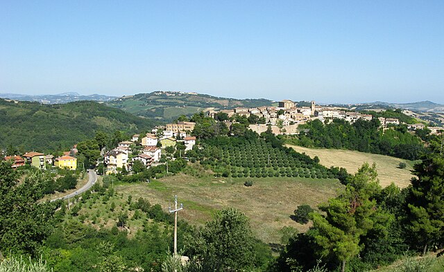
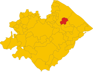
Карточето (Cartoceto, Cartoceto)
.svg)
- коммуна Италии
 Hiking in Карточето
Cartoceto, located in the Marche region of Italy, is known for its beautiful landscapes, rolling hills, and rich agricultural heritage. Hiking here offers a wonderful opportunity to explore both nature and picturesque views, along with cultural sites.
Hiking Trails:
-
Regional Park of San Bartolo: This is a nearby area featuring coastal trails with stunning views of the Adriatic Sea. The trails are well-marked and vary in difficulty, suitable for both beginners and seasoned hikers.
-
Local Nature Paths: Cartoceto and its surroundings have a number of local paths that wind through vineyards, olive groves, and charming rural landscapes. These trails often lead to small villages and offer a chance to experience local culture.
-
Monte Conero: A bit further away, Monte Conero offers more challenging hikes with spectacular coastal views. The area has trails that lead down to beautiful beaches, making for a rewarding hike.
Things to Keep in Mind:
- Trail Maps: It’s advisable to carry a trail map or use a GPS-enabled device, as some paths can be less clearly marked.
- Weather: Check the weather before you head out, as conditions can change quickly, especially in the hilly areas.
- Local Flora and Fauna: Be on the lookout for local wildlife and plant species while hiking. The biodiversity is a delight for nature enthusiasts.
- Hydration and Nutrition: Carry enough water and snacks, especially on longer hikes.
Cultural Experiences:
Hiking in Cartoceto is not just about the trails; it's also an opportunity to explore local culture. Consider visiting:
- Local farms to taste and purchase regional products like olive oil and wine.
- Historic sites and churches that may be along your hiking route.
Best Time to Visit:
- Spring and Autumn: These seasons may provide the most pleasant hiking weather with milder temperatures and beautiful scenery.
With its mix of natural beauty and cultural richness, hiking in Cartoceto can be a memorable experience. Whether you're seeking a leisurely stroll or a challenging hike, this area has plenty to offer!
- Страна:

- Почтовый код: 61030
- Телефонный код: 0721
- Код автомобильного номера: PU
- Координаты: 43° 45' 51" N, 12° 53' 0" E


- GPS треки (wikiloc): [Ссылка]
- Высота над уровнем моря: 235 м m
- Площадь: 23.2 кв.км
- Население: 7936
- Веб сайт: http://www.comune.cartoceto.pu.it
- Википедия русская: wiki(ru)
- Википедия английская: wiki(en)
- Википедия национальная: wiki(it)
- Хранилище Wikidata: Wikidata: Q190566
- Катеория в википедии: [Ссылка]
- код Freebase: [/m/0gl41s]
- код GeoNames: Альт: [6543584]
- код VIAF: Альт: [242162056]
- ID отношения в OpenStreetMap: [42615]
- UN/LOCODE: [ITCP2]
- код ISTAT: 041010
- кадастровый код Италии: B846
Граничит с регионами:


Фано
- коммуна Италии
Hiking in Фано
Fano, located on Italy's Adriatic coast in the Marche region, is not only known for its beautiful beaches but also offers some fantastic hiking opportunities. Here's a guide to hiking in and around Fano:...
- Страна:
- Почтовый код: 61032
- Телефонный код: 0721
- Код автомобильного номера: PU
- Координаты: 43° 50' 37" N, 13° 1' 11" E
- GPS треки (wikiloc): [Ссылка]
- Высота над уровнем моря: 12 м m
- Площадь: 121.84 кв.км
- Население: 60978
- Веб сайт: [Ссылка]
Момбароччо
- коммуна Италии
Hiking in Момбароччо
Mombaroccio, located in the Marche region of Italy, is a charming medieval town that offers various hiking opportunities amidst stunning landscapes. Here are some key points to consider for hiking in and around Mombaroccio:...
- Страна:
- Почтовый код: 61024
- Телефонный код: 0721
- Код автомобильного номера: PU
- Координаты: 43° 47' 49" N, 12° 51' 18" E
- GPS треки (wikiloc): [Ссылка]
- Высота над уровнем моря: 321 м m
- Площадь: 28.21 кв.км
- Население: 2100
- Веб сайт: [Ссылка]
Terre Roveresche
Hiking in Terre Roveresche
Terre Roveresche, located in the Marche region of Italy, is a picturesque area characterized by rolling hills, lush landscapes, and charming medieval villages. Hiking in this region can offer a unique blend of natural beauty, cultural exploration, and a taste of local heritage. Here are some key points to consider when hiking in Terre Roveresche:...
- Страна:
- Почтовый код: 61038
- Телефонный код: 0721
- Код автомобильного номера: PU
- Координаты: 43° 41' 20" N, 12° 57' 56" E
- GPS треки (wikiloc): [Ссылка]
- Площадь: 70.37 кв.км
- Население: 5260
- Веб сайт: [Ссылка]