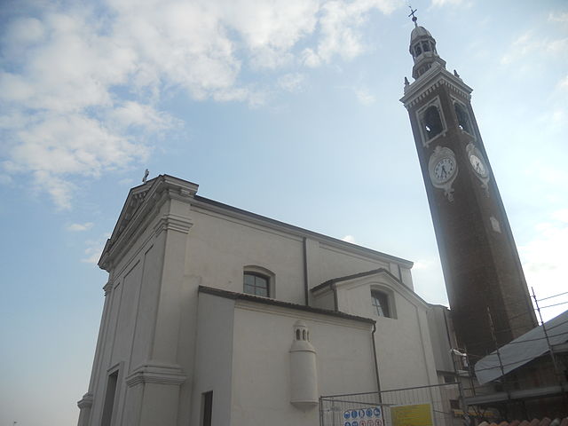
Кастильоне-д'Адда (Castiglione d'Adda, Castiglione d'Adda)
.svg)
- коммуна Италии
 Hiking in Кастильоне-д'Адда
Castiglione d'Adda, a small town in the Lombardy region of Italy, is known for its picturesque landscapes along the Adda River. While it's not a major hiking destination compared to other areas in Italy, it offers some beautiful natural scenery and opportunities for leisurely walks and hikes.
Here are some aspects to consider if you're interested in hiking around Castiglione d'Adda:
Trail Options
-
River Paths: The banks of the Adda River often feature well-trodden paths that provide pleasant walking routes. These paths allow hikers to enjoy the serene landscape, observe flora and fauna, and appreciate the local ecosystem.
-
Surrounding Countryside: Exploring the countryside surrounding Castiglione d'Adda can lead to charming views, fields, and small forests. You can often find trails that are less crowded, offering a peaceful experience.
-
Nearby Parks and Reserves: While the immediate area may not have extensive hiking trails, nearby natural parks or reserves (such as the Adda Nord Park) can provide more structured hiking experiences with marked trails.
Hiking Tips
- Best Time to Hike: The spring and fall months are usually the best for hiking in Lombardy, as the weather is generally mild and pleasant.
- Gear: Wear suitable footwear for hiking and consider carrying a daypack with water, snacks, and a map or a GPS device. While the trails may not be strenuous, it's always best to be prepared.
- Local Fauna and Flora: Be aware of the local wildlife and plants. The area is home to various bird species and other wildlife, making it excellent for nature enthusiasts.
Cultural Considerations
While hiking, take the opportunity to explore the town itself. Castiglione d'Adda has historical sites and charming architecture, which can add a cultural dimension to your visit.
Conclusion
While Castiglione d'Adda may not be a renowned hiking destination, it offers opportunities for peaceful walks among nature, particularly along the Adda River. If you're in the area, it’s worth taking the time to explore the natural beauty and enjoy the tranquility of the surroundings. Always check local maps for the most current trail information and accessibility.
- Страна:

- Почтовый код: 26823
- Телефонный код: 0377
- Код автомобильного номера: LO
- Координаты: 45° 13' 11" N, 9° 41' 43" E


- GPS треки (wikiloc): [Ссылка]
- Высота над уровнем моря: 60 м m
- Площадь: 12.98 кв.км
- Население: 4651
- Веб сайт: http://www.comune.castiglionedadda.lo.it
- Википедия русская: wiki(ru)
- Википедия английская: wiki(en)
- Википедия национальная: wiki(it)
- Хранилище Wikidata: Wikidata: Q42217
- Катеория в википедии: [Ссылка]
- код Freebase: [/m/044vj6]
- код GeoNames: Альт: [6539415]
- ID отношения в OpenStreetMap: [44487]
- место в MusicBrainz: [76804e33-064c-44d7-8c93-dd84a597cfe8]
- WOEID: [713511]
- UN/LOCODE: [ITCDH]
- код ISTAT: 098014
- кадастровый код Италии: C304
Граничит с регионами:

Бертонико
- коммуна Италии
Hiking in Бертонико
Bertonico, a quaint town in northern Italy, is situated in the province of Lodi in the Lombardy region. While it may not be a widely recognized hiking destination compared to larger national parks or mountainous areas, it offers a number of scenic walking trails that are ideal for those seeking a peaceful outdoor experience....
- Страна:
- Почтовый код: 26821
- Телефонный код: 0377
- Код автомобильного номера: LO
- Координаты: 45° 14' 2" N, 9° 40' 9" E
- GPS треки (wikiloc): [Ссылка]
- Высота над уровнем моря: 63 м m
- Площадь: 20.83 кв.км
- Население: 1127
- Веб сайт: [Ссылка]


Терранова-дей-Пассерини
- коммуна Италии
Hiking in Терранова-дей-Пассерини
Terranova dei Passerini is a charming municipality located in the Province of Lodi, in the Lombardy region of northern Italy. While it may not be a major hiking destination like some of the more mountainous regions of Italy, it offers a peaceful and scenic environment for outdoor enthusiasts who enjoy exploring less-trodden paths....
- Страна:
- Почтовый код: 26827
- Телефонный код: 0377
- Код автомобильного номера: LO
- Координаты: 45° 12' 58" N, 9° 36' 46" E
- GPS треки (wikiloc): [Ссылка]
- Высота над уровнем моря: 63 м m
- Площадь: 11.26 кв.км
- Население: 918
- Веб сайт: [Ссылка]


Камайраго
- коммуна Италии
Hiking in Камайраго
Camairago, a small town in the Lombardy region of Italy, is not primarily known as a hiking destination. However, its surrounding areas offer opportunities for hiking and enjoying nature. While the town itself may not have extensive trails, you can explore nearby regions for outdoor activities....
- Страна:
- Почтовый код: 26823
- Телефонный код: 0377
- Код автомобильного номера: LO
- Координаты: 45° 12' 22" N, 9° 43' 42" E
- GPS треки (wikiloc): [Ссылка]
- Высота над уровнем моря: 53 м m
- Площадь: 12.77 кв.км
- Население: 643
- Веб сайт: [Ссылка]


Монтодине
- коммуна Италии
Hiking in Монтодине
Montodine is a small municipality in the province of Cremona, Lombardy, Italy. While it may not be one of the most famous hiking destinations, it offers a quiet, rural landscape that can be quite pleasant for leisurely walks and nature exploration....
- Страна:
- Почтовый код: 26010
- Телефонный код: 0373
- Код автомобильного номера: CR
- Координаты: 45° 17' 0" N, 9° 43' 0" E
- GPS треки (wikiloc): [Ссылка]
- Высота над уровнем моря: 61 м m
- Площадь: 11.39 кв.км
- Население: 2517
- Веб сайт: [Ссылка]

Формигара
- коммуна Италии
Hiking in Формигара
Formigara is a lesser-known yet beautiful hiking destination in Italy, nestled within the picturesque Pavia province of Lombardy. It is part of the larger Lombardy region, known for its stunning landscapes, historical sites, and diverse flora and fauna. While Formigara itself may not be a prominent hiking area like some of the more famous national parks or mountains in Italy, it offers a serene environment for nature lovers and hikers....
- Страна:
- Почтовый код: 26020
- Телефонный код: 0374
- Код автомобильного номера: CR
- Координаты: 45° 14' 0" N, 9° 46' 0" E
- GPS треки (wikiloc): [Ссылка]
- Высота над уровнем моря: 56 м m
- Площадь: 12.64 кв.км
- Население: 1031
- Веб сайт: [Ссылка]


Гомбито
- коммуна Италии
Hiking in Гомбито
Gombito is a lesser-known hiking destination that offers stunning landscapes and a variety of trails suitable for different skill levels. While specific trail details can vary, here’s an overview of what you might expect when hiking in the Gombito area:...
- Страна:
- Почтовый код: 26020
- Телефонный код: 0374
- Код автомобильного номера: CR
- Координаты: 45° 16' 0" N, 9° 44' 0" E
- GPS треки (wikiloc): [Ссылка]
- Высота над уровнем моря: 65 м m
- Площадь: 9.13 кв.км
- Население: 631
- Веб сайт: [Ссылка]