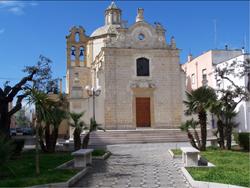
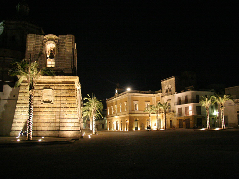
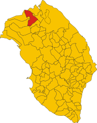
Челлино-Сан-Марко (Cellino San Marco, Cellino San Marco)
.svg)
- коммуна Италии
 Hiking in Челлино-Сан-Марко
Cellino San Marco is a charming town located in the Apulia region of Italy. While it might not be widely known for its hiking routes compared to more mountainous areas, it does offer some beautiful landscapes and trails suitable for walking and light hiking.
Here are some key features and suggestions for hiking around Cellino San Marco:
-
Natural Scenery: The region is characterized by rolling hills, olive groves, and vineyards, presenting a picturesque landscape perfect for leisurely hikes. The scenery changes with the seasons, providing a new experience for hikers throughout the year.
-
Proximity to Nature Reserves: While Cellino San Marco itself is not home to extensive hiking trails, nearby nature reserves and areas offer opportunities for hiking. The nearby "Parco Naturale Regionale Dune Costiere", for example, has trails along the coastal dunes and is great for a day’s hike with beautiful views of the Adriatic Sea.
-
Historical Sites: Incorporating visits to local historical sites might enhance your hiking experience. You can plan routes that allow you to explore ancient churches, masserie (traditional fortified farmhouses), and ruins while enjoying nature.
-
Wine and Culinary Hiking: The area is renowned for its wine, particularly Primitivo. Consider planning a hike that leads you through vineyards where you can stop for wine tastings or local culinary experiences, combining physical activity with local culture.
-
Temperature and Best Time to Hike: The Apulia region generally enjoys a Mediterranean climate. Late spring (May to June) and early autumn (September to October) are ideal for hiking, as the weather is pleasant, and the landscapes are vibrant.
-
Guided Hikes: If you're not familiar with the area, consider joining a guided hike. Local guides can provide insight into both the natural environment and cultural heritage.
-
Hiking Gear: Remember to wear appropriate footwear, and consider packing plenty of water, snacks, and sun protection, especially during warmer months.
While Cellino San Marco might not be a destination for hardcore hiking enthusiasts, it provides a lovely setting for casual walks and exploring the beautiful Apulian countryside.
- Страна:

- Почтовый код: 72020
- Телефонный код: 0831
- Код автомобильного номера: BR
- Координаты: 40° 28' 0" N, 17° 58' 0" E


- GPS треки (wikiloc): [Ссылка]
- Высота над уровнем моря: 56 м m
- Площадь: 37.84 кв.км
- Население: 6530
- Веб сайт: http://www.csm.br.it/
- Википедия русская: wiki(ru)
- Википедия английская: wiki(en)
- Википедия национальная: wiki(it)
- Хранилище Wikidata: Wikidata: Q51862
- Катеория в википедии: [Ссылка]
Граничит с регионами:


Бриндизи
- коммуна Италии
Hiking in Бриндизи
Brindisi, located in the Apulia region of southern Italy, offers a variety of hiking opportunities that showcase its beautiful landscapes, coastal scenery, and historical sites. Here are some key hiking spots and experiences in and around Brindisi:...
- Страна:
- Почтовый код: 72100
- Телефонный код: 0831
- Код автомобильного номера: BR
- Координаты: 40° 38' 18" N, 17° 56' 45" E
- GPS треки (wikiloc): [Ссылка]
- Высота над уровнем моря: 15 м m
- Площадь: 332.98 кв.км
- Население: 88126
- Веб сайт: [Ссылка]


Сан-Доначи
- коммуна Италии
Hiking in Сан-Доначи
San Donaci is a charming town located in the Apulia region of Italy, known for its rich history and beautiful landscapes. While it may not be as famous for hiking as some other regions in Italy, there are opportunities for outdoor activities and exploration in the surrounding areas....
- Страна:
- Почтовый код: 72025
- Телефонный код: 0831
- Код автомобильного номера: BR
- Координаты: 40° 27' 0" N, 17° 55' 0" E
- GPS треки (wikiloc): [Ссылка]
- Высота над уровнем моря: 42 м m
- Площадь: 34.04 кв.км
- Население: 6569
- Веб сайт: [Ссылка]

Сан-Пьетро-Вернотико
- коммуна Италии
Hiking in Сан-Пьетро-Вернотико
San Pietro Vernotico is a charming town located in the Apulia region of Italy, not far from the Adriatic coast. While it may not be as well-known for hiking as some other areas in Italy, there are still opportunities for outdoor enthusiasts to explore the natural beauty of the surrounding region....
- Страна:
- Почтовый код: 72027
- Телефонный код: 0831
- Код автомобильного номера: BR
- Координаты: 40° 29' 0" N, 18° 3' 0" E
- GPS треки (wikiloc): [Ссылка]
- Высота над уровнем моря: 26 м m
- Площадь: 46.94 кв.км
- Население: 13556
- Веб сайт: [Ссылка]
Кампи-Салентина
- коммуна Италии
Hiking in Кампи-Салентина
Campi Salentina is a charming town located in the Apulia region of southern Italy, known for its picturesque landscapes, rich history, and vibrant cultural heritage. Hiking in this area offers a unique opportunity to explore the natural beauty of the Salento Peninsula, along with fascinating historical sites. Here are some highlights and tips for hiking in Campi Salentina:...
- Страна:
- Почтовый код: 73012
- Телефонный код: 0832
- Код автомобильного номера: LE
- Координаты: 40° 24' 0" N, 18° 1' 0" E
- GPS треки (wikiloc): [Ссылка]
- Высота над уровнем моря: 33 м m
- Площадь: 45.88 кв.км
- Население: 10322
- Веб сайт: [Ссылка]


Гуаньяно
- коммуна Италии
Hiking in Гуаньяно
Guagnano, a small town in the Apulia region of southern Italy, is surrounded by picturesque landscapes that offer a variety of outdoor activities, including hiking. While Guagnano itself may not be as well known as some other hiking destinations in Italy, its proximity to natural and historical sites provides opportunities for enjoyable hikes....
- Страна:
- Почтовый код: 73010
- Телефонный код: 0832
- Код автомобильного номера: LE
- Координаты: 40° 24' 0" N, 17° 57' 0" E
- GPS треки (wikiloc): [Ссылка]
- Высота над уровнем моря: 44 м m
- Площадь: 38.03 кв.км
- Население: 5681
- Веб сайт: [Ссылка]


Сквинцано
- коммуна Италии
Hiking in Сквинцано
Squinzano is a charming town located in the province of Brindisi, in the region of Apulia (Puglia), Italy. While it may not be as widely recognized for hiking as some other Italian regions, it offers a unique landscape and cultural experience for outdoor enthusiasts....
- Страна:
- Почтовый код: 73018
- Телефонный код: 0832
- Код автомобильного номера: LE
- Координаты: 40° 26' 0" N, 18° 3' 0" E
- GPS треки (wikiloc): [Ссылка]
- Высота над уровнем моря: 48 м m
- Площадь: 29.78 кв.км
- Население: 14031
- Веб сайт: [Ссылка]