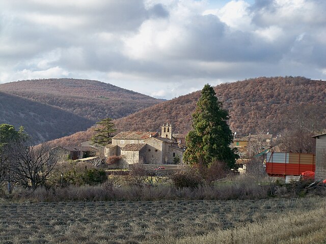
Шатонёф-Миравай (Châteauneuf-Miravail, Châteauneuf-Miravail)
- коммуна во Франции
 Hiking in Шатонёф-Миравай
Châteauneuf-Miravail is a picturesque village located in the Auvergne-Rhône-Alpes region of France, surrounded by beautiful natural landscapes, including hills and forests that offer excellent hiking opportunities. Here’s what you need to know about hiking in and around Châteauneuf-Miravail:
Trails and Routes
-
Local Trails: The region has a network of well-marked trails that cater to various skill levels. You can find leisurely paths suitable for families, as well as more challenging hikes for seasoned adventurers.
-
Scenic Views: Many trails offer stunning views of the surrounding countryside, valleys, and sometimes even glimpses of the nearby mountains. Be sure to stop at viewpoints along the way to take in the beauty of the landscape.
-
Nature Exploration: Hiking in this area allows you to immerse yourself in nature. Depending on the season, you can encounter diverse flora and fauna, and enjoy the peaceful sounds of the countryside.
Recommendations
-
Preparation: Before heading out, ensure you have a proper map or a GPS device, plenty of water, snacks, and suitable footwear. Weather can change quickly, so check the forecast and dress in layers.
-
Local Guides: If you’re unfamiliar with the area or prefer a guided experience, consider hiring a local hiking guide who can share insights about the region's history, culture, and ecology.
-
Combine Activities: After hiking, you might enjoy exploring the local village, tasting regional cuisine, or visiting nearby historical sites.
Best Seasons to Hike
- Spring and Fall: These seasons are ideal for hiking, with mild temperatures and colorful scenery.
- Summer: It can get warmer, so early morning or late afternoon hikes are preferable to avoid the heat.
Conservation
While hiking, please practice Leave No Trace principles to protect the natural environment. Stay on marked trails, respect wildlife, and carry out any trash you bring with you.
Overall, hiking in Châteauneuf-Miravail offers a charming blend of stunning landscapes, tranquility, and cultural experiences. Enjoy your adventure!
- Страна:

- Почтовый код: 04200
- Координаты: 44° 9' 44" N, 5° 43' 36" E


- GPS треки (wikiloc): [Ссылка]
- Площадь: 19.7 кв.км
- Население: 72
- Википедия русская: wiki(ru)
- Википедия английская: wiki(en)
- Википедия национальная: wiki(fr)
- Хранилище Wikidata: Wikidata: Q865233
- Катеория в википедии: [Ссылка]
- код Freebase: [/m/03m7w92]
- код Freebase: [/m/03m7w92]
- код GeoNames: Альт: [3026225]
- код GeoNames: Альт: [3026225]
- номер SIREN: [210400511]
- номер SIREN: [210400511]
- код VIAF: Альт: [265313288]
- код VIAF: Альт: [265313288]
- код LCNAF: Альт: [n94094570]
- код LCNAF: Альт: [n94094570]
- код муниципалитета INSEE: 04051
- код муниципалитета INSEE: 04051
Граничит с регионами:


Montfroc
- коммуна во Франции
Hiking in Montfroc
Montfroc, located in the Provence-Alpes-Côte d'Azur region of France, offers beautiful hiking opportunities amidst stunning natural landscapes. Here are some highlights and tips for hiking in and around Montfroc:...
- Страна:
- Почтовый код: 26560
- Координаты: 44° 10' 29" N, 5° 38' 20" E
- GPS треки (wikiloc): [Ссылка]
- Площадь: 14.76 кв.км
- Население: 77

Сен-Венсан-сюр-Жаброн
- коммуна во Франции
Hiking in Сен-Венсан-сюр-Жаброн
Saint-Vincent-sur-Jabron is a charming village situated in the Provence-Alpes-Côte d'Azur region of France. The area is known for its stunning natural scenery, including rolling hills, vineyards, and the nearby Jabron River, making it a great destination for hiking enthusiasts....
- Страна:
- Почтовый код: 04200
- Координаты: 44° 10' 15" N, 5° 44' 31" E
- GPS треки (wikiloc): [Ссылка]
- Площадь: 30.2 кв.км
- Население: 199

Ла-Рошжирон
- коммуна во Франции
Hiking in Ла-Рошжирон
La Rochegiron, located in the Auvergne region of France, is a wonderful destination for hiking enthusiasts. With its picturesque landscapes, scenic views, and a variety of trails, it caters to both novice and experienced hikers. Here’s a bit more information about what you can expect when hiking in the area:...
- Страна:
- Почтовый код: 04150
- Координаты: 44° 4' 39" N, 5° 39' 20" E
- GPS треки (wikiloc): [Ссылка]
- Площадь: 30.11 кв.км
- Население: 93

Кюрель
- коммуна во Франции
Hiking in Кюрель
Curel, located in the Alpes-de-Haute-Provence region of France, offers a serene and picturesque hiking experience. This area is characterized by its beautiful landscapes, rolling hills, and unique geological features, making it a great destination for hikers of all levels....
- Страна:
- Почтовый код: 04200
- Координаты: 44° 10' 37" N, 5° 39' 42" E
- GPS треки (wikiloc): [Ссылка]
- Площадь: 10.45 кв.км
- Население: 60
- Веб сайт: [Ссылка]

Л’Оспитале
- коммуна во Франции
Hiking in Л’Оспитале
L'Hospitalet, located in the Alpes-de-Haute-Provence region of France, is known for its stunning natural landscapes, making it an excellent destination for hiking enthusiasts. Here are some details about hiking in this area:...
- Страна:
- Почтовый код: 04150
- Координаты: 44° 5' 13" N, 5° 41' 54" E
- GPS треки (wikiloc): [Ссылка]
- Площадь: 19.35 кв.км
- Население: 89
Лардье
- коммуна во Франции
Hiking in Лардье
Lardiers is a small village located in the Alpes-de-Haute-Provence region of France. It's known for its picturesque scenery and offers a variety of hiking opportunities that cater to different skill levels. Here are some key points to consider when hiking in and around Lardiers:...
- Страна:
- Почтовый код: 04230
- Координаты: 44° 3' 25" N, 5° 42' 44" E
- GPS треки (wikiloc): [Ссылка]
- Площадь: 30.08 кв.км
- Население: 112