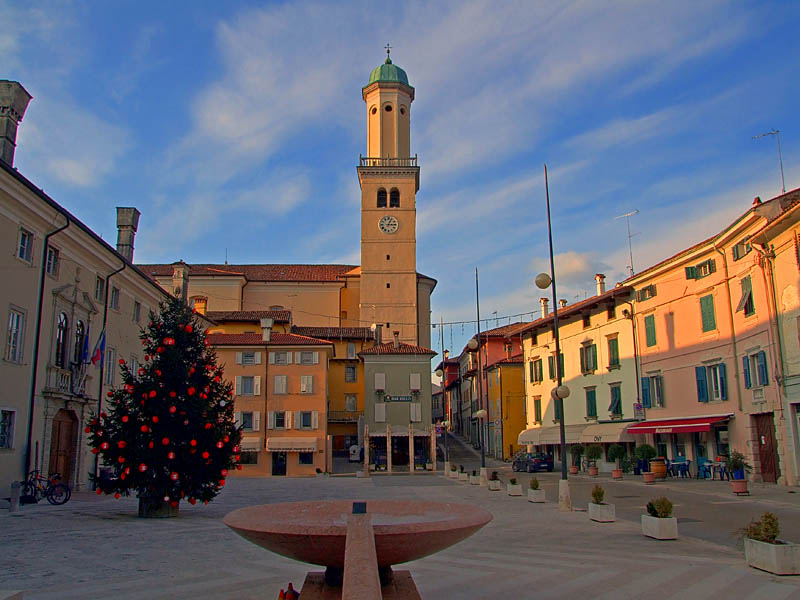
Кьоприс-Висконе (Chiopris-Viscone, Chiopris-Viscone)
.svg)
- коммуна Италии
 Hiking in Кьоприс-Висконе
Chiopris-Viscone is a small town located in the Friuli Venezia Giulia region of Italy, near the border with Slovenia. It offers a unique blend of scenic landscapes, rich local culture, and opportunities for outdoor activities, including hiking. Here are some things to consider when hiking in or around Chiopris-Viscone:
Terrain and Trails
- Varied Terrain: The area surrounding Chiopris-Viscone features a mix of hills, vineyards, and scenic countryside, providing a variety of hiking experiences.
- Local Trails: There may not be extensive marked trails within the immediate vicinity of Chiopris-Viscone, but local paths and minor roads can lead to beautiful views and rural landscapes.
- Nature Reserves: Look for nearby nature reserves or larger parks where more established trails can be found. The nearby Colli Orientali del Friuli region has some wonderful hiking options through vineyards and forests.
Nearby Hiking Areas
- Collio Region: Just a short drive away is the Collio wine region, known for rolling hills and vineyards. There are good trails that provide opportunities for hiking and wine tasting.
- Natural Parks: Consider visiting nearby natural parks, such as the Riserva Naturale Regionale della Val Rosandra, which offers hiking trails with stunning views and rich biodiversity.
Preparation
- Map and Guide: Bring a detailed map of the area; local tourism offices often provide helpful resources. It’s also good to have a GPS app or downloadable maps in case of limited cell service.
- Weather: Check the weather forecast before heading out, as conditions can change quickly in the mountains and hills.
- Equipment: Wear proper hiking attire and sturdy footwear. A walking stick may also be helpful on uneven terrain.
Cultural Experiences
- Local Cuisine: After your hike, enjoy some local cuisine or wine in a nearby trattoria. Friuli Venezia Giulia is known for its diverse culinary traditions, influenced by both Italian and Slavic cultures.
- Local Events: Check for any local festivals or events that might coincide with your visit, as they can provide a deeper understanding of the area's culture.
Safety
- Stay on Marked Trails: If you find marked hiking trails, it’s best to stick to them to minimize the impact on the environment and ensure your safety.
- Hike with Companions: It’s usually safer to hike with a partner or group, especially if you're exploring less-developed areas.
Chiopris-Viscone may not be a famous hiking destination, but it offers a chance for peaceful outdoor experiences amid beautiful Italian landscapes. Enjoy your hike!
- Страна:

- Почтовый код: 33040
- Телефонный код: 0432
- Код автомобильного номера: UD
- Координаты: 45° 55' 36" N, 13° 24' 15" E


- GPS треки (wikiloc): [Ссылка]
- Высота над уровнем моря: 33 м m
- Площадь: 9.21 кв.км
- Население: 648
- Веб сайт: http://www.comune.chiopris-viscone.ud.it
- Википедия русская: wiki(ru)
- Википедия английская: wiki(en)
- Википедия национальная: wiki(it)
- Хранилище Wikidata: Wikidata: Q53242
- Катеория в википедии: [Ссылка]
- код Freebase: [/m/0gk8m9]
- код GeoNames: Альт: [6535946]
- ID отношения в OpenStreetMap: [79266]
- UN/LOCODE: [ITCVS]
- код ISTAT: 030024
- кадастровый код Италии: C641
Граничит с регионами:

Кормонс
- коммуна Италии
Hiking in Кормонс
Cormons, located in the Friuli Venezia Giulia region of northeastern Italy, is surrounded by beautiful landscapes, making it an excellent destination for hiking enthusiasts. The area is characterized by rolling hills, vineyards, and stunning views of the Alps and the Adriatic Sea. Here are some highlights for hiking in and around Cormons:...
- Страна:
- Почтовый код: 34071
- Телефонный код: 0481
- Код автомобильного номера: GO
- Координаты: 45° 57' 0" N, 13° 28' 0" E
- GPS треки (wikiloc): [Ссылка]
- Высота над уровнем моря: 56 м m
- Площадь: 35.09 кв.км
- Население: 7347
- Веб сайт: [Ссылка]


Медеа
- коммуна Италии
Hiking in Медеа
Medea, located in the Friuli-Venezia Giulia region of Italy, offers a unique hiking experience characterized by its picturesque landscapes, vineyards, and historical sites. Here are some key points to consider if you’re planning to hike in this area:...
- Страна:
- Почтовый код: 34076
- Телефонный код: 0481
- Код автомобильного номера: GO
- Координаты: 45° 55' 0" N, 13° 25' 0" E
- GPS треки (wikiloc): [Ссылка]
- Высота над уровнем моря: 132 м m
- Площадь: 7.36 кв.км
- Население: 962
- Веб сайт: [Ссылка]
Сан-Джованни-аль-Натизоне
- коммуна Италии
Hiking in Сан-Джованни-аль-Натизоне
San Giovanni al Natisone is a charming area located in the Friuli Venezia Giulia region of northeastern Italy. It offers a variety of hiking opportunities set against the backdrop of picturesque landscapes. Here are some highlights for hikers in the region:...
- Страна:
- Почтовый код: 33048
- Телефонный код: 0432
- Код автомобильного номера: UD
- Координаты: 45° 59' 0" N, 13° 24' 0" E
- GPS треки (wikiloc): [Ссылка]
- Высота над уровнем моря: 66 м m
- Площадь: 24.06 кв.км
- Население: 6137
- Веб сайт: [Ссылка]
Сан-Вито-аль-Торре
- коммуна Италии
Hiking in Сан-Вито-аль-Торре
San Vito al Torre is a charming small town in the Friuli Venezia Giulia region of northeastern Italy, known for its scenic landscapes and proximity to the beautiful surroundings of the Italian countryside. While it may not be as widely recognized as other hiking destinations, it offers several opportunities for those looking to explore nature....
- Страна:
- Почтовый код: 33050
- Телефонный код: 0432
- Код автомобильного номера: UD
- Координаты: 45° 54' 0" N, 13° 22' 0" E
- GPS треки (wikiloc): [Ссылка]
- Высота над уровнем моря: 17 м m
- Площадь: 11.92 кв.км
- Население: 1268
- Веб сайт: [Ссылка]
Тривиньяно-Удинезе
- коммуна Италии
Hiking in Тривиньяно-Удинезе
Trivignano Udinese, located in the Friuli Venezia Giulia region of northeastern Italy, offers a beautiful landscape for hiking enthusiasts. The area is characterized by its rolling hills, lush vegetation, and proximity to the picturesque mountains of the Julian Alps. Here are some aspects to consider when hiking in and around Trivignano Udinese:...
- Страна:
- Почтовый код: 33050
- Телефонный код: 0432
- Код автомобильного номера: UD
- Координаты: 45° 57' 0" N, 13° 20' 0" E
- GPS треки (wikiloc): [Ссылка]
- Высота над уровнем моря: 43 м m
- Площадь: 18.46 кв.км
- Население: 1635
- Веб сайт: [Ссылка]