Чивитанова-дель-Саннио (Civitanova del Sannio, Civitanova del Sannio)
.svg)
- коммуна Италии
 Hiking in Чивитанова-дель-Саннио
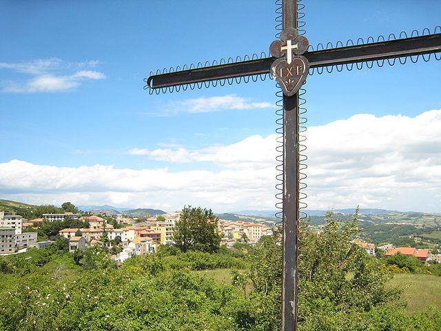
Civitanova del Sannio is a charming village located in the Molise region of Italy, surrounded by beautiful landscapes, rolling hills, and natural beauty that makes it a great destination for hiking enthusiasts. Here are some highlights for hiking in and around Civitanova del Sannio:
Trails and Nature
-
Monti Molisani: The area is part of the larger Monti Molisani mountain range. Here, you can find various trails that cater to different levels of hiking experience. The rugged terrain provides opportunities for both casual walks and more challenging treks.
-
Natural Parks: Nearby, you have access to protected natural areas such as the Parco Nazionale d'Abruzzo, Lazio e Molise. This park features diverse flora and fauna and offers many trails for hiking, including routes with breathtaking views of mountains, forests, and rivers.
-
Historical Routes: You can explore trails that lead to ancient ruins, old churches, and cultural landmarks in the region, providing a combination of nature and history during your hikes.
Recommendations for Hikers
-
Prepare Properly: Make sure to wear appropriate footwear and clothing suited for hiking. The weather can change quickly in the mountains, so carrying layers is advisable.
-
Stay Hydrated: Bring enough water, especially on longer hikes, as amenities may be limited on the trails.
-
Local Guidance: If you’re unfamiliar with the area, consider hiring a local guide who can provide insights into the best trails, local wildlife, and safety tips.
-
Respect Nature: Always follow the Leave No Trace principles to protect the natural environment, especially in less developed areas.
-
Seasonal Considerations: Spring and fall are ideal seasons for hiking, as temperatures are milder and the scenery is particularly beautiful.
Accessibility
Civitanova del Sannio is accessible by car, and several trails can be reached within a short drive. Depending on the season, some trails may be busier than others; planning your hikes during off-peak hours can enhance your experience.
Conclusion
Hiking in Civitanova del Sannio offers a blend of natural beauty, adventure, and cultural richness. Whether you are a casual walker or an experienced hiker, you will find plenty to explore in this picturesque region of Italy.
- Страна:

- Почтовый код: 86094
- Телефонный код: 0865
- Код автомобильного номера: IS
- Координаты: 41° 40' 0" N, 14° 24' 0" E


- GPS треки (wikiloc): [Ссылка]
- Высота над уровнем моря: 656 м m
- Площадь: 50.47 кв.км
- Население: 918
- Веб сайт: http://www.comune.civitanova.mc.it
- Википедия русская: wiki(ru)
- Википедия английская: wiki(en)
- Википедия национальная: wiki(it)
- Хранилище Wikidata: Wikidata: Q279026
- Катеория в википедии: [Ссылка]
- код Freebase: [/m/0gq_cd]
- код GeoNames: Альт: [6537947]
- ID отношения в OpenStreetMap: [41438]
- код TGN: [1044286]
- код Цифрового атласа Римской империи: [26465]
- код ISTAT: 094016
- кадастровый код Италии: C769
Граничит с регионами:
Дуронья
- коммуна Италии
Hiking in Дуронья
Duronia is a picturesque village located in the Molise region of Italy, surrounded by beautiful landscapes and natural beauty, making it a great destination for hiking enthusiasts. Here are some highlights about hiking in and around Duronia:...
- Страна:
- Почтовый код: 86020
- Телефонный код: 0874
- Код автомобильного номера: CB
- Координаты: 41° 40' 0" N, 14° 28' 0" E
- GPS треки (wikiloc): [Ссылка]
- Высота над уровнем моря: 918 м m
- Площадь: 22.47 кв.км
- Население: 407
- Веб сайт: [Ссылка]
Сальчито
- коммуна Италии
Hiking in Сальчито
Salcito is a small town located in the Molise region of Italy, known for its picturesque landscapes and historical significance. Hiking in and around Salcito offers a unique opportunity to explore the beautiful natural surroundings, including rolling hills, forests, and charming countryside....
- Страна:
- Почтовый код: 86026
- Телефонный код: 0874
- Код автомобильного номера: CB
- Координаты: 41° 45' 0" N, 14° 31' 0" E
- GPS треки (wikiloc): [Ссылка]
- Высота над уровнем моря: 678 м m
- Площадь: 28.26 кв.км
- Население: 666
- Веб сайт: [Ссылка]
Баньоли-дель-Триньо
- коммуна Италии
Hiking in Баньоли-дель-Триньо
Bagnoli del Trigno is a picturesque village located in the province of Isernia, in the Molise region of Italy. It's known for its stunning landscapes, rich historical heritage, and the natural beauty of the surrounding area, making it a fantastic destination for hiking enthusiasts....
- Страна:
- Почтовый код: 86091
- Телефонный код: 0874
- Код автомобильного номера: IS
- Координаты: 41° 42' 0" N, 14° 27' 0" E
- GPS треки (wikiloc): [Ссылка]
- Высота над уровнем моря: 660 м m
- Площадь: 36.8 кв.км
- Население: 708
- Веб сайт: [Ссылка]
Кьяучи
- коммуна Италии
Hiking in Кьяучи
Chiauci is a small town in the Abruzzo region of Italy, situated on the border of Molise. It is known for its beautiful landscapes, rich history, and charming architecture. Hiking in the Chiauci area offers a variety of trails that showcase the stunning natural beauty of the Apennine Mountains....
- Страна:
- Почтовый код: 86090
- Телефонный код: 0865
- Код автомобильного номера: IS
- Координаты: 41° 41' 0" N, 14° 23' 0" E
- GPS треки (wikiloc): [Ссылка]
- Высота над уровнем моря: 879 м m
- Площадь: 15.85 кв.км
- Население: 221
- Веб сайт: [Ссылка]

Фрозолоне
- коммуна Италии
Hiking in Фрозолоне
Frosolone, a charming town in the Molise region of Italy, is surrounded by beautiful landscapes and offers a variety of hiking opportunities. Nestled in the Apennine mountains, it features rolling hills, scenic valleys, and abundant nature, making it an excellent destination for outdoor enthusiasts. Here are some highlights for hiking in and around Frosolone:...
- Страна:
- Почтовый код: 86095
- Телефонный код: 0874
- Код автомобильного номера: IS
- Координаты: 41° 36' 0" N, 14° 27' 0" E
- GPS треки (wikiloc): [Ссылка]
- Высота над уровнем моря: 894 м m
- Площадь: 49.89 кв.км
- Население: 3172
- Веб сайт: [Ссылка]


Песколанчиано
- коммуна Италии
Hiking in Песколанчиано
Pescolanciano is a charming village located in the Molise region of Italy, surrounded by beautiful landscapes and rich natural features that make it a great destination for hiking enthusiasts. Here are some key points about hiking in and around Pescolanciano:...
- Страна:
- Почтовый код: 86097
- Телефонный код: 0865
- Код автомобильного номера: IS
- Координаты: 41° 41' 0" N, 14° 20' 0" E
- GPS треки (wikiloc): [Ссылка]
- Высота над уровнем моря: 800 м m
- Площадь: 34.73 кв.км
- Население: 848
- Веб сайт: [Ссылка]


Пьетраббонданте
- коммуна Италии
Hiking in Пьетраббонданте
Pietrabbondante, located in the Molise region of Italy, offers a unique hiking experience with its beautiful landscapes, historical significance, and the opportunity to explore rugged terrain. Here are some key highlights of hiking in this charming area:...
- Страна:
- Почтовый код: 86085
- Телефонный код: 0865
- Код автомобильного номера: IS
- Координаты: 41° 45' 0" N, 14° 23' 0" E
- GPS треки (wikiloc): [Ссылка]
- Высота над уровнем моря: 1027 м m
- Площадь: 27.44 кв.км
- Население: 735
- Веб сайт: [Ссылка]


Поджо-Саннита
- коммуна Италии
Hiking in Поджо-Саннита
Poggio Sannita, a charming town located in the Molise region of Italy, offers beautiful hiking opportunities for outdoor enthusiasts. Nestled in the Apennine Mountains, this area is characterized by stunning landscapes, rich biodiversity, and a variety of trails suitable for different skill levels. Here are some highlights and tips for hiking in and around Poggio Sannita:...
- Страна:
- Почтовый код: 86086
- Телефонный код: 0865
- Код автомобильного номера: IS
- Координаты: 41° 46' 40" N, 14° 24' 46" E
- GPS треки (wikiloc): [Ссылка]
- Высота над уровнем моря: 705 м m
- Площадь: 25.74 кв.км
- Население: 647
- Веб сайт: [Ссылка]
Сессано-дель-Молизе
- коммуна Италии
Hiking in Сессано-дель-Молизе
Sessano del Molise is a picturesque village located in the Molise region of Italy, surrounded by beautiful landscapes that are perfect for hiking enthusiasts. The area offers a variety of trails that vary in difficulty, allowing hikers of all skill levels to enjoy the natural beauty of the region....
- Страна:
- Почтовый код: 86097
- Телефонный код: 0865
- Код автомобильного номера: IS
- Координаты: 41° 38' 0" N, 14° 20' 0" E
- GPS треки (wikiloc): [Ссылка]
- Высота над уровнем моря: 796 м m
- Площадь: 25.32 кв.км
- Население: 730
- Веб сайт: [Ссылка]