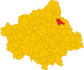
Колле-Умбрето (Colle Umberto, Colle Umberto)
.svg)
- коммуна Италии
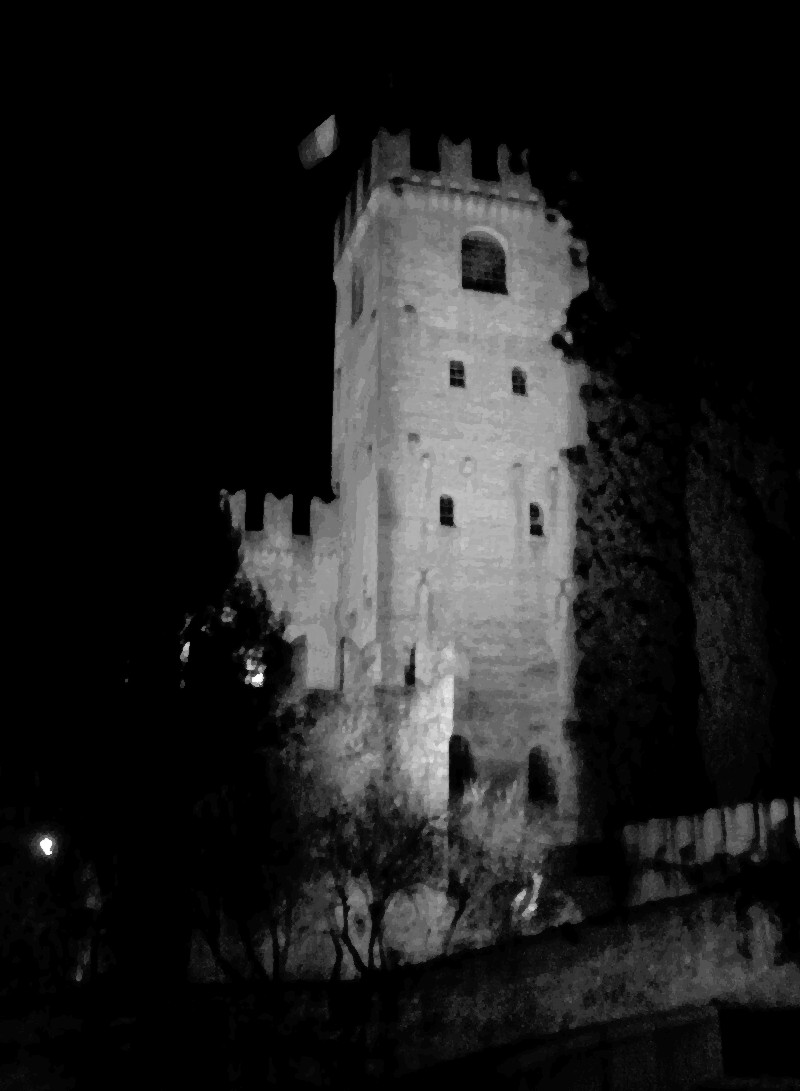
 Hiking in Колле-Умбрето
Colle Umberto, a picturesque location in the province of Treviso in northeastern Italy, offers a delightful hiking experience amidst beautiful landscapes, ancient trails, and charming villages. Though it's not as renowned as some of Italy’s larger national parks, it is part of the broader region of the Veneto, characterized by rolling hills, vineyards, and olive groves.
Hiking Trails:
-
Nature Trails: The region features a network of hiking paths that allow you to explore the serene countryside and enjoy panoramic views of the surrounding hills. The trails are generally well-marked and varied in difficulty, catering to both beginners and seasoned hikers.
-
Historical Routes: Some trails may take you to historical landmarks, such as old churches and castles, where you can learn about the local history and culture while enjoying the scenery.
-
Agricultural Walks: Given the area's rich agricultural background, you may encounter trails that wind through vineyards and orchards, providing a glimpse into the local farming practices and, perhaps, opportunities for wine tasting tours.
Best Time to Hike:
- Spring and Fall: The ideal times for hiking in Colle Umberto are spring (April to June) and fall (September to October) when the temperatures are mild, and the landscapes are particularly vibrant.
- Summer: The summer months can be hot, so early morning or late afternoon hikes are recommended to avoid the heat.
- Winter: While winter hiking is possible, be prepared for colder temperatures and potential snow in higher elevations.
Preparation Tips:
- Footwear: Wear sturdy hiking boots with good grip, as some areas may have uneven terrain.
- Navigation: While trails are marked, having a map or GPS app can be helpful, especially if you're venturing into less popular routes.
- Supplies: Bring plenty of water, snacks, and sun protection, along with a first-aid kit.
Local Attractions:
After hiking, you might be interested in exploring the local towns, enjoying traditional Italian cuisine, or visiting nearby wineries to experience the regional wines that the area is known for.
In summary, hiking in Colle Umberto offers a perfect blend of nature, culture, and relaxation, making it a rewarding experience for anyone looking to enjoy the outdoors in Italy.
- Страна:

- Почтовый код: 31014
- Телефонный код: 0438
- Код автомобильного номера: TV
- Координаты: 45° 57' 0" N, 12° 21' 0" E


- GPS треки (wikiloc): [Ссылка]
- Высота над уровнем моря: 144 м m
- Площадь: 13.58 кв.км
- Население: 5093
- Веб сайт: http://www.comune.colle-umberto.tv.it/
- Википедия русская: wiki(ru)
- Википедия английская: wiki(en)
- Википедия национальная: wiki(it)
- Хранилище Wikidata: Wikidata: Q46697
- Катеория в википедии: [Ссылка]
- код Freebase: [/m/0gk2n7]
- код GeoNames: Альт: [6538296]
- код VIAF: Альт: [127504652]
- ID отношения в OpenStreetMap: [46540]
- место в MusicBrainz: [eb732d6f-f66d-4059-8482-f9b36e55bb88]
- код TGN: [7036057]
- UN/LOCODE: [ITCLB]
- код ISTAT: 026020
- кадастровый код Италии: C848
Граничит с регионами:


Каппелла-Магжиоре
- коммуна Италии
Hiking in Каппелла-Магжиоре
Cappella Maggiore, located in the Veneto region of Italy, offers a picturesque setting for hiking enthusiasts. The area is characterized by its stunning natural landscapes, including rolling hills, forests, and scenic viewpoints. Here are some tips and highlights for hiking in Cappella Maggiore:...
- Страна:
- Почтовый код: 31012
- Телефонный код: 0438
- Код автомобильного номера: TV
- Координаты: 45° 58' 0" N, 12° 22' 0" E
- GPS треки (wikiloc): [Ссылка]
- Высота над уровнем моря: 115 м m
- Площадь: 11.09 кв.км
- Население: 4692
- Веб сайт: [Ссылка]


Сан-Фьор
- коммуна Италии
Hiking in Сан-Фьор
San Fior, located in the Veneto region of Italy, is not as widely recognized as some other hiking destinations, but it offers picturesque landscapes and a taste of the beautiful Italian countryside. Here are some key points about hiking in the area:...
- Страна:
- Почтовый код: 31020
- Телефонный код: 0438
- Код автомобильного номера: TV
- Координаты: 45° 55' 20" N, 12° 21' 41" E
- GPS треки (wikiloc): [Ссылка]
- Высота над уровнем моря: 57 м m
- Площадь: 17.82 кв.км
- Население: 6958
- Веб сайт: [Ссылка]

Годега-ди-Сант'Урбано
- коммуна Италии
Hiking in Годега-ди-Сант'Урбано
Godega di Sant'Urbano, located in the Veneto region of Italy, is a charming area that offers a range of outdoor activities, including hiking. While it's primarily known for its agricultural landscapes and proximity to the scenic foothills of the Alps, it also provides opportunities for those looking to explore nature on foot....
- Страна:
- Почтовый код: 31010
- Телефонный код: 0438
- Код автомобильного номера: TV
- Координаты: 45° 55' 43" N, 12° 23' 49" E
- GPS треки (wikiloc): [Ссылка]
- Высота над уровнем моря: 52 м m
- Площадь: 24.34 кв.км
- Население: 6034
- Веб сайт: [Ссылка]


Кординьано
- коммуна Италии
Hiking in Кординьано
Cordignano is a small municipality located in the province of Treviso, in the Veneto region of Italy. It is known for its picturesque landscapes, rolling hills, and a variety of outdoor activities, making it a great spot for hiking enthusiasts....
- Страна:
- Почтовый код: 31016
- Телефонный код: 0438
- Код автомобильного номера: TV
- Координаты: 45° 57' 0" N, 12° 25' 0" E
- GPS треки (wikiloc): [Ссылка]
- Высота над уровнем моря: 56 м m
- Площадь: 26.25 кв.км
- Население: 7024
- Веб сайт: [Ссылка]

Конельяно
- коммуна Италии
Hiking in Конельяно
Conegliano is located in the Veneto region of Italy and is surrounded by beautiful landscapes, making it an excellent destination for hiking enthusiasts. The area is known for its scenic vineyards, rolling hills, and picturesque views of the Prealps. Here are some highlights of hiking in Conegliano:...
- Страна:
- Почтовый код: 31015
- Телефонный код: 0438
- Код автомобильного номера: TV
- Координаты: 45° 53' 14" N, 12° 17' 49" E
- GPS треки (wikiloc): [Ссылка]
- Высота над уровнем моря: 74 м m
- Площадь: 36.38 кв.км
- Население: 35082
- Веб сайт: [Ссылка]


Витторио-Венето
- коммуна Италии
Hiking in Витторио-Венето
Vittorio Veneto, located in the Veneto region of Italy, is surrounded by stunning natural landscapes, making it a fantastic destination for hiking enthusiasts. Here are some key aspects of hiking in this area:...
- Страна:
- Почтовый код: 31029
- Телефонный код: 0438
- Код автомобильного номера: TV
- Координаты: 45° 59' 0" N, 12° 18' 0" E
- GPS треки (wikiloc): [Ссылка]
- Высота над уровнем моря: 138 м m
- Площадь: 82.8 кв.км
- Население: 28389
- Веб сайт: [Ссылка]