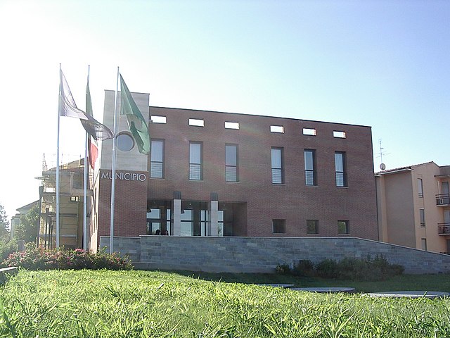
Кольтурано (Colturano, Colturano)
.svg)
- коммуна Италии
 Hiking in Кольтурано
Colturano is a charming location in Italy, offering a serene environment for hiking enthusiasts looking for beautiful landscapes and outdoor activities. While it's not a widely known hiking destination like some of Italy’s more famous national parks, those in the area can enjoy a variety of trails that showcase the beauty of the Italian countryside.
Hiking in Colturano
-
Scenic Trails: The scenic trails often meander through rolling hills, vineyards, and fields, allowing hikers to immerse themselves in nature and enjoy views of the surrounding landscape.
-
Nature and Wildlife: The area around Colturano is rich in flora and fauna, making it an excellent spot for nature lovers. Be on the lookout for various bird species and local wildlife as you hike.
-
Cultural Experience: Hiking around Colturano not only provides access to nature but also a glimpse into the local culture. You may encounter small villages, historical landmarks, and opportunities to indulge in local cuisine.
-
Trail Difficulty: The trails vary in difficulty—some may be suitable for beginners, while others may present more of a challenge for experienced hikers. It’s important to check local maps or consult with local hiking guides to find a trail that matches your skill level.
-
Best Time to Hike: The spring and autumn months are ideal for hiking in this region, as temperatures are generally mild and the scenery is particularly vibrant during these seasons.
Tips for Hiking in Colturano
-
Dress Appropriately: Wear comfortable hiking shoes and dress in layers to adapt to changing weather conditions.
-
Stay Hydrated: Carry plenty of water, especially during warmer months.
-
Navigation: Bring a map or a GPS device, as some trails may not be well-marked.
-
Observe Local Rules: Be mindful of local regulations, including those concerning wildlife and protected areas.
-
Plan Ahead: Consider the length of the hike and your pace, and let someone know your plans before heading out.
Whether you're a casual walker or an experienced hiker, Colturano offers a peaceful setting for enjoying the outdoors and exploring the picturesque Italian countryside.
- Страна:

- Почтовый код: 20060
- Телефонный код: 02
- Код автомобильного номера: MI
- Координаты: 45° 23' 0" N, 9° 20' 0" E


- GPS треки (wikiloc): [Ссылка]
- Высота над уровнем моря: 90 м m
- Площадь: 4.16 кв.км
- Население: 2079
- Веб сайт: http://www.comune.colturano.mi.it
- Википедия русская: wiki(ru)
- Википедия английская: wiki(en)
- Википедия национальная: wiki(it)
- Хранилище Wikidata: Wikidata: Q42414
- Катеория в википедии: [Ссылка]
- код Freebase: [/m/0gj5rg]
- код GeoNames: Альт: [6540334]
- ID отношения в OpenStreetMap: [44819]
- UN/LOCODE: [ITOLT]
- код ISTAT: 015082
- кадастровый код Италии: C908
Граничит с регионами:

Дрезано
- коммуна Италии
Hiking in Дрезано
Dresano is a small town located near Milan in Italy. While it may not be universally known for extensive hiking trails, the surrounding areas offer opportunities for outdoor enthusiasts to explore. Here are some insights into hiking in and around Dresano:...
- Страна:
- Почтовый код: 20070
- Телефонный код: 02
- Код автомобильного номера: MI
- Координаты: 45° 22' 0" N, 9° 22' 0" E
- GPS треки (wikiloc): [Ссылка]
- Высота над уровнем моря: 91 м m
- Площадь: 3.48 кв.км
- Население: 3036
- Веб сайт: [Ссылка]
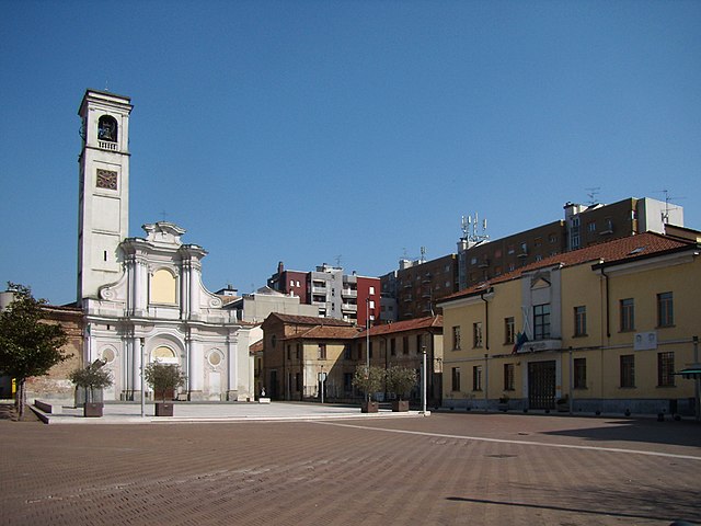
Медилья
- коммуна Италии
Hiking in Медилья
Mediglia is a small town located in the Lombardy region of Italy, near Milan. While it may not be as famous for hiking as the nearby mountainous areas like the Italian Alps or the Appennines, there are still opportunities for outdoor walks and exploration in and around Mediglia....
- Страна:
- Почтовый код: 20060
- Телефонный код: 02
- Код автомобильного номера: MI
- Координаты: 45° 24' 0" N, 9° 20' 0" E
- GPS треки (wikiloc): [Ссылка]
- Высота над уровнем моря: 95 м m
- Площадь: 21.96 кв.км
- Население: 12198
- Веб сайт: [Ссылка]


Виццоло-Предаписси
- коммуна Италии
Hiking in Виццоло-Предаписси
Vizzolo Predabissi is a small town located in the Lombardy region of Italy, near the southern outskirts of Milan. While it is not widely known for extensive hiking trails like some more mountainous regions, there are still several options for outdoor activities and hiking in and around the area....
- Страна:
- Почтовый код: 20070
- Телефонный код: 02
- Код автомобильного номера: MI
- Координаты: 45° 21' 0" N, 9° 21' 0" E
- GPS треки (wikiloc): [Ссылка]
- Высота над уровнем моря: 90 м m
- Площадь: 5.65 кв.км
- Население: 3948
- Веб сайт: [Ссылка]
Трибьано
- коммуна Италии
Hiking in Трибьано
Tribiano is a small town located in the Lombardy region of Italy, not far from Milan. While it may not be a well-known destination for hiking, its proximity to the surrounding areas offers some opportunities for outdoor activities. Here are some insights into hiking in and around Tribiano:...
- Страна:
- Почтовый код: 20067
- Телефонный код: 02
- Код автомобильного номера: MI
- Координаты: 45° 25' 0" N, 9° 23' 0" E
- GPS треки (wikiloc): [Ссылка]
- Высота над уровнем моря: 93 м m
- Площадь: 7 кв.км
- Население: 3545
- Веб сайт: [Ссылка]

Сан-Джулиано-Миланезе
- коммуна Италии
Hiking in Сан-Джулиано-Миланезе
San Giuliano Milanese, located just southeast of Milan, Italy, may not be the first destination that comes to mind when thinking about hiking. However, the surrounding areas and nearby parks offer several opportunities for outdoor activities and enjoyable walks....
- Страна:
- Почтовый код: 20098
- Телефонный код: 02
- Код автомобильного номера: MI
- Координаты: 45° 24' 0" N, 9° 17' 0" E
- GPS треки (wikiloc): [Ссылка]
- Высота над уровнем моря: 97 м m
- Площадь: 30.87 кв.км
- Население: 38318
- Веб сайт: [Ссылка]


Меленьяно
- коммуна Италии
Hiking in Меленьяно
Melegnano is a town located in the Lombardy region of Italy, known for its rich history, beautiful landscapes, and proximity to the larger metropolitan area of Milan. While Melegnano itself is more urban and does not boast extensive hiking trails within its immediate vicinity, there are several options for outdoor enthusiasts looking for hiking experiences in the surrounding areas....
- Страна:
- Почтовый код: 20077
- Телефонный код: 02
- Код автомобильного номера: MI
- Координаты: 45° 22' 0" N, 9° 19' 0" E
- GPS треки (wikiloc): [Ссылка]
- Высота над уровнем моря: 88 м m
- Площадь: 4.92 кв.км
- Население: 17940
- Веб сайт: [Ссылка]